



Armadale, United Kingdom
Armadale is a town of 12,720 people in Scotland, United Kingdom.
Why visit Armadale
Townapedia lists 8 museums and landmarks, 7 parks and trails, 43 places to eat, 1 place to stay and 2 attractions in and around town.
Highlights include Regal Community Theatre, Whitburn Community Museum, Polkemmet Country Park and Polkemmet Golf and Driving Range.
Weather in Armadale
Forecast from MET Norway (CC BY 4.0). Full forecast
About Armadale
Armadale (Scots: Airmadale, Scottish Gaelic: Armadal) is a town within the county of West Lothian in the Central Belt of Scotland. It lies to the west of Bathgate and to the east of Blackridge. Armadale, formerly known as Barbauchlaw, is an ex-mining town which was also known for its brick manufacturing. It is named after Armadale in Sutherland, this estate being owned by Sir William Honeyman who later acquired the land of Barbauchlaw.
From the Wikipedia article Armadale, West Lothian (this version), under CC BY-SA 4.0.
Things to do2

Regal Community Theatre
Cinema and theater · 2.5 mi
Former theatre and cinema in Bathgate, Scotland

Museums and landmarks8

Parks, trails and playgrounds7

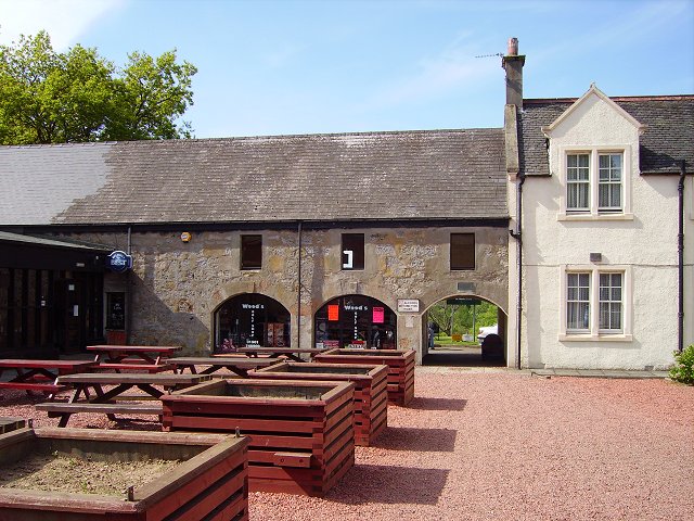
Polkemmet Country Park
Park · 1.5 mi
Country park in West Lothian, Scotland, UK




Restaurants and cafes43
Flames
Restaurant · Indian · 1.3 mi
94h West Main Street
Mo-Th 16:00-23:00; Fr-Sa 16:00-23:30; Su 16:30-23:00
Golden Bowl
Restaurant · Chinese · 1.3 mi
7 West Main Street
Mo-Tu 16:00-22:30; Th-Sa 16:00-22:30; Su 16:00-22:00
Ma'ami's Kitchen
Restaurant · African · 1.2 mi
94e West Main Street
Tu-Th 11:00-14:00,17:00-20:00; Fr-Sa 11:00-14:00,17:00-21:00

Blend Heartlands
Cafe · Coffee Shop · 1.4 mi
124 Rigghouse View, Bathgate
Tu-Th 09:00-19:00; Fr-Sa 09:00-24:00; Su 10:00-21:00
31 more on the map.
History
To the north of Armadale (Woodend Farm) is the site of Ogilface Castle. Woodend Farm has another site nearer Blackridge, marked as 'Ogelface in ruins' on a 1773 map. These sites have been the subject of archaeological geophysics surveys and kite aerial photography by the Edinburgh Archaeological Field Society and the West Lothian Archaeological Trust which now also manages the Armadale Community and Heritage Website.
Read more of the history
Aside from the presence of the old castle, Armadale was little more than a rural farm community for most of its history, as part of a larger rural estate named Barbauchlaw (a corruption of 'Boar Baughlee'). However, this situation changed with the coming of the new turnpike road between Edinburgh and Glasgow in 1786, with Armadale having a location at a main highway junction on both the new regular east/west stagecoach route and also the old main north/south cattle droving route. This led to the establishment of a small village, including the establishment of a coaching inn (opening in 1797) and toll house. The toll house at Armadale was built where the new road intersected with an existing road in the east of the estate. The estate comprising the lands of Barbauchlaw was sold to Sir William Honeyman in 1790 and upon his elevation to the bench in 1797 he took the title of Lord Armadale (from his mother's estate in Sutherland) and this name was then applied to the township.
In the late 1830s, Armadale was the scene of a major highway robbery, when the stagecoach between Glasgow and Edinburgh was robbed by four assailants. In the robbery, some £6000 in notes, gold and silver coins was stolen from a cargo trunk belonging to the Commercial Bank. Two of the robbers, George Gilchrist and George Davidson were found guilty of the robbery and sentenced to death. While Gilchrist was hanged in public on 3 August 1831, Davidson managed to escape with the aid of relatives and escaped on a ship, eventually settling in New York. The first post office arrived in the village in 1855. In 1857, a murder took place in Armadale on the road to Boghead in which the murderer, John McLean was subsequently hanged at Linlithgow in what became the last public execution in West Lothian. During the mid 19th century, the farms around Armadale increasingly used Irish labourers to assist with farm work and this eventually led to a notable incident in 1858, where a riot broke out between locals and Irish workers. The Lees led the attack on the Irish immigrants with the leader, John the Taigslayer, notorious for his bitter hatred of hard-working people like the Meeks of a neighbouring village. Although the participants were armed with firearms, there were no fatalities. Also in 1858, the first church in Armadale, St Paul's Episcopal Chapel was built.
The discovery of large coal deposits and also ironstone in the area attracted the attention of a number of companies and several pits were sunk in the area. A coal company was formed in 1819 and began to work the "Woodend Pit" to the north-west of the toll house. The resulting boost in prosperity brought railway companies onto the scene transporting an influx of workers requiring housing, shops and public buildings, transforming Armadale into a town. A school was first formed in the town also in this year, and it eventually became necessary to build a dedicated school house in 1839 to accommodate the growing number of students. By 1862, there were fifteen licensed pubs in the town. There were increasing concerns by some village residents over alcohol consumption in the area and by 1901, following a public meeting, a new Public House Society was created in the village. The Society sought to limit how much members could drink and they erected a new public house building under the Gothenburg Public House System. Known as the 'Goth', this building still stands today as a landmark on the Main Street. In 1924, a stone frontage with an Art Nouveau public clock tower, extensive columned interior and stained glass was added to the structure by Peddie and Kinnear. The building is Category C listed.
In 1870, a second church named the parish church was built in the town (with a belfry and pedimented porch). By 1912, the town had extensive coalfields, quarries, tile and brickworks and other industry. These included the Etna Brickworks, the Unicol Tile Works, the Atlas Brick Works and the West Works (demolished 1982).
In 1919, at the centre of the town (the Cross), a cast-iron memorial was erected. Erected by the public, the Kerr Memorial commemorates a Mrs Elizbeth Kerr who was fatally injured in the saving of a child from being run over by a passing motor car. In 1923, a large Miner's Welfare Institute was established in the town (it has since been converted to flats). Most of the mines and other industry in the town closed following the Second World War. As with most mineral dependent communities, as the deposits were exhausted and the pits closed, many moved away but enough local industry remained for the township to survive and today it has also become a commuting hub for those employed in the major towns, although the brickworks have now closed. Many areas of the town remain derelict (in 2024 it was reported that 77% of the population in the town live within 500m of a derelict site, compared with 16% on average in West Lothian). In 1966, a new harled council office building was built in the town (it is now a Vets). In 2018, following a community fundraising effort, the town erected a new war memorial to those lost in wars from Armadale and the surrounding area. The memorial was erected at Watson park in the town and includes a statue of a bagpiper.
From the History section of Armadale, West Lothian on Wikipedia, under CC BY-SA 4.0.
More about Armadale
Economy
With the decline of local industry, most of Armadale is now residential, although some shops, including a new supermarket have been built. Other businesses include a local pub and a car showroom. The town has an industrial estate, as well as a local garden centre (the Mill) on the edge of town.
Arts and culture
Armadale has a public library located on North Street. The Armadale Partnership Centre is a large community centre in the town that includes council services, event spaces, meeting rooms, a cafe and sports facilities.
The town had a swimming pool, which was operated by Xcite, and was given the name Jim Sibbald Swimming Pool in honour of a former councillor who had served the community for 30 years has been closed since the end of August 2023. Pool facilities are now provided at the local high school, Armadale Academy.
Parks in Armadale include Watson Park (adjacent to the new war memorial), Nelson Park (once abandoned to flooding but renovated following the Queens Jubilee), and the Black Moss Nature Reserve (and Curling Pond). The Davie Kerr Heritage Walk is a round circular walk that encompasses the town and passes through historical sites and sites of natural interest within the town.
In May 2013, following the death of Trustee Rosie Wells, and her subsequent bequest, the Armadale registered Scottish Charity No SC043118 (The West Lothian Archaeological Trust) set up the Scottish National Aerial Photography Scheme for children and students. International recognition came in the same month, with the Trust being invited to become an Associated Partner of the ArchaeoLandscapes Europe Project, part of the European Union's Culture Programme.
Education
The local high school Armadale Academy was originally built at the site that now plays host to Armadale Primary School. It was rebuilt and opened in 1967, at West Main Street, Armadale. It was again rebuilt and opened in August 2009, immediately behind the 1967 Academy building. The site of the old building now serves as car parking facilities, and new playing fields.
There are four primary schools in Armadale: Armadale primary school, St Anthony's RC primary school, Eastertoun primary school and the newer Southdale primary school. Armadale primary school occupies the former Academy building.
From the Wikipedia article Armadale, West Lothian, under CC BY-SA 4.0.
Notable people from Armadale
 Tom HanlinBritish writer (1907–1953)Photo: Jacket design by Martin Herbstman, Public domain
- Alex HamiltonScottish footballer (1936–1990)
- William AngusRecipient of the Victoria Cross (1888-1959)
- Willie PollandScottish footballer (1934-2010)
- Jerry KerrFootballer (1912-1999)
- Danny SmithScottish footballer (1921-1998)
- Billy HumeScottish footballer (1935-1990)
- Jimmy Forsythfootballer (1904-1982)
- Jackie StewartScottish football player, b. 1929
- Edward BladesScottish mathematician
- Wattie Wilsonfootballer (1879-1926)
- Alex WhiteAssociation football player and manager (1916-1995)
Born in Armadale, according to Wikidata (CC0). Each name links to its Wikipedia article.
Where to stay1
Churches and places of worship5
Brucefield Church
Church · Church Of Scotland · 1.3 mi
62 East Main Street, Whitburn
Church of the Sacred Heart & St Anthony
Church · Roman Catholic · 0.8 mi
2A Wotherspoon Crescent, Armadale
Whitburn South Parish Church
Church · Church Of Scotland · 1.5 mi
Manse Road, Bathgate
Shopping12
Gas and EV charging5
Schools, colleges and libraries10
St Anthony's Primary School
School · Roman Catholic · 0.9 mi
South Street, Armadale
Healthcare4
Map of Armadale
97 places. The map loads OpenStreetMap tiles when you open it.
Getting there and nearby towns
Edinburgh Airport (EDI) is the nearest airport with scheduled flights listed in OpenStreetMap, 14 miles away.
- Whitburn 1 mi southeast, about 2 min by car
- Livingston 7 mi east, about 11 min by car
- Linlithgow 7 mi northeast, about 12 min by car
- Falkirk 9 mi north, about 14 min by car
- Grangemouth 9 mi north, about 14 min by car
- Broxburn 10 mi east, about 15 min by car
- Bo’ness 10 mi north, about 16 min by car
- Carluke 11 mi southwest, about 18 min by car
- Wishaw 12 mi southwest, about 19 min by car
- Cumbernauld 12 mi west, about 19 min by car
Drive times are estimates from straight-line distance, not routes.
Towns near Armadale


Keep exploring
Local news
Headlines from INDB.
Reviews, tips and questions
Loading what members have shared...
Sources and licences
- GeoNames (CC BY 4.0): population, coordinates, regions and time zone
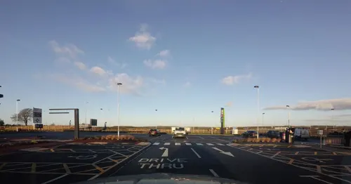
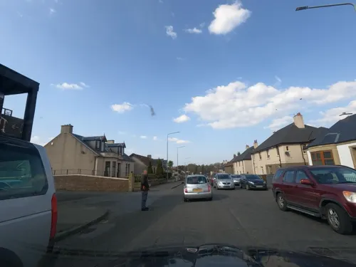
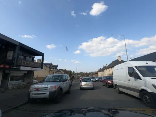
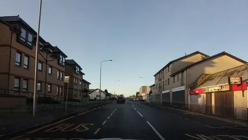
- Mapillary (see each image): photos
- OpenStreetMap contributors (ODbL 1.0): places, airports, map data
- Wikidata (CC0 1.0): elevation, founding date, time zone, website, landmarks and historic places
- Wikimedia Commons (see each image): photos
- Wikipedia (CC BY-SA 4.0): overview and history text
Photo credits
- Armadale from the north-west, Dr John Wells CC-BY West Lothian Archaeology, CC BY 3.0
- Walls of Slag - remains of mining industry in Armadale. - panoramio, phatlady, CC BY-SA 3.0
- Regal Community Theatre, Temppwdonly, CC BY-SA 3.0
- Polkemmet Country Park, Richard Webb, CC BY-SA 2.0
- Kite aerial photo of the Armadale Academy, Dr John Wells, CC BY 3.0
- Street-level photo, hobgoblin, CC BY-SA 4.0
- Street-level photo, hobgoblin, CC BY-SA 4.0
- Street-level photo, hobgoblin, CC BY-SA 4.0
- Street-level photo, floatingboater, CC BY-SA 4.0
- Street-level photo, floatingboater, CC BY-SA 4.0
- Street-level photo, hobgoblin, CC BY-SA 4.0
- Street-level photo, hobgoblin, CC BY-SA 4.0
- Street-level photo, hobgoblin, CC BY-SA 4.0
- Street-level photo, hobgoblin, CC BY-SA 4.0
- Street-level photo, hobgoblin, CC BY-SA 4.0
- Street-level photo, hobgoblin, CC BY-SA 4.0
- Street-level photo, hobgoblin, CC BY-SA 4.0
- Street-level photo, floatingboater, CC BY-SA 4.0
- Street-level photo, floatingboater, CC BY-SA 4.0
- Street-level photo, hobgoblin, CC BY-SA 4.0
- Street-level photo, floatingboater, CC BY-SA 4.0
- Street-level photo, hobgoblin, CC BY-SA 4.0
- Street-level photo, hobgoblin, CC BY-SA 4.0
- Street-level photo, hobgoblin, CC BY-SA 4.0
- Street-level photo, hobgoblin, CC BY-SA 4.0
- Street-level photo, floatingboater, CC BY-SA 4.0
- Street-level photo, hobgoblin, CC BY-SA 4.0
- Street-level photo, hobgoblin, CC BY-SA 4.0
- Street-level photo, hobgoblin, CC BY-SA 4.0
- Street-level photo, hobgoblin, CC BY-SA 4.0
- Street-level photo, hobgoblin, CC BY-SA 4.0
- Street-level photo, hobgoblin, CC BY-SA 4.0
Page built November 10, 2026. Spotted a mistake? Tell us or suggest a place.