


Portstewart, United Kingdom
Portstewart is a town of 8,394 people in Northern Ireland, United Kingdom.
Why visit Portstewart
Townapedia lists 5 museums and landmarks, 6 parks and trails, 30 places to eat, 7 places to stay and 6 attractions in and around town.
Highlights include Curry's Fun Park, Portstewart Strand and The Strand - Portstewart Golf Club.
Weather in Portstewart
Forecast from MET Norway (CC BY 4.0). Full forecast
About Portstewart
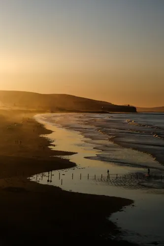
Portstewart is a small seaside town in County Londonderry, Northern Ireland. It had a population of 7,854 people in the 2021 United Kingdom census. It is a seaside resort, neighbouring both Coleraine in County Londonderry and Portrush in County Antrim. Its harbour and scenic coastal paths form an Atlantic promenade leading to a two-mile beach (Portstewart Strand), popular with holidaymakers in summer and surfers year-round.
From the Wikipedia article Portstewart (this version), under CC BY-SA 4.0.
Travel tips from other travellers: Portstewart on Wikivoyage (CC BY-SA 4.0).
Things to do6

Curry's Fun Park
Monument and historic site · 2.8 mi
Amusement park in Northern Ireland

Bann Bridge
Bridge · 3.4 mi
Bridge in Coleraine, County Londonderry, Northern Ireland

Riverside Theatre, Coleraine
Cinema and theater · 2.7 mi
Theatre in Coleraine, Northern Ireland

Museums and landmarks5

The ruins of the original Agherton Church Of Ireland Church
Monument and historic site · Anglican · 0.8 mi

Parks, trails and playgrounds6



Restaurants and cafes30



18 more on the map.
History
Portstewart was founded in 1792 by John Cromie, who named it after his maternal ancestors, the Stewarts of Ballylesse. A Lieutenant Stewart is said to have obtained a lease of land from The 5th Earl of Antrim (first creation; 1713–1775) in 1734. Prior to this, the area was formerly known in Irish as Port na Binne Uaine, a name related to the nearby island and townland of Benoney (an anglicisation of Binne Uaine). The name Port na Binne Uaine is still used today as the Irish language name of the town, alongside the Gaelicised version Port Stíobhaird.
Portstewart developed to a modest size seaside resort in the mid 19th century under the influence of a local landlord, John Cromie. Its development and character was influenced greatly by the Sabbatarian sensitivities of the Cromies and the consequent resistance to a railway connection in the mid 19th century.
From the History section of Portstewart on Wikipedia, under CC BY-SA 4.0.
Notable people from Portstewart
- Henry McCulloughBritish musician
- George WhiteBritish Army officer (1835–1912)
- Patrick KellyNorthern Irish footballer (born 2004)
- Eimear MullanIrish triathlete
- Helen Sophia O'HaraIrish watercolour artist
- Danny TaylorIrish rower and academic (1921-2003)
- Helen O'Harajournalist
- Barry McGoldrickIrish hurler and Gaelic footballer
Born in Portstewart, according to Wikidata (CC0). Each name links to its Wikipedia article.
Where to stay7
Churches and places of worship4
Shopping6
Gas and EV charging2
Schools, colleges and libraries6
Healthcare2
Map of Portstewart
74 places. The map loads OpenStreetMap tiles when you open it.
Getting there and nearby towns
City of Derry Airport (LDY) is the nearest airport with scheduled flights listed in OpenStreetMap, 21 miles away.
- Coleraine 4 mi southeast, about 6 min by car
- Limavady 13 mi southwest, about 21 min by car
- Derry 27 mi southwest, about 43 min by car
- Ballymena 28 mi southeast, about 45 min by car
- Randalstown 34 mi southeast, about 55 min by car
- Cookstown 37 mi south, about 1 h by car
- Antrim 38 mi southeast, about 1 h by car
- Strabane 39 mi southwest, about 1 h by car
- Larne 42 mi southeast, about 1 h 15 min by car
- Belfast 51 mi southeast, about 1 h 15 min by car
Drive times are estimates from straight-line distance, not routes.
Towns near Portstewart


Keep exploring
Local news
Headlines from INDB.
Reviews, tips and questions
Loading what members have shared...
Sources and licences
- GeoNames (CC BY 4.0): population, coordinates, regions and time zone
- OpenStreetMap contributors (ODbL 1.0): places, airports, map data
- Openverse (see each image): photos
- Wikidata (CC0 1.0): elevation, founding date, time zone, website, landmarks and historic places
- Wikimedia Commons (see each image): photos
- Wikipedia (CC BY-SA 4.0): overview and history text
Photo credits
- Curry's Fun Park, Portrush, Greentreetown, CC BY-SA 4.0
- University of Ulster, Belfast Campus, July 2010 (07), Ardfern, CC BY-SA 3.0
- Church at Enfield Street, Portstewart, Northern Ireland, D LN, CC BY-SA 4.0
- Portstewart Strand, Kyle Monahan, CC BY 2.0
Page built November 10, 2026. Spotted a mistake? Tell us or suggest a place.