



Portswood, United Kingdom
Portswood is a town of 14,831 people in England, United Kingdom.
Why visit Portswood
Townapedia lists 27 museums and landmarks, 45 parks and trails, 302 places to eat, 24 places to stay and 14 attractions in and around town.
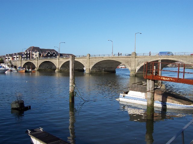
Highlights include Cobden Bridge, Grand Theatre, John Hansard Gallery and Southampton City Art Gallery.
Weather in Portswood
Forecast from MET Norway (CC BY 4.0). Full forecast
About Portswood
Portswood is a suburb and electoral ward of Southampton, England. The suburb lies to the north-north-east of the city centre and is bounded by (clockwise from west) Freemantle, Highfield, Swaythling, St. Denys and Bevois Valley.
From the Wikipedia article Portswood (this version), under CC BY-SA 4.0.
Photos of Portswood


Things to do14


Grand Theatre
Cinema and theater · 1.5 mi
Former theatre in Southampton, England


Mayflower Theatre
Cinema and theater · 1.6 mi
Theatre in Southampton, England, a former cinema


Southampton Guildhall
Cinema and theater · 1.5 mi
Performance venue in Southampton, England

The Point, Eastleigh
Cinema and theater · 3.3 mi
Theatre and dance centre in Eastleigh, Hampshire, England, in the former Town Hall


Theatre Royal, Southampton
Cinema and theater · 2.1 mi
Former theatre in Hampshire, England (1803–1884)
MAST Mayflower Studios
Cinema and theater · 1.5 mi
142-144 Above Bar Street, Southampton
2 more on the map.
Museums and landmarks27

John Hansard Gallery
Museum · 1.5 mi
Art museum in the UK
142 Above Bar Street, Southampton
Tu-Sa 11:00-17:00

Southampton City Art Gallery
Museum · 1.5 mi
Art gallery in Southampton
Commercial Road, Southampton
Mo-Fr 10:00-15:00; Sa 10:00-17:00


The Cenotaph
Monument and historic site · 1.4 mi
War memorial in Southampton, England

Titanic Engineers' Memorial
Monument and historic site · 1.3 mi
Grade II listed sculpture in Southampton, United Kingdom

Eastleigh Museum
Museum · 3.2 mi
Museum in Eastleigh, United Kingdom (closed)

Medieval Merchant's House
Museum · 2.1 mi
Grade I listed historic house museum in Southampton, United Kingdom

Solent Sky
Museum · 2.0 mi
Aviation museum in Southampton, Hampshire, United Kingdom

Southampton Tudor House and Garden
Museum · 2.0 mi
Grade I listed historic house museum in Southampton, Hampshire, England, UK

15 more on the map.
Parks, trails and playgrounds45
Riverside Park
Park · 0.8 mi
Public park in Southampton, Hampshire, England


Blechynden Terrace Park
Park · 1.6 mi
Park in Southampton, Hampshire, England


Lakeside Country Park
Park · 2.4 mi
Railway park in the United Kingdom

Mayfield Park
Park · 2.7 mi
Recreational area in the suburb of Woolston, Southampton, England, UK

St James' Park
Park · 1.7 mi
Recreational area in Shirley, Southampton, Hampshire, England


Daisy Dip Park
Park · 1.0 mi
Daisy Dip is a large open space between Swaythling and Bassett and links to Bassett Wood Greenway. At almost eight hectares the open...
Daisy Road, Bluebell Road, Laburnum Road, Southampton
24/7
Westwood Woodland Park
Park · 3.4 mi
Local Nature Reserve in Southampton in Hampshire
33 more on the map.
Restaurants and cafes302
Baboo Ji
Restaurant · Curry, Indian
273 Portswood Road, Southampton
Tu-Th 16:30-21:30; Fr,Sa 16:30-22:00
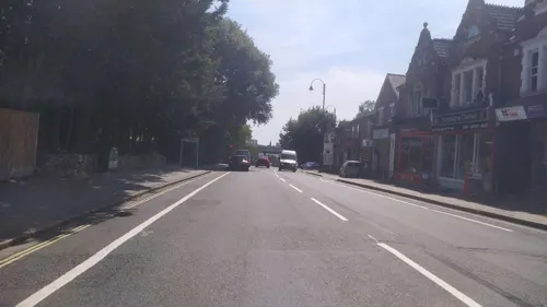
The Eagle Bar Lounge
Restaurant · Mediterranean · 0.5 mi
29-31 Portswood Road, Southampton
Mo-Tu 17:00-22:00, We-Th 12:00-22:00, Fr-Sa 12:00-00:00, Su 12:00-22:00
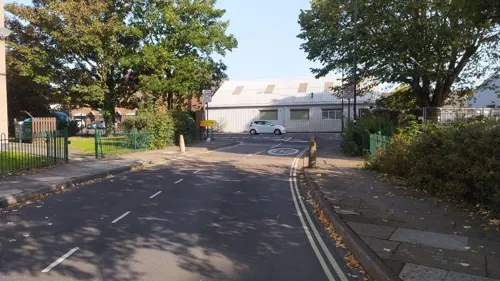
Unity Brewing Co. Taproom
Bar and pub · 1.1 mi
Bar and bottle shop. 12 taps of Unity beer, guest beer and a cider. Fridge of cans and bottles. Small selection of wine, soft drinks. ...
23-27 Princes Street, Southampton
We-Th 16:00-22:00; Fr-Su 14:00-22:00
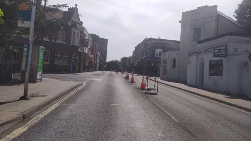
Board in the City
Cafe · Burger · 1.0 mi
38, 40 Onslow Road, Southampton
Mo-Fr 14:00-23:00; Tu off; Sa 11:00-23:00; Su 11:00-22:00
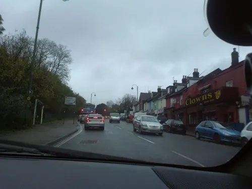
Elmina Lounge
Restaurant · 0.7 mi
104-108 Bevois Valley Road, Southampton
Mo-Th 12:00-21:00; Fr-Sa 10:00-22:00; Su 10:00-21:00


The Giddy Goose
Restaurant · Burger, American, Hot Dog · 0.6 mi
Empress Park, Southampton
Th-Su 17:00-22:00

Brewhouse & Kitchen (Southampton)
Bar and pub · 0.5 mi
47 Highfield Lane, Southampton
Mo-Th 12:00-23:00; Fr,Sa 12:00-24:00; Su 12:00-22:30
Overdraft Beer & Tacos
Bar and pub · 1.2 mi
29 Carlton Place, Southampton
Mo-Th 12:00-23:00; Fr-Sa 12:00-24:00; Su 12:00-22:00
290 more on the map.
History
The Manor of Portswood, which originally included the modern-day Bevois Town, Swaythling, St Denys and Highfield, was first named in a charter dating from 1045. The name Portswood comes from the Old English Porteswuda, meaning "wood of the town".
The manor was granted to St. Denys Priory by Richard I in 1189, and it remained under their ownership until the Dissolution of the Monasteries by Henry VIII in 1536. The land, and the title Lord of the manor, were purchased by Francis Dawtrey in 1538, and passed through several hands before being bought by Giles Stibbert in 1771. Stibbert, Lieutenant-General with the East India Company and later Commander-in-Chief of India, built the first Portswood House on the estate to the design of a Mr. Crunden.
The house, which stood in the area now bounded by Spring Crescent and Lawn Road, was demolished in 1852 to make way for more housing, and the name Portswood House transferred to the nearby Portswood Lodge. The estate was gradually sold for development, and the second Portswood House was demolished in 1923, allowing the whole estate to be sold by 1928.
In 1871 an attempt by the Southampton board of health to improve the local sewage system was opposed over concerns about higher taxes. Improvements were eventually begun in 1875.
From the History section of Portswood on Wikipedia, under CC BY-SA 4.0.
More about Portswood
Arts and culture
Portswood has a dedicated live music venue—The Brook, on Portswood Road. The Brook is a 600-capacity venue which has seen performances from Steve Harley and Cockney Rebel (in 2004, 2006, 2008 and 2010), as well as Steve Harley's 2-man (1998, 1999 and 2002), 3-man (2011) and 4-man (2003 and 2004) acoustic sets. More contemporary outfits such as The Hoosiers and Mr. Scruff have also played the venue. The venue went into liquidation in May 2007, but it was put on the market for £900,000, and was saved in August that year.
There are a number of pubs in the area covering different tastes from sports bars, to student-friendly pubs and real ale pubs.
Education
Portswood Ward includes the main Highfield Campus of the University of Southampton. The University's first presence in Highfield was in 1914, although the outbreak of the First World War meant the site became a military hospital and was not used for lectures until 1920.
The ward has three state-run primary schools; Portswood Primary School on Somerset Road, Highfield School on Hawthorn Road, and St Denys School on Dundee Road. There is also a small independent primary school, St Winifred's School, on Winn Road.
The nearest secondary schools are Cantell School in Bassett Green, and Bitterne Park School.
From the Wikipedia article Portswood, under CC BY-SA 4.0.
Notable people from Portswood
- Bill BuckEnglish cricketer (born 1946)
- Henry PersseEnglish cricketer (1885-1918)
- Richard Aslatt PearceVictorian clergyman
Born in Portswood, according to Wikidata (CC0). Each name links to its Wikipedia article.
Where to stay24
Churches and places of worship69
Central Baptist Church
Church · Baptist · 1.3 mi
Devonshire Road, Southampton
Shopping22
Gas and EV charging5
Schools, colleges and libraries53
Highfield Church of England Primary School - Junior Site
School · Anglican · 0.6 mi
Hawthorn Road, Southampton
Healthcare16
Royal South Hants Urgent Treatment Centre
Hospital · 1.0 mi
Brinton's Terrace, Southampton
Map of Portswood
250 places. The map loads OpenStreetMap tiles when you open it.
Getting there and nearby towns
Southampton Airport (SOU) is the nearest airport with scheduled flights listed in OpenStreetMap, 2 miles away.
- Southampton 2 mi south, about 3 min by car
- Bishopstoke 4 mi northeast, about 6 min by car
- Hedge End 4 mi east, about 6 min by car
- Hythe 5 mi south, about 8 min by car
- Fair Oak 5 mi northeast, about 8 min by car
- Romsey 6 mi northwest, about 10 min by car
- Cowes 12 mi south, about 19 min by car
- Lymington 13 mi southwest, about 21 min by car
- Cosham 15 mi east, about 25 min by car
- Portsmouth 16 mi southeast, about 25 min by car
Drive times are estimates from straight-line distance, not routes.
Towns near Portswood


Keep exploring
Local news
Headlines from INDB.
Reviews, tips and questions
Loading what members have shared...
Sources and licences
- GeoNames (CC BY 4.0): population, coordinates, regions and time zone
- Mapillary (see each image): photos
- OpenStreetMap contributors (ODbL 1.0): places, airports, map data
- Wikidata (CC0 1.0): elevation, founding date, time zone, website, landmarks and historic places
- Wikimedia Commons (see each image): photos
- Wikipedia (CC BY-SA 4.0): overview and history text
Photo credits
- Portswood, David Mainwood, CC BY-SA 2.0
- Cobden Bridge, Dave Jacobs, CC BY-SA 2.0
- Itchen Bridge in 2007 HDR, Rhys Jones from Southampton, UK, CC BY 2.0
- MayflowerTheatre, Turquoisefish at English Wikipedia, CC BY-SA 3.0
- Southampton Guildhall, Michael, Public domain
- The Point, Eastleigh, Paul Spencer, CC BY-SA 3.0
- John Hansard Gallery, Murgatroyd49, CC BY-SA 4.0
- SeaCity Museum, hahnchen at Wikimedia Commons (must include link if medium allows), CC BY-SA 3.0
- Southampton-Cenotaph, AlanFord at English Wikipedia, Public domain
- Titanic Engineers Memorial Southampton 2016, photo by Geni sculpture by Ferdinand Victor Blundstone, CC BY-SA 4.0
- Solent Sky general view, Nimbus227, Public domain
- Tudor House, Southampton, Peter Trimming from Croydon, England, CC BY 2.0
- SouthamptonCommon, The original uploader was AlanFord at English Wikipedia ., CC BY 2.5
- Blechynden Terrace Park twilight, Geni, CC BY-SA 4.0
- Itchen Valley Country Park visitor centre, Hugh Venables, CC BY-SA 2.0
- Beach Lake, Lakeside Country Park, Eastleigh, Peter Facey, CC BY-SA 2.0
- Watts Park, Northernhenge, CC0
- HighfieldChurch, AlanFord at English Wikipedia, Public domain
- All Saints Church, Southampton, 1852, cropped, William Frederick Rock Cropped by Waggers, Public domain
- Eingang-SSU, Paul Heimann ( GoG at German Wikipedia ), Public domain
- Avenue St Andrews, Colin Smith, CC BY-SA 2.0
- Stonehamhouse, Supposed at English Wikipedia, CC BY-SA 3.0
- South Stoneham Church, Rosemary Oakeshott, CC BY-SA 2.0
- St. Michael & All Angels, Bassett, Michael Ford, CC BY-SA 2.0
- St. Alban's Church, Southampton, Michael Ford, CC BY-SA 2.0
- Fleming Arms, Nigel Cox, CC BY-SA 2.0
- FoxMemorialMayfield, Hethurs ( talk ) 13:49, 19 May 2008 (UTC), CC BY-SA 3.0
- St. Mary's Church South Stoneham 2020, Geni, CC BY-SA 4.0
- St james park southampton april 2021, Geni, CC BY-SA 4.0
- Eastleigh Museum gallery, Geni, CC BY-SA 4.0
- Rockstone Place Park, Geni, CC BY-SA 4.0
- Grand Theatre Southampton 1905, Unknown (1905), Public domain
- Soton 1 (11859819316), KK70088, CC BY-SA 2.0
- Southampton Corporation Transport (11859819706), KK70088, CC BY-SA 2.0
- Southampton Citybus (12073453644), KK70088, CC BY-SA 2.0
- Northam Bridge, Peter Facey, CC BY-SA 2.0
- Nuffield-theatre-southampton, David Martin, CC BY-SA 2.0
- 'Patio de Los Arrayanes' by Ben Johnson viewed by local children in Southampton City Art Gallery, Wingate16, CC BY-SA 4.0
- Southampton Medieval Merchant's House bedroom, Hchc2009, CC BY-SA 3.0
- Street-level photo, southglos, CC BY-SA 4.0
- Street-level photo, noid, CC BY-SA 4.0
- Street-level photo, noid, CC BY-SA 4.0
- Street-level photo, severecci, CC BY-SA 4.0
- Street-level photo, noid, CC BY-SA 4.0
- Street-level photo, noid, CC BY-SA 4.0
- Street-level photo, iced, CC BY-SA 4.0
- Street-level photo, noid, CC BY-SA 4.0
- Street-level photo, ebel, CC BY-SA 4.0
- Street-level photo, RyanBush, CC BY-SA 4.0
- Street-level photo, noid, CC BY-SA 4.0
- Street-level photo, iced, CC BY-SA 4.0
- Street-level photo, severecci, CC BY-SA 4.0
- Street-level photo, jpennycook, CC BY-SA 4.0
- Street-level photo, jpennycook, CC BY-SA 4.0
- Street-level photo, noid, CC BY-SA 4.0
- Street-level photo, severecci, CC BY-SA 4.0
- Street-level photo, noid, CC BY-SA 4.0
- Street-level photo, noid, CC BY-SA 4.0
- Street-level photo, adam2, CC BY-SA 4.0
- Street-level photo, noid, CC BY-SA 4.0
- Street-level photo, noid, CC BY-SA 4.0
- Street-level photo, ebel, CC BY-SA 4.0
- Street-level photo, jpennycook, CC BY-SA 4.0
- Street-level photo, jpennycook, CC BY-SA 4.0
- Street-level photo, RyanBush, CC BY-SA 4.0
- Street-level photo, RyanBush, CC BY-SA 4.0


Page built November 10, 2026. Spotted a mistake? Tell us or suggest a place.