


Primrose Place, United Kingdom
Primrose Place is a town of 17,161 people in England, United Kingdom.
Why visit Primrose Place
Townapedia lists 6 museums and landmarks, 6 parks and trails, 33 places to eat and 2 places to stay in and around town.
Highlights include Whittlesey Museum, Must Farm Bronze Age settlement, Lattersey and Lattersey LNR.
Weather in Primrose Place
Forecast from MET Norway (CC BY 4.0). Full forecast
Museums and landmarks6

Whittlesey Museum
Museum · 0.9 mi
Museum in Whittlesey, Cambridgeshire, England, UK
Market Street, Peterborough
Fr-Su 14:30-16:30; Sa 10:00-12:00

Must Farm Bronze Age settlement
Monument and historic site · 2.9 mi
Bronze Age site in Cambridgeshire, England

Parks, trails and playgrounds6




Restaurants and cafes33
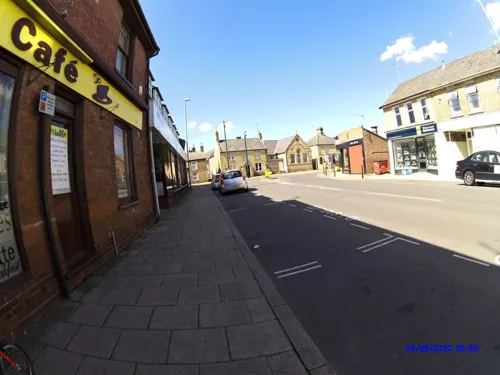
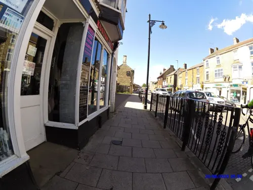
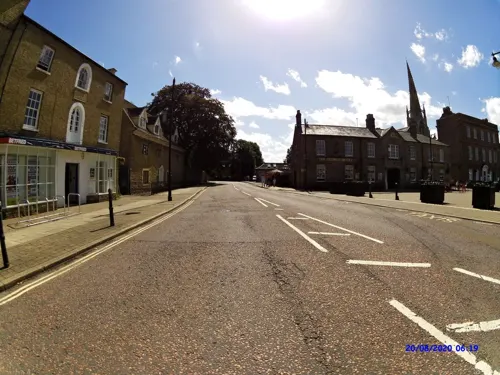

21 more on the map.
Where to stay2


Churches and places of worship9
Whittlesey Methodist/United Reformed Church
Church · Methodist, United Reformed · 0.8 mi
Shopping5
Gas and EV charging2
Schools, colleges and libraries6
Healthcare1
Map of Primrose Place
70 places. The map loads OpenStreetMap tiles when you open it.
Getting there and nearby towns
Cambridge City Airport (CBG) is the nearest airport with scheduled flights listed in OpenStreetMap, 27 miles away.
- Whittlesey 1 mi west, about 1 min by car
- Peterborough 6 mi west, about 9 min by car
- March 8 mi east, about 13 min by car
- Chatteris 10 mi southeast, about 16 min by car
- Market Deeping 12 mi northwest, about 19 min by car
- Wisbech 13 mi northeast, about 22 min by car
- Spalding 16 mi north, about 25 min by car
- Saint Ives 16 mi south, about 25 min by car
- Huntingdon 16 mi south, about 26 min by car
- Stamford 17 mi west, about 27 min by car
Drive times are estimates from straight-line distance, not routes.
Towns near Primrose Place


Keep exploring
Local news
Headlines from INDB.
Reviews, tips and questions
Loading what members have shared...
Sources and licences
- GeoNames (CC BY 4.0): population, coordinates, regions and time zone
- Mapillary (see each image): photos
- OpenStreetMap contributors (ODbL 1.0): places, airports, map data
- Wikidata (CC0 1.0): elevation, founding date, time zone, website, landmarks and historic places
- Wikimedia Commons (see each image): photos
Photo credits
- Whittlesey Town Hall June 2012, Chalkietom, CC BY-SA 4.0
- Must Farm CL3 4817 (26447110732), Dr._Colleen_Morgan from York, UK, CC BY 2.0
- Sir Harry Smith Community College, Chalkietom, CC BY-SA 4.0
- VicAveInSnow, Whittlepedia, CC BY-SA 3.0
- Street-level photo, smsm1, CC BY-SA 4.0
- Street-level photo, smsm1, CC BY-SA 4.0
- Street-level photo, smsm1, CC BY-SA 4.0
- Street-level photo, smsm1, CC BY-SA 4.0
- Street-level photo, smsm1, CC BY-SA 4.0
- Street-level photo, smsm1, CC BY-SA 4.0
- Street-level photo, smsm1, CC BY-SA 4.0
- Street-level photo, smsm1, CC BY-SA 4.0
- Street-level photo, smsm1, CC BY-SA 4.0
- Street-level photo, smsm1, CC BY-SA 4.0
- Street-level photo, smsm1, CC BY-SA 4.0
- Street-level photo, smsm1, CC BY-SA 4.0
- Street-level photo, smsm1, CC BY-SA 4.0
Page built November 10, 2026. Spotted a mistake? Tell us or suggest a place.