


Why visit Pwllheli
Townapedia lists 1 museum or landmark, 2 parks and trails, 38 places to eat, 8 places to stay and 4 attractions in and around town.
Highlights include Neuadd Dwyfor and Pont Bodefail.
Weather in Pwllheli
Forecast from MET Norway (CC BY 4.0). Full forecast
About Pwllheli
Pwllheli (Welsh: [pʊɬˈhɛli] ; ) is a market town and community on the Llŷn Peninsula (Welsh: Penrhyn Llŷn), in Gwynedd, north-west Wales. It had a population of 4,076 in 2011, which declined slightly to 3,947 in 2021; a large proportion (81%) were Welsh speaking. Pwllheli is the place where Plaid Cymru was founded. It is the birthplace of the Welsh poet Sir Albert Evans-Jones (bardic name Cynan).
From the Wikipedia article Pwllheli (this version), under CC BY-SA 4.0.
Travel tips from other travellers: Pwllheli on Wikivoyage (CC BY-SA 4.0).
Things to do4
Neuadd Dwyfor
Cinema and theater
Theatre and cinema in Pwllheli, Wales
19 Stryd Penlan, Pwllheli

Pont Bodfel
Bridge · 2.3 mi
Grade II listed building in Gwynedd. The bridge carries the major road N from Pwllheli to Nefyn over the Afon Rhyd-hir, some 900m N of...

Museums and landmarks1

Parks, trails and playgrounds2


Restaurants and cafes38
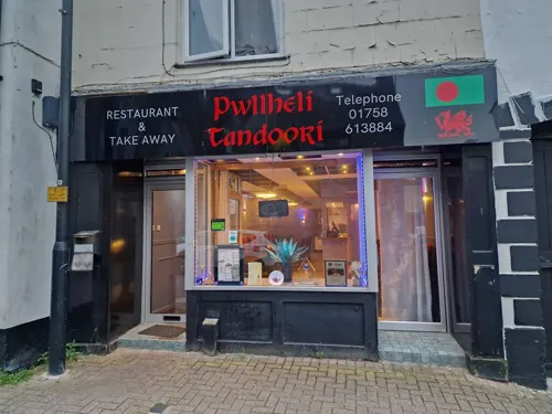
Pwllheli Tandoori
Restaurant · Indian
28 Stryd Penlan, Pwllheli

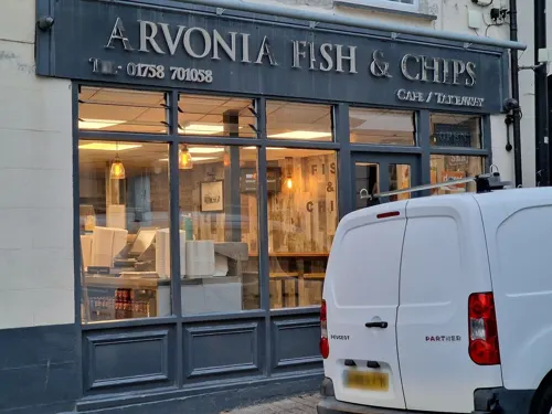



26 more on the map.
History
The town was given its charter as a borough by Edward, the Black Prince in 1355; a market is still held each Wednesday in the centre of the town on Y Maes ('the field', equivalent to 'the town square' in English).
The town grew around the shipbuilding and fishing industries and the granite quarry at Gimlet Rock (Welsh: Carreg yr Imbill).
During the 1890s, the town was developed by Solomon Andrews, a Cardiff businessman. This work included the promenade, roads and houses at West End. The Pwllheli and Llanbedrog Tramway was built, linking the town to Llanbedrog. The trams ran until 1927, when the section of track between Carreg-y-Defaid and Tyddyn-Caled was seriously damaged by a storm. Andrews ran the Cardiff Road section in 1928 and offered to sell the tramway to Pwllheli Corporation at the end of the season, but they did not take up his offer. He then sold the assets and the Corporation removed the tracks during the winter of 1928/29.
Read more of the history
Poet Albert Evans-Jones, who was an archdruid for the National Eisteddfod of Wales and was known by his bardic name Cynan, was born in Pwllheli. Before becoming an archdruid, he joined the First World War effort through the Welsh Student Company of the RAMC, serving in Salonika and France, initially as an ambulance driver and medic, later as the company's chaplain. He was the son of the proprietor of the Central Restaurant in Penlan Street, Pwllheli.
From the History section of Pwllheli on Wikipedia, under CC BY-SA 4.0.
More about Pwllheli
Arts and culture
Plas Bodegroes, which was a Michelin starred restaurant until 2009
Hafan y Môr, a former Butlins holiday camp now operated by Haven
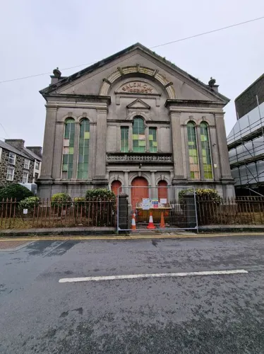
Capel Salem, purchased by potter Keith Brymer Jones and actress Marj Hogarth in 2022 and currently under renovation, which is documented in the Channel 4 series Our Welsh Chapel Dream.
Pwllheli has a section of the Wales Coast Path along its shoreline.
Pwllheli has a small harbour at the confluence of the Afon Erch and Afon Rhyd-Hir.
Hafan Pwllheli is a marina built in Pwllheli Harbour during the 1990s.
Education
Ysgol Glan y Môr was formed in 1969 by the merger of the former Pwllheli Grammar School at Penrallt and the Frondeg Secondary Modern School in Upper Ala Road to form a comprehensive school based on two sites in the town. The junior pupils (year 1 and year 2) were located at the Penrallt site and the senior pupils (year 3 and upwards) at a new complex in Cardiff Road. This new school was subsequently expanded to accommodate all pupils under the Ysgol Glan y Môr name.
The Penrallt site was later redeveloped as the Pwllheli campus of Coleg Meirion-Dwyfor. The façade of the main building of the old grammar school was retained and incorporated into the design of the current college buildings. Thus the 'old school' is readily seen from the town square (Y Maes), as it has been since the former Pwllheli County School moved to Penrallt in the early 20th century.
From the Wikipedia article Pwllheli, under CC BY-SA 4.0.
Notable people from Pwllheli
 Hywel WilliamsWelsh politician and MP for Arfon (born 1953)Photo: Richard Townshend, CC BY 3.0
 Gareth PierceBritish actorPhoto: Meena, CC BY-SA 4.0
 Owen DaviesWelsh Baptist minister (1840-1929)Photo: Owen Williams, Public domain
 Don PunchAustralian politician (born 1956)Photo: Perizyde, CC BY-SA 4.0
- Owain OwainWelsh novelist, short story writer and poet (1929–1993)
- Albert Evans-JonesWelsh poet (1895–1970)
- John Robert JonesBritish philosopher (1911–1970)
- Al LewisWelsh singer
- William Tudor HowellMP for Denbigh Boroughs from 1895 to 1900
- Eleazar RobertsWelsh astronomer and writer (1825-1912)
- William Llewelyn DaviesBritish librarian (1887-1952)
- Naz BallWelsh footballer (born 1962)
Born in Pwllheli, according to Wikidata (CC0). Each name links to its Wikipedia article.
Where to stay8
Churches and places of worship9
Shopping16
Gas and EV charging1
Schools, colleges and libraries3
Healthcare1
Map of Pwllheli
83 places. The map loads OpenStreetMap tiles when you open it.
Getting there and nearby towns
RAF Valley - Anglesey Airport (VLY) is the nearest airport with scheduled flights listed in OpenStreetMap, 25 miles away.
- Rhosneigr 24 mi north, about 39 min by car
- Tregarth 25 mi northeast, about 40 min by car
- Bangor 26 mi northeast, about 42 min by car
- Valley 28 mi north, about 45 min by car
- Holyhead 30 mi north, about 49 min by car
- Aberystwyth 36 mi southeast, about 57 min by car
- Llandudno 39 mi northeast, about 1 h by car
- Colwyn Bay 40 mi northeast, about 1 h by car
- Abergele 44 mi northeast, about 1 h 15 min by car
- Rhyl 48 mi northeast, about 1 h 15 min by car
Drive times are estimates from straight-line distance, not routes.
Towns near Pwllheli


Keep exploring
Local news
Headlines from INDB.
Reviews, tips and questions
Loading what members have shared...
Sources and licences
- GeoNames (CC BY 4.0): population, coordinates, regions and time zone
- Mapillary (see each image): photos
- OpenStreetMap contributors (ODbL 1.0): places, airports, map data
- Wikidata (CC0 1.0): elevation, founding date, time zone, website, landmarks and historic places
- Wikimedia Commons (see each image): photos
- Wikipedia (CC BY-SA 4.0): overview and history text
Photo credits
- Wedding of Shan Emlyn to Owen Edwards at Penmount Chapel, Pwllheli (1479604), Geoff Charles, CC BY-SA 4.0
- Wedding of Shan Emlyn to Owen Edwards at Penmount Chapel, Pwllheli (1479603), Geoff Charles, CC BY-SA 4.0
- Capel Salem, Pwllheli, Tom Parnell from Scottish Borders, Scotland, CC BY-SA 2.0
- Boat House (1), Aderixon, CC BY-SA 3.0
- Street-level photo, santon, CC BY-SA 4.0
- Street-level photo, santon, CC BY-SA 4.0
- Street-level photo, santon, CC BY-SA 4.0
- Street-level photo, santon, CC BY-SA 4.0
- Street-level photo, santon, CC BY-SA 4.0
- Street-level photo, santon, CC BY-SA 4.0
- Street-level photo, santon, CC BY-SA 4.0
- Street-level photo, santon, CC BY-SA 4.0
Page built November 10, 2026. Spotted a mistake? Tell us or suggest a place.