
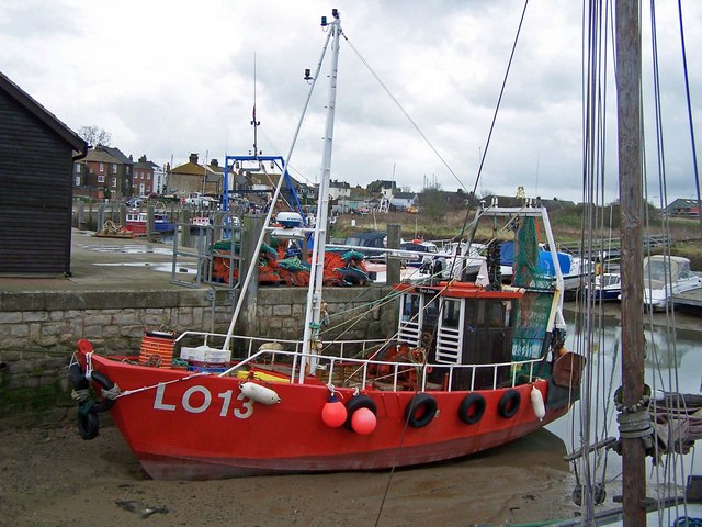



Queenborough, United Kingdom
Queenborough is a town of 3,548 people in England, United Kingdom.
Why visit Queenborough
Townapedia lists 3 museums and landmarks, 5 parks and trails, 35 places to eat, 3 places to stay and 4 attractions in and around town.
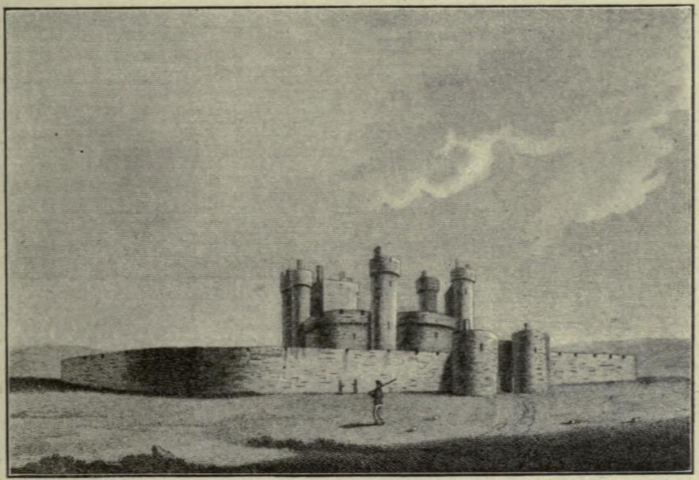
Highlights include Kingsferry Bridge, Queenborough Guildhall Museum, Queenborough Castle and Barton's Point Coastal Park.
Weather in Queenborough
Forecast from MET Norway (CC BY 4.0). Full forecast
About Queenborough
Queenborough is a town on the Isle of Sheppey in the Swale borough of Kent in South East England.
From the Wikipedia article Queenborough (this version), under CC BY-SA 4.0.
Things to do4


Museums and landmarks3
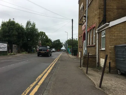
Queenborough Guildhall Museum
Museum
48 High Street, Queenborough
Apr-Oct Mo-Fr,Su off; Sa 14:00-17:00; Nov-Mar 24/7 off


HMS Princess Irene
Monument and historic site · 2.3 mi
1914 ocean liner converted to minelayer
Parks, trails and playgrounds5


Restaurants and cafes35
Mem's Mezze
Bar and pub · Turkish · 1.4 mi
Halfway Road, Minster-on-Sea
Mo off; Tu-Th,Su 15:00-22:00; Fr-Sa 15:00-23:00
Costa
Cafe · Coffee Shop · 0.7 mi
Thomsett Way, Sheerness
Mo-Fr 06:30-18:30; Sa 07:00-18:30; Su 08:00-17:30
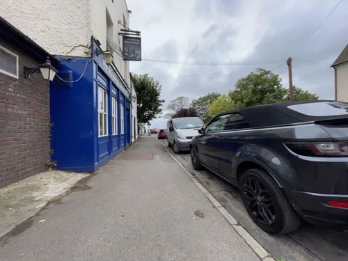
The Flying Dutchman
Bar and pub
19 High Street, Queenborough
Mo-Sa 12:00-21:00; Su 12:00-19:00
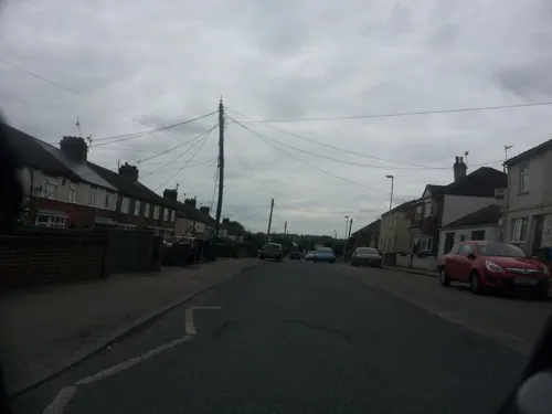
Dragon Palace
Restaurant · Chinese · 1.5 mi
27-33 Minster Road, Minster-on-Sea
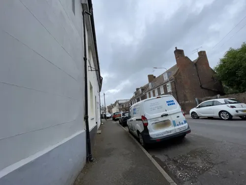

The Admiral's Arm
Bar and pub
West Street, Queenborough
Mo-Tu off; We 17:00-21:00; Th 18:00-23:00; Fr-Sa 16:00-23:00; Su...

Klondyke Cafe at the Lakes
Cafe · 1.5 mi
Halfway Road, Minster-on-Sea
Mo-Sa 07:00-14:30; Su 08:00-14:30
23 more on the map.
History
In Saxon times, the settlement on the site was known as Cyningburh, "king's borough".
The name Queenborough derives from the Old English cwēnburh and literally means the 'Queen's borough'. The town is named after Queen Philippa, the wife of King Edward III.
A fortress, called Sheppey Castle or Queenborough Castle, was built to guard the passage of ships along the Swale upon the command of King Edward III between 1361 and 1377, during the Hundred Years' War with France. It was built on the site of a much earlier, but smaller castle. Its unusual design – round and symmetrical – was described by historians Howard Colvin and R. Allen Brown as "exemplifying the principles of cylindrical and concentric fortification carried to their logical conclusion with perfect symmetry". They also suggest that the design, which bore similarities to Henry VIII's Device Forts of the 16th century, may have been designed to defend against and to make best use of gunpowder artillery. Queenborough was the only true concentric castle built in England. It regained importance in the 16th century under Thomas Cheney, when it is thought to have influenced the construction of nearby Deal Castle and Walmer Castle.
Read more of the history
In those days north Kent was divided by open waters and marshes stretching inland. The safest navigation to the open sea was then the route from the Thames into the Yantlet Creek (separating the Isle of Grain from the rest of Hoo Peninsula), and thus into the Swale from the Medway estuary, around the leeward side of the Isle of Sheppey into the Wantsum Channel, navigating past the Isle of Thanet to Sandwich and only then into the open waters of the English Channel. It was thus an easily defensible planned-town centre for the wool trade.
King Edward III had the town renamed after his Queen, Philippa of Hainault, and conferred upon it the rights of a free borough, with a governing body of a mayor and two bailiffs. He granted Queenborough a charter in 1366 and two years later bestowed the duties of a royal borough upon it.
During this period, Queenborough, on the Isle of Sheppey, was an important town for the export of wool, a significant crown revenue. In 1368, the Wool Staple was transferred from Canterbury to Queenborough: Sandwich and Queenborough became the two centres in Kent for wool trading.
The castle was excavated in 2005 by Channel 4's archaeology television programme Time Team.
The town was first represented by two members of parliament in 1572, one of its earlier MPs being the explorer Sir Humphrey Gilbert in 1580. Matthias Falconer of Brabant established the first copperas (iron II sulphate) factory in England at Queenborough in 1579.
King Charles I had the town reincorporated under the title of the "mayor, jurats, bailiffs and burgesses of Queenborough", during which time the population was chiefly employed in the local oyster fishery. However the fort having protected the Swale and Medway estuaries for 300 years was never in fact to realise its function as a garrison, and recorded no active military history. After being seized by Parliamentarians in 1650, after the Civil War, and being considered unsuitable for repair, being of "no practical use" it was demolished during the interregnum.
Not long after this, in 1667, the Dutch captured the new Sheerness fort (then under construction) and invaded Queenborough. The occupation lasted only a few days; though the Dutch caused widespread panic, they were unable to maintain their offensive, and withdrew having captured HMS Royal Charles and burnt numerous other ships in the Thames and Medway. Following this raid on the Medway, much-needed attention was given to the improvement of the naval defences of the Medway, which at length helped strengthen the economy of Queenborough and Sheppey. Some 300 years later, in 1967, The Queenborough and Brielle (the Netherlands) twinning project was established.
The parish church overhaul continued through to 1730, and a number of houses added to the growing town during the 18th century. With the general prosperity of the colonial and mercantile trades of the age, Queenborough thrived. Queenborough Guildhall was completed in 1793.
With the silting up of the Yantlet creek and the Wantsum channel and improved navigation through the Thames estuary to London, Queenborough began to lose its importance, becoming something of a backwater. Daniel Defoe described it as "a miserable and dirty fishing town (with) the chief traders ... alehouse keepers and oyster catchers".
The Royal Navy eventually became less prominent on the River Medway as other dockyards developed and ships grew in size, so that they were largely replaced by prison hulks which would frequently dispose of their dead charges on a salt marsh at the mouth of the Swale, which was subsequently to become known as Dead Man's Island, and can still be found as such, on local maps today. The new fort and harbour developments completed at Sheerness by this time further replaced Queenborough by being better positioned at the mouth of the Medway.
From the History section of Queenborough on Wikipedia, under CC BY-SA 4.0.
More about Queenborough
Economy
In December 2023, the large pharmaceutical factory operated by Recipharm closed with the loss of 150 jobs. The town also previously played host to a steel rolling mill facility, but this closed in February 2013, with the site being bulldozed in October of that year. 80 people lost their jobs as a result. The site is in the process of being redeveloped for housing as part of a regeneration scheme.
At the 2001 UK census, the economic activity of residents aged 16–74 of Queenborough and its neighbouring villages of Minster-on-Sea, Rushenden and Halfway Houses was 42.0% in full-time employment, 12.7% in part-time employment, 7.1% self-employed, 3.4% unemployed, 1.5% students with jobs, 3.0% students without jobs, 14.6% retired, 8.0% looking after home or family, 5.3% permanently sick or disabled and 2.4% economically inactive for other reasons. The unemployment rate of 3.40% was similar to the national rate of 3.35%.
From the Wikipedia article Queenborough, under CC BY-SA 4.0.
Notable people from Queenborough
 George Stephen KempPhoto: Kay Atherton, CC BY-SA 2.0
- Richard HatherillRoyal Navy officer, born 1769
Born in Queenborough, according to Wikidata (CC0). Each name links to its Wikipedia article.
Where to stay3
Sheppey Guest House
Motel and hotel · 0.9 mi
214 Queenborough Road, Minster-on-Sea
Churches and places of worship4
Kingdom Hall of Jehovah's Witnesses
Church · Jehovahs Witness · 1.5 mi
Power Station Road, Minster-on-Sea
Shopping3
Gas and EV charging1
Schools, colleges and libraries6
Healthcare2
Map of Queenborough
66 places. The map loads OpenStreetMap tiles when you open it.
Getting there and nearby towns
London Southend Airport (SEN) is the nearest airport with scheduled flights listed in OpenStreetMap, 11 miles away.
- Sheerness 2 mi northeast, about 3 min by car
- Lower Halstow 4 mi southwest, about 7 min by car
- Sittingbourne 5 mi south, about 9 min by car
- Eastchurch 5 mi east, about 8 min by car
- Upchurch 5 mi southwest, about 8 min by car
- Newington 6 mi southwest, about 9 min by car
- Teynham 7 mi southeast, about 11 min by car
- Southend-on-Sea 8 mi north, about 14 min by car
- Gillingham 9 mi west, about 14 min by car
- Chatham 10 mi west, about 16 min by car
Drive times are estimates from straight-line distance, not routes.
Towns near Queenborough


Keep exploring
Local news
Headlines from INDB.
Reviews, tips and questions
Loading what members have shared...
Sources and licences
- GeoNames (CC BY 4.0): population, coordinates, regions and time zone
- Mapillary (see each image): photos
- OpenStreetMap contributors (ODbL 1.0): places, airports, map data
- Wikidata (CC0 1.0): elevation, founding date, time zone, website, landmarks and historic places
- Wikimedia Commons (see each image): photos
- Wikipedia (CC BY-SA 4.0): overview and history text
Photo credits
- Queenborough Creek, Richard Dorrell, CC BY-SA 2.0
- 73107 on Kingsferry Bridge, "Stuart" 74009, CC BY-SA 2.0
- Queenborough Castle 1784, Unknown author Unknown author, Public domain
- 1994 Bentley Turbo R, Hugh Llewelyn, CC BY-SA 4.0
- 1976 Ford Ltd, Hugh Llewelyn, CC BY-SA 4.0
- Street-level photo, gness, CC BY-SA 4.0
- Street-level photo, paulbiv, CC BY-SA 4.0
- Street-level photo, paulbiv, CC BY-SA 4.0
- Street-level photo, paulbiv, CC BY-SA 4.0
- Street-level photo, paulbiv, CC BY-SA 4.0
- Street-level photo, paulbiv, CC BY-SA 4.0
- Street-level photo, paulbiv, CC BY-SA 4.0
- Street-level photo, paulbiv, CC BY-SA 4.0
- Street-level photo, paulbiv, CC BY-SA 4.0
- Street-level photo, paulbiv, CC BY-SA 4.0
- Street-level photo, gness, CC BY-SA 4.0
- Street-level photo, paulbiv, CC BY-SA 4.0
- Street-level photo, paulbiv, CC BY-SA 4.0
- Street-level photo, paulbiv, CC BY-SA 4.0
- Street-level photo, gness, CC BY-SA 4.0
- Street-level photo, gness, CC BY-SA 4.0
- Street-level photo, paulbiv, CC BY-SA 4.0
- Street-level photo, paulbiv, CC BY-SA 4.0
- Street-level photo, gness, CC BY-SA 4.0
- Street-level photo, paulbiv, CC BY-SA 4.0
- Street-level photo, paulbiv, CC BY-SA 4.0
- Street-level photo, paulbiv, CC BY-SA 4.0
- Street-level photo, paulbiv, CC BY-SA 4.0
- Street-level photo, paulbiv, CC BY-SA 4.0
Page built November 10, 2026. Spotted a mistake? Tell us or suggest a place.