


Why visit Chatham
Townapedia lists 84 museums and landmarks, 56 parks and trails, 228 places to eat, 12 places to stay and 9 attractions in and around town.
Highlights include Dickens World, Medway Viaducts, The Brook and Old Brook Pumping Station.
Weather in Chatham
Forecast from MET Norway (CC BY 4.0). Full forecast
About Chatham
Chatham is a town within the Medway unitary authority in the ceremonial county of Kent, England. It forms a conurbation with the neighbouring towns of Gillingham, Rochester, Strood and Rainham, and had a population of 80,596 in 2020.
From the Wikipedia article Chatham, Kent (this version), under CC BY-SA 4.0.
Travel tips from other travellers: Chatham on Wikivoyage (CC BY-SA 4.0).
Photos of Chatham


Things to do9

Dickens World
Monument and historic site · 1.5 mi
Amusement park in England


Rochester Bridge
Bridge · 1.5 mi
Bridge in Rochester, Kent, England, UK


Medway Little Theatre
Cinema and theater · 0.9 mi
256 St Margarets Banks

Museums and landmarks84


Old Brook Pumping Station
Monument and historic site
Solomons Road, Chatham
Jun-Sep Sa 11:00-15:00; Oct-May [1]Sa 11:00-15:00 || "groups by...
Former Town Hall and Medway Arts Centre
Monument and historic site · 0.4 mi
Theatre and former town hall in Chatham, Kent, England, UK
The Brook, Chatham

Royal Engineers Museum
Museum · 1.0 mi
Military museum in Gillingham, Kent, England, UK
Prince Arthur Road, Gillingham
Tu-Su 10:00-17:00; PH 10:00-17:00; Dec 24-Jan 04 off
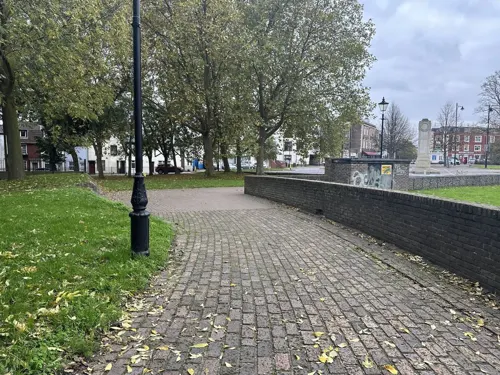


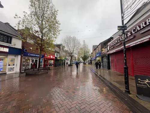
Gillingham Town Centre (High Street)
Monument and historic site · 0.9 mi
Gillingham High St is a main commercial thoroughfare in Gillingham, Kent. It features a mix of shops, cafes, and services, reflecting...
High Street, Gillingham


Restoration House
Monument and historic site · 1.1 mi
Historic house and museum in Rochester, Kent, England, United Kingdom
17 - 19 Crow Lane, Rochester
72 more on the map.
Parks, trails and playgrounds56



Capstone Farm Country Park
Park · 1.8 mi
Former farmland now nature reserve and park, near Gillingham, Kent, United Kingdom
44 more on the map.
Restaurants and cafes228

The Thomas Waghorn
Bar and pub · British
14 Railway Street, Chatham
Mo-Th,Su 08:00-24:00; Fr-Sa 08:00-01:00

Boyce's Bakery
Bakery · Bakery · 0.9 mi
62 High Street, Gillingham
Mo-Fr 07:30-16:30; Sa 07:30-16:30; Su off
Plan Burrito
Restaurant · Mexican · 1.0 mi
Plan Burrito Gillingham is a Tex-Mex restaurant on the High Street, serving burritos, tacos, and nachos. It offers customizable meals...
146 High Street, Gillingham
06:00-22:30

Three Sheets to the Wind
Bar and pub · 1.0 mi
173 High Street, Rochester
Tu-Sa 13:00-23:00, Su 13:00-22:00

Brettingtons
Restaurant · Steak House · 1.2 mi
Steak and Lobster House
79 High Street
Mooboo
Cafe · Bubble Tea · 1.0 mi
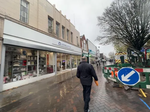
Mooboo Gillingham, at 129 High Street, specializes in bubble tea with over 1,000 drink combinations. Previously Bobaiocca Bubble Tea, it...
129 High Street, Gillingham
Mo-Fr 09:00-18:00; Sa 09:00-17:00
Pizza Hut
Restaurant · Pizza · 1.6 mi
Leviathan Way, Chatham
Mo-Th 11:00-22:00, Fr-Sa 11:00-23:00, Su 12:00-22:00


216 more on the map.
History
The A2 road passes by Chatham along the line of the ancient Celtic route. It was paved by the Romans, and named Watling Street by the Anglo-Saxons. Among certain archaeological finds here have been the remains of a Roman-era cemetery.
Chatham was a long, small village on the banks of the River Medway. By the 16th century, warships were being moored at Jillingham Water (Gillingham), because of its strategic sheltered location between London and the European continent. It was established as a Royal Dockyard by Queen Elizabeth I in 1568, and most of Chatham Dockyard lies within Gillingham. Initially a refitting base, it became a shipbuilding yard; from then until the late 19th century, further expansion of the yard took place. In its time, many thousands of personnel in the Royal Navy were employed at Chatham Dockyard, and many hundreds of vessels were launched there, including HMS Victory, which was constructed from 23 July 1759 to 30 April 1762. After World War I ended on 11 November 1918 numerous submarines were also built in Chatham Dockyard.
Read more of the history
In addition to Chatham Dockyard, defensive fortifications were built to protect it from attack. Upnor Castle had been built in 1567, but had proved ineffectual; the Raid on the Medway by the Nederlandse Staatsmarine (Dutch States Navy) from 19 June 1667 to 24 June 1667, during the Second Anglo-Dutch War, showed that more defences were required along the banks of the River Medway. The fortifications, which became more elaborate as the threat of invasion grew because of the Seven Years' War which had started on 17 May 1756, meant further construction begun during 18 October 1756 so a complex could be form across the neck of the Medway Peninsula by the bend in the River Medway, and this included Fort Amherst. The threat of a land-based attack from across the English Channel during the 19th century led to the construction of more Napoleonic Forts along the coastline in Kent, East Sussex, West Sussex, Hampshire and Dorset.
The second phase of fortress-building happened from September 1806 to February 1819, and included Fort Pitt (later used as a General Hospital and the site of the initial Army Medical School). The 1859 Royal Commission on the Defence of the United Kingdom ordered, "Inter Alia" ("Among Other Things"), a third outer ring of Napoleonic Forts: these included Fort Luton, Fort Bridgewoods, and Fort Borstal.
These fortifications required soldiers to protect them and army barracks to house those personnel. These included Kitchener Barracks (c 1750–80), the Royal Marine Barracks (c 1780), Brompton Artillery Barracks (1806) and Melville Barracks (opened 1820 as a Naval Hospital, RM Barracks from 1905). HMS Collingwood and HMS Pembroke were both Naval Barracks.
In response to the huge manpower needs, the village of Chatham and other nearby villages and towns grew commensurately. Trams, and later buses, linked those places to bring in the workforce. The area between the High Street and Luton village illustrates part of that growth, with its many streets of Victorian terraces.
The importance of Chatham Dockyard gradually declined as the resources of the Royal Navy in the United Kingdom were reduced or moved to other locations, and eventually, on 31 March 1984, it shut. The buildings of Chatham Dockyard were preserved as the site named as Chatham Historic Dockyard (operated by Chatham Historic Dockyard Trust), which was under consideration as a World Heritage Site the site is being used for other purposes. Part of the St Mary's Island section is now used as a marina, and the remainder is being developed for housing, commercial and other uses, branded as "Chatham Maritime".
From the History section of Chatham, Kent on Wikipedia, under CC BY-SA 4.0.
More about Chatham
Geography
Chatham is situated where the lower part of the dip slope of the North Downs meets the River Medway which at this point is flowing in a south–north direction. This gives the right bank, where the town stands, considerable advantages from the point of view of river use. Compared with the opposite bank, the river is fast-flowing and deep. The town lies below at river level, curving round to occupy a south-easterly trending valley (The Brook), in which lies the High Street. Beyond the Chatham Dockyard was marshy land, now called St Mary's Island, and has several new developments of housing estates. The New Road crosses the scene below the vantage point of the illustration.
The valley continues southeastwards as the Luton Valley, in which is the erstwhile village of that name; and Capstone Valley. The Darland Banks, the northern slopes of the Luton Valley above these valleys, are unimproved chalk grassland. The opposite slopes are the ‘'Daisy Banks'’ and ‘'Coney Banks'’, along which some of the defensive forts were built (including Fort Luton, in the trees to the left)
Until the start of the 20th century, most of the south part of the borough was entirely rural, with a number of farms and large tracts of woodland. The beginning of what is now Walderslade was when a speculative builder began to build the core of the village in Walderslade Bottoms.
Economy
The closure of the Royal Navy Dockyard on 31 March 1984 had the effect of changing the employment statistics of the town. About 7,000 people lost their jobs. The unemployment rate went up to 23.5%. From early April 1984 to December 1985, and onwards, the Medway Towns began to have an increase in alcohol and drug-related, antisocial behaviour, which many residents then realized had largely been caused by the closure of the Royal Navy Dockyard on 31 March 1984, and the resulting mass redundancies. There has been a concerted effort to revitalise the Thames Gateway area and one of the largest employers in Chatham is now Vanquis Bank Ltd, a subsidiary of Vanquis Banking Group.
From the Wikipedia article Chatham, Kent, under CC BY-SA 4.0.
Notable people from Chatham
 Alice OsemanEnglish author of young adult fictionPhoto: PhilipRomanoPhoto, CC BY-SA 4.0
 Conor Washingtonassociation football playerPhoto: Jrppezza, CC BY-SA 4.0
 Anne DudleyEnglish composer and pop musicianPhoto: Phil Guest, CC BY-SA 2.0
 George Boydassociation football playerPhoto: joshjdss, CC BY 2.0
 Richard DaddBritish artist (1817-1886)Photo: Henry Hering, Public domain
 George ThorneEnglish association football player (born 1993)Photo: Catherine Kõrtsmik, CC BY 2.0
 Thomas WyattEnglish rebel leader during the reign of Queen Mary I (1521-1554)Photo: Hans Holbein the Younger, Public domain
 Andrew Croftsassociation football player (born 1984)Photo: Andrew Crowther, CC BY-SA 3.0
- Lee RyanBritish singer
- Rob ElliotIrish association football player (born 1986)
- Thomas HodgskinBritish writer (1787-1869)
- William Halse Rivers RiversEnglish anthropologist, neurologist, ethnologist and psychiatrist (1864–1922)
Born in Chatham, according to Wikidata (CC0). Each name links to its Wikipedia article.
Where to stay12
Churches and places of worship54
Our Lady of Gillingham Church
Church · 1.4 mi
2A Ingram Road, Gillingham
Shopping39
Gas and EV charging6
Schools, colleges and libraries59
Rochester Riverside Church of England Primary School
School · Anglican · 1.4 mi
Gas House Road, Rochester
Healthcare24
Map of Chatham
250 places. The map loads OpenStreetMap tiles when you open it.
Getting there and nearby towns
Rochester Airport (RCS) is the nearest airport with scheduled flights listed in OpenStreetMap, 2 miles away.
- Gillingham 1 mi northeast, about 2 min by car
- Rochester 1 mi northwest, about 2 min by car
- Snodland 5 mi southwest, about 8 min by car
- Maidstone 8 mi south, about 13 min by car
- Gravesend 8 mi northwest, about 13 min by car
- Sittingbourne 9 mi east, about 15 min by car
- Tilbury 9 mi northwest, about 15 min by car
- Hartley 10 mi west, about 16 min by car
- Longfield 10 mi west, about 16 min by car
- Grays 11 mi northwest, about 18 min by car
Drive times are estimates from straight-line distance, not routes.
Towns near Chatham


Keep exploring
Local news
Headlines from INDB.
Reviews, tips and questions
Loading what members have shared...
Sources and licences
- GeoNames (CC BY 4.0): population, coordinates, regions and time zone
- Mapillary (see each image): photos
- OpenStreetMap contributors (ODbL 1.0): places, airports, map data
- Wikidata (CC0 1.0): elevation, founding date, time zone, website, landmarks and historic places
- Wikimedia Commons (see each image): photos
- Wikipedia (CC BY-SA 4.0): overview and history text
Photo credits
- Interior of the Claremont Way pedestrian underpass tunnel in Chatham, Kent, featuring graffiti and a concrete floor, OathOn, CC BY-SA 4.0
- Carton House, a tall red brick residential building with a central beige vertical strip, viewed from Church Street in Chatham, Kent, OathOn, CC BY-SA 4.0
- Fuck Covid 19 - Thanks, NHS (Tunnel graffiti, Chatham, England, June 2020), ketrin1407, CC BY 2.0
- Long view of the Medway Exchange telephone exchange building from New Road in Chatham, Kent, featuring dark brown brick and overgrown fencing, OathOn, CC BY-SA 4.0
- Long brick residential block, Copperfield House, seen from New Road in Chatham, Kent, featuring blue balcony panels, OathOn, CC BY-SA 4.0
- The Medway Exchange telephone exchange building (BT, Openreach) in Chatham, Kent, England, viewed from Claremont Way, OathOn, CC BY-SA 4.0
- MedwayM2Bridge5567, Clem Rutter, Rochester Kent, CC BY-SA 3.0
- Rochester Bridge from Rochester Castle Gardens, Prioryman, CC BY-SA 4.0
- Royal-Engineers-Museum-01, Immanuel Giel, CC BY-SA 4.0
- ChathamAmherst6572, Clem Rutter, Rochester Kent, CC BY 2.5
- Restoration House, Rochester, SilkTork, CC BY-SA 3.0
- Aerial view of the Great Lines Heritage Park, Stephen Kennard, CC0
- Nashenden Down 3, Dudley Miles, CC BY-SA 4.0
- Rede Common Local Nature Reserve 4842, ClemRutter, CC BY-SA 4.0
- FrindsburyChurchGreenChatZoom, Clem Rutter, Rochester, Kent., CC BY 2.5
- Southern End of the Church of St Nicholas, Rochester (01), Ethan Doyle White, CC BY-SA 4.0
- The Brook Theatre (Chatham Town Hall) - June 2025, Sunolafjagtenben-hur, CC0
- Rochester Cathedral from west, Raggatt2000, Public domain
- Entrance Brompton Academy, Gillingham 7566, ClemRutter, CC BY-SA 4.0
- Medway Maritime Hospital 01, Immanuel Giel, CC BY-SA 4.0
- RBSG HQ, St Andrews Square, Edinburgh, Thunderwing at English Wikipedia, CC BY-SA 3.0
- GuildhallRochester, ClemRutter at en.wikipedia, CC BY 2.5
- Royal Victoria and Bull Hotel. Medway, Dhowes9, CC BY-SA 3.0
- 60 High Street Rochester, Dhowes9, CC BY-SA 3.0
- Gordon Hotel, Dhowes9, CC BY-SA 3.0
- 173, 175, 177 High Street, Rochester, Paul the Archivist, CC BY-SA 4.0
- Rochester 37,39 High Street 5257, ClemRutter, CC BY-SA 4.0
- Rochester 79,81 High Street 5300, ClemRutter, CC BY-SA 4.0
- Rochester 106,104 High Street 5337, ClemRutter, CC BY-SA 4.0
- Luton library (6817432741), JuliaC2006 from Rochester, UK, CC BY 2.0
- The Thomas Waghorn JD Wetherspoon pub in converted Edwardian post office building on Railway Street at night, Chatham, Kent, England, 16 October 2025, OathOn, CC BY 4.0
- Aerial view of The Brook (A231), facing Dock Road & Globe Lane direction, Stephen Kennard, CC0
- Boyce’s Bakery, Gillingham (High Street) - 9th July, 2025, OathOn, CC0
- Baggins Book Bazaar, 19 High Street, Rochester, Kent, England – 'England's largest rare & secondhand bookshop', John K Thorne, Public domain
- The Brook Theatre - Chatham, Medway, Kent, Sunolafjagtenben-hur, CC0
- Hayward House, Rochester, Ethan Doyle White, CC BY-SA 4.0
- Travelodge, Station Square, Rochester Riverside - 9 April 2025, Sunolafjagtenben-hur, CC0
- Baggins Book Bazaar, 19 High Street, Rochester, Kent, England – 'England's largest rare & secondhand bookshop', John K Thorne, Public domain
- Rochester Riverside Church of England Primary School, Stephen Kennard, CC0
- Brompton-Academy, Immanuel Giel, CC BY-SA 4.0
- Aerial view of the Pentagon Shopping Centre complex in Chatham, Kent, Stephen Kennard, CC0
- Chatham- Dickens World 0118, Clem Rutter, Rochester, Kent, CC BY 3.0
- Old Brook Pumping Station, Chatham (May 2025), Sunolafjagtenben-hur, CC0
- Hillyfields Community Park - June 2025, Sunolafjagtenben-hur, CC0
- Bridge leading from Lower Lines Park towards housing of Johnson Avenue, DavidAnstiss, CC BY-SA 4.0
- Riverside country park 4815, Photograph by Clem Rutter, Rochester, Kent. ( www.clemrutter.net )., CC BY-SA 4.0
- Street-level photo, paulbiv, CC BY-SA 4.0
- Street-level photo, mapper42, CC BY-SA 4.0
- Street-level photo, mapper42, CC BY-SA 4.0
- Street-level photo, mapper42, CC BY-SA 4.0
- Street-level photo, tallguy, CC BY-SA 4.0
- Street-level photo, mapper42, CC BY-SA 4.0
- Street-level photo, tallguy, CC BY-SA 4.0
- Street-level photo, tallguy, CC BY-SA 4.0
- Street-level photo, tallguy, CC BY-SA 4.0
- Street-level photo, tallguy, CC BY-SA 4.0
- Street-level photo, mapper42, CC BY-SA 4.0
- Street-level photo, mapper42, CC BY-SA 4.0
- Street-level photo, mapper42, CC BY-SA 4.0
- Street-level photo, tallguy, CC BY-SA 4.0
- Street-level photo, mapper42, CC BY-SA 4.0
- Street-level photo, mapper42, CC BY-SA 4.0
- Street-level photo, paulbiv, CC BY-SA 4.0
- Street-level photo, mapper42, CC BY-SA 4.0
- Street-level photo, paulbiv, CC BY-SA 4.0
- Street-level photo, paulbiv, CC BY-SA 4.0
- Street-level photo, paulbiv, CC BY-SA 4.0
- Street-level photo, paulbiv, CC BY-SA 4.0
- Street-level photo, gness, CC BY-SA 4.0
- Street-level photo, paulbiv, CC BY-SA 4.0


Page built November 10, 2026. Spotted a mistake? Tell us or suggest a place.