


Radcliffe, United Kingdom
Radcliffe is a town of 29,950 people in England, United Kingdom.
Why visit Radcliffe
Townapedia lists 39 museums and landmarks, 27 parks and trails, 48 places to eat, 1 place to stay and 8 attractions in and around town.
Highlights include Clifton Aqueduct, Clifton Viaduct, Radcliffe Cenotaph and Radcliffe Tower.
Weather in Radcliffe
Forecast from MET Norway (CC BY 4.0). Full forecast
About Radcliffe
Radcliffe is a market town in the Metropolitan Borough of Bury, Greater Manchester, England. It lies in the Irwell Valley 7 miles (11 km) northwest of Manchester and 3 miles (5 km) southwest of Bury and is contiguous with Whitefield to the south. The disused Manchester Bolton & Bury Canal bisects the town.
From the Wikipedia article Radcliffe, Greater Manchester (this version), under CC BY-SA 4.0.
Things to do8

Clifton Aqueduct
Bridge · 2.4 mi
Grade II listed bridge in the United Kingdom

Clifton Viaduct
Bridge · 2.4 mi
Grade II listed bridge in Greater Manchester, England, UK

Daisyfield Viaduct
Bridge · 2.0 mi
Stone structure crossing the Manchester, Bolton and Bury Canal and River Irwell in Bury, Greater Manchester, England

Outwood Viaduct
Bridge · 0.4 mi
Grade II listed footbridge in Bury, Greater Manchester, England, UK

Ringley Old Bridge
Bridge · 1.9 mi
Grade II* listed bridge in Bolton, Greater Manchester, England, UK


Museums and landmarks39

Radcliffe Cenotaph
Monument and historic site
War memorial in Bury, Greater Manchester, England, UK

Radcliffe Tower
Monument and historic site · 0.6 mi
Grade I listed fortified house in Radcliffe, Greater Manchester, England, United Kingdom

Bury Castle
Monument and historic site · 2.5 mi
Castle in Greater Manchester, England, UK

Bury War Memorial
Monument and historic site · 2.5 mi
War memorial in Bury, UK

Lancashire Fusiliers War Memorial
Monument and historic site · 2.4 mi
War memorial in Bury, UK

Peel Memorial
Monument and historic site · 2.5 mi
Statue in Bury, Greater Manchester, England, UK

Bury Art Museum
Museum · 2.3 mi
Museum, archives, and gallery in Bury, Lancashire, England, United Kingdom
The Fusilier Museum
Museum · 2.3 mi
War museum in Moss Street, Bury, Lancashire, UK

LYR1
Monument and historic site
Boundary stone for Lancashire and Yorkshire Railway Company.
27 more on the map.
Parks, trails and playgrounds27


Clifton Country Park
Park · 2.0 mi
Nature reserve in Greater Manchester, England

Drinkwater Park
Park · 3.0 mi
Park in Prestwich, Greater Manchester, UK


Moses Gate Country Park
Park · 2.4 mi
Park in Moses Gate, United Kingdom

Philips Park
Park · 2.1 mi
Area of parkland in Prestwich, Greater Manchester, UK



15 more on the map.
Restaurants and cafes48
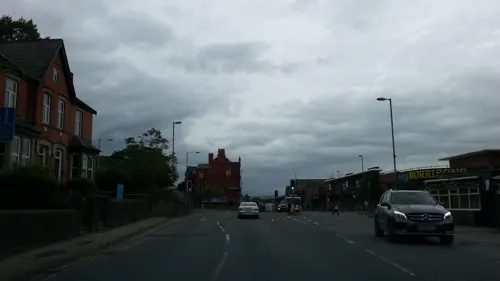
8 Manchester
Restaurant · Chinese · 1.4 mi
260 Bury New Road, Whitefield
Mo-Th 17:00-22:30; Fr 17:00-23:00; Su 12:30-21:30
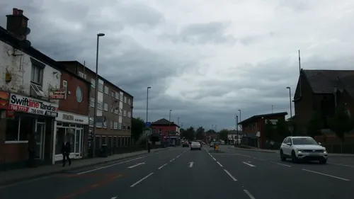
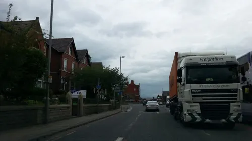
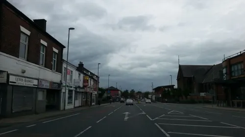
Porada
Restaurant · Italian · 1.3 mi
231 Bury New Road, Whitefield


36 more on the map.
History
The name Radcliffe is derived from the Old English words read and clif, meaning "the red cliff or bank", on the River Irwell in the Irwell Valley. The Domesday Book records the name as "Radeclive". Other archaic spellings include "Radclive" (recorded in 1227), and "Radeclif" (recorded in 1309 and 1360). The Radcliffe family took its name from the town.
The first human settlements in the area, albeit seasonal, are thought to have been as far back as 6,000BC during the Mesolithic period. Archaeological excavations in 1949 at Radcliffe Ees (a level plain along the north bank of the Irwell, formed by retreating glacial deposits during the previous ice age) found evidence of pre-historic activity, suggesting a lake village site, but dating techniques of the time were unreliable. Further investigations in 1961 revealed rows of sharpened posts and worked timbers, but no further dating evidence was collected. In 1911, while repairs to the bridge at Radcliffe Bridge were underway, a stone axe-hammer was found in the river bed. The 8.5-inch (22 cm) large tool artefact weighs 4 pounds (1.8 kg) and is made from polished Quartzite, with a bore to take a shaft.
Read more of the history
South of the present-day Withins reservoir is a possible location for a Hengi-form Tumulus. During the Roman period, a Roman road passed through the area on a south-east to north-west axis; tracing an alignment with the modern border between Radcliffe and Bury. The route linked the Roman forts of Mamucium (Manchester) and Bremetennacum (Ribchester). The approximate route was through Higher Lane in nearby Whitefield, through Dales Lane and across the Irwell over Radcliffe Ees through the site of the former East Lancashire Paper Mill. The route passes up Croft Lane, over Cross Lane and over the route of the Manchester Bolton & Bury Canal under the 10¾ milestone. It then crosses Bury and Bolton Road, and heads through Higher Spen Moor.
Other than placenames, little information about the area survives from the Dark Ages. Radcliffe was likely moorland and swamps.
Following the 11th century Norman conquest of England, Radcliffe became a parish and township in the hundred of Salford, and county of Lancashire. One of only four parishes from the hundred mentioned in the Domesday Book and held by Edward the Confessor as a Royal Manor, it initially consisted of two hamlets; Radcliffe, near to the border with Bury and centred on the Medieval Church of St Mary and the manorial Radcliffe Tower, and further to the west Radcliffe Bridge, at a crossing of the Irwell. As a Royal Manor, the hide may originally have been up to four times the size it was when it was recorded in 1212 as being held by William de Radeclive, of the "Radclyffes of the Tower" family.
In the 15th century the Pilkington family, who during the Wars of the Roses supported the House of York, owned much of the land around the parish. Thomas Pilkington was at this time lord of many estates in Lancashire. In 1485 Richard III was killed in the Battle of Bosworth. The Duke of Richmond, representing the House of Lancaster, was crowned Henry VII. Sir William Stanley may have placed the crown upon his head. As a reward for the support of his family, on 27 October 1485 Henry made Thomas Stanley the Earl of Derby. Thomas Pilkington was attainted, and in February 1489 Earl Thomas was given many confiscated estates including those of Pilkington, which included the township of Pilkington, and Bury. During the English Civil War Radcliffe, along with nearby Bolton, fought on the side of the Parliamentarians against the Royalist Bury.
In 1561, after about 400 years rule by the Radclyffes, Robert Assheton (Lord of the manor of Middleton) bought the manor of Radcliffe for 2,000 Marks. From 1765 the Assheton estates were divided between the two daughters of the late Ralph Assheton, one of whom married Thomas Egerton, 1st Earl of Wilton. The manor of Radcliffe appears to have been included in her share, and thereafter was included in the Wilton estates.
From the History section of Radcliffe, Greater Manchester on Wikipedia, under CC BY-SA 4.0.
More about Radcliffe
Geography
At 53°33′41″N 2°19′36″W (53.5615°, −2.3268°) and 170 miles (274 km) northwest of central London, Radcliffe lies in the Irwell Valley on the course of the River Irwell. The towns of Bury and Bolton lie to the northeast and northwest. For the purposes of the Office for National Statistics, Radcliffe forms a northerly part of the Greater Manchester Urban Area, with Manchester city centre 6.5 miles (10.5 km) to the south-southeast.
Radcliffe's position on the River Irwell has proved important in its history and development as the river provided a source of water for local industry. Radcliffe E'es, a level plain formed along the north bank of the Irwell during the previous ice age, is now derelict and the planned location of a new school. From a highpoint of 500 feet (152 m) above sea level in the northwest of Radcliffe, the surface gradually descends, particularly in the south and east, being the lowest along the River Irwell. The geology is represented by coal measure.
Economy
Radcliffe's first market was built by the Earl of Wilton and opened in 1851. The town was home to twelve Co-op stores, the largest of which was on Stand Lane. The four-storey structure, built in 1877, had shops and offices on the ground floor, and a large area for public meetings on the second floor. The building was truncated to two stories in June 1971, and eventually demolished. Two more Co-op stores were located on Bury Street and Cross Lane. The current market hall, built in 1937 on a different site to the old market, suffered a devastating fire in 1980 but was later restored. Radcliffe was once served by several banks including the Lancashire and Yorkshire Bank, the Manchester and Liverpool District Bank, the Union Bank of Manchester, and Parr's Bank ltd.
Radcliffe has two weekly newspapers, the Radcliffe Times, based in Bury since its merger with the Bury Times Group, and the Salford-based The Advertiser, which also covers the neighbouring areas of Prestwich and Whitefield. The main gates to the East Lancashire Paper mill (mill closed in 2001) were, in May 2018, installed in the centre of Radcliffe's Festival Gardens off Church Street.
Arts and culture
Radcliffe's wealth as a mill town gave rise to many outlets for the entertainment of its population. These included cinemas and public houses. Several cinemas were built in the town, including the Picturedrome in Water Street, and an Odeon cinema, built in 1937 along Dale Street. Whittaker Street public baths were built in 1898 and demolished in 1971. The swimming pool on Green Street which replaced the old Whittaker Street baths was itself closed down after storm damaged the main facilities in 2013 disclosing high levels of asbestos in the building super-structure. As a replacement a new £945,000 25-metre length modular above-ground swimming pool was erected in 2015 at the recently closed Riverside High School
on Spring Lane (formally Coney Green High School). The pool complex also includes a fully equipped public gymnasium. A public library was opened in 1907 on a site donated by Andrew Carnegie, who also contributed £5,000 (£520,000 today) towards the cost of the building. Two branch libraries were opened in Ainsworth between 1933 and 1935. A museum was located in the upper rooms of Close House before it was demolished in March 1969.
Education
One of the earliest schools in the parish was the Close Wesleyan Day School, a Dame school opened around 1840. St Thomas's day school was opened on 4 March 1861, and housed over 500 children. Due to overcrowding and the risk of subsidence caused by local mining activity, the school was rebuilt on a new site along School Street, provided by the Earl of Wilton. It was opened in October 1877 by Lady Wilton. On the opposite side of the town St John's school started life in 1860 as an institute along Irwell Street, and by 1864 contained 120 children. The buildings were enlarged in 1869. In 1897 eight teachers and a monitor taught 358 children. In 1899 the school leaving age was twelve, and many of the senior class were "half-timers" who would spend half the day at school, and the other half at work. This system was abolished in 1919. Regular epidemics of scarlet fever, chicken pox, mumps, and especially measles, meant that in 1897 and 1903 the school was temporarily closed. St John's School and the nearby church were demolished in the 1970s. Radcliffe also had a technical school on Whittaker Street. Formally opened by Lord Stanley on 7 November 1896, it adjoined the public baths on Whittaker Street. The building is now used as council offices.
From the Wikipedia article Radcliffe, Greater Manchester, under CC BY-SA 4.0.
Notable people from Radcliffe
 Danny BoyleEnglish filmmakerPhoto: Montclair Film, CC BY 2.0
 Nellie HalsteadBritish athlete (1910-1991)Photo: Unknown author Unknown author, Public domain
 John PartridgeEnglish actor and television presenterPhoto: Pam, CC BY 2.0
 Craig WhittakerBritish politician (born 1962)Photo: Richard Townshend, CC BY 3.0
 Catherine Chisholmfirst female medical graduate of The University of Manchester (1878-1952)Photo: Unknown author, CC BY 4.0
- John SpencerEnglish snooker player (1935–2006)
- Bruce MyersBritish actor (1942-2020)
- Billy HampsonEnglish footballer and manager (1882-1966)
- George BrooksEnglish footballer (1887-1918)
- Clive TyldesleyBritish sports commentator
- Simon HewittEnglish-born French cricketer
- George JonesEnglish footballer (born 1945)
Born in Radcliffe, according to Wikidata (CC0). Each name links to its Wikipedia article.
Where to stay1
Churches and places of worship27
Shopping3
Gas and EV charging3
Schools, colleges and libraries16
Radcliffe Hall Church of England Methodist Primary School
School · Anglican, Methodist · 0.6 mi
Bury Street, Manchester
St Bernadette's Roman Catholic Primary School
School · Roman Catholic · 1.3 mi
Abingdon Avenue, Manchester
Healthcare4
Map of Radcliffe
176 places. The map loads OpenStreetMap tiles when you open it.
Getting there and nearby towns
Manchester Airport (MAN) is the nearest airport with scheduled flights listed in OpenStreetMap, 15 miles away.
- Whitefield 1 mi southeast, about 2 min by car
- Little Lever 2 mi west, about 4 min by car
- Prestwich 3 mi southeast, about 4 min by car
- Farnworth 3 mi west, about 5 min by car
- Kearsley 3 mi southwest, about 5 min by car
- Swinton 4 mi south, about 7 min by car
- Little Hulton 4 mi southwest, about 7 min by car
- Bolton 5 mi west, about 8 min by car
- Salford 5 mi south, about 9 min by car
- Manchester 7 mi southeast, about 11 min by car
Drive times are estimates from straight-line distance, not routes.
Towns near Radcliffe


Keep exploring
Local news
Headlines from INDB.
Reviews, tips and questions
Loading what members have shared...
Sources and licences
- GeoNames (CC BY 4.0): population, coordinates, regions and time zone
- Mapillary (see each image): photos
- OpenStreetMap contributors (ODbL 1.0): places, airports, map data
- Wikidata (CC0 1.0): elevation, founding date, time zone, website, landmarks and historic places
- Wikimedia Commons (see each image): photos
- Wikipedia (CC BY-SA 4.0): overview and history text
Photo credits
- St thomas church radcliffe greater manchester2, Parrot of Doom, CC BY-SA 3.0
- Barlow Street, Radcliffe - panoramio, Gene Hunt, CC BY 3.0
- St Thomas and St John Church with St Philip Radcliffe, Alexander P Kapp, CC BY-SA 2.0
- Clifton Aqueduct aerial shot, Parrot of Doom, CC BY-SA 4.0
- Clifton viaduct looking north, Parrot of Doom, CC BY-SA 3.0
- Manchester bolton and bury canal, daisyfield viaduct 2, Parrot of Doom at English Wikipedia, Public domain
- Outwood viaduct from river irwell, Parrot of Doom, CC BY-SA 4.0
- Ringley old bridge, Parrot of Doom, CC BY-SA 3.0
- Radcliffe cenotaph, Ingy the Wingy, CC BY-SA 2.0
- Radcliffe tower hdr, Parrot of Doom, CC BY-SA 3.0
- Bury Castle moat wall, Chemical Engineer, CC BY-SA 4.0
- Bury War Memorial, Peter Broster, CC BY 4.0
- Lancashire Fusiliers memorial, Gallipoli Garden, Bury (5), Rept0n1x, CC BY-SA 3.0
- Peel Memorial statue - Bury, Christian David, CC BY-SA 4.0
- Feeder aqueduct burrs country park, Dennis Turner, CC BY-SA 2.0
- Manchester Town Hall Colonade, Pimlico Badger, CC BY-SA 2.0
- Long curve, Leverhulme park, darcy lever, bolton - panoramio, Mitt Doot, CC BY 3.0
- Moses gate 002, Original uploader was Geotek at en.wikipedia, Public domain
- All Saints Church, Whitefield, David Ingham from Bury, Greater Manchester, England, CC BY-SA 2.0
- Christ Church, Walshaw, Alexander P Kapp, CC BY-SA 2.0
- Bury Parish Church, David Ingham from Bury, Greater Manchester, England, CC BY-SA 2.0
- Prestwich, St Mary's Church, Iain Peacock, CC BY-SA 2.0
- Holy Trinity Church, Bury, Alexander P Kapp, CC BY-SA 2.0
- Parish Church of St Mary, Radcliffe, Alexander P Kapp, CC BY-SA 2.0
- St John Farnworth, Plucas58, Public domain
- St Margarets Church, Prestwich, Richerman ( talk ) 22:17, 26 January 2008 (UTC), CC BY 3.0
- St Matthew's Church, Little Lever, Alexander P Kapp, CC BY-SA 2.0
- Irwell Sculpture Trail Lookout, Parrot of Doom, Public domain
- Drinkwater Park, User:Richerman, CC BY-SA 3.0
- Street-level photo, adam2, CC BY-SA 4.0
- Street-level photo, adam2, CC BY-SA 4.0
- Street-level photo, adam2, CC BY-SA 4.0
- Street-level photo, adam2, CC BY-SA 4.0
- Street-level photo, adam2, CC BY-SA 4.0
- Street-level photo, adam2, CC BY-SA 4.0
- Street-level photo, adam2, CC BY-SA 4.0
- Street-level photo, adam2, CC BY-SA 4.0


Page built November 10, 2026. Spotted a mistake? Tell us or suggest a place.