


Why visit Radyr
Townapedia lists 8 museums and landmarks, 18 parks and trails, 34 places to eat, 4 places to stay and 2 attractions in and around town.
Highlights include Walnut Tree Viaduct, Castell Coch, Chapter and Glamorgan Canal / Long Wood.
Weather in Radyr
Forecast from MET Norway (CC BY 4.0). Full forecast
About Radyr
Radyr (Welsh: Radur; Welsh pronunciation: [ˈradɪr]) is an outer suburb of Cardiff, about 4 miles (6.4 km) northwest of Cardiff city centre. Radyr is part of Radyr and Morganstown Community, for which the 2011 Census recorded a population of 6,417.
From the Wikipedia article Radyr (this version), under CC BY-SA 4.0.
Photos of Radyr

Things to do2


Museums and landmarks8


Melingriffith Tin Plate Works
Monument and historic site · 1.0 mi
Defunct medieval metalworks in Wales

St Fagans National History Museum
Museum · 2.3 mi
Open-air museum in St Fagans, Cardiff, Wales, United Kingdom

Melingriffith Water Pump
Monument and historic site · 1.0 mi
Historical water-powered pump lifting water from stream into canal. Now not functional but powered by electric motor for demonstration

Parks, trails and playgrounds18

Glamorgan Canal / Long Wood
Park · 0.6 mi
Nature reserve in Cardiff, Wales




6 more on the map.
Restaurants and cafes34
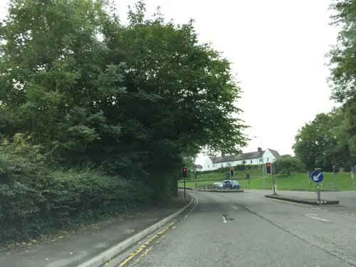
Tynant Inn
Bar and pub · 0.8 mi
Tŷ Nant Road, Cardiff
Mo-Th 11:30-23:00; Fr-Sa 11:30-23:30; Su 12:00-22:30
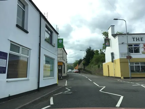
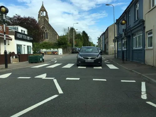
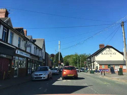
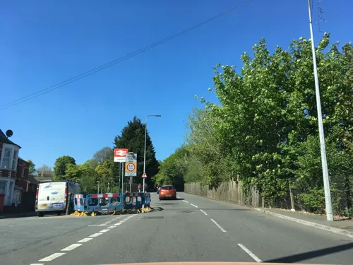
The Railway
Bar and pub · 1.5 mi
132 Station Road, Cardiff
Mo off; Tu-Fr 12:00-23:00; Sa 12:00-23:00; Su 12:00-22:00
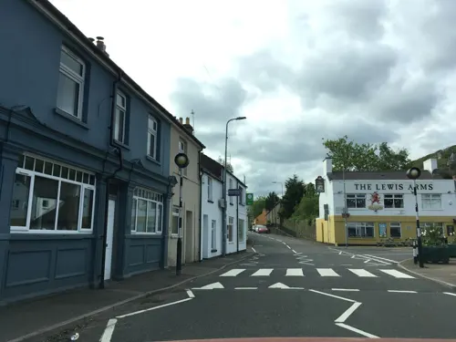
Ton Thai street food cafe
Restaurant · Thai · 1.0 mi
2D Merthyr Road, Cardiff
Mo, Th 16:30-21:30; Fr-Su 12:00-15:00, 16:30-21:30
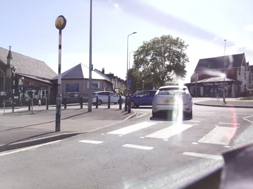
Coffi Lab
Cafe · Coffee Shop · 1.5 mi
54 Penlline Road, Cardiff
Mo-Fr 07:30-17:30; Sa 08:00-17:30; Su 08:30-17:00
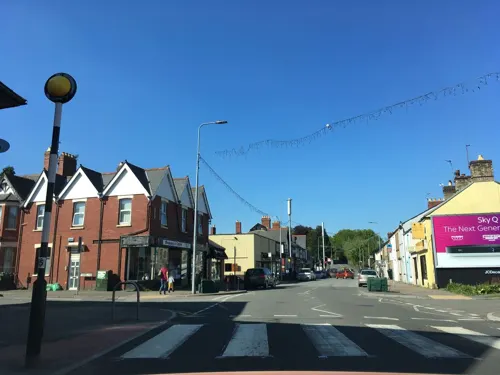



Pantmawr Inn
Bar and pub · 1.5 mi
Tyla Teg, Cardiff
Mo 15:00-23:00; Tu-Th 12:30-22:00; Fr 12:00-22:00; Sa 11:00-22:00;...
The Royal Exchange
Bar and pub · 1.4 mi
Ty Mawr Road, Cardiff
Mo-Th 14:00-23:30; Fr 13:00-24:30; Sa 13:00-24:30; Su 13:00-23:00
22 more on the map.
History
Evidence of Stone Age occupation of the Lesser Garth Cave near Morganstown was discovered in 1912 and included worked flints. In 1916 excavation of a mound of 30 metres (100 ft) in Radyr Woods revealed charcoal and Iron Age pottery. Radyr developed after the Norman invasion of Wales at the start of the 12th century and formed part of the Welsh Lordship or cantref of Miskin under the Lordship of Glamorgan created by the Norman King, William Rufus, in 1093.
Hints about the derivation of the name Radyr can be found in Lifris's writings Life of St Cadog, written between 1081 and 1104 but relating to the earlier period around AD 530, which mentions a croft or tref on the site called Aradur Hen. Lifris also tells the story of Tylyway, a hermit who was held to have lived on the banks of the Taff. Tylyway's cell is the most likely origin of the name Radyr; from the Welsh yr adur, meaning "the chantry", although Arudur Hen is also possible.
Read more of the history
The Norman motte in the "mound field" is a flat-topped mound 30 metres (100 ft) in diameter at the base and 3.8 metres (12 ft) high, surrounded by a ditch 7 metres (23 ft) wide. An adjoining bailey to east of the motte could indicate the boundary between Norman and Welsh land. The motte was surrounded by a timber palisade around a wooden keep and formed part of a defensive line with similar mottes at Thornhill and Whitchurch. The early settlement that became Radyr developed around the Norman church and manor house in what is now Danescourt. Surveys in 1307 describe an agricultural hamlet surrounded by arable fields. The 14th century Welsh Lord of Radyr, Cynwrig ap Hywel, followed by his descendants, farmed the area until it was devastated by the Black Death and by battles between the Marcher Lords in 14th and 15th centuries when the whole area was laid waste.
In 1469 Thomas Mathew (died 1469), the third or fourth son of Sir David Mathew (died 1484) of Llandaf, inherited the land by marriage to Catherine, heiress of Radyr, and built Radyr Court, a manor house on the site of what is now the Radyr Court Inn in Danescourt. The house was used as a court. Although it was destroyed by a fire in the 19th century, the three large dungeons survived and can still be seen at the Inn. On Thomas' death, his lands passed to his eldest son David and then to his younger son William Mathew (died 1528), who was knighted by King Henry VII at the Battle of Bosworth in 1485. Sir William accompanied Henry VIII to the Field of the Cloth of Gold in 1520. His successor was his eldest son Sir George Mathew, who became MP for Glamorganshire and in 1545 Sheriff of Glamorgan.
Sir George created a deer park that ranged far north of Radyr. Tenant farmers there were evicted, and the loss of rental income contributed to the decline in the family's fortunes. He had 24 children, eight of whom were illegitimate. Many were daughters, and Sir George needed large sums of money for their dowries. On his death Sir George's lands passed to his eldest son William, who also became an MP and invested in the Pentyrch ironworks. This was an astute move as feudalism was giving way to early industrialisation. William's descendants inherited a diminishing fortune. Captain George Mathew, the last of the family to live in Radyr, married Elizabeth Poyntz, and the couple left Radyr to live on her estates at Thurles in County Tipperary, Ireland in 1625.
Radyr's new owner was a wealthy landowner, Sir Edward Lewis, who was knighted by James I. Sir Edward owned St Fagans Castle and its surrounding lands, scene of the Battle of St Fagans in the English Civil War. The Lewis fortune passed to Elizabeth Lewis, who married Other Windsor, 3rd Earl of Plymouth, the principal landowner in Cardiff, Penarth and Barry.
A survey in 1766 shows that the Plymouth family owned the freeholds of most of Radyr. It continues to do so today. Plymouth Estates sold 22 acres (9 ha) of residential land in Radyr in 2007.
Many residents of Radyr worked in the Melingriffith Tin Plate Works, on the other side of the River Taff in Whitchurch. The works opened in 1749 and closed in 1957.
Samuel Lewis' 1849 Topographical Dictionary of Wales says of Radyr:
"A parish, in the poorlaw union of Cardiff, hundred of Kibbor, county of Glamorgan, in South Wales, 3½ miles (N. W. by W.) from Cardiff; containing 279 inhabitants. This parish probably derives its name, signifying "a cataract," from the rushing waters of the river Tâf, by which it is bounded on the north-east. It was formerly comprehended within the hundred of Miskin, but has been recently separated therefrom. It comprises about eleven hundred acres of arable and pasture land, inclosed and in a profitable state of cultivation: the surface is in some parts elevated, and in others flat, but nowhere subject to inundation; the soil is a strong brown earth, favourable to the production of good crops of grain of all kinds, potatoes, and hay. The substratum is partly a hard brown stone, and partly limestone of very good quality. Radyr Court, formerly the seat of the family of Matthew, ancestors of the late Lord Llandaf, has been partially taken down, and the remainder has been modernised, and converted into a farmhouse. The turnpike-road leading from Cardiff to Llantrissent passes a little to the south of the parish; and the Tâf-Vale railway runs through it, nearly parallel with the river, which is crossed by the line in this vicinity. Some of the inhabitants are employed at the iron-works in the parish of Pentyrch.
From the History section of Radyr on Wikipedia, under CC BY-SA 4.0.
More about Radyr
Geography
The surrounding soils are mostly a strong, brown, dry earth, well adapted for arable farming and the growing of grains of all kinds that contributed to the area being a mostly farming community until the modern era. Soils were further enriched over the millennia by alluvial deposits from the River Taff. The bedrock under the whole area is predominantly sandstone, dating from both the Devonian period (Old Red Sandstone) and the Triassic (New Red Sandstone) laid down in arid conditions. These may subsequently have been ground down by the Taff valley glacier during the last ice age around 18,000 years ago. Radyr Stone is a Triassic breccia used widely for decorative work in the Cardiff area, including Llandaff Cathedral, Cardiff Docks and in the bridges of the Taff Vale Railway.
The River Taff at this point runs roughly south through Taff's Well, past Radyr and through Llandaff.
Radyr Weir was built in 1774 to divert water into a leat to the Melingriffith Tin Plate Works. The weir is the third obstacle to migratory salmon and sea trout — the others being Llandaff Weir and Blackweir, both of which also have fish passes. Since the early 1980s, the salmon and sea trout stocks in the Taff have been recovering from nearly 200 years of industrial pollution and exploitation. In 1993 the National Rivers Authority monitored over 500 salmon and 700 sea trout returning to the river to spawn.
Education
The Church Rooms in Park Road were also a primary school until 1896 when the Board School was opened next door. Older pupils had to travel to secondary schools in Penarth by train. The part-time Radyr Library serves the area.
Bryn Deri Primary School was opened in 1976 and has included a nursery school since September 1999. Radyr has also a private pre-school, Park Road Nursery, and a Welsh-language nursery called Cylch Meithrin, both of which are based in the Old Church Rooms.
Radyr Primary School in Park Road opened in 1896, and new classrooms were added in 1968 to accommodate the rising population. The school currently has 11 classes and over 300 pupils.
Radyr Comprehensive School has more than 1,400 pupils from across west Cardiff. It also has a large Sixth Form college with about 300 students, and an active adult education centre.
In March 2021, Radyr Comprehensive School was the scene of a major incident where "malicious communication" was phoned through to the school. Armed police attended the scene and all pupils were successfully evacuated from the school.
From the Wikipedia article Radyr, under CC BY-SA 4.0.
Notable people from Radyr
 Trevor ArnottWelsh cricketer (1902-1975)Photo: Dave.Dunford, CC BY-SA 4.0
 Dai LewisWelsh rugby union playerPhoto: Walter Alfred Pearce, Public domain
Born in Radyr, according to Wikidata (CC0). Each name links to its Wikipedia article.
Where to stay4
Churches and places of worship22
Shopping5
Gas and EV charging2
Schools, colleges and libraries14
Healthcare8
Llandaff North Medical Centre
Clinic and pharmacy · 1.5 mi
99 Station Road, Cardiff
Map of Radyr
117 places. The map loads OpenStreetMap tiles when you open it.
Getting there and nearby towns
Cardiff Airport (CWL) is the nearest airport with scheduled flights listed in OpenStreetMap, 9 miles away.
- Whitchurch 2 mi east, about 3 min by car
- Rhiwbina 2 mi east, about 3 min by car
- Cardiff 4 mi southeast, about 7 min by car
- Caerphilly 4 mi northeast, about 7 min by car
- Llantrisant 5 mi west, about 8 min by car
- Wenvoe 5 mi south, about 8 min by car
- Penarth 7 mi southeast, about 11 min by car
- Pontypridd 7 mi northwest, about 11 min by car
- Barry 8 mi south, about 13 min by car
- Tonyrefail 9 mi northwest, about 14 min by car
Drive times are estimates from straight-line distance, not routes.
Towns near Radyr


Keep exploring
Local news
Headlines from INDB.
Reviews, tips and questions
Loading what members have shared...
Sources and licences
- GeoNames (CC BY 4.0): population, coordinates, regions and time zone
- Mapillary (see each image): photos
- OpenStreetMap contributors (ODbL 1.0): places, airports, map data
- Wikidata (CC0 1.0): elevation, founding date, time zone, website, landmarks and historic places
- Wikimedia Commons (see each image): photos
- Wikipedia (CC BY-SA 4.0): overview and history text
Photo credits
- Black poplar trunk Sycamore leaves by Taff, Radyr weir November 1974 (30986595756), Dr Mary Gillham Archive Project, CC BY 2.0
- Radyr weir (2197935272), Ben Salter from Wales, CC BY 2.0
- Christ Church Radyr, TR001, CC BY 3.0
- Chapter front 1, Chapter Arts Centre, Cardiff, Public domain
- Melingriffith tinworks from South East. February 14th 1972 (23916826348), Dr Mary Gillham Archive Project, CC BY 2.0
- St Fagans Museum Main Building 2018, Sionk, CC BY-SA 4.0
- Llandaff Fields path, Welsh leprechaun, Public domain
- Sanatorium Park Entrance, Moonbeam52, CC BY-SA 4.0
- Thompson's Park, Cardiff, Unknown author, Public domain
- Victoria Park Canton, Peter Wasp, CC BY-SA 2.0
- St Michael and All Angels church, Tongwynlais, John Grayson, CC BY-SA 2.0
- Radyr StJohnBaptist south, Motacilla, CC BY-SA 3.0
- Church of the Resurrection, Ely, Cardiff, Sean Kisby, CC BY-SA 3.0
- Ely Methodist Church, May 2020 02, No Swan So Fine, CC BY-SA 4.0
- Pen Rhiw chapel, St Fagans, Dave Snowden, CC BY-SA 2.0
- St Catherine's Church, King's Road, Cardiff, Ham II, CC BY-SA 4.0
- Castell Coch - exterior, Hchc2009, CC BY-SA 4.0
- Radyr Comprehensive School reception, TR001, CC BY 3.0
- Gelynis Farm, John Vigar, CC BY-SA 2.0
- Castell Coch 2018, DeFacto, CC BY-SA 4.0
- Glamorganshire Canal-by-George-Tod, Author= George Tod, CC BY-SA 2.0
- Walnut Tree Viaduct in 1960s, Dr Mary Gillham Archive Project, CC BY 2.0
- Street-level photo, southglos, CC BY-SA 4.0
- Street-level photo, southglos, CC BY-SA 4.0
- Street-level photo, southglos, CC BY-SA 4.0
- Street-level photo, southglos, CC BY-SA 4.0
- Street-level photo, southglos, CC BY-SA 4.0
- Street-level photo, southglos, CC BY-SA 4.0
- Street-level photo, southglos, CC BY-SA 4.0
- Street-level photo, southglos, CC BY-SA 4.0
- Street-level photo, southglos, CC BY-SA 4.0
- Street-level photo, southglos, CC BY-SA 4.0
- Street-level photo, miguel_andrade, CC BY-SA 4.0
- Street-level photo, miguel_andrade, CC BY-SA 4.0
- Street-level photo, southglos, CC BY-SA 4.0
- Street-level photo, miguel_andrade, CC BY-SA 4.0
- Street-level photo, southglos, CC BY-SA 4.0
- Street-level photo, southglos, CC BY-SA 4.0
- Street-level photo, southglos, CC BY-SA 4.0
- Street-level photo, southglos, CC BY-SA 4.0
- Street-level photo, southglos, CC BY-SA 4.0
- Street-level photo, laye, CC BY-SA 4.0
- Street-level photo, southglos, CC BY-SA 4.0
- Street-level photo, southglos, CC BY-SA 4.0


Page built November 10, 2026. Spotted a mistake? Tell us or suggest a place.