


Why visit Penarth
Townapedia lists 17 museums and landmarks, 41 parks and trails, 72 places to eat, 3 places to stay and 11 attractions in and around town.
Highlights include Cardiff Bridge, New Theatre, Cardiff Castle and Chapter.
Weather in Penarth
Forecast from MET Norway (CC BY 4.0). Full forecast
About Penarth
Penarth ( pen-ARTH, Welsh: [pɛnˈarθ]) is a town and community in the Vale of Glamorgan, Wales, approximately three miles (five kilometres) south of Cardiff city centre on the west shore of the Severn Estuary at the southern end of Cardiff Bay.
From the Wikipedia article Penarth (this version), under CC BY-SA 4.0.
Travel tips from other travellers: Penarth on Wikivoyage (CC BY-SA 4.0).
Things to do11
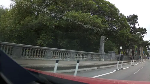
Cardiff Bridge
Bridge · 3.0 mi
Grade II listed building in Cardiff. Bridge in Cardiff, Wales


Pont y Werin
Bridge · 0.8 mi
Pedestrian and cycle bridge in Cardiff, Wales

Sherman Theatre
Cinema and theater · 3.4 mi
Theatre in Cardiff, Wales

Swiss Bridge at Cardiff Castle
Bridge · 3.0 mi
Bridge in Bute Park, Cardiff

The Prince of Wales
Cinema and theater · 2.7 mi
Pub in Cardiff, Wales; formerly a theatre

Cardiff Bay Opera House
Cinema and theater · 1.9 mi
Proposed centre for the performing arts in Cardiff Bay, Cardiff, Wales
Empire Theatre
Cinema and theater · 3.0 mi
Former theatre and cinema in Cardiff, Wales

Old Leckwith Bridge
Bridge · 2.7 mi
Grade II* listed building in Cardiff
Museums and landmarks17

Cardiff Castle
Monument and historic site · 3.0 mi
Castle in Cardiff, Wales


Cosmeston Medieval Village
Museum · 1.8 mi
Medieval village in south Wales

Museum of Cardiff
Museum · 2.8 mi
Local history museum in Cardiff, Wales, United Kingdom

National Museum Cardiff
Museum · 3.2 mi
Main site of the national museum of Wales, United Kingdom

South African War Memorial
Monument and historic site · 3.2 mi
Grade II* listed building in Cardiff. War memorial in Cardiff, Wales

Statue of Betty Campbell
Monument and historic site · 2.7 mi
2021 sculpture in Cardiff, Wales

Techniquest
Museum · 1.7 mi
Science and discovery centre in Cardiff Bay
Wales Genocide Memorial
Monument and historic site · 3.4 mi
Memorial in Cardiff, Wales


Turner House Gallery
Museum
Grade II listed building in Vale of Glamorgan. Art gallery in Penarth, south Wales
Firing Line: Cardiff Castle Museum of the Welsh Soldier
Museum · 3.0 mi
Museum in Cardiff Castle, Cardiff, Wales, United Kingdom
5 more on the map.
Parks, trails and playgrounds41


Cosmeston Lakes Country Park
Park · 1.7 mi
Country park in the Vale of Glamorgan, Wales


Vindico Arena
Sports field and stadium · 0.9 mi
Olympian Drive, Cardiff



29 more on the map.
Restaurants and cafes72

Cedar Tree Farm
Restaurant · British · 1.2 mi
Ferry Road, Cardiff
Su-Th 08:00-22:00; Fr-Sa 08:00-23:00

El Puerto
Restaurant · Seafood, Spanish · 0.5 mi
Paget Road, Cardiff
Mo Off; Tu Off; We Off; Th Off; Fr 19:00-23:00; Sa...

La Marina
Restaurant · Seafood, Spanish · 0.5 mi
Paget Road, Cardiff
Mo-Th 12:00-14:30,18:30-23:00; Fr 12:00-15:00,18:00-23:00; Sa...

Asda Café
Cafe · Coffee Shop · 1.3 mi
Ferry Road, Cardiff
Mo 07:00-24:00; Tu-Fr 00:00-24:00; Sa 00:00-22:00; Su 10:30-16:30

Romeo's By The Sea
Restaurant · Italian · 0.4 mi
The Esplanade, Penarth
Mo-We 12:00-14:30,17:30-20:00; Th-Sa 12:00-14:30,17:30-21:00; Su...

The Albion
Bar and pub
28 Glebe Street, Penarth
Mo-Th 15:00-23:00; Fr-Sa 12:00-00:00; Su 12:00-23:00

60 more on the map.
History
The Penarth area has a history of human inhabitation dating back at least 5000 years. In 1956 several Neolithic stone axe heads were found in the town. A large hoard of Roman rings and coins were also discovered at nearby Sully.
From the 12th century until 1543 the lands of Penarth were owned by the canons of St Augustine, Bristol. The Norman church of St Augustine (on the headland) dates from this period. After the dissolution of the monasteries the ownership transferred to the dean and chapter of Bristol Cathedral.
The manor lands were leased to the Earls of Plymouth of St. Fagans Castle. In 1853 the family purchased the manor outright.
Because the surrounding land was owned by religious institutions from an early date, there was no need for a large family house in Penarth. The oldest building in the area is a Tudor mansion, owned by the Herbert family, on the hillside at Cogan Pill. This has since been converted into a chain restaurant.
Piracy was prevalent on the coast near Penarth and, in the 1570s, a Special Commission being set up to investigate and suppress it. Leading family members in Penarth were believed to be implicated.
Read more of the history
Penarth's medieval walled Sheriff's Pound, an early form of multi-purpose gaol, remained in use until the late 18th century, as a place to retain stray sheep, cattle and pigs or to imprison thieves, rustlers and vagabonds. It was located roughly where the car park now stands, at the rear of the NatWest Bank in Plymouth Road.
In 1803, Penarth is recorded as having between 800 and 900 acres (320 and 360 hectares) of land under cultivation as several farms. In the 1801 census, there were just 72 people living in the Manor. Even as late as 1851, Penarth was still little more than a small rural farming and fishing village since medieval times, with just 24 houses and 105 residents, being one of five parishes contained within the Hundred of Dinas Powys, with a combined population of just over 300. Before the pier and dock were built, there was a tiny fleet of local sail-powered fishing vessels based on the main town beach that tied up on the seafront quayside.
The Plymouth estate office retained control over the planning, building and development of the new town, offering 99-year leases and remaining the ground landlord. All householders in Penarth were tenants of the Plymouth Estates, paying an annual ground rent. The situation would not change until the Leasehold Reform Act 1967, that gave householders the choice of purchasing their freehold or negotiating 999 year extensions on their short leases.
The earliest homes built in the town were streets of terraced houses with busy corner shops and public houses on almost every corner, following the contours of the headland and in the rapidly expanding Cogan area near the docks. Local grey limestone, quarried from what is now Cwrt-y-vil playing fields, gave a particular character to the surviving older buildings of the town. To the south of the town centre, imposing detached villa residences along the cliff tops looked across the Channel to the Somerset coast and the islands of Flat Holm (Welsh: Ynys Echni) and Steep Holm (Welsh: Ynys Rhonech). The villas were built by wealthy shipping and dock owners from Cardiff who were moving out of the industrialised city for a more genteel and sophisticated lifestyle.
By 1861, the number of people in the five parishes had increased to 1,898 and to 3,382 by 1871. In 1875, three of the constituent parishes - Penarth, Cogan, and Llandough - were merged into the Penarth Local Board, giving a population of 6,228 persons by 1881. This figure had doubled by 1891 with the opening of the railway and had increased even further by 1901 to 14,228 persons. The town of Penarth thus owes its development to the massive expansion of the South Wales coalfield in the 19th century. Its proximity to Cardiff, which was the natural outlet for the industrial valleys of Glamorgan, and its natural waterfront meant that Penarth was ideally situated to contribute to meeting the world's demand for Welsh coal through the construction of the docks.
The development of the town continued to be rapid and Penarth soon became self-sufficient, with its own local government, a thriving shopping centre and many new community facilities. What is now the main shopping area of Windsor Road was originally residential housing, but the owners sacrificed their front gardens to build shop extensions, although the original house architecture can still be seen above the shops. Most of the town's fine architectural features owe their origin to the landowners of the time and the results of their vision can be seen by the many grand buildings and parks which make Penarth what it is today. Thanks to the generosity of those far sighted landowners, Penarth earned its wide reputation as "The Garden by the Sea" because of its beautiful parks and open spaces. Furthermore, many of the buildings and features of the town have led to a substantial part of the town being designated as a Conservation Area because of its Victorian/Edwardian architecture. Penarth's town library was opened in 1905, thanks to a donation by the Carnegie Trust. The town's gothic style Police Station and town gaol opened in 1864, opposite the Windsor Arms brewery.
From the History section of Penarth on Wikipedia, under CC BY-SA 4.0.
More about Penarth
Geography
Penarth lies four miles (six kilometres) southwest of Cardiff by road and has a road infrastructure that has been much improved in recent years, together with a traditional rail link. The Cardiff Bay Barrage between Penarth Head and Grangetown was completed in 1999 and came into operation shortly afterwards. The impounding of the River Taff and River Ely has created 220.35 hectares (544+1⁄2 acres) of freshwater lake in the Cardiff Bay. The promised pedestrian and cyclist short cut to Cardiff across the barrage finally opened to the public on Friday 27 June 2008, after numerous postponements.
An imaginary line drawn between Lavernock Point, just two miles (three kilometres) southwest of Penarth and Sand Point, Somerset marks the lower limit of the Severn Estuary and the start of the Bristol Channel, hence Penarth is technically deemed to be in the Severn Estuary and not on the Bristol Channel. Because of the extreme tidal range there are very strong currents or rips close inshore, with speeds that exceed seven knots (3.5 m/s), for several hours at each tide. The rise and fall of the tides at Penarth are the second highest recorded anywhere in the world and on occasions when certain moon phases coincide with the spring and autumn equinoxes the sea level can overspill the esplanade wall and flood the roadway, particularly if in conjunction with a high wind.
Economy
In the Victorian era, Penarthians relied on the tourist trade, which prompted the construction of Penarth Pier in 1894. Today, Penarth's high street (Windsor Road) is the focal point and commercial area of the town. Most employers in Penarth are local services but the town is also home to some larger companies, some of which operate globally, these include the AIM listed EKF Diagnostics, headquartered on Stanwell Road and the startup Wealthify, acquired by Aviva in 2019.
Education
St Cyres Comprehensive School, formerly Penarth County Secondary School has employed a keen focus on its Welsh Baccalaureate programme, where it has led the way in delivering this new qualification, associated to the International Baccalaureate programme. Spread over two sites with years seven to nine located in both Penarth and nearby Dinas Powys, and years ten to thirteen on just Penarth, the bigger of the two sites. Work to complete the new school completed in 2012 with the completion of the Penarth Learning Community providing enviable facilities in the £48 million development. The main feeders schools for St Cyres are Llandough Primary, Fairfield County Primary, Cogan Primary and all the primary schools in Dinas Powys. In the autumn of 2008 St Cyres became the first fairtrade secondary school in Penarth and in March 2022 became the first School of Sanctuary in the Vale.
From the Wikipedia article Penarth, under CC BY-SA 4.0.
Notable people from Penarth
 Erin RichardsWelsh actress and directorPhoto: Gage Skidmore, CC BY-SA 3.0
 JemWelsh singer, songwriter, and record producerPhoto: Andrew Lillywhite, CC BY-SA 3.0
 Adrian GoldsworthyWelsh historian and authorPhoto: Vera de Kok, CC BY-SA 4.0
 High ContrastWelsh DJ, record producerPhoto: Bizzurp, CC BY-SA 3.0
 Edward YoudeBritish administrator, diplomat and sinologist (1924–1986)Photo: LungSanLau, CC BY-SA 3.0
 Aitor AriñoSpanish handball playerPhoto: Wenflou, CC0
 Mary GlynneWelsh actress (1895-1954)Photo: Unknown author Unknown author, Public domain
 Louis Rees-ZammitWelsh rugby and American football playerPhoto: stede64, CC BY-SA 2.0
- Eric LinklaterScottish fiction, history and travel writer (1899–1974)
- James WilliamsWelsh field hockey player, born 1878 (1878–1929)
- Arthur Loveridgezoologist (1891-1980)
- Angus Charles GrahamBritish scholar and Sinologist and Professor of Classical Chinese at the University of London (1919-1991)
Born in Penarth, according to Wikidata (CC0). Each name links to its Wikipedia article.
Where to stay3
Churches and places of worship38
Shopping21
Gas and EV charging2
Schools, colleges and libraries18
Healthcare6
Map of Penarth
229 places. The map loads OpenStreetMap tiles when you open it.
Getting there and nearby towns
Cardiff Airport (CWL) is the nearest airport with scheduled flights listed in OpenStreetMap, 8 miles away.
- Cardiff 3 mi north, about 5 min by car
- Whitchurch 5 mi north, about 9 min by car
- Weston-super-Mare 11 mi southeast, about 17 min by car
- Risca 12 mi north, about 19 min by car
- Newport 13 mi northeast, about 21 min by car
- Pontypridd 13 mi northwest, about 22 min by car
- Clevedon 14 mi east, about 22 min by car
- Yatton 15 mi east, about 25 min by car
- Burnham-on-Sea 16 mi southeast, about 25 min by car
- Treharris 17 mi north, about 27 min by car
Drive times are estimates from straight-line distance, not routes.
Towns near Penarth


Keep exploring
Local news
Headlines from INDB.
Reviews, tips and questions
Loading what members have shared...
Sources and licences
- GeoNames (CC BY 4.0): population, coordinates, regions and time zone
- Mapillary (see each image): photos
- OpenStreetMap contributors (ODbL 1.0): places, airports, map data
- Wikidata (CC0 1.0): elevation, founding date, time zone, website, landmarks and historic places
- Wikimedia Commons (see each image): photos
- Wikipedia (CC BY-SA 4.0): overview and history text
Photo credits
- Penarth Centre, Colin Smith, CC BY-SA 2.0
- Penarth, Vale of Glamorgan, September 2025, Sh90210, CC BY 4.0
- Penarth, August Dominus, CC0
- Windsor Arcade, Penarth, Sionk, CC BY-SA 3.0
- New Theatre Cardiff (16939562447), Tony Hisgett from Birmingham, UK, CC BY 2.0
- Penarth Pier 2013, Ben Salter, CC BY 2.0
- Sherman Cymru, Ham, CC BY-SA 3.0
- Swiss Bridge, Cardiff Castle - 1880s postcard, Unknown author Unknown author, Public domain
- Prince of Wales Theatre Cardiff Wood St facade B, Verbcatcher, CC BY-SA 4.0
- Cardiff Castle - panoramio (1), Tevfik Teker, CC BY 3.0
- Chapter front 1, Chapter Arts Centre, Cardiff, Public domain
- Cosmeston medieval village, Andy Spenceley, CC BY-SA 2.0
- Cardiff Story entrance (1), Seth Whales, CC BY-SA 3.0
- Amgueddfa Genedlaethol Caerdydd, Ham II, CC BY-SA 3.0
- Cathays Park Boer War Memorial, Ham, CC BY-SA 3.0
- Betty Campbell statue - full view, 14GTR, CC BY-SA 4.0
- Cardiff - Techniquest, Tiia Monto, CC BY-SA 3.0
- Hudswell Clarke 0-6-0T 544 (1900) Welsh Industrial & Maritime Museum, Cardiff 28.10.1992 (1) (10196698845), Gillett's Crossing from Bristol, United Kingdom, CC BY 2.0
- Evening on Grangemoor Park hill, Sionk, CC BY-SA 4.0
- Cosmeston Lake, see below, CC BY-SA 2.0
- Sanatorium Park Entrance, Moonbeam52, CC BY-SA 4.0
- Falk Oberdorf St. John Churchyard Park, Falk Oberdorf, Osterstr. 8, 32312 Lübbecke, CC BY-SA 3.0 de
- Pulpit, St Edward's Church, Roath, Cinnamonsweets, CC BY-SA 4.0
- Eglwys Gadeiriol Caerdydd, Ham II, CC BY-SA 4.0
- St John the Evangelist Church, Canton, Cardiff, Sean Kisby, CC BY-SA 3.0
- City United Reformed Church, Cardiff 01, Ham, CC BY-SA 3.0
- Eglwys Dewi Sant, Caerdydd 01, Ham, CC BY-SA 3.0
- Cardiff Bay Norwegian Church 02, Michael Gwyther-Jones from UK, CC BY 2.0
- St. Augustine's church, Penarth, Gareth James, CC BY-SA 2.0
- St James the Great, Newport Road, Ham II, CC BY-SA 4.0
- UWIC Llandaff Cardiff, Welsh leprechaun, Public domain
- Cardiff Wetlands Aerial View, Cardiff Harbour Authority, CC BY-SA 3.0
- Penarth Marina, Tony Hodge, CC BY-SA 2.0
- The Principal St David's Hotel, Tiia Monto, CC BY-SA 3.0
- Stanwell School former Girls School entrance Penarth, TR001, CC BY 3.0
- Westbourne School Penarth, Westbourne penarth, CC BY-SA 4.0
- Ice Arena Wales February 2016, Ben Salter, CC BY 2.0
- Penarth, Trinity Methodist Church (35833209746), The National Churches Trust, CC BY 2.0
- Llandough Primary School, Sionk, CC BY-SA 4.0
- Penarth and around, February 2018 21, No Swan So Fine, CC BY-SA 4.0
- Cogan primary school 2, TR001, CC BY 3.0
- Cedar Tree Farm Inn, Cardiff, Sionk, CC BY-SA 4.0
- The Merrie Harrier pub (1), Sionk, CC BY-SA 4.0
- Harvester Cardiff Bay, Sionk, CC BY 4.0
- Pont y Werin, Gareth James, CC BY-SA 2.0
- Sophia Gardens Coach Station 2, Sionk, CC BY-SA 4.0
- Alexandra Park, Penarth 2024, August Dominus, CC0
- Street-level photo, southglos, CC BY-SA 4.0
- Street-level photo, southglos, CC BY-SA 4.0
- Street-level photo, southglos, CC BY-SA 4.0
- Street-level photo, southglos, CC BY-SA 4.0
- Street-level photo, southglos, CC BY-SA 4.0
- Street-level photo, southglos, CC BY-SA 4.0
- Street-level photo, southglos, CC BY-SA 4.0
- Street-level photo, southglos, CC BY-SA 4.0
- Street-level photo, southglos, CC BY-SA 4.0
- Street-level photo, southglos, CC BY-SA 4.0


Page built November 10, 2026. Spotted a mistake? Tell us or suggest a place.