


Whitchurch, United Kingdom
Whitchurch is a town of 13,974 people in Wales, United Kingdom.
Why visit Whitchurch
Townapedia lists 29 museums and landmarks, 47 parks and trails, 147 places to eat, 4 places to stay and 10 attractions in and around town.
Highlights include New Theatre, Plasnewydd English Calvinistic Methodist Chapel, Insole Court and Cardiff Castle.
Weather in Whitchurch
Forecast from MET Norway (CC BY 4.0). Full forecast
About Whitchurch
Whitchurch (Welsh: Yr Eglwys Newydd, lit. 'the New Church') is a suburb and community in the north of Cardiff, capital of Wales. It is approximately 3 miles north of the centre of the city on the A470 road and A4054 road. It falls within the Whitchurch & Tongwynlais ward. The population of the community in 2021 was 15,817.
From the Wikipedia article Whitchurch, Cardiff (this version), under CC BY-SA 4.0.
Photos of Whitchurch


Things to do10


Plasnewydd English Calvinistic Methodist Chapel
Cinema and theater · 2.6 mi
Calvinistic Methodist chapel in Cardiff

Sherman Theatre
Cinema and theater · 2.5 mi
Theatre in Cardiff, Wales

Swiss Bridge at Cardiff Castle
Bridge · 2.6 mi
Bridge in Bute Park, Cardiff

The Prince of Wales
Cinema and theater · 3.0 mi
Pub in Cardiff, Wales; formerly a theatre


Cardiff Bridge
Bridge · 2.6 mi
Grade II listed building in Cardiff. Bridge in Cardiff, Wales

Empire Theatre
Cinema and theater · 2.8 mi
Former theatre and cinema in Cardiff, Wales
Old Leckwith Bridge
Bridge · 2.9 mi
Grade II* listed building in Cardiff

Museums and landmarks29


Melingriffith Tin Plate Works
Monument and historic site · 0.7 mi
Defunct medieval metalworks in Wales

Museum of Cardiff
Museum · 2.9 mi
Local history museum in Cardiff, Wales, United Kingdom

National Museum Cardiff
Museum · 2.6 mi
Main site of the national museum of Wales, United Kingdom

South African War Memorial
Monument and historic site · 2.6 mi
Grade II* listed building in Cardiff. War memorial in Cardiff, Wales

St Fagans National History Museum
Museum · 2.8 mi
Open-air museum in St Fagans, Cardiff, Wales, United Kingdom

Statue of Betty Campbell
Monument and historic site · 3.0 mi
2021 sculpture in Cardiff, Wales

Melingriffith Water Pump
Monument and historic site · 0.7 mi
Historical water-powered pump lifting water from stream into canal. Now not functional but powered by electric motor for demonstration

Ffotogallery
Museum · 2.2 mi
National development agency for photography in Wales
Firing Line: Cardiff Castle Museum of the Welsh Soldier
Museum · 2.7 mi
Museum in Cardiff Castle, Cardiff, Wales, United Kingdom
17 more on the map.
Parks, trails and playgrounds47


Glamorgan Canal / Long Wood
Park · 1.2 mi
Nature reserve in Cardiff, Wales



35 more on the map.
Restaurants and cafes147
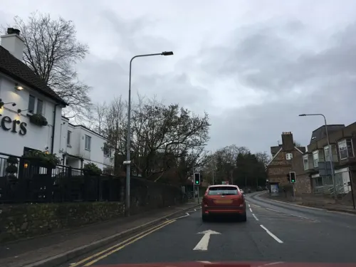
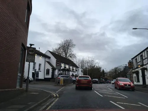
Maltsters Arms Hotel
Bar and pub · 1.3 mi
42-44 Cardiff Road, Cardiff
Su-Th 11:00-22:00; Fr,Sa 11:00-23:00
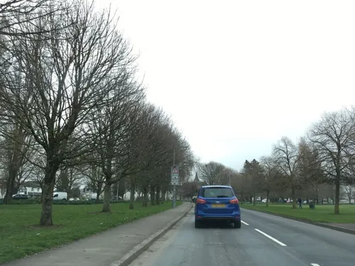
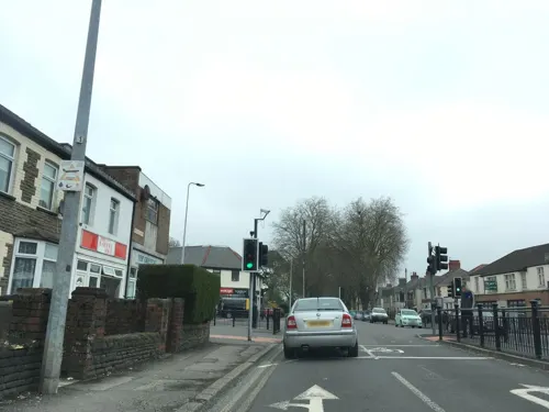


The Butchers Arms
Bar and pub · 1.2 mi
High Street, Cardiff
Mo-Th 16:00-22:00; Fr 16:00-23:30; Sa 12:00-23:30; Su 12:00-22:00

135 more on the map.
History
Whitchurch draws its name from White Church, although its name in Welsh Yr Eglwys Newydd means The New Church. The first mention of the area was in 1126 when the land was granted to Llandaff Cathedral and a chapel was built where Old Church Road now stands. The church, St Mary's, remained a dependency of the cathedral until 1845 when it became a separate parish.
After much resistance to the Norman conquest of Wales, the area succumbed to the Normans in 1266 who created the manor of Whitchurch which included Llandaff North and Rhiwbina, and who built Castell Coch to protect the approach to Cardiff in Tongwynlais. The castle became a ruin by the 16th century, possibly attacked by Owain Glyndŵr.
Until the early 18th century there were no more than around 300 people living in about 50 farms and cottages in Whitchurch, but by the end of the 19th century, this had risen to nearly 5,000.
An education report of 1847 reported that 8% of Whitchurch's children attended school. In 1854, the area's first national school was built, charging 2d a week. Whitchurch High School opened in 1937.
In the 19th century, the Bute family assumed responsibility of Whitchurch Common. Their attempt to produce wine on the slopes below Castell Coch was short-lived, bottling 40 gallons in 1887.
Cardiff Mental Hospital, later Whitchurch Hospital, opened in 1908. Velindre Hospital opened in 1956.
Read more of the history
In 1898 and 1922, parts of Whitchurch were absorbed into Cardiff, becoming amalgamated as a suburb of the City of Cardiff in 1967.
Whitchurch Library opened as a Carnegie library in 1904. In front of the library stands the Whitchurch War Memorial which commemorates the men of the community who died in the First and Second World Wars. Both the library and the memorial are Grade II listed buildings.
Between 1951 and 1961, the population of the parish rose from 19,827 to 27,325.
Built in 1749, the Melingriffith Tin Plate Works in north Whitchurch, on the bank of the River Taff opposite Radyr, was built on or near the site of an old corn mill that had operated as far back as the late 12th century. Melingriffith was the largest working tin factory in the UK, until the much later construction of the Treforest Tin Works.
The tin mills were powered exclusively by water drawn from the River Taff down the Melingriffith feeder stream, a water course that doubled as a canal that carried raw iron ore from the Pentyrch Iron Works until around 1815, when the Pentrych tramroad was completed. The tramroad crossed the River Taff over the Iron Bridge. The feeder's lock was permanently closed in 1871 when it was bridged over, but traces of it still remain.
The tin works closed in 1957, and today the only signs that the works ever existed at all are the mostly dry bed of the original Melingriffith feeder stream that still runs down from the River Taff from just above the Radyr weir, and the recently restored water pump standing opposite Oak Cottage. The works site itself has been completely cleared, and is now a modern housing estate.
The Melingriffith feeder stream made its way to the original Glamorganshire Canal, where they ran in parallel through the tin works and out the other side at Melingriffith Lock. Where they had come together north of the tin works, any overflow from the canal was originally designed to empty into the feeder. This point is now at the southern end of the Glamorganshire Canal local nature reserve and the water from the canal runs into the feeder before passing into a piped water course under a modern housing estate. The feeder reemerges at the Melingriffith Water Pump before flowing into the River Taff.
At the southern end of the housing estate, the feeder re-emerges at the point where the Melingriffith water pump stands, the pump originally designed to pump water from the feeder into the Canal at Melingriffith Lock. Today, the Glamorganshire Canal has been almost totally overbuilt. Ty Mawr Road has replaced the route of the canal from Melingriffith all the way to Whitchurch.
From the History section of Whitchurch, Cardiff on Wikipedia, under CC BY-SA 4.0.
More about Whitchurch
Education
Whitchurch High School, the largest comprehensive school in Wales with around 2400 pupils, located on Penlline Road.
Ysgol Gymraeg Melin Gruffydd, a two form entry Welsh-medium primary school on Glan-Y-Nant Road. The school is categorised by Welsh Government in the green category as a highly effective school. Its motto is Cofia ddysgu byw.
Whitchurch Primary School, located on Erw Las, one of the largest primary schools in Wales with over 700 pupils aged three to eleven. The school opened in September 2012 following the closure of Eglwys Newydd Primary School and Eglwys Wen Primary School. The school was officially opened by international footballer Gareth Bale. Its motto is Work together, play together, succeed together. The school is categorised by Welsh Government in the green category as a highly effective school.
From the Wikipedia article Whitchurch, Cardiff, under CC BY-SA 4.0.
Notable people from Whitchurch
- Roger DavisEnglish cricketer (born 1946)
- Frederick SmartWelsh rugby league footballer
- Tom LlewellynWelsh rugby union and rugby league footballer
Born in Whitchurch, according to Wikidata (CC0). Each name links to its Wikipedia article.
Where to stay4
Churches and places of worship72
Shopping32
Gas and EV charging7
Schools, colleges and libraries41
Healthcare23
Llandaff North Medical Centre
Clinic and pharmacy · 0.5 mi
99 Station Road, Cardiff
Cathedral View Medical Centre
Clinic and pharmacy · 0.8 mi
Llanidloes Road, Cardiff
Map of Whitchurch
250 places. The map loads OpenStreetMap tiles when you open it.
Getting there and nearby towns
Cardiff Airport (CWL) is the nearest airport with scheduled flights listed in OpenStreetMap, 9 miles away.
- Cardiff 3 mi southeast, about 5 min by car
- Newport 11 mi northeast, about 18 min by car
- Weston-super-Mare 16 mi southeast, about 25 min by car
- Clevedon 16 mi east, about 26 min by car
- Yatton 19 mi southeast, about 31 min by car
- Portishead 20 mi east, about 31 min by car
- Nailsea 21 mi east, about 33 min by car
- Burnham-on-Sea 21 mi southeast, about 34 min by car
- Minehead 24 mi southwest, about 39 min by car
- Bristol 27 mi east, about 44 min by car
Drive times are estimates from straight-line distance, not routes.
Towns near Whitchurch


Keep exploring
Local news
Headlines from INDB.
Reviews, tips and questions
Loading what members have shared...
Sources and licences
- GeoNames (CC BY 4.0): population, coordinates, regions and time zone
- Mapillary (see each image): photos
- OpenStreetMap contributors (ODbL 1.0): places, airports, map data
- Wikidata (CC0 1.0): elevation, founding date, time zone, website, landmarks and historic places
- Wikimedia Commons (see each image): photos
- Wikipedia (CC BY-SA 4.0): overview and history text
Photo credits
- Whitchurch Cardiff, Welsh leprechaun, Public domain
- St Mary's Church, Whitchurch, Cardiff, John Lord, CC BY-SA 2.0
- The Plough pub, Whitchurch, Cardiff, Sionk, CC BY-SA 4.0
- St Mary’s Church, Whitchurch, January 2019 (4), No Swan So Fine, CC BY-SA 4.0
- Porch of St Mary’s Church, Whitchurch, August 2020 01, No Swan So Fine, CC BY-SA 4.0
- Dusk at St Mary’s Whitchurch, October 2018 (2), No Swan So Fine, CC BY-SA 4.0
- Dusk at St Mary’s Whitchurch, October 2018 (3), No Swan So Fine, CC BY-SA 4.0
- St Mary’s Church, Whitchurch, January 2019 (1), No Swan So Fine, CC BY-SA 4.0
- St Mary’s Church, Whitchurch, January 2019 (3), No Swan So Fine, CC BY-SA 4.0
- Porch of St Mary’s Church, Whitchurch, August 2020 02, No Swan So Fine, CC BY-SA 4.0
- Dusk at St Mary’s Whitchurch, October 2018 (6), No Swan So Fine, CC BY-SA 4.0
- St Mary’s Church, Whitchurch, January 2019 (2), No Swan So Fine, CC BY-SA 4.0
- Dusk at St Mary’s Whitchurch, October 2018 (1), No Swan So Fine, CC BY-SA 4.0
- Dusk at St Mary’s Whitchurch, October 2018 (5), No Swan So Fine, CC BY-SA 4.0
- Dusk at St Mary’s Whitchurch, October 2018 (4), No Swan So Fine, CC BY-SA 4.0
- New Theatre Cardiff (16939562447), Tony Hisgett from Birmingham, UK, CC BY 2.0
- The Gate Arts Centre, Plasnewydd, Ham, CC BY-SA 3.0
- Sherman Cymru, Ham, CC BY-SA 3.0
- Swiss Bridge, Cardiff Castle - 1880s postcard, Unknown author Unknown author, Public domain
- Prince of Wales Theatre Cardiff Wood St facade B, Verbcatcher, CC BY-SA 4.0
- Cardiff Castle - panoramio (1), Tevfik Teker, CC BY 3.0
- Chapter front 1, Chapter Arts Centre, Cardiff, Public domain
- Melingriffith tinworks from South East. February 14th 1972 (23916826348), Dr Mary Gillham Archive Project, CC BY 2.0
- Cardiff Story entrance (1), Seth Whales, CC BY-SA 3.0
- Amgueddfa Genedlaethol Caerdydd, Ham II, CC BY-SA 3.0
- Cathays Park Boer War Memorial, Ham, CC BY-SA 3.0
- St Fagans Museum Main Building 2018, Sionk, CC BY-SA 4.0
- Betty Campbell statue - full view, 14GTR, CC BY-SA 4.0
- Bute Park, Cardiff, Athena's Pix (Back, but give me time!) profile at Flickr website, CC BY 2.0
- Llandaff Fields path, Welsh leprechaun, Public domain
- Roath Park BillySastard, The original uploader was Chrisbilly2 at English Wikipedia ., CC BY-SA 2.5
- Sanatorium Park Entrance, Moonbeam52, CC BY-SA 4.0
- Falk Oberdorf St. John Churchyard Park, Falk Oberdorf, Osterstr. 8, 32312 Lübbecke, CC BY-SA 3.0 de
- Thompson's Park, Cardiff, Unknown author, Public domain
- Victoria Park Canton, Peter Wasp, CC BY-SA 2.0
- The Tabernacle, Presbyterian Church of Wales, Whitchurch, Cardiff, John Lord, CC BY-SA 2.0
- Albany Road Baptist Church, Cardiff, Ham II, CC BY-SA 4.0
- Eglwys Gadeiriol Caerdydd, Ham II, CC BY-SA 4.0
- Christ Church Radyr, TR001, CC BY 3.0
- Cardiff WoodvilleRd SSAndrew&Teilo, Motacilla, CC BY-SA 4.0
- St John the Evangelist Church, Canton, Cardiff, Sean Kisby, CC BY-SA 3.0
- Ysgol Howell, Llandaf 01, Ham II, CC BY-SA 4.0
- Rhiwbina Library Cardiff, Welsh leprechaun, Public domain
- Whitchurch Road Surgery, JenOwen11, CC BY-SA 3.0
- Insole Court, Cardiff – front façade, TomZelinsky, CC BY 4.0
- Glamorganshire Canal-by-George-Tod, Author= George Tod, CC BY-SA 2.0
- Walnut Tree Viaduct in 1960s, Dr Mary Gillham Archive Project, CC BY 2.0
- Sophia Gardens Coach Station 2, Sionk, CC BY-SA 4.0
- Street-level photo, southglos, CC BY-SA 4.0
- Street-level photo, southglos, CC BY-SA 4.0
- Street-level photo, southglos, CC BY-SA 4.0
- Street-level photo, southglos, CC BY-SA 4.0
- Street-level photo, southglos, CC BY-SA 4.0
- Street-level photo, southglos, CC BY-SA 4.0
- Street-level photo, southglos, CC BY-SA 4.0
- Street-level photo, southglos, CC BY-SA 4.0
- Street-level photo, southglos, CC BY-SA 4.0
- Street-level photo, southglos, CC BY-SA 4.0
- Street-level photo, southglos, CC BY-SA 4.0
- Street-level photo, southglos, CC BY-SA 4.0
- Street-level photo, southglos, CC BY-SA 4.0
- Street-level photo, southglos, CC BY-SA 4.0
- Street-level photo, southglos, CC BY-SA 4.0
- Street-level photo, southglos, CC BY-SA 4.0
- Street-level photo, southglos, CC BY-SA 4.0
- Street-level photo, paskalis, CC BY-SA 4.0
- Street-level photo, southglos, CC BY-SA 4.0
- Street-level photo, southglos, CC BY-SA 4.0


Page built November 10, 2026. Spotted a mistake? Tell us or suggest a place.