


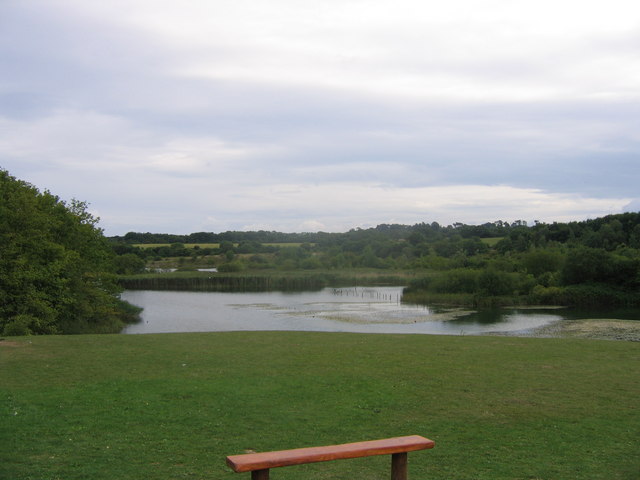

Barry, United Kingdom
Barry is a town of 54,673 people in Wales, United Kingdom, founded in 1884.
Why visit Barry
Townapedia lists 11 museums and landmarks, 37 parks and trails, 165 places to eat, 12 places to stay and 6 attractions in and around town.
Highlights include Welsh Hawking Centre, Porthkerry Viaduct, Cold Knap Roman Building and Cosmeston Medieval Village.
Weather in Barry
Forecast from MET Norway (CC BY 4.0). Full forecast
About Barry
Barry (; Welsh: Y Barri; pronounced [ə ˈbari]) is a coastal town and community in the Vale of Glamorgan, Wales. It is on the north coast of the Bristol Channel approximately 9 miles (14 km) south-southwest of Cardiff. Barry is a seaside resort, with attractions including several beaches and the resurrected Barry Island Pleasure Park. According to the 2021 census, the population of Barry was 56,605.
From the Wikipedia article Barry, Vale of Glamorgan (this version), under CC BY-SA 4.0.
Travel tips from other travellers: Barry on Wikivoyage (CC BY-SA 4.0).
Things to do6

Welsh Hawking Centre
Zoo and aquarium · 1.5 mi
Falconry centre in Barry, Wales

Porthkerry Viaduct
Bridge · 1.5 mi
Grade II listed bridge in the United Kingdom

Barry Lighthouse
Lighthouse · 1.2 mi
Lighthouse in Barry, Vale of Glamorgan, Wales

Barry Memorial Hall
Cinema and theater · 0.5 mi
Arts centre, theatre and cinema in Barry, Wales
Museums and landmarks11


Cosmeston Medieval Village
Museum · 4.4 mi
Medieval village in south Wales

Porthkerry Methodist Church
Monument and historic site
Former church
Porthkerry Road, Barry

Parks, trails and playgrounds37


Cosmeston Lakes Country Park
Park · 4.3 mi
Country park in the Vale of Glamorgan, Wales



25 more on the map.
Restaurants and cafes165

Master Mariner
Bar and pub · 1.6 mi
Skomer Road, Gibbonsdown
Mo-Th 09:00-23:00; Fr-Sa 09:00-00:00; Su 09:00-23:00

Bab Haus Mex
Restaurant · Mexican, Tex-Mex
Unit G3 Hood Road, Barry
Mo off; Tu off; We-Sa 12:00-21:00; Su 12:00-19:00
297 Bar
Bar and pub
Unit 33 Hood Road, Barry
Mo off; Tu off; We-Fr 16:00-23:00; Sa 12:00-23:00; Su 16:00-21:00

Academy Junction
Cafe · Coffee Shop
Hood Road, Barry
Mo-Fr 07:00-17:00; Sa 08:00-17:00; Su 09:00-17:00
Craft Republic
Bar and pub · 0.4 mi
Neptune Road, Barry
Tu,We 08:00-21:00; Th-Sa 08:00-23:00; Su 09:00-21:00
153 more on the map.
History
The area now occupied by Barry has seen human activity in many periods of history. Mesolithic or Middle Stone Age microlith flint tools have been found at Friars Point on Barry Island and near Wenvoe and Neolithic or New Stone Age polished stone axe-heads were discovered in St. Andrews Major. A cinerary urn (pottery urn buried with cremation ashes) was found on Barry Island during excavations of Bronze Age barrows and two more were found in a barrow at Cold Knap Point. A large defended enclosure or Iron Age promontory hillfort was located at the Bulwarks at Porthkerry and there was evidence of the existence of an early Iron Age farmstead during construction of Barry College off Colcot Road.
In Roman times farmsteads existed on the site of Barry Castle and Biglis and there were verbal reports of discovery of a cemetery including lead coffins with scallop-shell decoration. Both St. Baruc's Chapel and St. Nicholas Church have re-used Roman bricks and tiles incorporated in their building fabric and a Roman villa was discovered in Llandough. In 1980 a Roman building consisting of 22 rooms and cellars in four ranges around a central courtyard was excavated at Glan-y-môr and is believed to be a third-century building associated with naval activity, maybe a supply depot.
Read more of the history
The Vikings launched raids in the area and Barry Island was known to be a raider base in 1087. Flat Holm and Steep Holm islands in the Bristol Channel have their name Holm name derived from a Scandinavian word for an island in an estuary. The excavation of the Glan-y-môr site revealed the site had been reused in the 6th and 7th century and also between AD 830 and 950 as a dry stone sub-rectangular building with a turf or thatched roof.
The main feature of the area at this time was the island in the Bristol Channel, separated from the mainland by a tidal estuary. It is described in Giraldus Cambrensis or Gerald of Wales' Itinerarium Cambriae ("Journey through Wales", 1191). He states that Barry derives its name from St. Baruc whose remains are deposited in a chapel on the island. The local noble family who owned the island and the adjoining estates took the name of de Barri from the island.
Following the Norman Conquest of England the area was divided into manors with the Barry area split into two large lordships, Penmark and Dinas Powys. Penmark was split into the sub-manors of Fonmon, West Penmark and Barry. Dinas Powys was split into the sub-manors of Cadoxton and Uchelolau ('Highlight'). The sub-manor of Barry was granted by the de Umfraville family to the de Barri family and the seat of the manor was Barry Castle, located on high ground overlooking the Bristol Channel, a site occupied in Roman times by a native homestead. The castle was a small fortified manor house, built to replace an earlier earthwork. By the late 13th century the castle had two stone buildings on the east and west sides of a courtyard. Early in the 14th century the castle was strengthened by the addition of a large hall and gatehouse on its south side, the ruins of which are all that survive today. By now Barry had grown into a village and port with its own church and watermill but in the 14th century its population was drastically reduced by the Black Death and the consequences of the rebellion of Owain Glyndŵr. It took the population some 300 years to recover and once more hold the title of village, essentially a sparsely populated area with a few scattered farms and much of the land a marsh that a small river flowed through. By 1622 the pattern of fields, where enclosure was almost complete, around Barry village was pretty much as it was to remain until the growth of the modern town. According to the 1673 hearth tax list the parish contained thirteen houses.
Whitehouse Cottage, the oldest existing inhabited house in modern Barry, dates from the late 1500s with the east end of the building added in around 1600. It overlooks the sea at Cold Knap.
By 1871 the population of Barry was over 100, with 21 buildings, the new estate-owning Romilly family being involved in the buildup of the village but it remained a largely agricultural community. It grew when it was developed as a coal port in the 1880s. The coal trade was growing faster than the facilities at Tiger Bay in Cardiff ever could and so a group of colliery owners formed the Barry Railway Company and chose to build the docks at Barry. Work commenced in 1884 and the first dock basin was opened in 1889 to be followed by two other docks and extensive port installations. The Barry Railway brought coal down from the South Wales Valleys to the new docks whose trade grew from one million tons in the first year, to over nine million tons by 1903. The port was crowded with ships and had flourishing ship repair yards, cold stores, flour mills and an ice factory. By 1913, Barry was the largest coal exporting port in the world. Barry Council Office and Library was completed in 1908.
Behind the docks rose the terraced houses of Barry which, with Cadoxton, soon formed a sizeable town. The railways which had played a major part in the development of the dock helped make Barry Island a popular resort. Barry Memorial Hall on Gladstone Road was inaugurated in November 1932, and obtained its name to honour those locals who lost their lives in World War I.
During its industrial peak a number of ships sank off the Barry coast.
From the History section of Barry, Vale of Glamorgan on Wikipedia, under CC BY-SA 4.0.
More about Barry
Education
Barry has four secondary schools. Since 1993, Bryn Hafren and Barry Comprehensive School have worked together to provide the co-educational Barry Sixth Form. In July 2018, as part of the 'Transforming Secondary Education in Barry' scheme, both Barry Comprehensive School and Bryn Hafren closed their doors to make way for two new mixed-sex secondary schools which opened in September 2018. The old Barry Comprehensive School site has now become Whitmore High School and Bryn Hafren has now become Pencoedtre High School.
Primary education (5–11) in Barry is provided by a number of community, Welsh-language, and faith-based schools spread throughout the town.
From the Wikipedia article Barry, Vale of Glamorgan, under CC BY-SA 4.0.
Notable people from Barry
 Julia GillardPrime Minister of Australia from 2010 to 2013Photo: © Commonwealth of Australia..., CC BY 3.0 au
 Damian GreenBritish Conservative politicianPhoto: Richard Townshend, CC BY 3.0
 Alastair ReynoldsBritish science fiction author (born 1966)Photo: Robert Day, CC BY-SA 2.0
 Barnett JannerBritish politician (1892–1982)Photo: Rob Mieremet, CC0
- Gareth JonesWelsh journalist (1905–1935)
- Gwynfor EvansWelsh politician (1912-2005)
- Roger LiveseyBritish actor (1906–1976)
- David DaviesBritish swimmer
- Andrew SelbyWelsh boxer
- Lee SelbyWelsh boxer
- Grace WilliamsWelsh composer (1906-1977)
- Bob JohnWelsh football player and coach (1899-1982)
Born in Barry, according to Wikidata (CC0). Each name links to its Wikipedia article.
Where to stay12
Churches and places of worship21
Holy Trinity Presbyterian Church
Church · Presbyterian
Aberystwyth Crescent, Barry
Saint Helen's Roman Catholic Church
Church · Catholic · 1.0 mi
Wyndham Street, Barry
Shopping23
Gas and EV charging5
Schools, colleges and libraries24
Healthcare15
Map of Barry
250 places. The map loads OpenStreetMap tiles when you open it.
Getting there and nearby towns
Cardiff Airport (CWL) is the nearest airport with scheduled flights listed in OpenStreetMap, 2 miles away.
- Penarth 5 mi northeast, about 9 min by car
- Cardiff 7 mi northeast, about 11 min by car
- Whitchurch 8 mi north, about 13 min by car
- Llantwit Major 9 mi west, about 14 min by car
- Llantrisant 10 mi north, about 17 min by car
- Caerphilly 12 mi north, about 20 min by car
- Weston-super-Mare 14 mi east, about 22 min by car
- Coity 14 mi northwest, about 23 min by car
- Pontypridd 14 mi north, about 23 min by car
- Bridgend 15 mi northwest, about 24 min by car
Drive times are estimates from straight-line distance, not routes.
Towns near Barry


Keep exploring
Local news
Headlines from INDB.
Reviews, tips and questions
Loading what members have shared...
Sources and licences
- GeoNames (CC BY 4.0): population, coordinates, regions and time zone
- Mapillary (see each image): photos
- OpenStreetMap contributors (ODbL 1.0): places, airports, map data
- Wikidata (CC0 1.0): elevation, founding date, time zone, website, landmarks and historic places
- Wikimedia Commons (see each image): photos
- Wikipedia (CC BY-SA 4.0): overview and history text
Photo credits
- Welsh Hawking Centre, Christopher Ware, CC BY-SA 2.0
- Up above- Porthkerry railway viaduct, Vale of Glamorgan, Wales (27367830171), Jeremy Segrott from Cardiff, Wales, UK, CC BY 2.0
- Cosmeston medieval village, Andy Spenceley, CC BY-SA 2.0
- Barry Island main gates, 21stCenturyGreenstuff ( talk ), CC BY 3.0
- Cosmeston Lake, see below, CC BY-SA 2.0
- Porthkerry Park in Barry, Unknown author, Public domain
- Llancarfan, St Cadoc (35873785235), The National Churches Trust, CC BY 2.0
- Church of St Michael & All Angels, Michaelston-le-Pit, John Lord, CC BY-SA 2.0
- All Saints Church, Cath Mudford, CC BY-SA 3.0
- Barry Hospital, Tony Hodge, CC BY-SA 2.0
- Bryn Hafren Comprehensive School, James Anderson, CC BY-SA 3.0
- Merthyr Dyfan parish church, John Lord, CC BY-SA 2.0
- Barry Island Primary School, Sionk, CC BY-SA 4.0
- Street-level photo, southglos, CC BY-SA 4.0
- Street-level photo, southglos, CC BY-SA 4.0
- Street-level photo, southglos, CC BY-SA 4.0
- Street-level photo, southglos, CC BY-SA 4.0


Page built November 10, 2026. Spotted a mistake? Tell us or suggest a place.