


Caerphilly, United Kingdom
Caerphilly is a town of 31,060 people in Wales, United Kingdom.
Why visit Caerphilly
Townapedia lists 18 museums and landmarks, 13 parks and trails, 99 places to eat, 5 places to stay and 10 attractions in and around town.
Highlights include Caerphilly Workmen's Hall, Walnut Tree Viaduct, Caerphilly Castle and Caerphilly Workmen's Hall and Institute.
Weather in Caerphilly
Forecast from MET Norway (CC BY 4.0). Full forecast
About Caerphilly
Caerphilly (, ; Welsh: Caerffili, Welsh pronunciation: [ˌkairˈfɪli] ) is a town and community in Wales. It is situated at the southern end of the Rhymney Valley and separated from the Cardiff suburbs of Lisvane and Rhiwbina by Caerphilly Mountain.
From the Wikipedia article Caerphilly (this version), under CC BY-SA 4.0.
Travel tips from other travellers: Caerphilly on Wikivoyage (CC BY-SA 4.0).
Things to do10




Museums and landmarks18

Caerphilly Workmen's Hall and Institute
Monument and historic site
20 Castle Street, Caerphilly



Caerphilly Miners' Centre for the Community
Monument and historic site · 0.7 mi
Watford Road, Caerphilly

Mountain view ranch
Monument and historic site · 1.8 mi
Pay-to-enter playground with cafe
6 more on the map.
Parks, trails and playgrounds13

Glamorgan Canal / Long Wood
Park · 3.9 mi
Nature reserve in Cardiff, Wales




1 more on the map.
Restaurants and cafes99
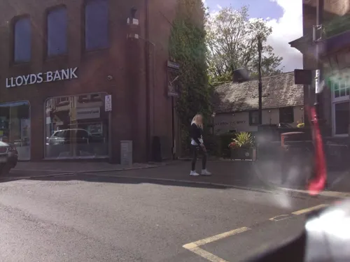
The Courthouse
Bar and pub
Cardiff Road, Caerphilly
Mo-Tu 12:00-22:00; We-Th 12:00-22:30; Fr-Sa 12:00-23:00; Su 12:00-22:00
Mayflower Chop Suey House
Restaurant · Chinese · 1.9 mi
1 Newport Road, Caerphilly
Mo 17:00-22:30; Tu off; We-Su 17:00-22:30
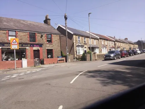
Miss Bee's Pantry
Cafe · Coffee Shop · 1.4 mi
9 Church Street, Caerphilly
Mo 10:00-16:00; Tu-Sa 10:00-15:00; Su off
The Black Cock Inn
Bar and pub · 1.5 mi
Waunwaelod Way, Caerphilly
Mo-Sa 12:00-23:00; Su 12:00-22:30
The Bridge End Inn
Bar and pub · 1.3 mi
The Square, Caerphilly
Mo-Su 11:00-00:00
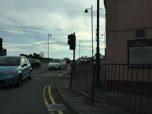
The Piccadilly
Bar and pub
Piccadilly Square, Caerphilly
Mo-Fr 12:00-24:00; Sa 12:00-24:30; Su 12:00-24:00

The Church House Inn
Bar and pub · 1.7 mi
Church Street, Caerphilly
Mo 11:00-23:00; Tu 11:00-00:00; We-Sa 00:00-00:30,11:00-00:00; Su...


Casa Mia
Restaurant · Mediterranean, Seafood, Tapas, Pasta, Pizza
4-6 The Twyn, Caerphilly
Mo-Fr 12:00-15:30,18:00-23:00; Sa 12:00-17:00,18:00-23:30; Su 12:00-17:00
Ten Degrees at Market Street
Restaurant · British
13 Market Street, Caerphilly
Mo off; Tu off; We 11:00-23:00; Th 11:00-24:00; Fr-Sa 11:00-25:00;...
87 more on the map.
History
The town's site has long been of strategic significance. Around AD 75, a fort was built by the Romans during their conquest of Britain. An excavation of the site in 1963 showed that the fort was occupied by Roman forces until the middle of the second century.
Read more of the history
Following the Norman invasion of Wales in the late 11th century, the area of Sengenhydd remained in Welsh hands. By the middle of the 12th century, the area was under the control of the Welsh chieftain Ifor Bach (Ifor ap Meurig). His grandson Gruffydd ap Rhys was the final Welsh lord of Sengenhydd, which fell to the English nobleman Gilbert de Clare, the Red Earl, in 1266. In 1267 Henry III was forced to recognise Llywelyn ap Gruffudd as Prince of Wales, and by September 1268 Llywelyn had secured northern Sengenhydd. Gilbert de Clare had already begun to take steps to consolidate his own territorial gains, beginning the construction of Caerphilly Castle on 11 April 1268. The castle would also act as a buffer against Llewelyn's own territorial ambitions and was attacked by the Prince of Wales' forces before construction was halted in 1270. Construction recommenced in 1271 and was continued under the Red Earl's son, Gilbert de Clare, 8th Earl of Gloucester. With only interior remodelling carried out to the castle by Hugh le Despenser in the 1320s, Caerphilly Castle remains a pure example of 13th-century military architecture and is the largest castle in Wales, and the second largest in Britain (after Windsor).
The original town of Caerphilly grew up as a small settlement established just south of the castle by Gilbert de Clare. After the death of de Clare at the battle of Bannockburn in 1314, Edward II became guardian of de Clare's three sisters and heiresses. In 1315 he replaced de Badlesmere with a new English administrator, Payn de Turberville of Coity, who persecuted the people of Glamorgan. Then, like many in northern Europe at the time, the region was in the throes of a serious famine. In coming to the defence of his people, Llywelyn Bren, the great-grandson of Ifor Bach and Welsh Lord of Senghenydd, incurred the wrath of de Turberville, who charged him with sedition. Llywelyn appealed to Edward II to call off or control his self-interested agent, but Edward ordered Llywelyn to appear before Parliament to face the charge of treason. The King promised Llywelyn that if the charges were found true, he would be hanged. Llywelyn fled and prepared for war. On 28 January 1316, Llywelyn began the revolt with a surprise attack on Caerphilly Castle. He captured the constable outside the castle and the outer ward, but could not break into the inner defences. His forces burned the town, slaughtered some of its inhabitants and started a siege. The town was rebuilt but remained very small throughout the Middle Ages. The first evidence of its emerging importance was the construction of a court house in the 14th century, the only pre-19th-century building, apart from the castle, that remains in the town.
At the beginning of the 15th century the castle was again attacked, this time by Owain Glyndŵr, who took control of it around 1403–5. Repairs to the castle continued until at least 1430, but just a century later the antiquary John Leland recorded that the castle was a ruin set in marshland, with a single tower being used as a prison. In the mid-16th century the 2nd Earl of Pembroke used the castle as a manorial court, but in 1583 the castle was leased to Thomas Lewis, who accelerated its dilapidation by removing stonework to build his nearby manor, the Van. The Lewis family, who claimed descent from Ifor Bach, left the manor in the mid-18th century when they purchased St Fagans Castle, the Van falling into decay.
During the 1700s, Caerphilly began to grow into a market town, and in the 19th century, as the South Wales Valleys underwent massive growth through industrialisation, the town's population grew. Caerphilly railway station was opened in 1871, and in 1899 the Rhymney Railway built its Caerphilly railway works maintenance facilities; however, the expansion of the population in the 19th century was more to do with the increasing market for coal.
From the History section of Caerphilly on Wikipedia, under CC BY-SA 4.0.
More about Caerphilly
Arts and culture
Caerphilly is featured in the Sex Pistols documentary The Filth and the Fury. Protests and a prayer meeting were held outside the Castle Cinema on the evening of 14 December 1976, when the group were playing a concert there. However, Caerphilly was one of the few councils that would allow the group to perform (Leeds and Manchester being the others). Caerphilly Castle was used as a filming location for Merlin and the Doctor Who episodes The Rebel Flesh and The Almost People (2011).
There are a number of notable figures who grew up in Caerphilly. They include comedian Tommy Cooper and the footballers David Pipe, Aaron Ramsey and Robert Earnshaw, whose family relocated to the town from Zambia.
The town has a rugby union club, Caerphilly RFC, who play in League Two East Central of the WRU National League.
Caerphilly also has its own angling club named Caerphilly & District Angling Association which was founded in the late 1940's.
The town is known outside Wales for Caerphilly cheese and has hosted two food fairs, the Caerphilly Food Festival, which is held on the streets of the town, and the Big Cheese Festival, which has been held in and around Caerphilly Castle every summer since 1998. Visitor numbers reached 80,000 in 2012. The event includes a wide variety of cheese stalls as well as a funfair, fireworks and a cheese race around the castle.
From the Wikipedia article Caerphilly, under CC BY-SA 4.0.
Notable people from Caerphilly
 Eleanor de ClareAnglo-Welsh noblewomanPhoto: The original uploader was Mt99lp at..., Public domain
 Manon CarpenterWelsh racing cyclistPhoto: Downhill911, CC BY-SA 4.0
 Nathan CleverlyWelsh boxerPhoto: DemonicGenocide, Public domain
 Evan JamesWelsh poetPhoto: Varitek, CC BY-SA 3.0
 Sian EvansWelsh singerPhoto: Manfred Werner / Tsui, CC BY-SA 3.0
 Lindsay WhittleBritish politicianPhoto: Senedd Cymru / Welsh Parliament, CC BY 4.0
 Hefin DavidWelsh politician (1977–2025)Photo: Senedd Cymru - Welsh Parliament, CC BY 4.0
- Aaron RamseyWelsh association football player and manager (born 1990)
- Tommy CooperWelsh prop comedian and magician (1921-1984)
- Natasha HardingWelsh footballer (born 1989)
- Alan WilliamsBritish politician (1930-2014)
- Dylan LawlorWelsh footballer
Born in Caerphilly, according to Wikidata (CC0). Each name links to its Wikipedia article.
Where to stay5
Churches and places of worship26
Shopping19
Gas and EV charging3
Schools, colleges and libraries21
Healthcare9
Map of Caerphilly
223 places. The map loads OpenStreetMap tiles when you open it.
Getting there and nearby towns
Cardiff Airport (CWL) is the nearest airport with scheduled flights listed in OpenStreetMap, 13 miles away.
- Whitchurch 4 mi south, about 7 min by car
- Pontypridd 6 mi west, about 9 min by car
- Risca 6 mi northeast, about 9 min by car
- Nelson 6 mi northwest, about 10 min by car
- Gelligaer 6 mi north, about 10 min by car
- Cardiff 7 mi south, about 11 min by car
- Llantrisant 7 mi west, about 11 min by car
- Treharris 7 mi northwest, about 12 min by car
- Newport 9 mi east, about 15 min by car
- Penarth 10 mi south, about 15 min by car
Drive times are estimates from straight-line distance, not routes.
Towns near Caerphilly


Keep exploring
Local news
Headlines from INDB.
Reviews, tips and questions
Loading what members have shared...
Sources and licences
- GeoNames (CC BY 4.0): population, coordinates, regions and time zone
- Mapillary (see each image): photos
- OpenStreetMap contributors (ODbL 1.0): places, airports, map data
- Wikidata (CC0 1.0): elevation, founding date, time zone, website, landmarks and historic places
- Wikimedia Commons (see each image): photos
- Wikipedia (CC BY-SA 4.0): overview and history text
Photo credits
- Castell Caerffili o'r awyr - aerial (drone) view of Caerphilly Castle - 2023 04, Llywelyn2000, CC BY-SA 4.0
- Caerphilly library (48441518506), JuliaC2006 from Rochester, UK, CC BY 2.0
- St Michael and All Angels church, Tongwynlais, John Grayson, CC BY-SA 2.0
- St Isan's church, Llanishen, John Grayson, CC BY-SA 2.0
- Craig yr Allt, Stemonitis, CC BY-SA 3.0
- Ruins of Castell Morgraig, John Lord, CC BY-SA 2.0
- Groeswen Chapel, Penyrheol, Trecenydd and Energlyn, FruitMonkey, CC BY-SA 3.0
- New House Country Hotel, near Cardiff, Gareth James, CC BY-SA 2.0
- Caerphilly Workmen's Hall and Institute, May 2020, No Swan So Fine, CC BY-SA 4.0
- Van Road United Reformed Church, Caerphilly, May 2020 02, No Swan So Fine, CC BY-SA 4.0
- Memorial to David Williams, Caerphilly, May 2020 02, No Swan So Fine, CC BY-SA 4.0
- Llyfrgell Caerffili – Caerphilly Library (14724201272), National Assembly for Wales from Wales, CC BY 2.0
- Tonyfelin Medical Centre, Sionk, CC BY-SA 4.0
- Glamorganshire Canal-by-George-Tod, Author= George Tod, CC BY-SA 2.0
- Walnut Tree Viaduct in 1960s, Dr Mary Gillham Archive Project, CC BY 2.0
- Bedwas Workmen’s Hall, Mac Edmunds, CC BY 4.0
- Caerphilly Mountain dog (21926850258), Jeremy Segrott from Cardiff, Wales, UK, CC BY 2.0
- Caerphilly Castle - South East Tower, Pauljwales, CC BY-SA 3.0
- Street-level photo, southglos, CC BY-SA 4.0
- Street-level photo, southglos2, CC BY-SA 4.0
- Street-level photo, southglos, CC BY-SA 4.0
- Street-level photo, southglos, CC BY-SA 4.0
- Street-level photo, southglos, CC BY-SA 4.0
- Street-level photo, southglos2, CC BY-SA 4.0
- Street-level photo, southglos, CC BY-SA 4.0
- Street-level photo, victuallers, CC BY-SA 4.0
- Street-level photo, victuallers, CC BY-SA 4.0
- Street-level photo, southglos, CC BY-SA 4.0
- Street-level photo, southglos, CC BY-SA 4.0
- Street-level photo, southglos, CC BY-SA 4.0
- Street-level photo, southglos, CC BY-SA 4.0
- Street-level photo, southglos, CC BY-SA 4.0
- Street-level photo, southglos, CC BY-SA 4.0
- Street-level photo, southglos, CC BY-SA 4.0
- Street-level photo, southglos, CC BY-SA 4.0
- Street-level photo, southglos, CC BY-SA 4.0
- Street-level photo, southglos, CC BY-SA 4.0
- Street-level photo, victuallers, CC BY-SA 4.0
- Street-level photo, southglos, CC BY-SA 4.0


Page built November 10, 2026. Spotted a mistake? Tell us or suggest a place.