


Why visit Rayne
Townapedia lists 6 museums and landmarks, 18 parks and trails, 50 places to eat, 2 places to stay and 1 attraction in and around town.
Highlights include Cineworld, Cressing Temple, Warner Textile Archive and Hoppit Mead.
Weather in Rayne
Forecast from MET Norway (CC BY 4.0). Full forecast
About Rayne
Rayne is a village and civil parish in the Braintree district of Essex, England. It lies about 2 miles (3.2 km) west of Braintree on the A120 road. The settlement follows the line of the Roman road Stane Street between Colchester and Braughing. At the 2021 census the parish had a population of 2,360, and the built up area had a population of 2,154.
From the Wikipedia article Rayne, Essex (this version), under CC BY-SA 4.0.
Photos of Rayne


Things to do1

Museums and landmarks6

Cressing Temple
Museum · 2.3 mi
Ancient monument situated between Witham and Braintree in Essex, England, UK


Parks, trails and playgrounds18





6 more on the map.
Restaurants and cafes50
Mulberry Tree
Bar and pub · British
Braintree Bypass, Braintree
Mo-Fr 06:30-10:30,11:30-23:00; Sa 07:00-11:00,11:30-23:00; Su...
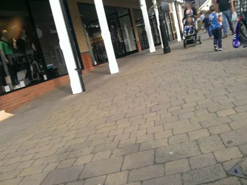
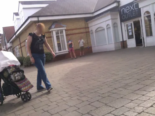
Cookies & Cones
Ice cream · 0.6 mi
Charter Way, Braintree
Mo-Fr 11:00-17:00; Sa 10:00-18:00; Su 10:00-17:00
The Cornish Bakery
Bakery · 0.6 mi
Charter Way, Braintree
Mo-Fr 10:00-18:00; Sa 09:00-19:00; Su 10:00-17:00
Costa
Cafe · Coffee Shop · 0.6 mi
Charter Way, Braintree
Mo-Fr 10:00-18:00; Sa 09:00-19:00; Su 10:00-17:00

Taste of China
Restaurant · Chinese · 1.2 mi
8 Cressing Road, Braintree
Tu-Th 07:00-22:00; Fr-Sa 17:00-22:30; Su 17:00-22:00
Wildwood
Restaurant · Grill, Pasta, Pizza · 0.6 mi
Charter Way, Braintree
Mo-Th 12:00-21:30; Fr-Sa 12:00-10:30; Su 12:00-21:00

The Lounge Bar
Bar and pub · 1.5 mi
10-12 Market Place, Braintree
Mo-We 11:00-24:00; Th 11:00-01:00; Fr-Sa 11:00-04:00; Su 11:00-24:00
The Picture Palace
Bar and pub · 1.5 mi
Fairfield Road, Braintree
Mo,Tu,We,Th,Su 08:00-24:00; Fr,Sa 08:00-25:00
38 more on the map.
History
Archaeological finds indicate Roman activity around Rayne, including agricultural remains and a possible heated building.
The village is recorded in the Domesday Book (1086) under five separate entries. Together these describe extensive ploughlands, meadows, woodland, two mills, 15 slaves, and show that Rayne paid the highest taxation in Hinckford Hundred.
The parish church of All Saints has origins in the 13th century, with the earliest known rector recorded in 1260. The west tower was built in 1510 by the Capel family, prominent landowners who also resided at Rayne Hall. Several manor houses stood within the parish, including Rayne Hall, Old Hall (Baynards), and Rayne Manor, the latter once belonging to the Knights Hospitaller.
Rayne Parish Council was established in December 1894 following the Local Government Act 1894. The council acquired playing fields, planted commemorative trees, and developed local amenities.
The village was served by Rayne railway station, opened in 1869 on the Bishop’s Stortford–Braintree branch line. Passenger services ceased in 1952 and freight in 1964. The station survives as the visitor centre for the Flitch Way country park.
During the Second World War the Rayne Foundry contributed to wartime industry, and later produced replacement brass cogs for the clock of Big Ben. The foundry closed in 2001 and the site was redeveloped for housing.
Read more of the history
In 2006 Rayne was named Essex Village of the Year, and in 2006–07 it won the national Calor Village of the Year (Information and Communication category). The Rayne Heritage Trail, supported by the Heritage Lottery Fund, highlights more than 60 listed buildings and sites of interest.
From the History section of Rayne, Essex on Wikipedia, under CC BY-SA 4.0.
More about Rayne
Geography
The parish lies on gently undulating land crossed by the line of the Roman Stane Street. The Flitch Way long-distance trail runs through the village.
At the 2011 census the population was 2,299. Compared with national averages, the parish has higher levels of home ownership and a large proportion of residents employed in professional and managerial occupations.
Arts and culture
Rayne hosts community events and maintains a strong local identity. The Rayne Heritage Trail provides an app-based and guided exploration of the village’s history. Oral histories record village life during the Second World War, including billeting of soldiers and evacuation of children.
The village once supported several public houses; two remain, alongside shops and services catering to residents and walkers on the Flitch Way.
From the Wikipedia article Rayne, Essex, under CC BY-SA 4.0.
Where to stay2
Churches and places of worship10
Chapel Of The Immaculate Conception, Franciscan Convent
Church · 1.9 mi
Shopping17
Gas and EV charging3
Schools, colleges and libraries13
Map of Rayne
120 places. The map loads OpenStreetMap tiles when you open it.
Getting there and nearby towns
London Stansted Airport (STN) is the nearest airport with scheduled flights listed in OpenStreetMap, 14 miles away.
- Braintree 2 mi northwest, about 2 min by car
- Witham 5 mi southeast, about 8 min by car
- Gosfield 5 mi north, about 8 min by car
- Halstead 6 mi northeast, about 10 min by car
- Great Bardfield 8 mi northwest, about 14 min by car
- Castle Hedingham 9 mi north, about 14 min by car
- Tolleshunt Knights 9 mi southeast, about 15 min by car
- Chelmsford 10 mi southwest, about 17 min by car
- Maldon 10 mi southeast, about 16 min by car
- Great Yeldham 10 mi north, about 16 min by car
Drive times are estimates from straight-line distance, not routes.
Towns near Rayne


Keep exploring
Local news
Headlines from INDB.
Reviews, tips and questions
Loading what members have shared...
Sources and licences
- GeoNames (CC BY 4.0): population, coordinates, regions and time zone
- Mapillary (see each image): photos
- OpenStreetMap contributors (ODbL 1.0): places, airports, map data
- Wikidata (CC0 1.0): elevation, founding date, time zone, website, landmarks and historic places
- Wikimedia Commons (see each image): photos
- Wikipedia (CC BY-SA 4.0): overview and history text
Photo credits
- CressingTemple, User:JohnArmagh, Public domain
- Hoppit Mead 2, Dudley Miles, CC BY-SA 4.0
- Bocking Blackwater 10, Dudley Miles, CC BY-SA 4.0
- Cuckoo Wood 1, Dudley Miles, CC BY-SA 4.0
- BraintreeFranciscanChapelFront, CalderUK, CC BY-SA 4.0
- KR23MYX Seat Ibiza Freightliner, Steve Knight, CC BY 4.0
- DC53PAN-LK53KWF 190118 CPS (39783373522), Chris Sampson, CC BY 2.0
- Citroen HY van (circa 1970) at Braintree Outlet mall, kitmasterbloke, CC BY 2.0
- Y5TRU 151217 CPS (38976709694), Chris Sampson, CC BY 2.0
- AB53PAN-LK53KXB 290917 CPS (27907354019), Chris Sampson, CC BY 2.0
- DB54PAN-YN54WWT-3 200418 CPS (42714233641), Chris Sampson, CC BY 2.0
- DC53PAN-LK53KWF 230318 CPS (42714231341), Chris Sampson, CC BY 2.0
- AB62PAN-YX62FVV 160318-2 CPS (26008411127), Chris Sampson, CC BY 2.0
- DB54PAN-YN54WWT 180518 CPS (42714236681), Chris Sampson, CC BY 2.0
- Street-level photo, chris_debian, CC BY-SA 4.0
- Street-level photo, petermead, CC BY-SA 4.0
- Street-level photo, petermead, CC BY-SA 4.0
- Street-level photo, IpswichEdits, CC BY-SA 4.0
- Street-level photo, petermead, CC BY-SA 4.0
- Street-level photo, petermead, CC BY-SA 4.0
- Street-level photo, petermead, CC BY-SA 4.0
- Street-level photo, petermead, CC BY-SA 4.0
- Street-level photo, petermead, CC BY-SA 4.0
- Street-level photo, petermead, CC BY-SA 4.0
- Street-level photo, petermead, CC BY-SA 4.0
- Street-level photo, petermead, CC BY-SA 4.0
- Street-level photo, petermead, CC BY-SA 4.0
- Street-level photo, petermead, CC BY-SA 4.0
- Street-level photo, TobyDS, CC BY-SA 4.0
- Street-level photo, petermead, CC BY-SA 4.0
- Street-level photo, chris_debian, CC BY-SA 4.0
- Street-level photo, IpswichEdits, CC BY-SA 4.0
- Street-level photo, IpswichEdits, CC BY-SA 4.0
- Street-level photo, petermead, CC BY-SA 4.0


Page built November 10, 2026. Spotted a mistake? Tell us or suggest a place.