


Braintree, United Kingdom
Braintree is a town of 53,477 people in England, United Kingdom.
Why visit Braintree
Townapedia lists 12 museums and landmarks, 25 parks and trails, 75 places to eat, 3 places to stay and 1 attraction in and around town.
Highlights include Cineworld, Warner Textile Archive, Braintree Museum and Hoppit Mead.
Weather in Braintree
Forecast from MET Norway (CC BY 4.0). Full forecast
About Braintree
Braintree is a town in Essex, England. At the 2021 census the built up area as defined by the Office for National Statistics had a population of 43,190. It is the largest settlement in the Braintree District, which also covers an extensive surrounding area.
From the Wikipedia article Braintree, Essex (this version), under CC BY-SA 4.0.
Travel tips from other travellers: Braintree on Wikivoyage (CC BY-SA 4.0).
Photos of Braintree


Things to do1

Museums and landmarks12


American Army War Memorial
Monument and historic site · 1.5 mi
Windermere Drive, Great Notley, Braintree
Memorial to the Crew and Passengers of B-17G Flying Fortress 44-8198
Monument and historic site · 0.7 mi
The Annual Famous Cristmas Lights Of Nayling Road
Monument and historic site · 0.9 mi
Parks, trails and playgrounds25






13 more on the map.
Restaurants and cafes75
Mulberry Tree
Bar and pub · British · 1.4 mi
Braintree Bypass, Braintree
Mo-Fr 06:30-10:30,11:30-23:00; Sa 07:00-11:00,11:30-23:00; Su...
Cookies & Cones
Ice cream · 0.9 mi
Charter Way, Braintree
Mo-Fr 11:00-17:00; Sa 10:00-18:00; Su 10:00-17:00
The Cornish Bakery
Bakery · 1.0 mi
Charter Way, Braintree
Mo-Fr 10:00-18:00; Sa 09:00-19:00; Su 10:00-17:00

Taste of China
Restaurant · Chinese · 0.6 mi
8 Cressing Road, Braintree
Tu-Th 07:00-22:00; Fr-Sa 17:00-22:30; Su 17:00-22:00
Wildwood
Restaurant · Grill, Pasta, Pizza · 1.0 mi
Charter Way, Braintree
Mo-Th 12:00-21:30; Fr-Sa 12:00-10:30; Su 12:00-21:00

The Lounge Bar
Bar and pub
10-12 Market Place, Braintree
Mo-We 11:00-24:00; Th 11:00-01:00; Fr-Sa 11:00-04:00; Su 11:00-24:00
The Picture Palace
Bar and pub
Fairfield Road, Braintree
Mo,Tu,We,Th,Su 08:00-24:00; Fr,Sa 08:00-25:00
63 more on the map.
History
Braintree dates back over 4,000 years when it was just a small village. People in the area during the Bronze and Iron Ages built houses in the lower part of the town, near the River Brain, known as the Brain Valley. When the Romans invaded, they built two roads and the settlement grew at the junction of these roads. The town was mentioned in the Domesday Book in 1086, where it was noted as a small village consisting of 30 acres. This area was later inhabited by the Saxons, who occupied the town after the Romans left and named the Roman road Stane Street (i.e.
When the Romans invaded, they built two roads; a settlement developed at the junction of these roads but was later abandoned when the Romans left Britain. The town was recorded in the Domesday Book of 1086, where it was named "Branchetreu", and consisted of 30 acres (12 hectares) in possession of Richard, son of Count Gilbert. Pilgrims used the town as a stopover and the size of the town increased, leading the Bishop of London to obtain a market charter for the town in 1190.
From the History section of Braintree, Essex on Wikipedia, under CC BY-SA 4.0.
More about Braintree
Geography
Braintree lies in north Essex, about 46 miles (74 km) from London, with factories and housing to the south and rural areas to the north, where arable crops are grown. It lies about 150 feet (45 m) above sea level. Essex is rather flat on the whole, and the Braintree area is no exception; however, there is a general downward trend in the height of the ground from the northwest towards the coast to the southeast. Two rivers flow through Braintree in this direction. Pod's Brook approaches the western side of the town, forming a natural boundary between Braintree and the neighbouring village of Rayne about two miles (three kilometres) west. Pod's Brook becomes the River Brain as it passes under the Roman road, before running through the southern part of Braintree. The River Pant (or Blackwater) runs roughly parallel to it, through the north of Bocking and away to the east of the town. The Brain eventually flows into the Blackwater several miles away, near Witham.
Economy
Braintree has two main market areas that link throughout the town, which run on Wednesdays and Saturdays. They are based outside the Town Hall in Market Square, and also run along Bank Street and the High Street. The High Street is a pedestrianised area, which allowed only buses until 2020, when it was fully pedestrianised.
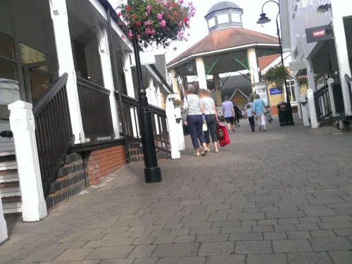
Braintree Village, formerly known as Freeport, is a shopping area on the outskirts of the town, described as a "designer outlet village". It has approximately 90 departments where designer brands sell surplus stock for lower than the recommended retail price. It also has its own railway station, namely Braintree Freeport.
There are also several industrial centres located around the main Braintree town area, including the Springwood Industrial Estate, Park Drive Industrial Estate and Broomhills Industrial Estate, off Pod's Brook Lane.
Arts and culture
Braintree's museum, containing displays relating to the history of the town, is named after the local naturalist John Ray and has a number of relatively famous patrons, including the Essex-born artist Jennifer Walter, who was also the youngest ever female Bard of Bath. The associated Warner Textile Archive contains the second largest collection of publicly owned textiles in the UK, after the Victoria & Albert Museum.
The Braintree Arts Theatre opened in 2009, on the Notley High School campus.
The Bocking Arts Theatre is based at The Literary and Mechanical Institute at the top of Bocking End and promotes pantomimes, drama and a range of live entertainment events. It is also used extensively for local community activities including regular NHS blood donor sessions, record and stamp/coin collectors' fairs, and charity fundraising events. The management of the building is now reliant on unpaid volunteers under the auspices of the Bocking Arts Theatre Charitable Trust. Built in 1863, this Grade II listed building was bequeathed to the citizens of Braintree by George Courtald and his family and celebrated its 150-year anniversary in 2013.
Education
Braintree has four secondary schools: Gosfield School Independent Co-Educational, Alec Hunter Academy, Notley High School Technology College (which is also the location of the Braintree Sixth Form) and Tabor Academy.
Post 16 education is provided by Gosfield School, Notley High School, The College at Braintree, Braintree Sixth Form and Tabor Academy.
Braintree has a special education school called The Edith Borthwick School.
From the Wikipedia article Braintree, Essex, under CC BY-SA 4.0.
Notable people from Braintree
 Liam HowlettBritish musicianPhoto: aliina s., CC BY 2.0
 Evelyn WoodBritish Army officer (1838–1919)Photo: Bassano, Public domain
 Samuel CourtauldEnglish industrialist and art collectorPhoto: Ham, CC BY-SA 3.0
 Tim RobertsonAustralian actorPhoto: Finn Robertson, CC BY-SA 4.0
 Beans On ToastsingerPhoto: K8_fan ( talk ) ( Uploads ), CC0
 Nigel BurchBritish musician, artist, songwriter and poetPhoto: ADogDooSnowCone, CC BY-SA 4.0
 TirzahBritish singer-songwriter and recording artistPhoto: Christoph Thorwartl, CC BY 2.0
- James ChallisBritish astronomer (1803-1882)
- Robert Cattrallfield hockey player
- Katharine O'SheaBritish aristocrat (1846-1921)
- Edward BawdenEnglish painter (1903-1989)
- Sir William Dawes, 3rd BaronetArchbishop of York; Bishop of Chester; Master of St Catharine's
Born in Braintree, according to Wikidata (CC0). Each name links to its Wikipedia article.
Where to stay3
Churches and places of worship13
Chapel Of The Immaculate Conception, Franciscan Convent
Church · 0.9 mi
The Church in Great Notley
Church · Anglican, Methodist, United Reformed, Baptist · 1.4 mi
Shopping24
Gas and EV charging4
Schools, colleges and libraries19
St Michael's Church of England Voluntary Aided Primary School
School · Anglican · 0.5 mi
Maple Avenue, Braintree
Healthcare1
Map of Braintree
177 places. The map loads OpenStreetMap tiles when you open it.
Getting there and nearby towns
London Stansted Airport (STN) is the nearest airport with scheduled flights listed in OpenStreetMap, 13 miles away.
- Halstead 6 mi northeast, about 10 min by car
- Witham 7 mi southeast, about 11 min by car
- Chelmsford 10 mi south, about 17 min by car
- Maldon 11 mi southeast, about 18 min by car
- Sudbury 13 mi northeast, about 22 min by car
- Colchester 15 mi east, about 24 min by car
- Haverhill 15 mi north, about 24 min by car
- Saffron Walden 17 mi northwest, about 27 min by car
- Wickford 19 mi south, about 30 min by car
- Harlow 20 mi west, about 32 min by car
Drive times are estimates from straight-line distance, not routes.
Towns near Braintree


Keep exploring
Local news
Headlines from INDB.
Reviews, tips and questions
Loading what members have shared...
Sources and licences
- GeoNames (CC BY 4.0): population, coordinates, regions and time zone
- Mapillary (see each image): photos
- OpenStreetMap contributors (ODbL 1.0): places, airports, map data
- Wikidata (CC0 1.0): elevation, founding date, time zone, website, landmarks and historic places
- Wikimedia Commons (see each image): photos
- Wikipedia (CC BY-SA 4.0): overview and history text
Photo credits
- EU71FPB Peugeot 307 estate, Essex Police. Braintree, Steve Knight, CC BY 2.0
- Braintree Town Hall, Richard Kelly, CC BY 4.0
- Braintree Town Hall 1926 front elevation, kitmasterbloke, CC BY 2.0
- Braintree Town Hall 1926 rear elevation, kitmasterbloke, CC BY 2.0
- Braintree Manor House front, kitmasterbloke, CC BY 2.0
- The Manor House Little Square Braintree, kitmasterbloke, CC BY 2.0
- Hoppit Mead 2, Dudley Miles, CC BY-SA 4.0
- Bocking Blackwater 10, Dudley Miles, CC BY-SA 4.0
- Cuckoo Wood 1, Dudley Miles, CC BY-SA 4.0
- BraintreeFranciscanChapelFront, CalderUK, CC BY-SA 4.0
- St Michael's Church, Braintree, Robert Edwards, CC BY-SA 2.0
- Town Hall stained glass panel, kitmasterbloke, CC BY 2.0
- Pargetting and Lintel of Manor House, kitmasterbloke, CC BY 2.0
- Pargetting on rear of Manor House 2, kitmasterbloke, CC BY 2.0
- Pargetting on rear of Manor House 1, kitmasterbloke, CC BY 2.0
- Rear elevation of the Manor House, kitmasterbloke, CC BY 2.0
- Street-level photo, petermead, CC BY-SA 4.0
- Street-level photo, petermead, CC BY-SA 4.0
- Street-level photo, chris_debian, CC BY-SA 4.0
- Street-level photo, petermead, CC BY-SA 4.0
- Street-level photo, petermead, CC BY-SA 4.0
- Street-level photo, IpswichEdits, CC BY-SA 4.0
- Street-level photo, petermead, CC BY-SA 4.0
- Street-level photo, petermead, CC BY-SA 4.0
- Street-level photo, petermead, CC BY-SA 4.0
- Street-level photo, petermead, CC BY-SA 4.0
- Street-level photo, petermead, CC BY-SA 4.0
- Street-level photo, petermead, CC BY-SA 4.0
- Street-level photo, petermead, CC BY-SA 4.0
- Street-level photo, petermead, CC BY-SA 4.0
- Street-level photo, IpswichEdits, CC BY-SA 4.0
- Street-level photo, IpswichEdits, CC BY-SA 4.0
- Street-level photo, petermead, CC BY-SA 4.0
- Street-level photo, TobyDS, CC BY-SA 4.0


Page built November 10, 2026. Spotted a mistake? Tell us or suggest a place.