


Smethwick, United Kingdom
Smethwick is a town of 53,653 people in England, United Kingdom.
Why visit Smethwick
Townapedia lists 47 museums and landmarks, 46 parks and trails, 201 places to eat, 13 places to stay and 14 attractions in and around town.
Highlights include Alexandra Theatre, Birmingham Hippodrome, Galton Valley Canal Museum and James Chance Memorial.
Weather in Smethwick
Forecast from MET Norway (CC BY 4.0). Full forecast
About Smethwick
Smethwick () is an industrial town in the Sandwell district, in the county of the West Midlands, England. It lies 4 miles (6 km) west of Birmingham city centre. Historically it was in Staffordshire and then Worcestershire before being placed into West Midlands county.
From the Wikipedia article Smethwick (this version), under CC BY-SA 4.0.
Photos of Smethwick


Things to do14

Alexandra Theatre
Cinema and theater · 3.0 mi
Theatre in Birmingham, England

Birmingham Hippodrome
Cinema and theater · 3.2 mi
Theatre in Birmingham, England

Birmingham Repertory Theatre
Cinema and theater · 2.6 mi
Theatre in Birmingham, England

Crescent Theatre
Cinema and theater · 2.4 mi
Amateur theatre run by volunteers, in Birmingham, England.

Galton Bridge
Bridge · 0.8 mi
Cast-iron canal bridge in Smethwick, West Midlands, England

National Sea Life Centre
Monument and historic site · 2.5 mi
Aquarium in Birmingham, United Kingdom

Old Joint Stock Theatre
Cinema and theater · 2.9 mi
Studio theatre and pub in Birmingham, England

Old Rep
Cinema and theater · 3.1 mi
Theatre in Birmingham, West Midlands, England, UK


The Drum
Cinema and theater · 3.1 mi
Former arts centre and theatre in Birmingham, England

Aston Hippodrome
Cinema and theater · 3.1 mi
Former theatre in Birmingham, England
Blue Orange Theatre
Cinema and theater · 2.5 mi
Theatre in the Jewellery Quarter in Birmingham, England
2 more on the map.
Museums and landmarks47


Lions of the Great War
Monument and historic site
A statue of a marching Sikh soldier with a rifle slung over his left arm. He is mounted on a stone pedestal.


Barber Institute of Fine Arts
Museum · 3.4 mi
Art gallery and concert hall in Birmingham, England, United Kingdom

Birmingham Assay Office
Museum · 2.7 mi
One of the four assay offices in the United Kingdom

Birmingham Back to Backs
Museum · 3.2 mi
Last surviving court of back-to-back houses in Birmingham, England, United Kingdom, now operated as a museum

Birmingham Museum and Art Gallery
Museum · 2.8 mi
Museum and art gallery in Birmingham, UK

Birmingham Walk of Stars
Monument and historic site · 2.6 mi
Walk of fame in Birmingham, England

Blue Plaque: Chance Brothers Glassworks
Monument and historic site · 1.3 mi

Blue Plaque: Charles Grigg (1916-2013)
Monument and historic site · 1.4 mi
35 more on the map.
Parks, trails and playgrounds46


Edgbaston Reservoir Local Nature Reserve
Hiking and trails · 1.5 mi
70 acre site, less than two miles from the City centre is a site of historic importance, designed and built by Thomas Telford in 1827 to...
Reservoir Road


Lightwoods Park
Park · 1.5 mi
Public park in Smethwick in the West Midlands, England


Sandwell Valley RSPB reserve
Park · 2.9 mi
RSPB nature reserve in the English West Midlands county

Queens Park, Birmingham
Park · 2.3 mi
Park in Harborne, United Kingdom
Sandwell Valley Country Park
Park · 2.6 mi
Country park in the English midlands
34 more on the map.
Restaurants and cafes201
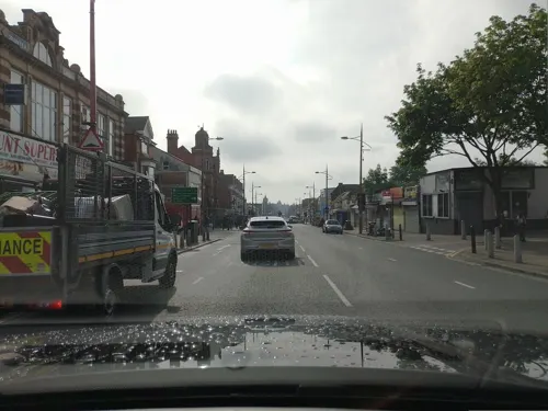
Old Dresser Cafe
Cafe · Polish, Local · 0.9 mi
434 Bearwood Road, Smethwick
Su, Tu 10:00-16:00; We-Th 10:00-20:00; Fr 12:00-22:00; Sa 10:00-22:00
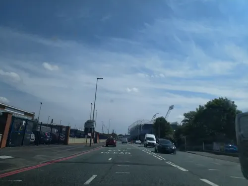
Starbucks
Cafe · Coffee Shop · 1.2 mi
Birmingham Road, West Bromwich
Mo-Fr 06:00-22:00, Sa 06:30-22:00, Su 07:30-22:00


Asda Café
Cafe · Coffee Shop · 0.4 mi
Mo 08:00-23:00; Tu-Fr 07:00-23:00; Sa 07:00-22:00; Su 11:00-17:00

189 more on the map.
History
It was suggested that the name Smethwick meant "smiths' place of work", but a more recent interpretation has suggested the name means "the settlement on the smooth land". Smethwick was recorded in the Domesday Book as Smedeuuich, the d in this spelling being the Anglo-Saxon letter eth. Until the end of the 18th century it was an outlying hamlet of the south Staffordshire village of Harborne. Harborne became part of the county borough of Birmingham and thus transferred from Staffordshire to Warwickshire in 1891, leaving Smethwick in the County of Staffordshire.
The world's oldest working engine, the Smethwick Engine, made by Boulton & Watt, originally stood near Bridge Street, Smethwick. It is now at Thinktank, the new science museum in Birmingham.
Read more of the history
One notable company was The London Works, manufacturing base of the Fox Henderson Company which made the cast-iron framework for the Crystal Palace. This was founded by Charles Fox, whose inventions included the first patented railway points. His notable employees included William Siemens, the notable mechanical and electrical engineer. The company was bankrupted in 1855 by the failure of an overseas railway to pay for work done. The site was later used by GKN. In 2015 the site was being cleared to build the new Midland Metropolitan University Hospital which aims to combine the Sandwell General Hospital at West Bromwich and City Hospital, Dudley Road. Work at the site later came to a standstill because of a crisis in the construction industry.
Other former industry included railway rolling stock manufacture, at the Birmingham Railway Carriage and Wagon Company factory; screws and other fastenings from Guest, Keen and Nettlefolds (GKN); engines from Tangye; tubing from Evered's; steel pen nibs from British Pens; and various products from Chance Brothers' glassworks, including lighthouse lenses and the glazing for the Crystal Palace (the London works, in North Smethwick, manufactured its metalwork). Phillips Cycles, once one of the largest bicycle manufacturers in the world, was based in Bridge Street, Smethwick. Nearby, in Downing Street, is the famous bicycle saddle maker, Brooks Saddles. The important metalworking factory of Henry Hope & Sons Ltd was based at Halford's Lane where the company manufactured steel window systems, roof glazing, gearings and metalwork.
Council housing began in Smethwick after 1920 on land previously belonging to the Downing family, whose family home became Holly Lodge High School for Girls in 1922. The mass council house building of the 1920s and 1930s also involved Smethwick's boundaries being extended into part of neighbouring Oldbury in 1928.
The Ruskin Pottery Studio, named in honour of the artist John Ruskin, was in Oldbury Road. Many English churches have stained glass windows made by Hardman Studios in Lightwoods House, or, before that, by the Camm family.
During the Second World War, Smethwick was bombed on a number of occasions by the German Luftwaffe. A total of 80 people died as a result of these air raids.
After the First World War about 50+ Sikh families settled in Smethwick beginning in 1917, with a majority of the men being veterans of the war. After the Second World War, Smethwick attracted a large number of immigrants from Commonwealth countries beginning in 1945, the largest ethnic group being Sikhs from the Punjab in India, the majority of whom had served in that War. The ethnic minority communities were initially unpopular with the white population of Smethwick, leading to the election of Conservative Party Member of Parliament (MP) Peter Griffiths at the 1964 general election, who campaigned by appealing to the racist element and whose supporters had used the slogan, "If you want a nigger for a neighbour, vote Labour". This came two years after race riots had hit the town in 1962; it was also set against a background of local factory closures.
In 1961, the Sikh community purchased the unused Congregational Church on the High Street in Smethwick. Soon after, this was converted into a gurdwara, today known as the [Guru Nanak Gurdwara Smethwick].
Bearwood Primary School appointed Tony O'Connor as head teacher in 1967. He was the first black head teacher in the UK, having been born in Jamaica and moved to Britain with the RAF in 1943. Smethwick received bad publicity when, the day after the announcement of his appointment, racist slogans and swastikas were daubed around the school. However, O'Connor was well liked by both parents and children; he eventually retired in 1983.
In the mid- to late 1960s, a large council estate in the west of Smethwick was built. It was officially known as the West Smethwick Estate, but as all of the homes were constructed from concrete the estate was known locally as the "concrete jungle". The homes, mostly three or four storey townhouses, were prone to damp and other construction faults. By the 1980s, levels of crime and unemployment on the estate were high, and by the early 1990s, Sandwell Council had decided to demolish it. Between 1993 and 1997, the estate was entirely redeveloped with modern low-rise housing, and was renamed Galton Village. Another local housing estate called the Windmill Lane Estate, located near Cape Hill, was also redeveloped. Due to reports of crime, high unemployment rates, and structural issues within the estate, the Windmill Lane Estate, which included high-rise flats Murdoch Place and Boulton place, was demolished in 1988.
There is a collection of red brick turn-of-20th century terrace, 1930s semi-detached, newly built modern housing and a number of high rise blocks of flats. Other estates and areas include Black Patch, Cape Hill, Uplands, Albion Estate, Bearwood, Londonderry and Rood End.
In July 2013, a major fire occurred at the Jayplas plastics and paper recycling plant on Dartmouth Road.
From the History section of Smethwick on Wikipedia, under CC BY-SA 4.0.
More about Smethwick
Geography
Smethwick borders West Bromwich and Oldbury to the north and west, and the Birmingham districts of Handsworth, Winson Green, Harborne, Edgbaston and Quinton to the south and east.
Education
In 1967, Tony O'Connor was appointed headmaster at what was then Bearwood Junior and Infants School
Sandwell Academy, Halfords Lane, West Bromwich (built on the sites of Sandwell Secondary Modern and Albion Junior schools)
Shireland Hall Infant and Junior School, Edith Road, Cape Hill
Smethwick College (part of Sandwell College, now in a new purpose-built building in West Bromwich town centre), Crocketts Lane
From the Wikipedia article Smethwick, under CC BY-SA 4.0.
Notable people from Smethwick
 David DavisEnglish association football playerPhoto: Birmingham City F.C., CC0
 Douglas FoxBritish engineerPhoto: Swaine and Son, GFDL 1.2
 Bobby ThomsonEnglish footballer (1943-2009)Photo: Joop van Bilsen for Anefo, CC0
- Richard SwinburneBritish philosopher of religion
- Ken WhartonBritish racing driver (1916-1957)
- Nancy MackayCanadian sprinter
- Patrick Cowdellboxer
- Lee HughesEnglish footballer (born 1976)
- Sydney BarnesEnglish cricketer (1873-1967)
- S. Fowler Wrightwriter, editor, poet
- Oswald RaynerMI6 agent, journalist (1888–1961)
- Frank BrettellEnglish football player, manager and administrator (1862-1936)
Born in Smethwick, according to Wikidata (CC0). Each name links to its Wikipedia article.
Where to stay13
Churches and places of worship106
Shopping33
Gas and EV charging13
Schools, colleges and libraries47
Healthcare25
Map of Smethwick
250 places. The map loads OpenStreetMap tiles when you open it.
Getting there and nearby towns
Birmingham Airport (BHX) is the nearest airport with scheduled flights listed in OpenStreetMap, 10 miles away.
- West Bromwich 2 mi northwest, about 3 min by car
- Oldbury 2 mi west, about 3 min by car
- Birmingham 3 mi east, about 5 min by car
- Bartley Green 4 mi south, about 7 min by car
- Dudley 5 mi west, about 8 min by car
- Wednesbury 5 mi northwest, about 8 min by car
- Tipton 5 mi northwest, about 8 min by car
- Walsall 6 mi north, about 10 min by car
- Brierley Hill 7 mi west, about 10 min by car
- Willenhall 7 mi northwest, about 12 min by car
Drive times are estimates from straight-line distance, not routes.
Towns near Smethwick


Keep exploring
Local news
Headlines from INDB.
Reviews, tips and questions
Loading what members have shared...
Sources and licences
- GeoNames (CC BY 4.0): population, coordinates, regions and time zone
- Mapillary (see each image): photos
- OpenStreetMap contributors (ODbL 1.0): places, airports, map data
- Wikidata (CC0 1.0): elevation, founding date, time zone, website, landmarks and historic places
- Wikimedia Commons (see each image): photos
- Wikipedia (CC BY-SA 4.0): overview and history text
Photo credits
- Clock Tower Smethwick Council House (3989647067) (2), Tony Hisgett from Birmingham, UK, CC BY 2.0
- War Memorial - Victoria Park, Smethwick (44082088540), Elliott Brown from Birmingham, United Kingdom, CC BY-SA 2.0
- War Memorial - Victoria Park, Smethwick (32027391608), Elliott Brown from Birmingham, United Kingdom, CC BY-SA 2.0
- War Memorial - Victoria Park, Smethwick (45848793272), Elliott Brown from Birmingham, United Kingdom, CC BY-SA 2.0
- Smethwick Heritage Centre - Victoria Park, Smethwick - Birmid sculpture (45855282862), Elliott Brown from Birmingham, United Kingdom, CC BY-SA 2.0
- Alexandra Theatre Birmingham, Oosoom, CC BY-SA 3.0
- Birmingham Hippodrome, Oosoom at English Wikipedia, CC BY-SA 3.0
- The Rep from Broad Street, Birmingham, Erebus555, CC BY-SA 3.0
- Galton Bridge and tunnel, Oosoom at English Wikipedia, CC BY-SA 3.0
- The National SEA LIFE Centre Birmingham, Gp258, CC BY-SA 4.0
- The Old Joint Stock, Oosoom at English Wikipedia, CC BY-SA 3.0
- Old Rep theatre Birmingham, Tony Hisgett from Birmingham, UK, CC BY 2.0
- Summit Bridge, Brianboru100, CC BY-SA 3.0
- The Drum, Potters Lane, Newton (Aston), Birmingham, Elliott Brown from Birmingham, United Kingdom, CC BY 2.0
- BirminghamBarberInstitute, GavinWarrins, Public domain
- Birmingham Assay Office - Newhall Street - Birmingham - 2005-10-13, No machine-readable author provided. Tagishsimon assumed (based on copyright claims)., CC BY-SA 3.0
- Birmingham back-to-backs, User Oosoom on en.wikipedia, CC BY-SA 3.0
- West Smethwick Park - 2015-08-17 - Andy Mabbett - 02, Andy Mabbett, CC BY-SA 4.0
- BlackPatchAug04, Sibadd at English Wikipedia, CC BY-SA 3.0
- Handsworth Park, Birmingham, West Midlands Police, CC BY-SA 2.0
- Martineau Gardens, stephen boisvert, CC BY 2.0
- RSPB Reserve Gates 1, Tony Hisgett, CC BY 2.0
- Birmingham Orthodox Cathedral, Original uploader was Oosoom at en.wikipedia, CC BY-SA 3.0
- Bishop Latimer Church of All Saints Winson Green, Brianboru100, CC BY-SA 3.0
- Koperenplaat bovenin vuurtoren - Vlieland - 20243185 - RCE, A. J. van der Wal, CC BY-SA 4.0
- Edgbaston Reservoir, WikiImprovment78, CC BY-SA 4.0
- Guru Nanak Gurdwara Smethwick, Manhut, CC BY-SA 3.0
- Christ Church, Summerfield, Birmingham, Oosoom at English Wikipedia, CC BY-SA 3.0
- Church of St Germain, Brianboru100, CC BY-SA 3.0
- St Patrick's Church, Dudley Road, Winson Green (NHLE Code 1075615) (August 2024) (3), User:Hassocks5489, CC0
- The Abbey - front on, AndyUnderscore, CC BY-SA 4.0
- From the Secret Garden - Midland Metropolitan Hospital, Elliott Brown, CC BY-SA 2.0
- Chance Monument West Smethwick park (4565999608), Tony Hisgett from Birmingham, UK, CC BY 2.0
- Lightwoods House (35074970023), Tony Hisgett from Birmingham, UK, CC BY 2.0
- Smethwick - Guru Nanak Gurdwara - panoramio, Tanya Dedyukhina, CC BY 3.0
- Methodist Church Bearwood (2), Tony Hisgett from Birmingham, UK, CC BY 2.0
- Smethwick Old Church 1 (4540675481), Tony Hisgett from Birmingham, UK, CC BY 2.0
- Abbey Junior School 1a (5060294292), Tony Hisgett from Birmingham, UK, CC BY 2.0
- Chance Glassworks with canalside buildings, Oosoom at English Wikipedia, CC BY-SA 3.0
- Birmingham Walk of Stars Ozzy Osbourne, Oosoom at English Wikipedia, CC BY-SA 3.0
- New Smethwick Pumping Station, Oosoom at English Wikipedia, CC BY-SA 3.0
- Lightwoods House 01, R J Higginson, CC BY-SA 3.0
- Grove Park - Harborne - pond, Elliott Brown, CC BY 2.0
- The Lions of the Great War - High Street, Smethwick (45846856412), Elliott Brown from Birmingham, United Kingdom, CC BY-SA 2.0
- Original Crescent Theatre, Birmingham, Michael Westley, CC BY-SA 2.0
- Paradise Birmingham from the Library of Birmingham - Birmingham Museum & Art Gallery (31411871182), Elliott Brown from Birmingham, United Kingdom, CC BY-SA 2.0
- Street-level photo, lvl5, CC BY-SA 4.0
- Street-level photo, laye, CC BY-SA 4.0
- Street-level photo, lvl5, CC BY-SA 4.0
- Street-level photo, laye, CC BY-SA 4.0
- Street-level photo, laye, CC BY-SA 4.0
- Street-level photo, laye, CC BY-SA 4.0
- Street-level photo, laye, CC BY-SA 4.0
- Street-level photo, laye, CC BY-SA 4.0
- Street-level photo, lvl5, CC BY-SA 4.0
- Street-level photo, adam2, CC BY-SA 4.0
- Street-level photo, lvl5, CC BY-SA 4.0
- Street-level photo, lvl5, CC BY-SA 4.0
- Street-level photo, lvl5, CC BY-SA 4.0
- Street-level photo, lvl5, CC BY-SA 4.0
- Street-level photo, lvl5, CC BY-SA 4.0
- Street-level photo, lvl5, CC BY-SA 4.0
- Street-level photo, laye, CC BY-SA 4.0
- Street-level photo, lvl5, CC BY-SA 4.0


Page built November 10, 2026. Spotted a mistake? Tell us or suggest a place.