


Why visit Salcombe
Townapedia lists 13 museums and landmarks, 13 parks and trails, 16 places to eat and 7 places to stay in and around town.
Highlights include Moor Sand site and Overbeck's.
Weather in Salcombe
Forecast from MET Norway (CC BY 4.0). Full forecast
About Salcombe
Salcombe is a resort town in the South Hams district of Devon, in south west England. The town is close to the mouth of the Kingsbridge Estuary, mostly built on the steep west side of the estuary. It lies within the South Devon Area of Outstanding Natural Beauty (AONB). The town's extensive waterfront and the naturally sheltered harbour formed by the estuary gave rise to its success as a boat and shipbuilding and sailing port and, in modern times, tourism especially in the form of pleasure boats and yachting.
From the Wikipedia article Salcombe (this version), under CC BY-SA 4.0.
Travel tips from other travellers: Salcombe on Wikivoyage (CC BY-SA 4.0).
Photos of Salcombe


Museums and landmarks13

Moor Sand site
Monument and historic site · 2.2 mi
Shipwreck near Salcombe, Devon, England, UK

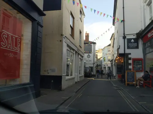

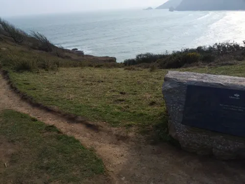


1 more on the map.
Parks, trails and playgrounds13
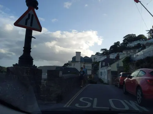



1 more on the map.
Restaurants and cafes16
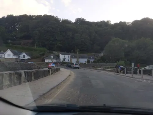
The Winking Prawn
Restaurant · Seafood · 0.7 mi
Cliff Road, Salcombe
Mo-Th 10:00-20:00; Fr-Su 09:30-20:00



Captain Flint’s
Restaurant · Burger, Chicken, Fish, Ice Cream, Pasta, Pizza, Seafood, Steak House
82 Fore Street
Th-Sa 18:00-21:15

4 more on the map.
Where to stay7


History
There are several shipwrecks off Salcombe. The oldest is of a Bronze Age ship, one of only three known in Britain, which had weapons and jewelry made in what is now France. The Salcombe Cannon Wreck is a 17th-century ship that contained 400 Moroccan gold coins and Dutch items. In 1936, a Finnish four-masted barque, Herzogin Cecilie, ran aground on the Ham Stone and was subsequently beached at Starehole Bay, near Bolt Head. Also off Salcombe is HMS Untiring, a World War II submarine, sunk in 1957 as a sonar target.
The name Salcombe derives from the Old English saltcumb meaning 'salt combe (valley)'.
A description of the South Hams is given in the 9th-century charter S298. It does not refer to Salcombe but its area is part of Badestone (Batson). "Salcombe" first appears in the records in 1244, on the boundaries of Batson and West Portlemouth (Portlemore Barton). In 1570, there were 56 mariners, while two years later, another survey shows five ships under 60 tons at Salcombe.
In 1566, there were ten seine nets at Salcombe, while in the 1580s, Salcombe fishermen travelled to Padstow annually for the new herring fishery. While there, they rented cottages and storehouses.
Read more of the history
The ruins of Fort Charles remain towards the south of the town. It was built for Henry VIII to defend the estuary. During the English Civil War, the town sided with the Royalists. From January to May 1646, the fort held out against the Roundheads and was the last Royalist stronghold. It was slighted on the orders of Parliament.
There is little record of the town between 1650 and 1750, but it is thought that the inhabitants lived by fishing and smuggling. In 1764, the first holiday home, The Moult, was built in Salcombe.
In the 19th century, Salcombe was a major centre for shipping in the fruit trade. Salcombe vessels sailed to Iberia, the Mediterranean and the Caribbean as well as to the Azores and Newfoundland. The fruit cargoes were oranges and lemons from the Azores, and pineapples from the Bahamas and West Indies. Other cargoes brought back included sugar, rum, coconuts and shaddocks (pomelos). In addition, wood such as ebony and mahogany was brought for furnishing ships. Salcombe and Kingsbridge were busy ship-building locations, producing the Salcombe schooner, which was a fast boat that could be sailed with few hands. However, almost half the fleet was lost with all hands. A mutual marine assurance association had been established in 1811 to insure Salcombe ships.
The Salcombe fleet also was involved in the coastal trade, supplying coal from Wales and taking away cider, malt, grain and slates. A ferry to Brest was set up in 1870 but did not last.
By 1871, the central part of Salcombe, excluding the outlying districts, numbered 776 people, with 34 shipwrights and 13 ship's carpenters. There were also five sawyers, three block makers, two ship's riggers, three sail makers, a tin plate worker and four blacksmiths. However, in the 1870s, the fruit trade declined due to outbreaks of orange and pineapple disease, as well as the advent of steamships. Some work was found taking salt to Newfoundland and returning with cod but, by 1914, there were only three or four locally owned trading ships in the estuary. At that time, pleasure sailing began at Salcombe, with the yacht club being founded in 1894. One of the boats raced was the Salcombe Yawl for which an owner's association has been set up.
Salcombe became a ship registry port in 1864, but still came under Dartmouth for customs purposes. A customs house was later built at Salcombe which still exists. Between 1796 and 1887, at least 200 vessels were launched from Salcombe. To provide more space, the shipyards were extended by reclaiming the foreshore, but they were later built over and new ones constructed in Shadycombe Creek. However, many vessels were lost, including seven local boats off the Azores in November 1851. There were four sailmakers lofts at Salcombe and three shipsmiths in 1851. The majority of the Victorian houses seen in Salcombe today were built by shipowners and masters. After 1880, with the advent of steam propulsion and larger ships, there was less new construction and repair work. Salcombe's seamen and craftsmen moved to the deep-sea fishing ports or to the dockyards.
A turnpike road was built to Salcombe in 1824. Originally, Salcombe was part of Malborough parish but a chapel-of-ease was built at Salcombe in 1401. The parish church was not built until the 19th century. The population of Salcombe was 972 in 1841, but had risen to about 1500 by 1850. There is also a Wesleyan Chapel and a Catholic church.
Between the two world wars, Salcombe developed as a holiday resort, with Salcombe Sailing Club being founded in 1922.
During the Second World War, a radar station was set up on Bolt Head, and Salcombe became an Advance Amphibious Base for the United States Navy in September 1943. The Salcombe Hotel became the latter's headquarters and 60 other properties were requisitioned, and Quonset huts were built on the hill near the Rugby Club. As well, Whitestrand Quay and slipway were constructed. 137 officers and 1793 men were based at Salcombe. 66 ships and many auxiliary vessels sailed from Salcombe on 4 June 1944, as part of "Force U" which landed on Utah Beach, Normandy. Afterwards, Shadycombe Creek and Mill Bay were used to repair damaged landing craft. The base closed on 7 May 1945, and a plaque was set up in Normandy Way to commemorate the United States Navy. Salcombe and district suffered a number of bombing raids during the war.
The former radar station at Bolt Head, near Salcombe, was set up to be used as the Regional Seat of Government in the event of attack during the Cold War. It has now been dismantled.
There have been many changes to the Salcombe Waterfront since World War II, the most noticeable being the construction of the Creek car and boat park, and the road to Batson. Salcombe became an urban district following an Act of Parliament in 1972.
From the History section of Salcombe on Wikipedia, under CC BY-SA 4.0.
More about Salcombe
Economy
Due to its unspoiled beauty, sandy beaches and harbour facilitating sailing and yachting, Salcombe has one of the highest average property prices in the UK, soaring above Sandbanks, Poole in recent years. Many of the shops, bars and restaurants in the town, especially towards the waterfront, cater for a predominantly well-off, fashionable and nautically-inclined clientele, with prices to match. There are many clothes shops and art galleries. Salcombe has hotels and bed and breakfast establishments as well as self-contained apartments and houses which help its population soar from approximately 1900 in the winter months to nearly 25,000 during the height of the summer.
Salcombe has a number of boatyards and marine stores, while boats are stored on the carpark by the fishing quay during the winter. There is a power boat school and SCUBA diving is popular, although consent from the harbour office must first be obtained to ensure safety. The town and yacht club regatta weeks are one of the main features of the summer season. There are races for dingies and yachts as well as crabbers in addition to other activities. Salcombe Estuary Rowing Club is a member of the Cornish Pilot Gig Association and takes part in races around the south west.
Fishing is still carried out at Salcombe, mostly of shellfish. About 2,000 tons a year were landed between 1986 and 1990.
From the Wikipedia article Salcombe, under CC BY-SA 4.0.
Notable people from Salcombe
 Carl HarbordEnglish-American actor (1908–1958)Photo: Film screenshot (Universal Pictures), Public domain
Born in Salcombe, according to Wikidata (CC0). Each name links to its Wikipedia article.
Churches and places of worship4
Shopping3
Gas and EV charging1
Schools, colleges and libraries2
Map of Salcombe
59 places. The map loads OpenStreetMap tiles when you open it.
Getting there and nearby towns
Exeter Airport (EXT) is the nearest airport with scheduled flights listed in OpenStreetMap, 38 miles away.
- Modbury 9 mi northwest, about 15 min by car
- Ivybridge 12 mi northwest, about 20 min by car
- Yealmpton 13 mi northwest, about 20 min by car
- Newton Ferrers 13 mi northwest, about 21 min by car
- Stoke Gabriel 13 mi northeast, about 21 min by car
- Brixton 14 mi northwest, about 23 min by car
- Paignton 16 mi northeast, about 26 min by car
- Brixham 16 mi northeast, about 25 min by car
- Plymstock 17 mi northwest, about 27 min by car
- Plymouth 19 mi northwest, about 30 min by car
Drive times are estimates from straight-line distance, not routes.
Towns near Salcombe


Keep exploring
Local news
Headlines from INDB.
Reviews, tips and questions
Loading what members have shared...
Sources and licences
- GeoNames (CC BY 4.0): population, coordinates, regions and time zone
- Mapillary (see each image): photos
- OpenStreetMap contributors (ODbL 1.0): places, airports, map data
- Wikidata (CC0 1.0): elevation, founding date, time zone, website, landmarks and historic places
- Wikimedia Commons (see each image): photos
- Wikipedia (CC BY-SA 4.0): overview and history text
Photo credits
- Salcombechurch, Rodw, Public domain
- Salcombe (2022-05-07) 040, Simon Cobb, CC0
- Salcombe (2022-05-07) 041, Simon Cobb, CC0
- Salcombe (2022-05-07) 042, Simon Cobb, CC0
- Salcombe (2022-05-07) 037, Simon Cobb, CC0
- Salcombe (2022-05-07) 038, Simon Cobb, CC0
- Salcombe (2022-05-07) 039, Simon Cobb, CC0
- Salcombe (2022-05-07) 036, Simon Cobb, CC0
- Salcombe (2022-05-07) 033, Simon Cobb, CC0
- Salcombe (2022-05-07) 043, Simon Cobb, CC0
- Salcombe (2022-05-07) 003, Simon Cobb, CC0
- Salcombe (2022-05-07) 035, Simon Cobb, CC0
- Salcombe (2022-05-07) 034, Simon Cobb, CC0
- Salcombe Cannon Wreck and Moor Sands Sites, Natritmeyer, CC BY-SA 4.0
- Overbecks, Brian, CC BY-SA 2.0
- SalcombeCastleFromNorthSands, Stephen Lea, CC BY-SA 3.0
- Salcombe (2022-05-07) 032, Simon Cobb, CC0
- Pub Victoria inn - panoramio, cowbridgeguide.co.uk, CC BY 3.0
- KN13ARX 230713 CPS (11711541205), Chris Sampson, CC BY 2.0
- Street-level photo, WaggyDog, CC BY-SA 4.0
- Street-level photo, WaggyDog, CC BY-SA 4.0
- Street-level photo, WaggyDog, CC BY-SA 4.0
- Street-level photo, ukchris, CC BY-SA 4.0
- Street-level photo, WaggyDog, CC BY-SA 4.0
- Street-level photo, WaggyDog, CC BY-SA 4.0
- Street-level photo, WaggyDog, CC BY-SA 4.0
- Street-level photo, WaggyDog, CC BY-SA 4.0
- Street-level photo, WaggyDog, CC BY-SA 4.0
- Street-level photo, WaggyDog, CC BY-SA 4.0
- Street-level photo, WaggyDog, CC BY-SA 4.0
- Street-level photo, WaggyDog, CC BY-SA 4.0
- Street-level photo, WaggyDog, CC BY-SA 4.0
- Street-level photo, WaggyDog, CC BY-SA 4.0
- Street-level photo, WaggyDog, CC BY-SA 4.0
- Street-level photo, WaggyDog, CC BY-SA 4.0


Page built November 10, 2026. Spotted a mistake? Tell us or suggest a place.