

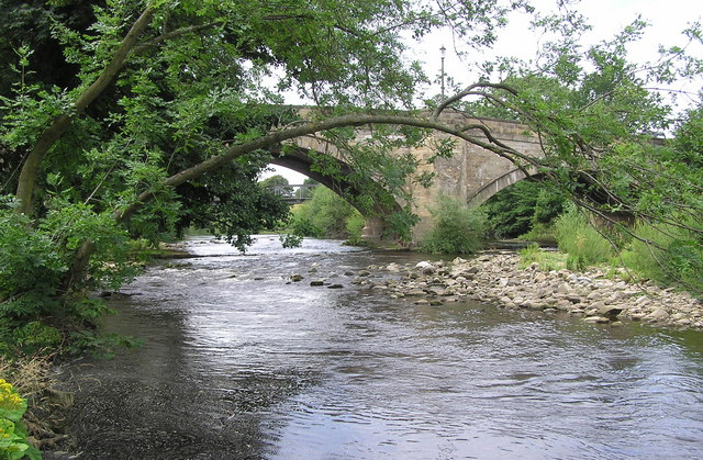


Why visit Scorton
Townapedia lists 6 museums and landmarks, 2 parks and trails, 2 places to eat, 1 place to stay and 2 attractions in and around town.
Highlights include Catterick Bridge, Skeeby Bridge, Kiplin Hall and Henry Jenkins Memorial.
Weather in Scorton
Forecast from MET Norway (CC BY 4.0). Full forecast
About Scorton
Scorton is a village and civil parish in the county of North Yorkshire, England. It is approximately 8 miles (13 km) north-west of the county town of Northallerton.
From the Wikipedia article Scorton, North Yorkshire (this version), under CC BY-SA 4.0.
Things to do2

Catterick Bridge
Bridge · 1.7 mi
Road bridge in North Yorkshire, England, UK
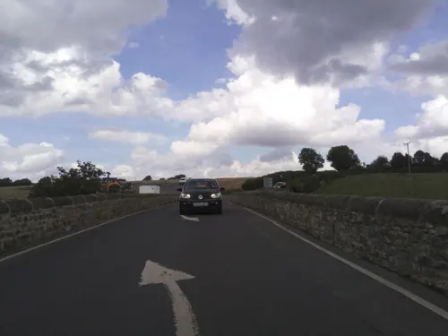
Skeeby Bridge
Bridge · 3.4 mi
Bridge in Skeeby, North Yorkshire, England, UK
Museums and landmarks6

Kiplin Hall
Museum · 2.2 mi
Grade I listed historic house museum in North Yorkshire, England, UK


Cataractonium
Monument and historic site · 1.8 mi
Roman fort and settlement in Catterick, located in North Yorkshire, England

Moulton Hall
Museum · 2.3 mi
Grade I listed historic house museum in Richmondshire, United Kingdom
Parks, trails and playgrounds2

Restaurants and cafes2


History
The village is mentioned in Domesday Book as "Scortone" in the lands of Count Alan of Brittany, who was tenant-in-chief during the Norman invasion. Before the invasion the manor was granted to Thorfin of Ravensworth but subsequently granted in 1086 to Bodin, brother of Bardulf. The manor was thereafter split into two parts, the larger granted to the Fitz Hugh family and the smaller to the Fitz Alans. The descent of the larger part of the manor followed that of the manor of Kirkby Ravensworth until 1512 when it came into the Fiennes family, who were entitled as Baron Dacre. In 1600 the manor was left to Charles Tankard and Christopher Jeynes, who had sold it to Leonard Wastell by 1616. Towards the end of the 18th century the manor passed to the Earl of Tyrconnel and followed that family's descent.
The name is derived from a combination of the Old Norse word skor, meaning a rift in the rock, and the Old English suffix tūn, meaning farm or settlement. Put together they mean ravine farm.
Read more of the history
Scorton was home to the now closed Scorton Grammar School, 1720–1991. Most of the buildings and grounds have been converted into houses. Scorton has a raised village green, one of only two in England. It is said that the green was built in the early 18th century by John Noble, the first headmaster of Scorton Grammar School. There was also the St John of God Hospital, built in 1880 in the grounds of the former convent of St Clare, later a nursing home, Abbey Care Village.
Between 1939 and 1945 the village was home to RAF Scorton, which served as a satellite of RAF Catterick. Many squadrons flew from Scorton during the Second World War including No. 56 Squadron RAF who flew Spitfires and others who flew Beaufighters. The aerodrome has now been extensively quarried away.
Scorton was once served by the Eryholme-Richmond branch line but it was closed in 1969. The station building is now a house and much of the line between Scorton railway station and Catterick Bridge has been destroyed by quarrying.
From the History section of Scorton, North Yorkshire on Wikipedia, under CC BY-SA 4.0.
More about Scorton
Geography
The village is at the northern end of the B6271 from Northallerton where the B1263 from Richmond joins it. Scorton Beck, a tributary of the River Swale, flows south on the east side of the village. The nearest settlements are Bolton-on-Swale 0.5 miles (0.8 km) to the south, Catterick 1.4 miles (2.3 km) to the south west and Brompton-on-Swale 2 miles (3.2 km) to the west.
From the Wikipedia article Scorton, North Yorkshire, under CC BY-SA 4.0.
Where to stay1
Churches and places of worship8
Church of St Paulinus Presbytery And Attached Outbuildings
Church · 2.7 mi
Schools, colleges and libraries2
Michael Syddall Church of England Aided Primary School
School · Anglican · 1.5 mi
Healthcare1
Map of Scorton
24 places. The map loads OpenStreetMap tiles when you open it.
Getting there and nearby towns
Teesside International Airport (MME) is the nearest airport with scheduled flights listed in OpenStreetMap, 11 miles away.
- Northallerton 8 mi southeast, about 13 min by car
- Darlington 9 mi north, about 15 min by car
- Yarm 13 mi northeast, about 20 min by car
- Newton Aycliffe 15 mi north, about 25 min by car
- Thornaby-on-Tees 16 mi northeast, about 25 min by car
- Stockton-on-Tees 17 mi northeast, about 27 min by car
- Bishop Auckland 18 mi north, about 29 min by car
- Billingham 18 mi northeast, about 30 min by car
- Ripon 18 mi south, about 30 min by car
- Middlesbrough 20 mi northeast, about 31 min by car
Drive times are estimates from straight-line distance, not routes.
Towns near Scorton


Keep exploring
Local news
Headlines from INDB.
Reviews, tips and questions
Loading what members have shared...
Sources and licences
- GeoNames (CC BY 4.0): population, coordinates, regions and time zone
- Mapillary (see each image): photos
- OpenStreetMap contributors (ODbL 1.0): places, airports, map data
- Wikidata (CC0 1.0): elevation, founding date, time zone, website, landmarks and historic places
- Wikimedia Commons (see each image): photos
- Wikipedia (CC BY-SA 4.0): overview and history text
Photo credits
- Scorton, Cacolantern, Public domain
- Catterick Bridge, Hugh Mortimer, CC BY-SA 2.0
- KHi121la, Rojabro, CC BY-SA 3.0
- Henry Jenkins memorial, Bolton-on-Swale 2016-06-02, August Schwerdfeger, CC BY 4.0
- Street-level photo, parson983, CC BY-SA 4.0
- Street-level photo, southglos, CC BY-SA 4.0
Page built November 10, 2026. Spotted a mistake? Tell us or suggest a place.