


Why visit Seaview
Townapedia lists 6 museums and landmarks, 8 parks and trails, 20 places to eat, 5 places to stay and 2 attractions in and around town.
Highlights include St Helens Fort, Ryde Theatre and Town Hall, HMS Royal George and Nunwell House.
Weather in Seaview
Forecast from MET Norway (CC BY 4.0). Full forecast
About Seaview
Seaview is a small Edwardian resort located on the north-eastern corner of the Isle of Wight, overlooking the Solent.
From the Wikipedia article Seaview, Isle of Wight (this version), under CC BY-SA 4.0.
Things to do2

St Helens Fort
Lighthouse · 1.6 mi
Sea fort with lighthouse in the Solent close to the Isle of Wight, England, UK

Ryde Theatre and Town Hall
Cinema and theater · 2.4 mi
Theatre and former town hall in Ryde, Isle of Wight, England, UK
Museums and landmarks6

HMS Royal George
Monument and historic site · 2.6 mi
1756 first-rate ship of the line

Nunwell House
Museum · 3.2 mi
Country house in Brading, Isle of Wight, England, UK



Parks, trails and playgrounds8

Alan Hersey Nature Reserve
Park · 0.4 mi
Nature reserve on the Isle of Wight

Brading Marshes RSPB reserve
Park · 3.1 mi
RSPB nature reserve on the Isle of Wight

Seaview Wildlife Encounter
Park · 0.5 mi
Wildlife park in Seaview, Isle of Wight, England


Restaurants and cafes20
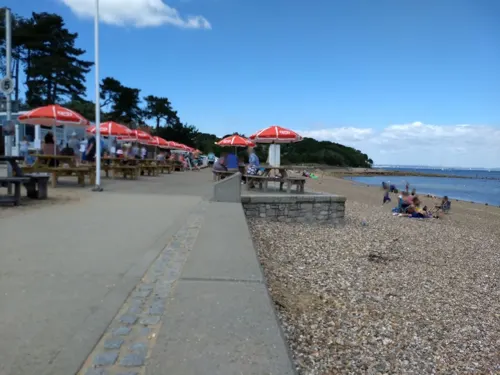
Baywatch on the Beach
Cafe · Fish And Chips, Seafood, Sandwich · 1.5 mi
The Duver, Ryde
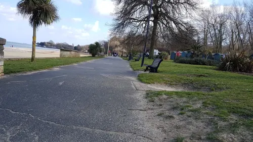
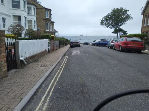
The Old Barracks Tea Rooms
Cafe · Pizza, Burger, Sandwich · 0.8 mi
Puckpool Hill, Seaview


8 more on the map.
Where to stay5
Churches and places of worship14
Church of St. Michael and All Angels, Swanmore, Ryde
Church · 2.5 mi
Shopping3
Schools, colleges and libraries2
Healthcare2
Map of Seaview
62 places. The map loads OpenStreetMap tiles when you open it.
Getting there and nearby towns
Bembridge Airport (BBP) is the nearest airport with scheduled flights listed in OpenStreetMap, 3 miles away.
- St. Helens 2 mi south, about 3 min by car
- Ryde 2 mi west, about 4 min by car
- Brading 3 mi southwest, about 5 min by car
- Gosport 5 mi north, about 8 min by car
- Sandown 5 mi southwest, about 8 min by car
- Portsmouth 6 mi north, about 9 min by car
- South Hayling 8 mi northeast, about 12 min by car
- Hayling Island 8 mi northeast, about 12 min by car
- Newport 8 mi west, about 13 min by car
- Cowes 9 mi west, about 14 min by car
Drive times are estimates from straight-line distance, not routes.
Towns near Seaview


Keep exploring
Local news
Headlines from INDB.
Reviews, tips and questions
Loading what members have shared...
Sources and licences
- GeoNames (CC BY 4.0): population, coordinates, regions and time zone
- Mapillary (see each image): photos
- OpenStreetMap contributors (ODbL 1.0): places, airports, map data
- Wikidata (CC0 1.0): elevation, founding date, time zone, website, landmarks and historic places
- Wikimedia Commons (see each image): photos
- Wikipedia (CC BY-SA 4.0): overview and history text
Photo credits
- Seaview, IW, UK, Mypix, CC BY-SA 4.0
- Seaview Ryde Road bus stop diversion notice, Arriva436, CC BY-SA 3.0
- Seaview Ryde Road bus stop, Arriva436, CC BY-SA 3.0
- Seaview Ryde Road bus stops, Arriva436, CC BY-SA 3.0
- St Helens Fort, Editor5807, CC BY 3.0
- The "Royal George" at Deptford Showing the Launch of "The Cambridge"., John Cleveley the Elder, Public domain
- Nunwell House, Jo Turner, CC BY-SA 2.0
- Alan Hersey Nature Reserve central streams, Editor5807, Public domain
- Brading Marshes, IW, UK, Mypix, CC BY-SA 4.0
- All Saints' Church in Ryde, Editor5807, Public domain
- Church of St. Michael and All Angels, Swanmore, Ryde, Editor5807, Public domain
- Holy Trinity Church, Bembridge, Editor5807, Public domain
- Former Holy Trinity Church, Dover Street, Ryde (June 2017) (5), Hassocks5489, CC0
- Ryde St. John's Church 2, Editor5807, CC BY 3.0
- St James's Church, Lind Street, Ryde (May 2016) (2), Hassocks5489, CC0
- St Mary's Church, Brading, Isle of Wight, England, ITookSomePhotos, CC BY-SA 4.0
- St Helens New Church, Isle of Wight, UK (2), Mypix, CC BY-SA 4.0
- Appley Tower, Isle of Wight, BabelStone, CC BY-SA 3.0
- HMS Sirius memorial - panoramio, wightdogs, CC BY-SA 3.0
- Plaques on the wall of St Helen's Old Church, Naturenet, CC BY-SA 4.0
- Urocissa erythrorhyncha -Seaview Wildlife Encounter, Seaview, Isle of Wight, UK-8a, John Proctor from Southampton, CC BY 2.0
- Street-level photo, cjmalone, CC BY-SA 4.0
- Street-level photo, mappernerd, CC BY-SA 4.0
- Street-level photo, mappernerd, CC BY-SA 4.0
- Street-level photo, mappernerd, CC BY-SA 4.0
- Street-level photo, jpennycook, CC BY-SA 4.0
- Street-level photo, cjmalone, CC BY-SA 4.0
- Street-level photo, mappernerd, CC BY-SA 4.0
- Street-level photo, mappernerd, CC BY-SA 4.0
- Street-level photo, mappernerd, CC BY-SA 4.0
- Street-level photo, mappernerd, CC BY-SA 4.0
- Street-level photo, mappernerd, CC BY-SA 4.0
- Street-level photo, mappernerd, CC BY-SA 4.0
- Street-level photo, cjmalone, CC BY-SA 4.0
- Street-level photo, mappernerd, CC BY-SA 4.0
- Street-level photo, mappernerd, CC BY-SA 4.0
- Street-level photo, mappernerd, CC BY-SA 4.0
- Street-level photo, trigpoint, CC BY-SA 4.0
- Street-level photo, mappernerd, CC BY-SA 4.0
- Street-level photo, mappernerd, CC BY-SA 4.0
- Street-level photo, oferreira, CC BY-SA 4.0
- Street-level photo, trigpoint, CC BY-SA 4.0
- Street-level photo, mappernerd, CC BY-SA 4.0
- Street-level photo, mappernerd, CC BY-SA 4.0
- Street-level photo, mappernerd, CC BY-SA 4.0
- Street-level photo, mappernerd, CC BY-SA 4.0
- Street-level photo, mappernerd, CC BY-SA 4.0


Page built November 10, 2026. Spotted a mistake? Tell us or suggest a place.