


Shotley Gate, United Kingdom
Shotley Gate is a town of 1,511 people in England, United Kingdom.
Why visit Shotley Gate
Townapedia lists 16 museums and landmarks, 14 parks and trails, 50 places to eat, 9 places to stay and 5 attractions in and around town.
Highlights include Harwich Maritime Museum, Harwich High Lighthouse, HMS Ganges and Ha’penny Pier & Visitors Centre.
Weather in Shotley Gate
Forecast from MET Norway (CC BY 4.0). Full forecast
About Shotley Gate
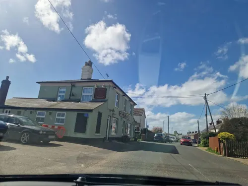
Shotley Gate is a settlement in the civil parish of Shotley, in the Babergh district, in the county of Suffolk, England. It is located at the tip of Shotley Peninsula and is the largest settlement in the parish of Shotley, in 2020 it had an estimated population of 1461. Shotley Gate has a pub called the Bristol Arms (formerly the Shotley Gate Inn) the settlement of Shotley Gate developed either side of Bristol Hill.
From the Wikipedia article Shotley Gate (this version), under CC BY-SA 4.0.
Photos of Shotley Gate


Things to do5

Harwich High Lighthouse
Lighthouse · 1.3 mi
Lighthouse in Harwich, Essex, England, UK
Harwich Low Lighthouse
Lighthouse · 1.4 mi
Lighthouse in Harwich, Tendring, Essex, England, UK

Museums and landmarks16




Walton Priory
Monument and historic site · 3.3 mi
Benedictine priory in Suffolk, England, UK

Lightship LV18
Monument and historic site · 1.0 mi
The ex-Trinity House vessel LV18 is the last surviving example of a manned light vessel in British waters, which has been preserved in...
The Quay, Harwich


4 more on the map.
Parks, trails and playgrounds14






2 more on the map.
Restaurants and cafes50

38 more on the map.
Where to stay9
Churches and places of worship5
Shopping16
Gas and EV charging3
Schools, colleges and libraries4
Healthcare2
Map of Shotley Gate
124 places. The map loads OpenStreetMap tiles when you open it.
Getting there and nearby towns
RAF Honington (BEQ) is the nearest airport with scheduled flights listed in OpenStreetMap, 34 miles away.
- Harwich 1 mi southeast, about 2 min by car
- Dovercourt 2 mi south, about 2 min by car
- Felixstowe 4 mi east, about 6 min by car
- Kesgrave 7 mi north, about 12 min by car
- Ipswich 8 mi northwest, about 14 min by car
- Walton-on-the-Naze 8 mi south, about 12 min by car
- Thorpe le Soken 8 mi southwest, about 13 min by car
- Frinton-on-Sea 9 mi south, about 14 min by car
- Woodbridge 10 mi north, about 15 min by car
- Clacton-on-Sea 13 mi southwest, about 20 min by car
Drive times are estimates from straight-line distance, not routes.
Towns near Shotley Gate


Keep exploring
Local news
Headlines from INDB.
Reviews, tips and questions
Loading what members have shared...
Sources and licences
- GeoNames (CC BY 4.0): population, coordinates, regions and time zone
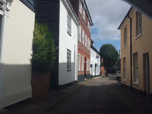
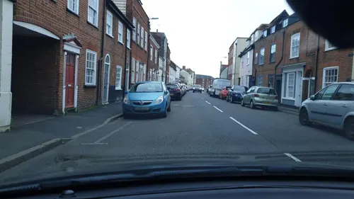
- Mapillary (see each image): photos
- OpenStreetMap contributors (ODbL 1.0): places, airports, map data
- Wikidata (CC0 1.0): elevation, founding date, time zone, website, landmarks and historic places
- Wikimedia Commons (see each image): photos
- Wikipedia (CC BY-SA 4.0): overview and history text
Photo credits
- HMS Ganges mast, Coote, R G G (Lt) Royal Navy official photographer, Public domain
- Levington Lagoon 4, Dudley Miles, CC BY-SA 4.0
- High Lighthouse, Maria, CC BY-SA 3.0
- Electric Palace Cinema, Maria, CC BY-SA 3.0
- Locals up in arms as alien spaceship lands on Harwich allotments (17315033826), John Fielding from Norwich, UK, CC BY 2.0
- The Mayflower Primary School, Victuallers, CC BY-SA 4.0
- Harwich lifeboat museum, Geof Sheppard, CC BY-SA 4.0
- Calshot Spit lightvessel, Murgatroyd49, CC BY-SA 4.0
- The Chapel at The Priory, Blythburgh 1377199, No Swan So Fine, CC BY-SA 4.0
- Who remember John Noakes climbing to the top of this mast on Blue Peter? (17299597486), John Fielding from Norwich, UK, CC BY 2.0
- HMS Ganges on Shotley Point 4 (17139326349), John Fielding from Norwich, UK, CC BY 2.0
- The former HMS Ganges on Shotley Point (17139327759), John Fielding from Norwich, UK, CC BY 2.0
- Bristol Arms, Dzidek232, CC0
- Bristol Arms (64216), Dzidek232, CC0
- Shotley pier jan 2026, Scribwik, CC BY-SA 4.0
- Essex Way, Copperas Wood, west of Harwich. - panoramio, Maarten Sepp, CC BY-SA 3.0
- Street-level photo, edloach, CC BY-SA 4.0
- Street-level photo, edloach, CC BY-SA 4.0
- Street-level photo, smsm1, CC BY-SA 4.0
- Street-level photo, edloach, CC BY-SA 4.0
- Street-level photo, adam2, CC BY-SA 4.0
- Street-level photo, smsm1, CC BY-SA 4.0
- Street-level photo, edloach, CC BY-SA 4.0
- Street-level photo, edloach, CC BY-SA 4.0
- Street-level photo, edloach, CC BY-SA 4.0
- Street-level photo, edloach, CC BY-SA 4.0
- Street-level photo, edloach, CC BY-SA 4.0
- Street-level photo, edloach, CC BY-SA 4.0
- Street-level photo, edloach, CC BY-SA 4.0
- Street-level photo, edloach, CC BY-SA 4.0
- Street-level photo, edloach, CC BY-SA 4.0
- Street-level photo, edloach, CC BY-SA 4.0
- Street-level photo, edloach, CC BY-SA 4.0
- Street-level photo, edloach, CC BY-SA 4.0
- Street-level photo, edloach, CC BY-SA 4.0
- Street-level photo, edloach, CC BY-SA 4.0
- Street-level photo, edloach, CC BY-SA 4.0
- Street-level photo, edloach, CC BY-SA 4.0
- Street-level photo, edloach, CC BY-SA 4.0
- Street-level photo, edloach, CC BY-SA 4.0
- Street-level photo, edloach, CC BY-SA 4.0
Page built November 10, 2026. Spotted a mistake? Tell us or suggest a place.