


Skinningrove, United Kingdom
Skinningrove is a town of 1,606 people in England, United Kingdom.
Why visit Skinningrove
Townapedia lists 4 museums and landmarks, 6 parks and trails, 7 places to eat and 2 places to stay in and around town.
Highlights include Saltburn War Memorial and Street House Anglo-Saxon cemetery.
Weather in Skinningrove
Forecast from MET Norway (CC BY 4.0). Full forecast
About Skinningrove
Skinningrove is a village in the civil parish of Loftus, in the Redcar and Cleveland district, in the ceremonial county of North Yorkshire, England. Its name is of Old Norse origin and is thought to mean skinners' grove or pit.
From the Wikipedia article Skinningrove (this version), under CC BY-SA 4.0.
Museums and landmarks4

Saltburn War Memorial
Monument and historic site · 3.1 mi
War memorial in Saltburn, Marske and New Marske, North Yorkshire, England, UK

Street House Anglo-Saxon cemetery
Monument and historic site · 1.7 mi
Cemetery in North Yorkshire, England


Parks, trails and playgrounds6




Restaurants and cafes7

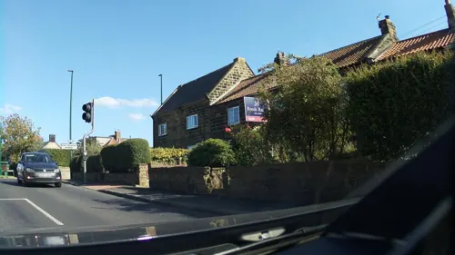
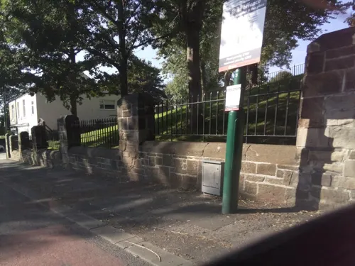

The Reunion Bar & Restaurant
Restaurant · 1.1 mi
West Road, Loftus
Mo 16:00-21:30; Tu-Sa 12:00-22:00; Su 12:00-19:30

Station Hotel
Bar and pub · 1.1 mi
Friendly, somewhat grungy pub with atmosphere. Free live bands on Saturdays. Open Mike Night on third Sunday of every month.
Station Road, Saltburn-by-the-Sea
Where to stay2


History
The village had an agricultural and fishing economy, until the opening of local ironstone workings, in 1848, initiated an industrialisation boom. A railway was built by 1865, and iron smelting began in 1874.
A jetty on the coast, built in 1880, allowed seagoing vessels to carry heavy cargoes from the area. Mining continued until 1958, and primary iron production until the 1970s.
Skinningrove was formerly a township in the parish of Brotton. In 1866, it became a separate civil parish.
On 17 February 2003, a rarely seen oarfish was caught by angler Val Fletcher, using a fishing rod baited with squid. The fish was 11 ft 4 in (3.3 m) long and weighed 140 lb (63.5 kg). Graham Hill, the science officer at the Deep, an aquarium in Hull, said that he had never heard of another oarfish being caught off the coast of Britain.
The Natural History Museum in London said that it would have been interested in preserving the fish in its permanent collection; however the fish had been 'cut up into steaks' before any scientists could examine it.
From the History section of Skinningrove on Wikipedia, under CC BY-SA 4.0.
More about Skinningrove
Arts and culture
From 1982 to 2019, Skinningrove hosted a bonfire and fireworks display, which attracted hundreds of people from around North Yorkshire. Each year, the bonfire was based on a different theme. The bonfire was discontinued from 2023, due to safety concerns and local infrastructure being unable to cope with the large crowds.
Photographer Chris Killip created an unpublished photo series about the town's residents in the early 1980s, about which the American filmmaker Michael Almereyda produced a short film. The film won Best Non-Fiction Short at the 2012 Sundance Film Festival.
From the Wikipedia article Skinningrove, under CC BY-SA 4.0.
Churches and places of worship6
Saints Joseph and Cuthbert
Church · Catholic · 1.2 mi
39 High Street, Saltburn-by-the-Sea
Schools, colleges and libraries5
Saint Joseph's Catholic Primary School
School · Roman Catholic · 1.5 mi
Rosecroft Lane, Saltburn-by-the-Sea
Healthcare1
Map of Skinningrove
31 places. The map loads OpenStreetMap tiles when you open it.
Getting there and nearby towns
Teesside International Airport (MME) is the nearest airport with scheduled flights listed in OpenStreetMap, 22 miles away.
- Guisborough 7 mi west, about 11 min by car
- Redcar 7 mi northwest, about 12 min by car
- Ingleby Greenhow 12 mi southwest, about 19 min by car
- Middlesbrough 13 mi west, about 22 min by car
- Whitby 13 mi southeast, about 20 min by car
- Hartlepool 15 mi northwest, about 24 min by car
- Billingham 16 mi west, about 25 min by car
- Thornaby-on-Tees 16 mi west, about 26 min by car
- Stockton-on-Tees 17 mi west, about 27 min by car
- Yarm 19 mi west, about 31 min by car
Drive times are estimates from straight-line distance, not routes.
Towns near Skinningrove


Keep exploring
Local news
Headlines from INDB.
Reviews, tips and questions
Loading what members have shared...
Sources and licences
- GeoNames (CC BY 4.0): population, coordinates, regions and time zone
- Mapillary (see each image): photos
- OpenStreetMap contributors (ODbL 1.0): places, airports, map data
- Wikidata (CC0 1.0): elevation, founding date, time zone, website, landmarks and historic places
- Wikimedia Commons (see each image): photos
- Wikipedia (CC BY-SA 4.0): overview and history text
Photo credits
- Skinningrove, Uncredited, CC BY-SA 2.0
- Saltburn War Memorial, Simon Armstrong, CC BY-SA 3.0
- Saxon Princess Kirkleatham, Prioryman, CC BY-SA 3.0
- Street-level photo, southglos, CC BY-SA 4.0
- Street-level photo, southglos, CC BY-SA 4.0
- Street-level photo, southglos, CC BY-SA 4.0
- Street-level photo, southglos, CC BY-SA 4.0
- Street-level photo, southglos, CC BY-SA 4.0
- Street-level photo, southglos, CC BY-SA 4.0
- Street-level photo, southglos, CC BY-SA 4.0
Page built November 10, 2026. Spotted a mistake? Tell us or suggest a place.