


Willenhall, United Kingdom
Willenhall is a town of 49,587 people in England, United Kingdom.
Why visit Willenhall
Townapedia lists 22 museums and landmarks, 16 parks and trails, 50 places to eat, 1 place to stay and 4 attractions in and around town.
Highlights include Grand Theatre, Arena Theatre, Bilston Craft Gallery and Sikh Regiment Memorial.
Weather in Willenhall
Forecast from MET Norway (CC BY 4.0). Full forecast
About Willenhall
Willenhall is a market town in the Metropolitan Borough of Walsall, in the county of West Midlands, England. At the 2021 Census the town had a population of 49,587. It lies between Wolverhampton and Walsall on the River Tame, and is contiguous with both Wolverhampton and South Staffordshire. The M6 motorway at Junction 10 separates it from Walsall.
From the Wikipedia article Willenhall (this version), under CC BY-SA 4.0.
Photos of Willenhall

Things to do4

Grand Theatre
Cinema and theater · 2.7 mi
Theatre in Wolverhampton, England


Arena Theatre
Cinema and theater · 2.9 mi
University theatre in Wolverhampton, England

Museums and landmarks22

Bilston Craft Gallery
Museum · 1.3 mi
Museum and library in Bilston, Wolverhampton

Sikh Regiment Memorial
Monument and historic site · 1.4 mi
2021 statue in Wolverhampton, England

The New Art Gallery Walsall
Museum · 3.1 mi
Modern and contemporary art gallery in Walsall, England, United Kingdom

Walsall Leather Museum
Museum · 3.2 mi
Municipal museum in Walsall, England, United Kingdom

Wednesbury Museum and Art Gallery
Museum · 2.9 mi
Art museum in Sandwell, West Midlands, United Kingdom

Wolverhampton Art Gallery
Museum · 2.8 mi
Art gallery in West Midlands, United Kingdom

Wolverhampton Pillar
Monument and historic site · 2.9 mi
Shaft of an Anglo-Saxon High cross, still standing in its original location in the churchyard of St Peter's Collegiate Church, in...

Locksmith's House
Museum
Museum in Willenhall, Staffordshire, England, United Kingdom

Walsall Castle
Monument and historic site · 2.5 mi
Manor house in Walsall, West Midlands, England
Battle of Wōdnesfeld (910)
Monument and historic site · 1.5 mi
Approximate location for the site of the Battle of Wōdnesfeld in 910, during the Viking Invasions of England between Northumbrian...
10 more on the map.
Parks, trails and playgrounds16

Brunswick Park
Park · 2.9 mi
Public park in Wednesbury, West Midlands, England, UK
East Park
Park · 1.7 mi
Park in Wolverhampton, West Midlands, England, UK
Peascroft Wood
Park · 1.2 mi
Nature reserve in the West Midlands, England
West Park
Park · 3.4 mi
Park in Wolverhampton, West Midlands, England, UK

4 more on the map.
Restaurants and cafes50
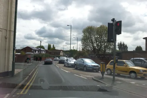
The Bridge Tavern
Bar and pub · 1.5 mi
1 Bentley Lane, Willenhall
Mo-Th 16:00-23:00; Fr 16:00-00:30; Sa 12:00-00:30; Su 12:00-23:00



38 more on the map.
History
Willenhall has been described as "undoubtedly a place of great antiquity, on the evidence of its name it manifestly had its origins in an early Saxon settlement. The Anglo-Saxon form of its name Willanhale may be interpreted as 'the meadow land of Willa' – Willa being a personal name." Alternatively, the name may mean willow halh, the first element of it being the Old English wilgen 'of willows'. The Old English word halh meaning "a nook or corner of land, often used of land in a hollow or river bend."
The first record of the settlement of Willenhall is from the eighth century when a treaty was signed there by King Ethelbald of Mercia, in which Willenhall was referred to as Willenhalch. In 996 the town was referred to as Willenhale, and as Winenhale it was mentioned in the Domesday Book (1086) as a very small settlement, and it remained so until the growth of industry in the 18th century.
Read more of the history
During the 10th century, Willenhall was in the Shire of Stafford and The Hundred of Offlow (unit of a 100 villages), consisting of 30 households and a population of around 120. In the Middle Ages, Willenhall was included in the parish of St. Peter's Collegiate Church, Wolverhampton. Although there was a church in the village, people would have to travel to Wolverhampton for weddings and funerals. It was not until 1840 that Willenhall had a parish church. St. Giles was the first church to be built. The present church is the third on the site, dating from 1867. The River Tame flows through the churchyard and was until recent years one of the few places where the water surfaced.
Willenhall was a small agricultural village throughout the Middle Ages. From Tudor times, the natural mineral wealth began to be exploited with ore being sent out to charcoal furnaces in nearby Cannock Chase. The iron product was then returned to be turned into small metal goods. Nails were a common product and by the end of 17th century Willenhall had a healthy hand trade, making grid irons, curry combs, bolts, latches and coffin handles. According to the Hearth Tax Returns in 1665, Willenhall comprised 136 households and 894 persons and the largest building in the area was the Leveson Manor House. The population did not increase dramatically until the 18th century when iron and coal began to be fully exploited. The town grew up around the Market Place and Stafford Street with many tiny streets crammed with houses, workshops and pubs. Evidence of the town's growing prosperity is still visible today in the Dale House, once the home of the Hincks family, and 33 Market Place, the home of the Clemsons, both maltsters.
Willenhall suffered its very own great fire in 1659, when most of the town centre was devastated. Most common homes at this time were still made of wattle and daub with glassless wind-eyes (windows), properties easily razed by fire. Rebuilding where money allowed was in brick; The Bell Inn Public House being a good surviving example from 1660, although now closed for business and in the ownership of a local heritage trust (the Willenhall Townscape Heritage Initiative).
Willenhall's first workhouse opened in 1741 adjacent to what is now Upper Lichfield Street; it was in operation for 100 years before merging with Wolverhampton. By 1801, the population was 3,143.
Poor housing and lack of any proper sanitation led to a cholera epidemic in 1849 when 292 people died. Many of those who died were buried in the Cholera Burial Ground "on land at the bottom of Doctors Piece." A commemorative plaque at the site reads:THE PARISH OF WILLENHALL WAS VISITED BY CHOLERA IN 1849.THE FIRST DEATH BY THAT DISEASE TOOK PLACE ON THE 17TH AUGUST, THE LAST ON 4TH OCTOBER. IN 49 DAYS 292 PERSONS DIED, THE CHURCHYARD OF ST GILES BEING TOO CROWDED FOR FURTHER INTERMENT, THIS GROUND, A PORTION OF THE CHURCH ESTATE WAS (WHILE YET UNCONSECRATED) FIRST USED FOR BURIALS ON THE FIRST OF SEPTEMBER. ON THREE DAYS THE BURIALS WERE 15 DAILY THE WHOLE NUMBER INTERRED HERE AND IN THE CHURCHYARD BEING 211.
The epidemic shocked the town into improving conditions, and in 1854 the Willenhall Local Board of Health was founded: to reflect a growth in civic pride, it established a library building in Clemson Street in 1866. The board was a forerunner of Willenhall Urban District Council which took over in 1894.
The clock in the Market Place was erected in 1892 by public subscription to the memory of Joseph Tonks, who was a doctor working in the town post-cholera. About the clock, Hackwood writes: This was erected, as an inscription upon it testifies, as a memorial to the late Joseph Tonks, surgeon. "whose generous and unsparing devotion in the cause of alleviating human suffering" was "deemed worthy of public record."
Tonks brought both health and sanitation to Willenhall but died at the age of 35.
Willenhall was formerly a township in the parish of Wolverhampton, in 1866 Willenhall became a separate civil parish, in 1894 Willenhall became an urban district, the district contained the civil parish of Willenhall and from 1934 the parish of Short Heath. On 1 April 1966 the district was abolished and merged with the County Borough of Walsall and the County Borough of Wolverhampton, part also went to Cannock Rural District. The parish was also abolished on 1 April 1966 and merged with Walsall, Wolverhampton and Essington. In 1961 the parish had a population of 32,352.
By 1901, the population of "Willenhall, minus Short Heath" was 18,515.
From the History section of Willenhall on Wikipedia, under CC BY-SA 4.0.
More about Willenhall
Education
Willenhall is home to three secondary schools. St Thomas More Catholic School is near the border of Bilston and Darlaston, Willenhall E-Act Academy (formerly known as Willenhall Comprehensive School, which moved from Bilston Road) and is now located on the town's Lodge Farm estate. Finally Pool Hayes Academy (formerly known as Pool Hayes Arts and Community School) is located on the town's Summer Hayes Estate. There is also Moseley Park School located on Moseley Road in Willenhall, near Portobello and Stow Heath Primary School.
For younger students in Willenhall there are numerous primary schools, these are:
Fibbersley Park Academy – A recently built Super School located near Willenhall Park, made up of the merger of Clothier Street, Little London & Lakeside Primary now closed. Fibbersley Park Academy had an extension in 2016* increasing the year groups from 60 to 90 pupils.
Short Heath Junior School, Rosedale CofE Primary School & Lane Head Nursery School – Three federated schools located on the outskirts of the Lodge Farm Estate & Lane Head.
Barcroft School – The product of the recent merger of Elm Street Infants and Albion Road Juniors. Located near Willenhall Town Centre albion road and barcroft have been demolished
Woodlands Primary – Located in the Short Heath area of the town, very near to Lane Head.
From the Wikipedia article Willenhall, under CC BY-SA 4.0.
Notable people from Willenhall
 Allan ClarkeEnglish footballerPhoto: lufcfilms, CC0
- Mark DaviesBritish footballer (born 1988)
- Johnny WatkissAustralian soccer player
- Joe ButcherEnglish footballer (1875-1945)
- Derek ClarkeEnglish footballer (born 1950)
- Kelvin ClarkeEnglish footballer (born 1957)
- Terry PittBritish politician (1937–1986)
- Richard DaviesBritish footballer (born 1990)
- Frank ClarkeEnglish footballer (born 1942)
- Bert BlissEnglish footballer (1890-1968)
- Jack PittEnglish footballer (1920-2004)
- Moses LaneEnglish footballer (1895-1949)
Born in Willenhall, according to Wikidata (CC0). Each name links to its Wikipedia article.
Where to stay1
Churches and places of worship43
Shopping14
Gas and EV charging4
Schools, colleges and libraries31
Healthcare10
Map of Willenhall
195 places. The map loads OpenStreetMap tiles when you open it.
Getting there and nearby towns
Birmingham Airport (BHX) is the nearest airport with scheduled flights listed in OpenStreetMap, 16 miles away.
- Wolverhampton 3 mi west, about 4 min by car
- Wednesbury 3 mi southeast, about 4 min by car
- Walsall 3 mi east, about 5 min by car
- Featherstone 4 mi north, about 7 min by car
- West Bromwich 5 mi southeast, about 9 min by car
- Pelsall 5 mi northeast, about 8 min by car
- Dudley 6 mi south, about 10 min by car
- Great Wyrley 6 mi north, about 9 min by car
- Aldridge 6 mi east, about 10 min by car
- Oldbury 6 mi south, about 10 min by car
Drive times are estimates from straight-line distance, not routes.
Towns near Willenhall


Keep exploring
Local news
Headlines from INDB.
Reviews, tips and questions
Loading what members have shared...
Sources and licences
- GeoNames (CC BY 4.0): population, coordinates, regions and time zone
- Mapillary (see each image): photos
- OpenStreetMap contributors (ODbL 1.0): places, airports, map data
- Wikidata (CC0 1.0): elevation, founding date, time zone, website, landmarks and historic places
- Wikimedia Commons (see each image): photos
- Wikipedia (CC BY-SA 4.0): overview and history text
Photo credits
- Roots in Willenhall (55192987814), Elliott Brown, CC BY-SA 4.0
- Flock of Birds sculpture 1 at Willenhall Memorial Park (55193284376), Elliott Brown, CC BY-SA 4.0
- Flock of Birds sculpture 1 at Willenhall Memorial Park (55193692110), Elliott Brown, CC BY-SA 4.0
- The Wooden Soldier sculpture at Willenhall Memorial Park (55193284276), Elliott Brown, CC BY-SA 4.0
- Saragarhi Memorial, Wednesfield (53259285121), Elliott Brown from Birmingham, United Kingdom, CC BY-SA 2.0
- Walsall Leather Museum, Brianboru100, CC BY-SA 3.0
- Wolverhampton Art Gallery, Æthelred, CC BY-SA 3.0
- Wolverhampton Saxon Pillar St Peter's Gardens, Brianboru100, CC BY-SA 4.0
- Wolverhampton Catholic Church of St Mary and St John, Brianboru100, CC BY-SA 4.0
- All Saints Bloxwich, Martin Neylon, CC BY-SA 4.0
- St Bartholomew's Wednesbury, Brianboru100, CC BY-SA 3.0
- Church of St Mary Oxford Street Bilston, Brianboru100, CC BY-SA 3.0
- St Lawrence Church, KelliW592, CC BY-SA 4.0
- Grand Theatre Wolverhampton, Andrew W Kerr, CC BY-SA 4.0
- Ian Parker at the Robin 2 (4194403657), Tony Hisgett from Birmingham, UK, CC BY 2.0
- Bilston Craft Gallery and Library - Mount Pleasant, Bilston (27903837899), Elliott Brown from Birmingham, United Kingdom, CC BY-SA 2.0
- New Art Gallery Walsall - interior 11 - barrier tape, Andy Mabbett, CC BY-SA 3.0
- Wednesbury Museum and Art Gallery - Holyhead Road, Wednesbury (38535690832), Elliott Brown from Birmingham, United Kingdom, CC BY-SA 2.0
- Street-level photo, edloach, CC BY-SA 4.0
- Street-level photo, adam2, CC BY-SA 4.0
- Street-level photo, edloach, CC BY-SA 4.0
- Street-level photo, edloach, CC BY-SA 4.0
- Street-level photo, adam2, CC BY-SA 4.0
- Street-level photo, adam2, CC BY-SA 4.0


Page built November 10, 2026. Spotted a mistake? Tell us or suggest a place.