


South Nutfield, United Kingdom
South Nutfield is a town of 1,920 people in England, United Kingdom.
Why visit South Nutfield
Townapedia lists 4 museums and landmarks, 15 parks and trails, 20 places to eat, 2 places to stay and 1 attraction in and around town.
Highlights include Ouse Valley Viaduct, Cuckfield Museum, Ashenground and Bolnore Woods and Blunts Wood and Paiges Meadow.
Weather in South Nutfield
Forecast from MET Norway (CC BY 4.0). Full forecast
About South Nutfield
Nutfield is a village and civil parish in the Tandridge District of Surrey, England. It lies in the Weald immediately south of the Greensand Ridge and has a railway station at South Nutfield which is one stop from Redhill, on the Redhill to Tonbridge Line. It includes a watersports park and picnic destination, Mercers Country Park.
From the Wikipedia article Nutfield, Surrey (this version), under CC BY-SA 4.0.
Things to do1

Ouse Valley Viaduct
Bridge · 1.5 mi
Viaduct carrying the London-Brighton Railway Line over the River Ouse in Sussex, England, UK
Museums and landmarks4



Parks, trails and playgrounds15


Blunts Wood and Paiges Meadow
Park · 1.0 mi
Nature reserve in West Sussex

Eastern Road Nature Reserve
Park · 2.7 mi
Local Nature Reserve in England




Blunts Wood and Paiges Wood and Meadows Local Nature Reserve
Hiking and trails · 1.0 mi

3 more on the map.
Restaurants and cafes20


Cuckfish
Restaurant · Fish And Chips · 0.8 mi
High Street, Cuckfield
Mo-Th 16:00-20:00; Fr-Sa 12:00-14:00,16:00-21:00

The Talbot
Bar and pub · 0.8 mi
High Street, Haywards Heath
Mo-Th 11:00-23:00; Fr 11:00-24:00; Sa 09:30-24:00; Su 09:30-21:00
The Burrell Arms
Bar and pub · 1.5 mi
Commercial Square, Haywards Heath
Mo-Sa 11:00-00:00; Su 12:00-23:00

Curry Inn
Restaurant · Indian · 1.5 mi
58 Commercial Square, Haywards Heath
12:00-14:00,17:30-23:00; Tu off

8 more on the map.
History
Nutfield appears in Domesday Book of 1086 as Notfelle. It was held by Countess Ida of Boulogne (2nd wife of Count Eustace). Its domesday assets were: 3 hides; 1 church, 16 ploughs, 1 mill worth 2s, 10 acres (40,000 m2) of meadow, herbage worth 12 hogs. It rendered £15 per year to its feudal overlords.
At the end of the 12th century, Nutfield was held by Hubert de Anstey and his wife Dionysia, then in 1210 it passed to his son and heir Nicholas de Anstey.
The Grade II* listed St Peter and St Paul's church was built in the early 13th century, with the lower part of the chancel wall still surviving. The chancel was extended and the upper part rebuilt in the early 14th century. The tower dates from the early 15th century but was partly rebuilt in 1786 and then restored in 1882. The roofs of the nave and chancel are covered with slabs of Horsham Stone while the spire is tiled with wood shingles. A sacristy was constructed in 1884. There are two stained glass windows by Edward Burne-Jones.
In 1755, around 900 Roman brass coins dating to the Later Empire were found in an earthenware pot along one of the village's roads.
The Grade II listed Nutfield Priory, to the west of the village centre, was constructed by John Gibson in 1872–4.
Read more of the history
The railway reached Nutfield in 1842, but it was not until 1884 that Nutfield station was opened, around which time many mansion houses were constructed by the Victorians, exploiting the views over the South Downs.
From the History section of Nutfield, Surrey on Wikipedia, under CC BY-SA 4.0.
More about South Nutfield
Geography
The Nutfield Marshes are located at the north of the parish, in the Vale of Holmesdale. The area contains a series of wetland nature reserves restored from mining activities.
Fuller's earth pits are worked along the ridge of the Lower Green Sand, and have accounted for 65% of the United Kingdom's bentonite production since records began. Both blue and yellow varieties of fuller's earth are extracted, with the clays in Nutfield considered to be of exceptional quality.
A branch of the River Mole, Nutfield Brook, runs through South Nutfield.
From the Wikipedia article Nutfield, Surrey, under CC BY-SA 4.0.
Where to stay2
Chownesmead Hotel - Under Construction
Motel and hotel · 1.3 mi
Chownes Mead Lane, Haywards Heath
Churches and places of worship9
Holy Trinity Church
Church · Anglican · 0.9 mi
Church Street, Haywards Heath
Shopping5
Gas and EV charging2
Schools, colleges and libraries5
Holy Trinity Church of England Primary School, Cuckfield
School · Anglican · 0.5 mi
Glebe Road, Haywards Heath
Haywards Heath Library, Information Centre & Registration Office
Library · 1.5 mi
Boltro Road, Haywards Heath
Healthcare1
Map of South Nutfield
64 places. The map loads OpenStreetMap tiles when you open it.
Getting there and nearby towns
London Gatwick Airport (LGW) is the nearest airport with scheduled flights listed in OpenStreetMap, 10 miles away.
- Haywards Heath 2 mi southeast, about 3 min by car
- Balcombe 3 mi north, about 5 min by car
- Ardingly 3 mi northeast, about 5 min by car
- Burgess Hill 4 mi south, about 6 min by car
- Handcross 4 mi northwest, about 6 min by car
- Horsted Keynes 5 mi east, about 8 min by car
- Hurstpierpoint 6 mi south, about 10 min by car
- Broadfield 6 mi northwest, about 10 min by car
- Cowfold 6 mi west, about 10 min by car
- Crawley 7 mi north, about 11 min by car
Drive times are estimates from straight-line distance, not routes.
Towns near South Nutfield


Keep exploring
Local news
Headlines from INDB.
Reviews, tips and questions
Loading what members have shared...
Sources and licences
- GeoNames (CC BY 4.0): population, coordinates, regions and time zone
- Mapillary (see each image): photos
- OpenStreetMap contributors (ODbL 1.0): places, airports, map data
- Wikidata (CC0 1.0): elevation, founding date, time zone, website, landmarks and historic places
- Wikimedia Commons (see each image): photos
- Wikipedia (CC BY-SA 4.0): overview and history text
Photo credits
- Ouse Valley viaduct - 42183534692, Dmitry Djouce, CC BY 2.0
- Bolnore Wood (1), Dudley Miles, CC BY-SA 4.0
- Blunts Wood and Paiges Meadow (4), Dudley Miles, CC BY-SA 4.0
- Eastern Road Nature Reserve (2), Dudley Miles, CC BY-SA 4.0
- Scrase Valley (3), Dudley Miles, CC BY-SA 4.0
- All Saints Church Lindfield, Hjamesberglen, CC BY-SA 4.0
- Ardingly College (public school) Chapel, CreiterAdam45z, CC BY-SA 4.0
- Jireh Strict Baptist Chapel, Haywards Heath, The Voice of Hassocks, Public domain
- Ardingly Church 2, Charlesdrakew, Public domain
- St Richard's Church, Haywards Heath, The Voice of Hassocks, Public domain
- St Wilfrid's, Haywards Heath, Antiquary, CC BY 4.0
- Holy Trinity Church, Cuckfield (IoE Code 302923), The Voice of Hassocks, Public domain
- Norris Brothers plaque, Charlotte John, CC BY-SA 4.0
- Beech Hurst Park Miniature Railway - 53086275686, andreboeni, CC BY 2.0
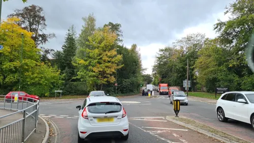
- Street-level photo, andreste96, CC BY-SA 4.0


Page built November 10, 2026. Spotted a mistake? Tell us or suggest a place.