


St Mary's, United Kingdom
St Mary's is a town of 1,666 people in England, United Kingdom.
Why visit St Mary's
Townapedia lists 28 museums and landmarks, 25 parks and trails, 23 places to eat, 14 places to stay and 12 attractions in and around town.
Highlights include Peninnis Lighthouse, Peninnis Head Lighthouse, Porth Hellick Down Burial Chamber and Bant's Carn.
Weather in St Mary's
Forecast from MET Norway (CC BY 4.0). Full forecast
About St Mary's
St Mary's (Cornish: An Nor, lit. 'the land') is the largest and most populous island of the Isles of Scilly, an archipelago in Cornwall, England, United Kingdom.
From the Wikipedia article St Mary's, Isles of Scilly (this version), under CC BY-SA 4.0.
Photos of St Mary's


Things to do12

Peninnis Lighthouse
Lighthouse · 0.9 mi
Lighthouse in St Mary's, England



St Agnes Lighthouse
Lighthouse · 2.8 mi
Lighthouse in Cornwall, England, UK

Museums and landmarks28
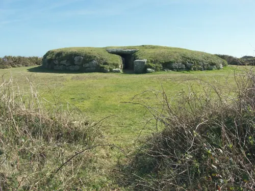
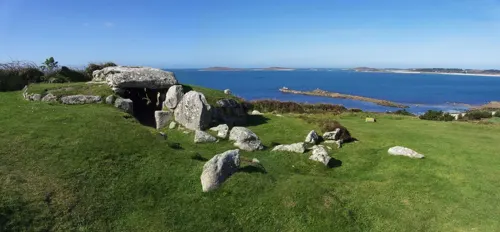
Bant's Carn
Monument and historic site · 1.1 mi
Bronze Age burial mound with entrance passage and inner chamber. .
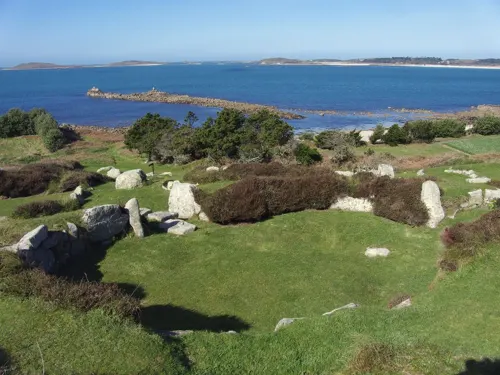

HMS Colossus
Monument and historic site · 2.1 mi
1787 Courageux-class third-rate ship of the line


Hollandia
Monument and historic site · 3.3 mi
Ship of the Dutch East India Company, wrecked in 1743 on her maiden voyage
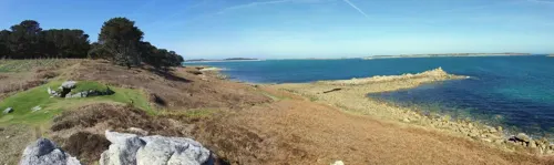

Isles of Scilly Museum
Museum · 0.8 mi
Museum in Isles of Scilly, England, United Kingdom
Church Street, Hugh Town

Bartholomew Ledges Wreck
Monument and historic site · 1.8 mi
Shipwreck in St Mary's Sound, Isles of Scilly, Cornwall, England, UK
Obadiah's Barrow
Monument and historic site · 2.3 mi
Neolithic entrance grave on the Isles of Scilly
16 more on the map.
Parks, trails and playgrounds25





13 more on the map.
Restaurants and cafes23



Ned & Fin's
Cafe · Coffee Shop, Sausage Rolls & Hom Made Various · 0.9 mi
The Parade, Hugh Town
09:30 - 16:00

11 more on the map.
More about St Mary's
Education
Five Islands Academy (previously Five Islands School) has a combined primary and secondary campus in St. Mary's. A boarding house, Mundesley Boarding House, serves secondary students from other islands. Students at the sixth-form college level reside and board elsewhere, in mainland Great Britain. Previously the Learning and Skills Council paid for costs of accommodation for sixth-formers.
Carn Gwaval Wellbeing Centre has adult further education programmes.
From the Wikipedia article St Mary's, Isles of Scilly, under CC BY-SA 4.0.
Where to stay14
Churches and places of worship14
Shopping13
Schools, colleges and libraries2
Healthcare2
Isles of Scilly Pharmacy
Clinic and pharmacy · 0.7 mi
King Edward's Road, St. Mary's
Map of St Mary's
133 places. The map loads OpenStreetMap tiles when you open it.
Getting there and nearby towns
St Mary's Airport (ISC) is the nearest airport with scheduled flights listed in OpenStreetMap, 0 miles away.
- Hugh Town 1 mi west, about 1 min by car
- Isles of Scilly 1 mi north, about 1 min by car
- St Just 31 mi northeast, about 50 min by car
- Penzance 36 mi northeast, about 59 min by car
- Marazion 39 mi east, about 1 h by car
- Uny Lelant 42 mi northeast, about 1 h 15 min by car
- Helston 47 mi east, about 1 h 15 min by car
- Camborne 49 mi northeast, about 1 h 15 min by car
- Redruth 52 mi northeast, about 1 h 30 min by car
- Chacewater 56 mi northeast, about 1 h 30 min by car
Drive times are estimates from straight-line distance, not routes.
Towns near St Mary's


Keep exploring
Local news
Headlines from INDB.
Reviews, tips and questions
Loading what members have shared...
Sources and licences
- GeoNames (CC BY 4.0): population, coordinates, regions and time zone
- Mapillary (see each image): photos
- OpenStreetMap contributors (ODbL 1.0): places, airports, map data
- Wikidata (CC0 1.0): elevation, founding date, time zone, website, landmarks and historic places
- Wikimedia Commons (see each image): photos
- Wikipedia (CC BY-SA 4.0): overview and history text
Photo credits
- G-BUBN arriving at St Mary's Airport 01, andrewrabbott, CC BY-SA 4.0
- G-BUBN arriving at St Mary's Airport 02, andrewrabbott, CC BY-SA 4.0
- Twin Otter at St Mary's Airport, Andrewrabbott, CC BY-SA 4.0
- 'Colossus' (1787), 'Leviathan' (1790), 'Carnatic' (1783), 'Minotaur' (1793) RMG J3066, Navy Office, John Williams; Edward Hunt, Public domain
- Hollandia, Pvt pauline, CC BY-SA 3.0
- BryherChurch, Andrewrabbott at English Wikipedia, Public domain
- Former Bible Christian Chapel, St Agnes, Isles of Scilly, Andrewrabbott, CC BY-SA 4.0
- Old Wesleyan Chapel, Hugh Town, Isles of Scilly, Andrewrabbott, CC BY-SA 4.0
- StAgnesChurch, Andrewrabbott at English Wikipedia, Public domain
- StMartinsChurchScilly4, Andrewrabbott ( talk ), Public domain
- Isles of Scilly, St Mary's Parish Church, Andrewrabbott, CC BY-SA 3.0
- OldChurchStMarys, Andrewrabbott at English Wikipedia, Public domain
- Porth Arlo beach, St Marys, Scilly, Professorbeach, CC BY-SA 4.0
- Sir Cloudesley Shovell, in the Association, with the Eagle, Rumñy, and the Firebrand, Lost on the Rocks of Scilly, October, 22, 1707 (cropped), William Rayner, Public domain
- Five Islands Academy, HenryTemplo, CC BY-SA 4.0
- Boarding Card ISC Airport, Kmtextor, CC BY 4.0
- Britten-Norman Islander Skybus on St. Mary's 56, Lambert, CC BY-SA 2.0
- Cockpit of G-BUBP, Andrewrabbott, CC BY-SA 4.0
- Carn Thomas Secondary School, St. Mary's, Bob Embleton, CC BY-SA 2.0
- Peninnis Lighthouse, Jowaninpensans, CC BY-SA 4.0
- Buzza Hill Dolmen, David Stanley from Nanaimo, Canada, CC BY 2.0
- Street-level photo, coljay72, CC BY-SA 4.0
- Street-level photo, coljay72, CC BY-SA 4.0
- Street-level photo, coljay72, CC BY-SA 4.0
- Street-level photo, coljay72, CC BY-SA 4.0
- Street-level photo, coljay72, CC BY-SA 4.0
- Street-level photo, coljay72, CC BY-SA 4.0
- Street-level photo, coljay72, CC BY-SA 4.0


Page built November 10, 2026. Spotted a mistake? Tell us or suggest a place.