


Camborne, United Kingdom
Camborne is a town of 20,450 people in England, United Kingdom.
Why visit Camborne
Townapedia lists 34 museums and landmarks, 10 parks and trails, 60 places to eat, 5 places to stay and 4 attractions in and around town.
Highlights include Heartlands (playground), Dolcoath Mine New Sump Shaft Compresser House, Heartlands and Tehidy.
Weather in Camborne
Forecast from MET Norway (CC BY 4.0). Full forecast
About Camborne
Camborne (Cornish: Kammbronn [ˈkamːbrɔnː] , meaning "crooked hill") is a town and civil parish in Cornwall, England. At the 2021 census the population of the parish was 23,831 and the population of the built-up area was 20,450. The town lies about 2 miles (3 km) inland, but the northern boundary of the parish is the coast, including Hell's Mouth and Deadman's Cove. The coast is followed by the South West Coast Path.
From the Wikipedia article Camborne (this version), under CC BY-SA 4.0.
Photos of Camborne


Things to do4
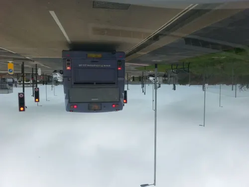
Heartlands (playground)
Monument and historic site · 1.2 mi
UK amusement park


Museums and landmarks34
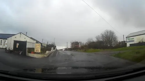
Dolcoath Mine New Sump Shaft Compresser House
Monument and historic site · 0.7 mi
This building was erected in 1886 on the ordered on Capt Josiah Thomas. It housed a holmans Bros 12-inch air compressor capable of...
Dolcoath Road, Camborne



Giant's Quoit
Monument and historic site · 1.7 mi
Dolmen in Cornwall, England, UK
Red River Stream Works
Monument and historic site · 1.1 mi
Old arsenic works with a stack (chimney)
Richard Trevithick
Monument and historic site · 1.5 mi
Memorial stone marking the site of the demolished birthplace of steam engine pioneer Richard Trevithick. Final sentence of inscription:...
22 more on the map.
Parks, trails and playgrounds10


Restaurants and cafes60
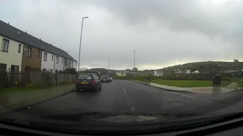
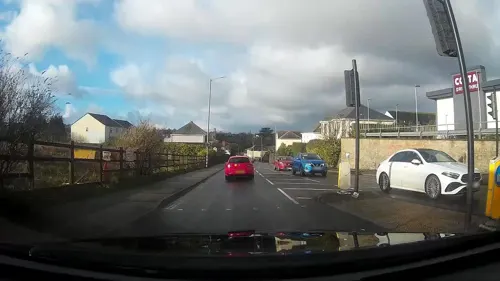
Costa
Cafe · Coffee Shop · 1.2 mi
Gas Lane, Camborne
Mo-Fr 06:30-20:30; Sa 06:30-19:30; Su 06:30-17:30
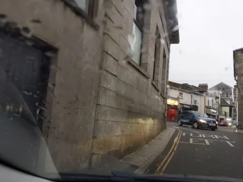
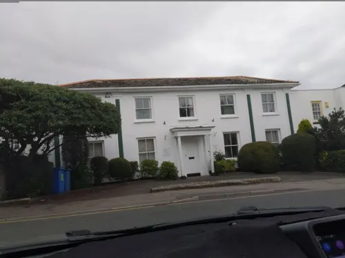





Zest
Cafe · 1.5 mi
Station Road, Redruth
Mo-Fr 10:00-17:30; Sa 09:00-16:00; Su 10:00-16:00
48 more on the map.
History
The first mention of the medieval Camborne churchtown is in 1181 although in 1931 the ruins of a probable Romano-British villa were found at Magor Farm, Illogan, near Camborne, and excavated that year under the guidance of the Royal Institution of Cornwall.
There are also early Christian sites such as an inscribed altar stone, (now in the Church of St Martin and St Meriadoc), and dated to the 10th or 11th centuries, which attests to the existence of a settlement then.
Langdon (1896) records seven stone crosses in the parish of which two are at Pendarves. By the late Middle Ages manorial holdings developed in the surrounding area, and church-paths linked the churchtown to the outlying hamlets. Cornish medieval mystery plays were held in a playing place and the churchyard is said to have had a pilgrimage chapel and holy well. John Norden visited in 1584 and described Camborne as "A churche standinge among the barrayne hills". At this time there would have been moors and rough grazing as well as small fields in the surrounding countryside.
Read more of the history
By 1708 Camborne had rights to hold markets and three fairs a year. A sign of increasing industrial activity and increasing industrial population is the first chapel built in 1806 and the development of a local Methodist community. In 1823 the population was around 2,000 and in 1841 it was 4,377, with 75 smiths recorded and over two-thirds of the working population employed in the mining industry. In the expanding town gasworks were opened in 1834, the Hayle Railway was built (1834–37) and Holmans opened a small foundry in 1839. The current Market House was completed in 1866.
Camborne was connected to the electric telegraph network in 1863 when the Electric and International Telegraph Company opened stations at Truro, Redruth, Penzance, Camborne, Liskard and St Austell.
Mining is first recorded locally in the 1400s with early exploitation of the small streams cutting through the mineralised area and from shallow mines following lodes. Adit mining was first recorded in the 16th century. The town is best known as a centre for the former Cornish tin and copper mining industry, having its working heyday during the later 18th and early 19th centuries. Camborne was just a village until transformed by the mining boom which began in the late 18th century and saw the Camborne and Redruth district become the "richest square mile in the old world".
As the economic recession of the 1870s led to the first years of mining decline in Camborne, social tensions mounted. In October 1873 thousands of miners, aided and abetted by the townspeople, rioted against a hated, authoritarian police force. One of the greatest shows of mining defiance in Cornish history left the Town Hall vandalised, the Police Station ransacked, and the estimated fifty constables present in the town beaten and scattered. The militia were called in from Plymouth to quell the insurrection, and the Home Secretary, Robert Lowe, asked to be kept informed of events. The Camborne riots were reported in the national newspapers and Sir Colman Rashleigh, JP for Cornwall, had to address the Grand Jury regarding the tumult. The entire Camborne police force was found to be at fault and either removed from duty or transferred as a result. No rioter was ever convicted.
Dolcoath Mine, (English: Old Ground Mine), the 'Queen of Cornish Mines' was, at a depth of 3,500 feet (1,100 m), for many years the deepest mine in the world, not to mention one of the oldest before its closure in 1921. The last working tin mine in Europe, South Crofty, which closed in 1998, is also to be found in Camborne.
Apart from the mines themselves, Camborne was also home to many important related industries, including the once world-renowned foundry of Holman Bros Ltd (CompAir). Holmans, a family business founded in 1801, was for generations, Camborne's, and indeed Cornwall's largest manufacturer of industrial equipment, even making the famous Sten submachine gun for a stint during the Second World War. The Holman Projector was used by the Royal Navy. At its height Holmans was spread over three sites within Camborne, employing some three and half thousand men. Despite Britain's industrial decline, Compair Holmans Camborne factory finally closed in 2003.
A modest quantity of South Crofty tin was purchased by a local enterprise and this gradually dwindling stock is used to make specialist tin jewellery, branded as the South Crofty Collection. Tin originally mined at South Crofty was used to form the bronze medals awarded in the 2012 London Olympics.
Because of the prior importance of metal mining to the Cornish economy, the Camborne School of Mines (CSM) developed as the only specialist hard rock education establishment in the United Kingdom, until the Royal School of Mines was established in 1851. Plans for the school were laid out in 1829, leading to the current school in 1888. It now forms part of the University of Exeter; it moved to the university's Tremough campus (now known as Penryn Campus) in 2004.
On Christmas Eve 1801, the Puffing Devil—a steam-powered road locomotive built by Camborne engineer Richard Trevithick—made its way up Camborne Hill in Cornwall. It was the world's first self-propelled passenger carrying vehicle. The events have been turned into a local song:
From the History section of Camborne on Wikipedia, under CC BY-SA 4.0.
More about Camborne
Geography
Camborne forms the western part of a loose conurbation which stretches to Redruth, 3 miles (5 km) to the east. At the 2011 census, the Office for National Statistics defined Camborne to be part of what it called the Redruth built-up area, which had a population of 42,690, making it the largest built-up area in Cornwall. Cornwall Council similarly defined what it called "Camborne/Pool/Redruth", which had a population of 55,400 in 2011. Following a change in methodology for the 2021 census, Camborne is now considered a separate built-up area by the Office for National Statistics, with a population of 20,450.
The Camborne and Redruth area lies on the northern side of the Carn Brea/Carnmenellis granite upland which slopes northwards to the sea. The two towns are served by the A30 road, which now bypasses both towns to the north. The former route of the road through the towns (parts of which are now numbered the A3047) was turnpiked in 1839. The villages along the turnpike road between Camborne and Redruth were (from the west) Roskear, Tuckingmill, Pool and Illogan Highway.
Arts and culture
Camborne Town Band has been contesting music records from the late 19th century until the present day. It has performed on BBC Radio.
Holman Climax Male Voice Choir, based in Camborne, was formed in 1940 by Edgar S. Kessell (1910–1981).
Alan M. Kent's 2005 novel Proper job, Charlie Curnow! is set in and around the Trelawney Estate, a fictional housing estate on the outskirts of Camborne.
Education
A Church of England National School was built in College Street in 1844 (replaced by a newer building further up the street towards the parish church in 1896—now demolished); in the following year a school for four hundred boys was opened in the Centenary Methodist Chapel and in 1847 the Basset Road British (Methodist) School was opened. A School of Mines started in 1872 with the Basset family paying for chemistry laboratories. The town now has a number of schools covering all age ranges, notably the main secondary school, Camborne Science and International Academy (founded in 1956 as Treswithian School), and a campus of Cornwall College.
A private girls' school was founded in 1877 as Redbrook College with about 20 pupils. It became a state grammar school for girls in 1908 as Camborne Grammar School, and merged with Treswithian School in the change to comprehensive education in the 1970s.
From the Wikipedia article Camborne, under CC BY-SA 4.0.
Notable people from Camborne
 Arthur WoolfCornish engineerPhoto: böhringer friedrich, CC BY-SA 2.5
 Luke Charterisrugby union playerPhoto: National Assembly for Wales, CC BY 2.0
 Josiah Thomasminer and politician in New South Wales, Australia (1863-1933)Photo: Swiss Studios, Public domain
 Barney SolomonEnglish rugby union player (1883-1952)Photo: Unknown author Unknown author, Public domain
 Julia GoldsworthyBritish politician (born 1978)Photo: Chris McCarthy, CC BY-SA 3.0
 Francis TrevithickLocomotive engineerPhoto: Unknown author Unknown author, Public domain
 Joshua Cristallwatercolorist (1767-1847)Photo: Joshua Cristall, Public domain
- Josh MatavesiFijian rugby union player
- Sian WilliamsBritish footballer (born 1968)
- Mark Guy PearseBritish writer
- Benjamin LuxonBritish opera singer (1937-2024)
- Thomas B. DunstanAmerican politician
Born in Camborne, according to Wikidata (CC0). Each name links to its Wikipedia article.
Where to stay5
Churches and places of worship15
Holy Trinity Church And Lamp House Immediately South West
Church · 0.9 mi
Kingdom Hall of Jehovah's Witnesses
Church · Jehovahs Witness · 0.7 mi
Boiler Works Road, Camborne
Shopping11
Gas and EV charging2
Schools, colleges and libraries14
Healthcare6
Korus Health Diagnostic Hub
Clinic and pharmacy · 1.2 mi
Unit C Dudnance Lane, Camborne
Map of Camborne
161 places. The map loads OpenStreetMap tiles when you open it.
Getting there and nearby towns
Land's End Airport (LEQ) is the nearest airport with scheduled flights listed in OpenStreetMap, 18 miles away.
- Helston 8 mi south, about 12 min by car
- Falmouth 11 mi east, about 17 min by car
- Truro 11 mi east, about 18 min by car
- Penzance 12 mi southwest, about 20 min by car
- Newquay 17 mi northeast, about 28 min by car
- St Austell 25 mi east, about 40 min by car
- Saltash 49 mi east, about 1 h 15 min by car
- Plymouth 52 mi east, about 1 h 30 min by car
- Plymstock 54 mi east, about 1 h 30 min by car
- Tavistock 56 mi northeast, about 1 h 30 min by car
Drive times are estimates from straight-line distance, not routes.
Towns near Camborne


Keep exploring
Local news
Headlines from INDB.
Reviews, tips and questions
Loading what members have shared...
Sources and licences
- GeoNames (CC BY 4.0): population, coordinates, regions and time zone
- Mapillary (see each image): photos
- OpenStreetMap contributors (ODbL 1.0): places, airports, map data
- Wikidata (CC0 1.0): elevation, founding date, time zone, website, landmarks and historic places
- Wikimedia Commons (see each image): photos
- Wikipedia (CC BY-SA 4.0): overview and history text
Photo credits
- Camborne Commercial Square, Tony Atkin, CC BY-SA 2.0
- Tolcarne Street, Camborne, Cornwall - March 2025, Mutney, CC BY 4.0
- Camborne Bus Station, Cornwall - July 2022 (1), Mutney, CC BY-SA 4.0
- 1961 Morris Minor, Union Street, Camborne, Cornwall - April 2024, Mutney, CC0
- Ford Cortina, Union Street, Camborne, Cornwall - April 2024, Mutney, CC0
- Camborne Bus Station, Cornwall - July 2022 (2), Mutney, CC BY-SA 4.0
- Garage with red door, Gas Street, Camborne, Cornwall - August 2024, Mutney, CC0
- Houses on Union Street, Camborne, Cornwall - July 2022 (2), Mutney, CC BY-SA 4.0
- Building on the corner of Gas Street and New Connexion Street, Camborne, Cornwall - March 2023, Mutney, CC BY-SA 4.0
- Houses on Union Street, Camborne, Cornwall - July 2022 (1), Mutney, CC BY-SA 4.0
- Victoria Street, Camborne, Cornwall - January 2025 (3), Mutney, CC BY 4.0
- Houses on Union Street, Camborne, Cornwall - July 2022 (3), Mutney, CC BY-SA 4.0
- Houses on Union Street, Camborne, Cornwall - July 2022 (4), Mutney, CC BY-SA 4.0
- Wesley Centre, Victoria Street, Camborne, Cornwall - January 2025, Mutney, CC BY 4.0
- Saffron Tandoori, in former Sunday School building, New Connexion Street, Camborne, Cornwall - March 2023, Mutney, CC BY-SA 4.0
- Corner building, Union Street, Camborne, Cornwall - July 2022, Mutney, CC BY-SA 4.0
- Wesley Court apartment building, Victoria Street, Camborne, Cornwall - January 2025, Mutney, CC BY 4.0
- Union Street, Camborne, Cornwall - January 2025, Mutney, CC BY 4.0
- SWEB building, Union Street, Camborne, Cornwall - September 2022 (2), Mutney, CC BY 4.0
- Bus station, Camborne, Cornwall - October 2022, Mutney, CC BY-SA 4.0
- House on Union Street, Camborne, Cornwall - July 2022, Mutney, CC BY-SA 4.0
- SWEB building, Union Street, Camborne, Cornwall - September 2022 (1), Mutney, CC BY 4.0
- Primary school project work displayed in the Masonic Hall, Camborne, Cornwall - April 2024 (8), Mutney, CC BY 4.0
- Tolcarne Street, Camborne, Cornwall - January 2026, Mutney, CC BY 4.0
- Primary school project work displayed in the Masonic Hall, Camborne, Cornwall - April 2024 (10), Mutney, CC BY 4.0
- Primary school project work displayed in the Masonic Hall, Camborne, Cornwall - April 2024 (9), Mutney, CC BY 4.0
- Primary school project work displayed in the Masonic Hall, Camborne, Cornwall - April 2024 (4), Mutney, CC BY 4.0
- Primary school project work displayed in the Masonic Hall, Camborne, Cornwall - April 2024 (7), Mutney, CC BY 4.0
- Lodge room, Camborne Masonic Hall, Cornwall - April 2024 (5), Mutney, CC0
- Primary school project work displayed in the Masonic Hall, Camborne, Cornwall - April 2024 (3), Mutney, CC BY 4.0
- Primary school project work displayed in the Masonic Hall, Camborne, Cornwall - April 2024 (6), Mutney, CC BY 4.0
- Primary school project work displayed in the Masonic Hall, Camborne, Cornwall - April 2024 (11), Mutney, CC BY 4.0
- Primary school project work displayed in the Masonic Hall, Camborne, Cornwall - April 2024 (2), Mutney, CC BY 4.0
- Candle mural, Camborne Masonic Hall, Cornwall - April 2024, Mutney, CC0
- Camborne School, Cornwall - September 2022, Mutney, CC BY 4.0
- Cornish Choughs pub, Church Road, Camborne, Cornwall - September 2022, Mutney, CC BY 4.0
- Mini-roundabout outside Tyacks Hotel, Camborne, Cornwall - April 2924, Mutney, CC0
- Lowenac Hotel, Basset Road, Camborne. Cornwall - July 2022, Mutney, CC BY-SA 4.0
- Centenary Wesleyan Church (9479399631), Tim Green from Bradford, CC BY 2.0
- Heartlands May 2012 - panoramio, Jane White, CC BY-SA 3.0
- Street-level photo, WaggyDog, CC BY-SA 4.0
- Street-level photo, IMC1964, CC BY-SA 4.0
- Street-level photo, WaggyDog, CC BY-SA 4.0
- Street-level photo, WaggyDog, CC BY-SA 4.0
- Street-level photo, WaggyDog, CC BY-SA 4.0
- Street-level photo, IMC1964, CC BY-SA 4.0
- Street-level photo, WaggyDog, CC BY-SA 4.0
- Street-level photo, IMC1964, CC BY-SA 4.0
- Street-level photo, adam2, CC BY-SA 4.0
- Street-level photo, WaggyDog, CC BY-SA 4.0
- Street-level photo, adam2, CC BY-SA 4.0
- Street-level photo, WaggyDog, CC BY-SA 4.0
- Street-level photo, WaggyDog, CC BY-SA 4.0
- Street-level photo, WaggyDog, CC BY-SA 4.0
- Street-level photo, WaggyDog, CC BY-SA 4.0
- Street-level photo, WaggyDog, CC BY-SA 4.0
- Street-level photo, WaggyDog, CC BY-SA 4.0
- Street-level photo, IMC1964, CC BY-SA 4.0
- Street-level photo, IMC1964, CC BY-SA 4.0
- Street-level photo, WaggyDog, CC BY-SA 4.0
- Street-level photo, WaggyDog, CC BY-SA 4.0


Page built November 10, 2026. Spotted a mistake? Tell us or suggest a place.