


Stamford Bridge, United Kingdom
Stamford Bridge is a town of 3,528 people in England, United Kingdom.
Why visit Stamford Bridge
Townapedia lists 3 museums and landmarks, 1 park or trail, 11 places to eat, 2 places to stay and 3 attractions in and around town.
Highlights include Kexby Old Bridge, Stamford Bridge and Battle Flat.
Weather in Stamford Bridge
Forecast from MET Norway (CC BY 4.0). Full forecast
About Stamford Bridge
Stamford Bridge is a village and civil parish on the River Derwent in the East Riding of Yorkshire, England, approximately 5 miles (8 km) east of York and 22 miles (35 km) west of Driffield. The village sits astride an ancient ford on the River Derwent.
From the Wikipedia article Stamford Bridge, East Riding of Yorkshire (this version), under CC BY-SA 4.0.
Things to do3
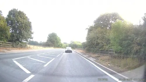
Kexby Old Bridge
Bridge · 2.6 mi
Grade II* listed bridge near Kexby, North Yorkshire, England, UK


Museums and landmarks3

Battle Flat
Monument and historic site · 0.5 mi
English victory against the Norwegian army of Harald Hardrada and Tostig Godwinson


Parks, trails and playgrounds1

Restaurants and cafes11




History
The Romans established a fort here about 70 AD, around which later developed a large linear civilian settlement focused on a bridge one mile (1.6 km) south of the present town.
Iter I of the Antonine Itinerary lists "Derventio" as being seven Roman miles from Eboracum (York) which matches the distance from York. In relation to known discoveries under the town of Malton, antiquaries always assumed that Malton should be called Derventio. The remains at Stamford Bridge were not known to them, lying undiscovered under arable and pasture fields until quite recently.
The name Derventio is of Celtic origin (dervo- "oak-tree") and relates to the River Derwent. The fort had access to the Roman road network of Roman Britain via the Roman road known as Cade's Road (Margary road 80a).
The Battle of Stamford Bridge on 25 September 1066 is often regarded as the traditional end of the Viking Age in England. At Stamford Bridge, King Harold II repelled the invading Norwegian force led by his brother Tostig Godwinson and King Harald Hardrada of Norway, but, three weeks later, his loss at the Battle of Hastings allowed the Norman Conquest of England.
The settlement was called Pons Belli by the Normans, meaning battle bridge. Rents of freeholders and cottagers were recorded in 1368 and there was a common oven recorded the same year.
Read more of the history
The A166 east–west road crossing the river at Stamford Bridge is one of the main roads from York to the East Riding and the coast. The road bridge in the village was closed on 5 March 2007, for just over 11 weeks, so that essential repairs could be carried out, in light of the enormous volume of traffic that uses it, exceptional for such an old bridge (dating from 1727). The bridge reopened on 22 May.
The village suffered from record floods in November 2000 which seriously flooded 30 businesses and homes. Flood defences have now been installed, costing £3.7 million.
The 80m-long bridge, built in 1727, over the River Derwent has been struck in several traffic accidents in recent years, causing severe damage to its stone parapets. In 2024, the East Riding of Yorkshire Council invested £350,000 in repairing the Grade II listed bridge and improving road safety, following years of damage caused by vehicles.
From the History section of Stamford Bridge, East Riding of Yorkshire on Wikipedia, under CC BY-SA 4.0.
More about Stamford Bridge
Education
The village school was first built in Main Street in 1795 as a result of a legacy left by Christopher Wharton. Education was provided free for 12 poor boys and 6 poor girls who had to provide one shilling a year for kindling. Pay scholars were also taught and by 1822 the school population numbered 30. 1874 saw compulsory education and in 1911 the East Riding County Council took over and built a school on the present Church Road site.
This original building was modernised and extended in 1968 and because of the rapid development of the village a further extension was added in 1978. In April 1983 a new infants building, in Godwinsway, Stamford Bridge, was added to the school. Built for 120 infant children it makes the school a split site establishment, but adds greatly to the educational provision for the children. In 2000 this building was also extended.
From the Wikipedia article Stamford Bridge, East Riding of Yorkshire, under CC BY-SA 4.0.
Where to stay2
Churches and places of worship11
St Leonard's Church and cross base adjacent to St Mary's Church
Church · 2.3 mi
Shopping2
Gas and EV charging1
Schools, colleges and libraries1
Healthcare1
Map of Stamford Bridge
36 places. The map loads OpenStreetMap tiles when you open it.
Getting there and nearby towns
Leeds Bradford Airport (LBA) is the nearest airport with scheduled flights listed in OpenStreetMap, 32 miles away.
- York 7 mi west, about 11 min by car
- Haxby 7 mi west, about 11 min by car
- Wheldrake 7 mi south, about 11 min by car
- Sheriff Hutton 8 mi northwest, about 13 min by car
- Skelton 9 mi west, about 14 min by car
- Upper Poppleton 10 mi west, about 16 min by car
- Riccall 12 mi southwest, about 20 min by car
- Linton upon Ouse 14 mi west, about 23 min by car
- Selby 15 mi southwest, about 25 min by car
- Hemingbrough 15 mi south, about 25 min by car
Drive times are estimates from straight-line distance, not routes.
Towns near Stamford Bridge


Keep exploring
Local news
Headlines from INDB.
Reviews, tips and questions
Loading what members have shared...
Sources and licences
- GeoNames (CC BY 4.0): population, coordinates, regions and time zone
- Mapillary (see each image): photos
- OpenStreetMap contributors (ODbL 1.0): places, airports, map data
- Wikidata (CC0 1.0): elevation, founding date, time zone, website, landmarks and historic places
- Wikimedia Commons (see each image): photos
- Wikipedia (CC BY-SA 4.0): overview and history text
Photo credits
- The road bridge at Stamford Bridge over the River Derwent, Andy Beecroft, CC BY-SA 2.0
- Stamford Bridge Railway Station, Andrew Whale, CC BY-SA 2.0
- St Marys Church Full Sutton, Alan Walker, CC BY-SA 2.0
- All Saints Church Low Catton, Paul Glazzard, CC BY-SA 2.0
- The Battle of Stamford Bridge label QS:Len,"The Battle of Stamford Bridge", Peter Nicolai Arbo, Public domain
- Battle of Stamford Bridge, full, Matthew Paris, Public domain
- Stamford Bridge, The Square from southwest c.1913 (archive ref PO-1-133-5) (25160921101), East Riding Archives, No restrictions
- The Gold Cup Inn Low Catton, Paul Glazzard, CC BY-SA 2.0
- Street-level photo, southglos, CC BY-SA 4.0
- Street-level photo, aidan573, CC BY-SA 4.0
- Street-level photo, southglos, CC BY-SA 4.0
- Street-level photo, southglos, CC BY-SA 4.0
- Street-level photo, southglos, CC BY-SA 4.0
- Street-level photo, southglos, CC BY-SA 4.0
- Street-level photo, southglos, CC BY-SA 4.0
- Street-level photo, southglos, CC BY-SA 4.0
Page built November 10, 2026. Spotted a mistake? Tell us or suggest a place.