


Hemingbrough, United Kingdom
Hemingbrough is a town of 2,483 people in England, United Kingdom.
Why visit Hemingbrough
Townapedia lists 2 museums and landmarks, 1 park or trail, 5 places to eat, 1 place to stay and 2 attractions in and around town.
Highlights include River Ouse swing bridge and Wressle Castle.
Weather in Hemingbrough
Forecast from MET Norway (CC BY 4.0). Full forecast
About Hemingbrough
Hemingbrough is a village and civil parish in North Yorkshire, England, approximately 5 miles (8 km) from Selby and 4 miles (6.4 km) from Howden on the A63. It was in the historic East Riding of Yorkshire, but since 1974 has come under North Yorkshire. The village has a 12th-century former collegiate church (Hemingbrough Minster), a Methodist chapel and shops. There is a primary school and nursery.
From the Wikipedia article Hemingbrough (this version), under CC BY-SA 4.0.
Things to do2
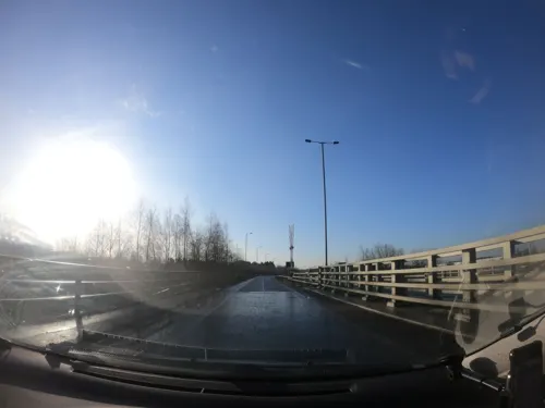
River Ouse swing bridge
Bridge · 2.5 mi
Rad Bridge over the River Ouse, Yorkshire, England

Museums and landmarks2

Wressle Castle
Monument and historic site · 2.0 mi
Late 14th-century quadrangular castle in East Yorkshire, England, UK

Drax Priory
Monument and historic site · 1.5 mi
"In 1868 it was reported that traces of the priory could still be found[2] but field work in the 1980s and 1990s has failed to find any...
Parks, trails and playgrounds1

Restaurants and cafes5



History
The toponym is of uncertain origin. The place is mentioned in the Knýtlinga saga, and the name may be the burh of a Viking named Hemingr. Alternative explanations are that it was the burh of the followers of a man called Hema, or the burh by the fish-weir (Old English hemming).
It is thought that from this village came Walter of Hemingbrough, one of Britain's early chroniclers. Writing in the 14th century, he gave us a history beginning with the Norman Conquest, now in the British Museum.
In the Middle Ages the village was in the Ouse and Derwent wapentake of the East Riding of Yorkshire. At that time the village was on the River Ouse, but at some point the river broke through a meander leaving the village some distance from the river. Hemingbrough was a large parish, and included the townships of Barlby, Osgodby, Cliffe with Lund, South Duffield, Brackenholme with Woodhall and Menthorpe with Bowthorpe. All these townships became separate civil parishes in 1866. In 1935 the civil parish of Hemingbrough absorbed the civil parish of Brackenholme with Woodhall.
In 1974 Hemingbrough was transferred from the East Riding to the new county of North Yorkshire. From 1974 to 2023, the parish was in the Selby District of the shire county of North Yorkshire. In 2023 the district was abolished and North Yorkshire became a unitary authority.
Read more of the history
The village holds a summer fete, replete with floats on lorries and tractor trailers. There is a memorial garden which the Archbishop of York Dr John Sentamu visited in April 2016.
In February 2014, Hemingbrough Parish Council were awarded funds from the Heritage Lottery Fund to help raise awareness of the historical heritage within Hemingbrough Parish to benefit the local community.
From the History section of Hemingbrough on Wikipedia, under CC BY-SA 4.0.
Where to stay1
Churches and places of worship8
Schools, colleges and libraries2
Map of Hemingbrough
21 places. The map loads OpenStreetMap tiles when you open it.
Getting there and nearby towns
Leeds Bradford Airport (LBA) is the nearest airport with scheduled flights listed in OpenStreetMap, 29 miles away.
- Selby 4 mi west, about 6 min by car
- Goole 6 mi southeast, about 10 min by car
- Riccall 6 mi northwest, about 9 min by car
- Wheldrake 9 mi north, about 14 min by car
- Thorne 11 mi south, about 18 min by car
- Monk Fryston 11 mi west, about 17 min by car
- Church Fenton 11 mi west, about 17 min by car
- South Milford 11 mi west, about 18 min by car
- Knottingley 12 mi west, about 20 min by car
- York 14 mi north, about 22 min by car
Drive times are estimates from straight-line distance, not routes.
Towns near Hemingbrough


Keep exploring
Local news
Headlines from INDB.
Reviews, tips and questions
Loading what members have shared...
Sources and licences
- GeoNames (CC BY 4.0): population, coordinates, regions and time zone
- Mapillary (see each image): photos
- OpenStreetMap contributors (ODbL 1.0): places, airports, map data
- Wikidata (CC0 1.0): elevation, founding date, time zone, website, landmarks and historic places
- Wikimedia Commons (see each image): photos
- Wikipedia (CC BY-SA 4.0): overview and history text
Photo credits
- HemingbroughChurchwindowdetail, Elizabeth Emma Mary Ryan, CC BY-SA 4.0
- Hemingbrough Mary the Virgin GeoUK 3183831, Peter Church, CC BY-SA 2.0
- Hemingbrough St Mary GeoUK3183837, Peter Church, CC BY-SA 2.0
- Wressle-Castle-29042011, Dupont Circle, CC BY-SA 3.0
- St Peter and St Paul Drax, Chemical Engineer, CC BY-SA 3.0
- St Mary's Church, Hemingbrough, Paul Glazzard, CC BY-SA 2.0
- Street-level photo, lamaar639, CC BY-SA 4.0
Page built November 10, 2026. Spotted a mistake? Tell us or suggest a place.