

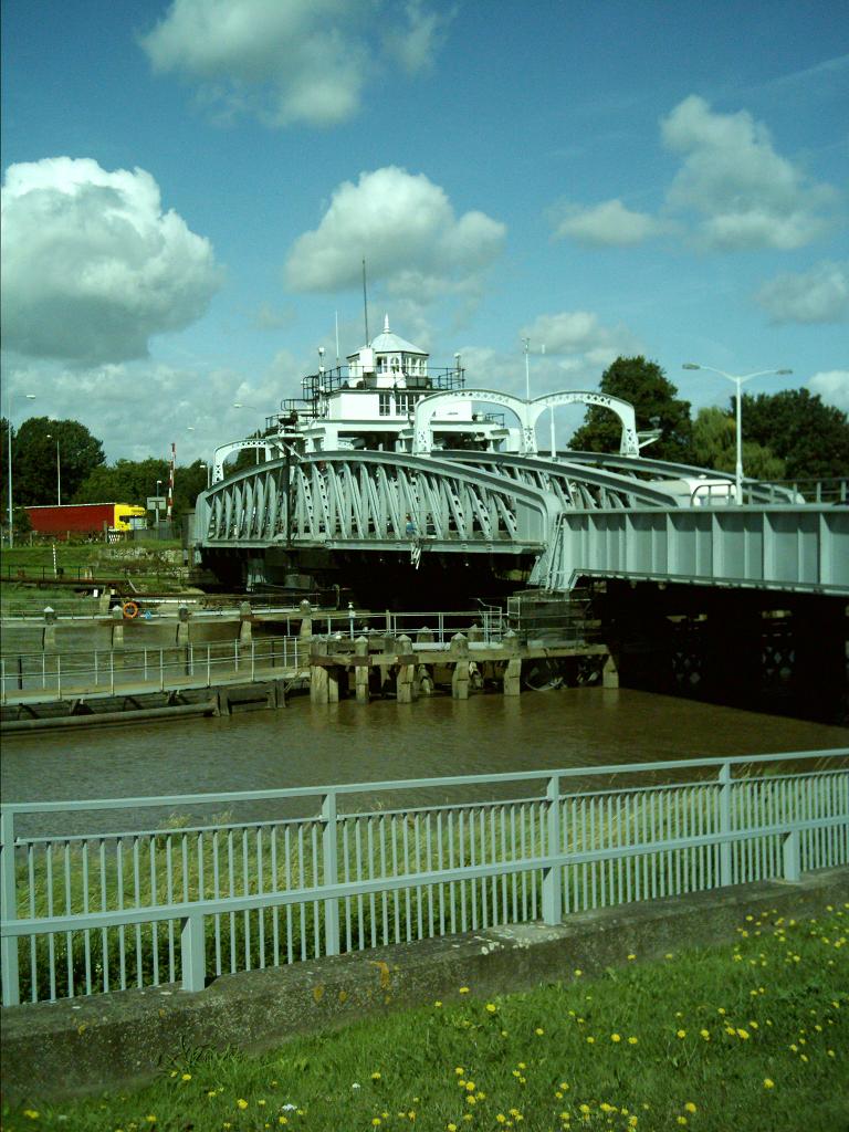


Terrington St Clement, United Kingdom
Terrington St Clement is a town of 3,301 people in England, United Kingdom.
Why visit Terrington St Clement
Townapedia lists 2 museums and landmarks, 6 parks and trails, 5 places to eat and 4 attractions in and around town.
Highlights include Crosskeys Bridge, King's Lynn Arts Centre, True's Yard Museum and WW2 Coastal Defence Lookout.
Weather in Terrington St Clement
Forecast from MET Norway (CC BY 4.0). Full forecast
About Terrington St Clement
Terrington St Clement is a village and civil parish in King's Lynn and West Norfolk borough and district in Norfolk, England. It is in the drained marshlands to the south of the Wash, 7 miles (11 km) west of King's Lynn, Norfolk, and 5 miles (8.0 km) east of Sutton Bridge, Lincolnshire, on the old route of the A17 trunk road.
From the Wikipedia article Terrington St Clement (this version), under CC BY-SA 4.0.
Things to do4

Crosskeys Bridge
Bridge · 4.3 mi
Bridge in South Holland, Lincolnshire, England, UK
King's Lynn Arts Centre
Cinema and theater · 4.0 mi
Arts centre and theatre in King's Lynn, England, formerly St. George's Guildhall

East Bank Lighthouse
Lighthouse · 4.9 mi
Lighthouse in South Holland, England
West Bank Lighthouse
Lighthouse · 5.0 mi
Lighthouse in South Holland, England
Museums and landmarks2

True's Yard Museum
Museum · 4.2 mi
Social history museum in King's Lynn, Norfolk

WW2 Coastal Defence Lookout
Monument and historic site · 3.4 mi
WW2 brick and concorete 3 story observation tower overlookinh the sea.
Parks, trails and playgrounds6

The Walks
Park · 4.6 mi
Park in King's Lynn, Norfolk, England, United Kingdom

Eagles Golf Centre
Golf course · 2.0 mi
9 hole Par 32 & 9 hole Pitch & Putt
39 School Road, King's Lynn


Restaurants and cafes5



History
The name Terrington derives from the Old English for 'Farm/settlement of Tir(a)'s people' as -ingtūn means a settlement called after, or connected with... .
During the Iron Age, salt making was a large industry around The Wash. It bloomed during the Roman period. The village produced one ton of salt a year in the late 16th century. The industry kept on going into the 17th century. During low tide, 2-3 centimeter (an inch) of silt was taken from the surface and put on a filter bed. Sea water was used to wash the salt out of the silt. The resulting brine was cooked to harvest the salt. The industry used local peat as fuel. The left over mounts of silt were left in place, gradually raising the ground. In later ages the mounts provided a solid basis, firm ground, to build upon. An example of the remnant mounts can be seen on modern satellite maps, between Beacon Hill Lane and Orange Row Road, which is called Scottesgate on the 1662 Dugdale map. Nearby street names like Pope's Lane, Brellows Hill and Cobbs Hill refer to salt winning families.
In AD 1013 Godric, son of Æthelstan Mannessune gifted part of the lands of Terrington ("Ticingetona") to the monks of Ramsey Abbey in his will where his brother, Eadnoth the Younger had been abbott. This is recorded in the S 1518 Charter.
Read more of the history
The settlement, along with Terrington St John, is referred to in the Domesday Book as Tilinghetuna where the population is recorded as 25 households made up of 12 villagers, 11 smallholders, 1 freeman, and 1 slave in 1086. Other resources recorded in 1086 included 515 sheep, 14 pigs, 11 cattle, and 1 cob with 48 acres of meadow and 12.5 salthouses. In 1066, before the Norman conquest of England the two lands were held by Thorkil, and by Thorth (son of Ulfkil). By 1086 the lands of Thorkil were transferred to Hermer de Ferrers, and the land of Thorth to Ralph Baynard.
By the medieval period, the small settlement which began on raised ground on the edge of the marsh had grown substantially. A parish church, dedicated to St Clement (Pope Clement I), known as the "Cathedral of the Marshland" or the "Cathedral of the Fens", was built in the 14th century by Edmund Gonville, Rector of Terrington, who founded Gonville Hall (now Gonville and Caius College) at Cambridge University.
John Colton (died 1404), Lord Chancellor of Ireland and Archbishop of Armagh, was born in the village.
Methodists were established in the village in 1813. During the Victorian era a Wesleyan Methodist chapel, a Primitive Methodist chapel, a Salvation Army headquarters and three other mission chapels were established.
The area has been the subject of some historical research by local residents, while archaeological investigation has included field walking during the Fenland Survey, although this largely excluded the area around the present settlement. Archaeological test pits were dug between 2005 and 2009; the report was published online.
From the History section of Terrington St Clement on Wikipedia, under CC BY-SA 4.0.
Notable people from Terrington St Clement
- Keith RuddEnglish cricketer (born 1946)
Born in Terrington St Clement, according to Wikidata (CC0). Each name links to its Wikipedia article.
Churches and places of worship11
Shopping2
Schools, colleges and libraries7
Tilney All Saints Church of England Primary School
School · Anglican · 2.0 mi
Shepherdsgate Road, King's Lynn
Map of Terrington St Clement
37 places. The map loads OpenStreetMap tiles when you open it.
Getting there and nearby towns
RAF Marham (KNF) is the nearest airport with scheduled flights listed in OpenStreetMap, 13 miles away.
- Clenchwarton 3 mi east, about 4 min by car
- King's Lynn 4 mi east, about 7 min by car
- North Wootton 6 mi east, about 10 min by car
- West Walton 7 mi southwest, about 11 min by car
- Wisbech 9 mi southwest, about 14 min by car
- Emneth 9 mi southwest, about 14 min by car
- Fleet 10 mi west, about 17 min by car
- Downham Market 11 mi south, about 18 min by car
- Grimston 11 mi east, about 17 min by car
- March 17 mi southwest, about 27 min by car
Drive times are estimates from straight-line distance, not routes.
Towns near Terrington St Clement


Keep exploring
Local news
Headlines from INDB.
Reviews, tips and questions
Loading what members have shared...
Sources and licences
- GeoNames (CC BY 4.0): population, coordinates, regions and time zone
- Mapillary (see each image): photos
- OpenStreetMap contributors (ODbL 1.0): places, airports, map data
- Wikidata (CC0 1.0): elevation, founding date, time zone, website, landmarks and historic places
- Wikimedia Commons (see each image): photos
- Wikipedia (CC BY-SA 4.0): overview and history text
Photo credits
- TerringtonStClementChurch, User:Thirteene, Public domain
- Crosskeys Bridge Sutton Bridge Lincolnshire, Madlyn at English Wikipedia, Public domain
- True's Yard King's Lynn, Alienturnedhuman ( talk ), Public domain
- St John's church Terrington St John Norfolk (6225250914), David from Colorado Springs, United States, CC BY 2.0
- St Lawrence's church Tilney St Lawrence Norfolk (6089926581), David from Colorado Springs, United States, CC BY 2.0
- Kings-lynn-walks-and-red-mount, Alienturnedhuman at English Wikipedia, Public domain
- Street-level photo, sk53_quint, CC BY-SA 4.0
- Street-level photo, sk53_quint, CC BY-SA 4.0
Page built November 10, 2026. Spotted a mistake? Tell us or suggest a place.