


Golders Green, United Kingdom
Golders Green is a town of 18,818 people in England, United Kingdom.
Why visit Golders Green
Townapedia lists 78 museums and landmarks, 69 parks and trails, 166 places to eat, 20 places to stay and 12 attractions in and around town.
Highlights include Alexandra Palace, Dingwalls, Cricklewood Broadway and Cricklewood Broadway.
Weather in Golders Green
Forecast from MET Norway (CC BY 4.0). Full forecast
About Golders Green
Golders Green is a suburb in the London Borough of Barnet in north West London, 5.6 miles (9 km) northwest of Charing Cross. Its historical origins lie in a medieval small suburban linear settlement that was sited near a farm and public grazing area green. The bulk of Golders Green forms a late Victorian/early Edwardian suburb centered on a commercial crossroads, the rest being of a later build.
From the Wikipedia article Golders Green (this version), under CC BY-SA 4.0.
Photos of Golders Green

Things to do12

Alexandra Palace
Cinema and theater · 3.2 mi
Entertainment venue in Alexandra Park, London


Everyman Cinema
Cinema and theater · 1.7 mi
Cinema and former theatre in Hampstead, London, England

Golders Green Hippodrome
Cinema and theater · 0.4 mi
Theatre in London, England, UK

Kiln Theatre
Cinema and theater · 2.3 mi
Theatre and cinema in Kilburn, Brent, London, England

Pentameters Theatre
Cinema and theater · 1.7 mi
Pub theatre in Hampstead, Camden, London, England


Cock Tavern Theatre
Cinema and theater · 2.6 mi
Former pub theatre in Kilburn, London (2009-2011)


Museums and landmarks78

Fenton House
Museum · 1.5 mi
Handsome 17th-century house with unusual collections and picturesque walled gardens
Hampstead Grove, London

Kenwood House
Monument and historic site · 1.5 mi
Art museum and historic house in Hampstead, London
Mo-Su 10:00-16:00

Hendon War Memorial
Monument and historic site · 1.4 mi
War memorial in London

2 Willow Road
Museum · 1.9 mi
Heritage Museum in London, United Kingdom


Church Farmhouse Museum
Museum · 1.6 mi
Former museum in Barnet, London

Edward Onslow Ford Memorial
Monument and historic site · 3.2 mi
Memorial in London

Freud Museum London
Museum · 2.2 mi
Historic house museum in London, England, United Kingdom

Burgh House and Hampstead Museum
Museum · 1.7 mi
Local museum in Camden, London, England, United Kingdom
66 more on the map.
Parks, trails and playgrounds69

Brent Park
Park · 0.8 mi
Park in London Borough of Barnet, United Kingdom


Lyttelton Playing Fields
Park · 1.1 mi
Public park in London, England

Princes Park
Park · 0.5 mi
Park in Temple Fortune, in the London Borough of Barnet, North London, England


57 more on the map.
Restaurants and cafes166
Bombay Nights
Restaurant · Indian · 1.5 mi
90 Fortune Green Road, London
Mo 16:45-23:30; Tu-Th 17:00-23:30; Fr-Sa 17:00-23:45; Su 17:00-23:30
Eat Tokyo G2 Shabu-Shabu
Restaurant · Japanese · 0.4 mi
628 Finchley Road, London
Mo-Fr 11:30-15:00, 17:30-23:00; Sa 11:30-16:00, 17:30-23:00; Su 10:00-22:00
Pizaza Golders Green
Restaurant · Pizza
100 Golders Green Road, London
Su-Th 12:00-23:00; Sa 21:00-03:00
Takagiya
Restaurant · Japanese · 1.5 mi
102 Fortune Green Road, London
We-Fr 18:00-23:00; Sa 12:00-14:00,18:00-23:00
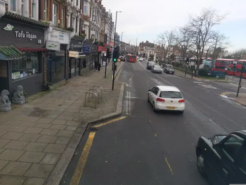
Tofu Vegan
Restaurant · Chinese · 0.4 mi
28 North End Road, London
Tu-Th 12:00-15:00, 17:00-22:15; Fr 12:00-15:00, 17:00-22:30; Sa...
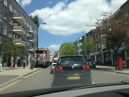
Have an Avo
Cafe · 1.5 mi
100 Fortune Green Road, London
Tu-Fr 07:30-17:50; Sa 08:00-17:00; Su 08:30-17:00
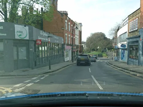

Moyo Nigerian and Japenese Restaurant Hendon
Restaurant · African, Japanese · 1.5 mi
57 The Burroughs, London
Mo, We-Fr 17:30-22:00; Sa 15:00-22:00
154 more on the map.
History
The name Golders comes from a family named Godyere who lived in the area, and Green alludes to the manorial common at a cross roads next to which the settlement was built. Golders Green has been a place in the parish and manor of Hendon since around the 13th century. The earliest reference to the name of the adjacent district of "Temple Fortune" is on John Rocque's map of 1754, which also shows what is now Golders Green Road as Groles Green. However the name Temple Fortune reveals a much earlier history. It is likely that the name refers to the Knights of St John, who had land here (c. 1240). Fortune may be derived from a small settlement (tun) on the route from Hampstead to Hendon. Here a lane from Finchley, called Ducksetters Lane (c. 1475), intersected. It is likely that the settlement was originally the Bleccanham estate (c. 10th century). By the end of the 18th century Temple Fortune Farm was established on the northern side of Farm Close.
Read more of the history
The building of Finchley Road (c. 1827) replaced Ducksetters Lane as a route to Finchley, and resulted in the development of a small hamlet. Hendon Park Row (c. 1860s) is of this period, and consisted of around thirty small dwellings built by a George Stevens, which were, with two exceptions, demolished around 1956. A small dame school and prayer house run by Anglican deaconesses existed in the 1890s and 1900s, and developed to become St. Barnabas (1915). Along Finchley Road were a number of villas (c. 1830s), joined by the Royal Oak public house (c. 1850s). By the end of the 19th century there were around 300 people living in the area, which included a laundry and a small hospital for children with skin diseases. The principal industry was brick making.
In 1895, Golders Green Jewish Cemetery was established adjacent to Hoop Lane, with the first burial in 1897. Golders Green Crematorium was opened in 1902 (although much of it was built after 1905). A significant moment in Temple Fortune's development into a suburban area occurred in 1907, when transport links were vastly improved by the opening of Golders Green Underground station.
Although the area had been served by horse-drawn omnibuses (since at least the 1880s) and later motor buses (from 1907), the tram line of 1910, connecting Finchley Church End with Golders Green Station, led to the development of the area west of Finchley Road. The establishment of Hampstead Garden Suburb brought major changes to the area east of Finchley Road. Temple Fortune Farm was demolished and along the front of the road the building of the Arcade and Gateway House (c. 1911) established the Hampstead Garden Suburb's retail district.
In 1913, the Golders Green Hippodrome, former home of the BBC Concert Orchestra, and the police station opened. The 3,000 seater, Orpheum Theatre (1930) was intended to rival the Hippodrome in Golders Green and it enjoyed a royal visit from Elizabeth II, in 1972, but closed its doors in 1974, and was completely demolished in May 1982.
In March 2026, four ambulances owned by Hatzalah, a Jewish volunteer service, were set on fire. A month later, two Jewish locals were stabbed in a separate incident, which was condemned by the prime minister, Keir Starmer. Both incidents were characterised as antisemitic by the Metropolitan Police. On 14 May 2026, King Charles III paid a visit to the community and met with both victims of the stabbings, together with the first responders to the incident. The King voiced his concerns about the rise of antisemitism in the area. The following month, a communal stairwell in a residentual apartment building on Bridge Lane, mainly inhabited by Jewish familied was set on fire. Residents confronted the suspect and extinguished the fire, preventing any damage or injuries. A suspect fled the scene.
From the History section of Golders Green on Wikipedia, under CC BY-SA 4.0.
More about Golders Green
Geography
For local elections Golders Green ward covers the north and west of the area; Childs Hill the south to the centre and Garden Suburb, named after Hampstead Garden Suburb: most of the east. Councillors are elected from across 21 wards. Nationally it votes for the MP for seat of Finchley and Golders Green, which encompasses the parts of the NW11 and NW2 postcode districts it contains. The same boundaries are used for the Golders Green, Childs Hill and Garden Suburb wards of the Metropolitan Police Service.
It is about 160 feet (50 m) to 260 feet (80 m) above sea level.
The area is adjacent to the Heath Extensions part of Hampstead Heath.
Economy
Golders Green has restaurants with many cuisines including Indian, Israeli, Thai, Turkish, Japanese, Chinese, Korean and Italian eateries. These are over a dozen coffee bars; together with a number of niche food stores. The area is home to several leading banks.
Education
There are six state aided primary schools in Golders Green; these include: Brookland Infant & Junior, Garden Suburb Infant & Junior, Menorah Primary School and Wessex Gardens.
The King Alfred School is located on North End Road and Henrietta Barnett School is located in nearby Hampstead Garden Suburb.
From the Wikipedia article Golders Green, under CC BY-SA 4.0.
Notable people from Golders Green
- Anthea AskeyBritish actress (1933-1999)
- Anya LahiriIndian actress
- Louis MarksBritish television producer and screenwriter
- Langton Douglas FoxCatholic bishop (1917-1997)
- Joanna RichardsonEnglish biographer (1925-2008)
- Michael AllmandVictoria Cross recipient
- Ann McPhersonBritish doctor
- John BurgessEnglish actor (1933–2010)
- Tony StreatherEnglish mountain climber (1926–2018)
- Wendy Elsa GreengrossEnglish general practitioner and broadcaster
- Edward Bonham CarterEnglish businessman (born 1960)
- John KayBritish journalist (1943-2021)
Born in Golders Green, according to Wikidata (CC0). Each name links to its Wikipedia article.
Where to stay20
Churches and places of worship75
Shopping39
Gas and EV charging7
Schools, colleges and libraries51
St Mary's and St John's CofE School (Neale House Campus)
School · Anglican · 1.3 mi
Prothero Gardens, London
Healthcare16
Map of Golders Green
250 places. The map loads OpenStreetMap tiles when you open it.
Getting there and nearby towns
RAF Northolt (NHT) is the nearest airport with scheduled flights listed in OpenStreetMap, 9 miles away.
- Highgate 2 mi southeast, about 3 min by car
- Belsize Park 2 mi southeast, about 4 min by car
- Archway 3 mi east, about 5 min by car
- Muswell Hill 3 mi east, about 4 min by car
- Chalk Farm 3 mi southeast, about 5 min by car
- Friern Barnet 3 mi northeast, about 5 min by car
- Camden Town 3 mi southeast, about 6 min by car
- Harlesden 3 mi southwest, about 5 min by car
- Hornsey 3 mi east, about 6 min by car
- Wood Green 4 mi northeast, about 6 min by car
Drive times are estimates from straight-line distance, not routes.
Towns near Golders Green


Keep exploring
Local news
Headlines from INDB.
Reviews, tips and questions
Loading what members have shared...
Sources and licences
- GeoNames (CC BY 4.0): population, coordinates, regions and time zone
- Mapillary (see each image): photos
- OpenStreetMap contributors (ODbL 1.0): places, airports, map data
- Wikidata (CC0 1.0): elevation, founding date, time zone, website, landmarks and historic places
- Wikimedia Commons (see each image): photos
- Wikipedia (CC BY-SA 4.0): overview and history text
Photo credits
- Golders Green clock tower in 2007, Oxyman, CC BY-SA 2.0
- Ravenscroft Avenue, Golders Green, Mark Ahsmann, CC BY-SA 3.0
- APalace 1, Jack Rose, CC BY-SA 4.0
- Lock 17 Market Bar, Camden Town, NW1 (6800612358), Ewan Munro from London, UK, CC BY-SA 2.0
- Kiln Theatre, QueensOfTheHighRoad, CC BY-SA 4.0
- Fenton House Hampstead front February 2006, Unknown author, CC BY-SA 2.0
- 1-3 Willow Road, Steve Cadman from London, U.K., CC BY-SA 2.0
- BU Gallery Exterior 2015 (1), Benuricw, CC BY-SA 4.0
- Church Farmhouse Museum, Grim23, CC BY-SA 3.0
- Edward Onslow Ford Memorial, front, ketrin1407, CC BY 2.0
- Freud Museum London 2, Rup11, CC BY-SA 3.0
- River Brent in Brent Park, Dudley Miles, CC BY-SA 3.0
- Childs Hill Park, Dudley Miles, CC0
- Golders Hill Park in 2006, Martin Addison, CC BY-SA 2.0
- Hendon Park, Dudley Miles, Public domain
- Lyttelton Playing Fields 1, Dudley Miles, CC BY-SA 3.0
- Princes Park tree, Dudley Miles, CC0
- Adelaide Nature Reserve 1, Dudley Miles, CC BY-SA 3.0
- Belsize Wood south end 2, Dudley Miles, CC BY-SA 3.0
- Clarefield Park, Dudley Miles, CC0
- Our Lady of Willesden - St Mary's Church a, Timothy Titus, CC BY 4.0
- East Finchley Baptist Church Sept 2016, Philafrenzy, CC BY-SA 4.0
- St Jude Hampstead Garden Suburb, Steve Cadman from London, U.K., CC BY-SA 2.0
- Free Church, Hampstead Garden Suburb, Steve Cadman from London, U.K., CC BY-SA 2.0
- Hampstead cemetery, Ultrahorse at English Wikipedia, Public domain
- St Albans, Golders Green-1, This image was produced by me, David Castor ( user:dcastor ). The pictures I submit to the Wikipedia Project are released to the public domain. This gives you the right to use them in any way you..., Public domain
- Inside Brent Cross, Billy Hicks, CC BY-SA 3.0
- St Jude's, Hampstead Garden Suburb, Steve Cadman (stevecadman), CC BY-SA 2.0
- Pentameters Theatre front, July 2021 (02), Isochrone, CC BY-SA 4.0
- Cherry tree woods finchley, G ri m 2 3 ★, CC BY-SA 3.0
- Ashley Lane, Dudley Miles, Public domain
- Basing Hill Park, Dudley Miles, CC0
- Everyman Cinema Club, Hampstead, NW3 (2487183245), Ewan Munro from London, UK, CC BY-SA 2.0
- Golders Green Hippodrome North End Road London NW11 7RP, Spudgun67, CC BY-SA 4.0
- Hampstead Heath park (4053420425), Cristian Bortes from Cluj-Napoca, Romania, CC BY 2.0
- Kenwood House Pieter v d Broecke by Frans Hals, Ricardalovesmonuments, CC BY-SA 4.0
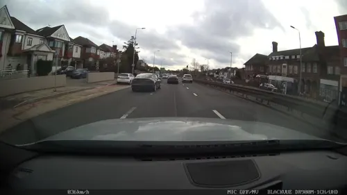
- Street-level photo, domdomegg, CC BY-SA 4.0
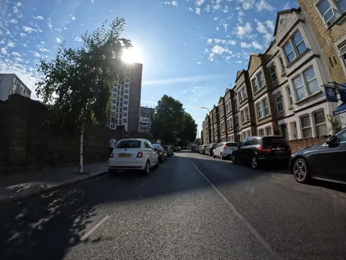
- Street-level photo, laye, CC BY-SA 4.0
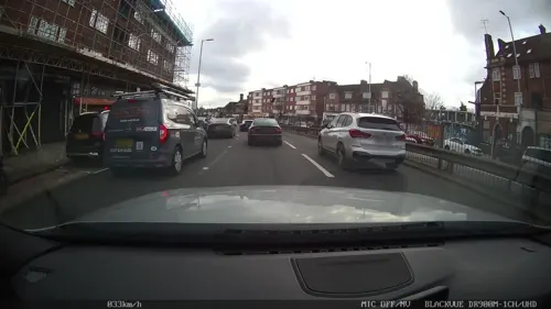
- Street-level photo, laye, CC BY-SA 4.0
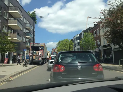
- Street-level photo, Semir_Mapillary, CC BY-SA 4.0
- Street-level photo, domdomegg, CC BY-SA 4.0
- Street-level photo, domdomegg, CC BY-SA 4.0
- Street-level photo, domdomegg, CC BY-SA 4.0
- Street-level photo, laye, CC BY-SA 4.0
- Street-level photo, tcoppel, CC BY-SA 4.0
- Street-level photo, tcoppel, CC BY-SA 4.0
- Street-level photo, harry_wood, CC BY-SA 4.0
- Street-level photo, tcoppel, CC BY-SA 4.0
- Street-level photo, harry_wood, CC BY-SA 4.0
- Street-level photo, zymurgic, CC BY-SA 4.0
- Street-level photo, erias, CC BY-SA 4.0
- Street-level photo, Semir_Mapillary, CC BY-SA 4.0
- Street-level photo, laye, CC BY-SA 4.0
- Street-level photo, erias, CC BY-SA 4.0
- Street-level photo, domdomegg, CC BY-SA 4.0
- Street-level photo, domdomegg, CC BY-SA 4.0
- Street-level photo, zymurgic, CC BY-SA 4.0
- Street-level photo, sk53_quint, CC BY-SA 4.0
- Street-level photo, Semir_Mapillary, CC BY-SA 4.0
- Street-level photo, erias, CC BY-SA 4.0
- Street-level photo, laye, CC BY-SA 4.0
- Street-level photo, Semir_Mapillary, CC BY-SA 4.0


Page built November 10, 2026. Spotted a mistake? Tell us or suggest a place.