


Harrow on the Hill, United Kingdom
Harrow on the Hill is a town of 10,632 people in England, United Kingdom.
Why visit Harrow on the Hill
Townapedia lists 10 museums and landmarks, 38 parks and trails, 220 places to eat, 11 places to stay and 7 attractions in and around town.
Highlights include Grosvenor Theatre, Watkin's Tower, Headstone Manor and Headstone Manor and Museum.
Weather in Harrow on the Hill
Forecast from MET Norway (CC BY 4.0). Full forecast
About Harrow on the Hill
Harrow on the Hill or Harrow-on-the-Hill is an area and historic town in the London Borough of Harrow in north-west London, England. The name refers to Harrow Hill, 408 feet (124 m), and is located some half a mile south of the modern town of Harrow. The village dates back to early medieval times, built around the 11th-century St Mary's Church, and is the location of three schools, namely, Harrow, St Dominic's and John Lyon.
From the Wikipedia article Harrow on the Hill (this version), under CC BY-SA 4.0.
Photos of Harrow on the Hill


Things to do7

Grosvenor Theatre
Cinema and theater · 1.6 mi
Former cinema and theatre in Harrow, London, now a Zoroastrian Centre


Watkin's Tower
Monument and historic site · 2.6 mi
Partially completed iron lattice tower in London, England

Museums and landmarks10

Headstone Manor
Museum · 1.8 mi
Grade I listed manor house in the London Borough of Harrow, England,UK

Headstone Manor and Museum
Museum · 1.8 mi
Museum in London Borough of Harrow, United Kingdom

Heath Robinson Museum
Museum · 2.7 mi
Museum in northwest London, United Kingdom, about W. Heath Robinson

Chandos Mausoleum
Monument and historic site · 3.2 mi
Part of St Lawrence Whitchurch in Harrow, London
Polish Air Force Memorial
Monument and historic site · 3.3 mi
War memorial in South Ruislip, London Borough of Hillingdon, United Kingdom

Parks, trails and playgrounds38


Grove Farm
Park · 1.2 mi
Local Nature Reserve in the London Borough of Ealing, England, UK


Litten Nature Reserve
Park · 2.8 mi
Nature reserve in London, England

Masons Field
Park · 2.7 mi
Local Nature Reserve in London Borough of Brent
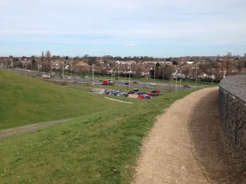
Northala Fields
Park · 2.8 mi
Park located in Northolt, in the London Borough of Ealing



26 more on the map.
Restaurants and cafes220
Chennai Srilalitha
Restaurant · Indian · 1.2 mi
"Speciality South Indian Pure Vegetarian Restaurant"
196 Kenton Road, Harrow
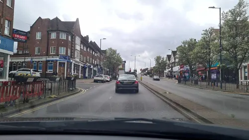
Ram's Pure Vegetarian
Restaurant · Indian · 1.1 mi
"Restaurant, Sweets n' Savouries, Caterers, Banqueting. Punjabi, South Indian & Specialist Surti Cuisine"
201-203 Kenton Road, Harrow


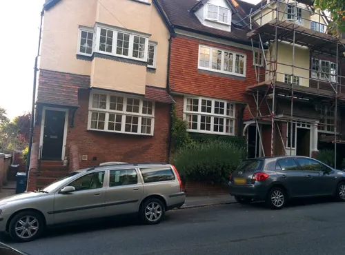
The White Horse
Bar and pub · 0.5 mi
50 Middle Road, Harrow
Mo,Tu 12:00-23:00; We-Sa 12:00-24:00; Su 12:00-22:30


Tunnel Lounge by Flare
Restaurant · Pizza, Burger · 1.2 mi
273 Pinner Road, Harrow
Fr 12:00-23:59; Sa 00:00-02:00; Su 12:00-23:59

208 more on the map.
History
Harrow on the Hill was an ancient parish in the Gore hundred of Middlesex. The parish historically covered a large rural area surrounding the hilltop settlement itself, extending to Pinner, Harrow Weald, Wealdstone and Wembley. Pinner became a separate parish in 1766. In 1831, the parish of Harrow on the Hill had a population of 3,861 and occupied an area of 9,870 acres (39.9 km2). In 1850 a local board district was established for the central part of the parish, including the main village and the adjoining hamlets of Greenhill, Roxeth, and Sudbury.
Following the opening of Harrow-on-the-Hill station in 1880, a new town centre grew up around the station, which was at the northern foot of the hill, in the Greenhill area. The new town centre became known simply as Harrow to distinguish it from the older village on the hill.
The Local Government Act 1894 converted local board districts such as Harrow-on-the-Hill into urban districts, and established elected parish and district councils. It also said that parishes could no longer straddle district boundaries. The parish of Harrow-on-the-Hill was reduced to just cover the urban district, and the remainder of the parish was split into three parishes called Harrow Weald, Wealdstone and Wembley (with the latter two also being made urban districts at the same time).
Read more of the history
By 1931, the parish occupied a reduced area of 2,129 acres (8.62 km2) and had a population of 26,380. A county review order in 1934 abolished the neighbouring urban district of Wealdstone and parishes of Harrow Weald, Pinner, Great Stanmore and Little Stanmore, merging them with the urban district of Harrow-on-the Hill to become an enlarged urban district that was called just Harrow rather than Harrow on the Hill. On 1 April 1934 the parish of Harrow on the Hill was abolished to form Harrow, part also went to Wembley and Ealing. In 1954, Harrow was incorporated to become a municipal borough. The same area became the London Borough of Harrow in 1965, when it was transferred from Middlesex to Greater London.
From the History section of Harrow on the Hill on Wikipedia, under CC BY-SA 4.0.
Notable people from Harrow on the Hill
 Pam St. ClementBritish actressPhoto: AnemoneProjectors, CC BY-SA 4.0
 Thomas Abthorpe CooperAmerican actorPhoto: Chester Harding, Public domain
 David Aukintheatrical/executive producer/qualified solicitorPhoto: Peabody Awards, CC BY 2.0
 John Lyonfarmer and benefactor who endowed Harrow SchoolPhoto: Edwardx, CC BY-SA 4.0
 Adrian FlavinIrish rugby union playerPhoto: Pierre-Selim, CC BY-SA 3.0
- Helen MorseAustralian actress
- Elizabeth WordsworthFounding principal of Lady Margaret Hall, Oxford
- Richard CooperBritish actor (1893-1947)
- Catherine MarshallBritish suffragist, campaigner and social activist (1880 – 1961)
- Maurice LarkinEnglish historian
- Samuel ParrEnglish schoolmaster, writer, minister and doctor of law (1747-1825)
- Anthony SmithBritish writer, academic and broadcaster
Born in Harrow on the Hill, according to Wikidata (CC0). Each name links to its Wikipedia article.
Where to stay11
Churches and places of worship51
Shopping43
Gas and EV charging8
Schools, colleges and libraries54
Saint Jérôme Church of England Bilingual School
School · Anglican · 1.0 mi
120-138 Station Road, Harrow
Healthcare30
Shilun's Pharmacy
Clinic and pharmacy · 1.5 mi
3 The Parade, Sudbury Heights Avenue
Map of Harrow on the Hill
250 places. The map loads OpenStreetMap tiles when you open it.
Getting there and nearby towns
RAF Northolt (NHT) is the nearest airport with scheduled flights listed in OpenStreetMap, 4 miles away.
- Harrow 0 mi north, about 1 min by car
- Sudbury 1 mi south, about 2 min by car
- Northolt 2 mi southwest, about 3 min by car
- Pinner 3 mi northwest, about 4 min by car
- Harrow Weald 3 mi north, about 4 min by car
- Ruislip 4 mi west, about 6 min by car
- Ickenham 5 mi west, about 8 min by car
- Northwood 5 mi northwest, about 8 min by car
- Watford 6 mi northwest, about 10 min by car
- Hillingdon 6 mi southwest, about 9 min by car
Drive times are estimates from straight-line distance, not routes.
Towns near Harrow on the Hill


Keep exploring
Local news
Headlines from INDB.
Reviews, tips and questions
Loading what members have shared...
Sources and licences
- GeoNames (CC BY 4.0): population, coordinates, regions and time zone
- Mapillary (see each image): photos
- OpenStreetMap contributors (ODbL 1.0): places, airports, map data
- Wikidata (CC0 1.0): elevation, founding date, time zone, website, landmarks and historic places
- Wikimedia Commons (see each image): photos
- Wikipedia (CC BY-SA 4.0): overview and history text
Photo credits
- St Mary's Church, Harrow on the Hill, steeple 2026-07-03, Brett Jordan, CC BY 4.0
- The Old House, High Street, Harrow on the Hill, Bernard Burns, CC BY-SA 4.0
- Ace Cinema, Rayners Lane, Bernard Burns, CC BY-SA 3.0
- Headstone Manor, Bernard Burns, CC BY-SA 3.0
- Harrow Museum Tithe Barn, Bernard Burns, CC BY-SA 3.0
- Heath Robinson Museum exterior 2 by Tom Fish, Sharonpink2, CC BY-SA 4.0
- Preston Park, Dudley Miles, Public domain
- Fryent Country Park view north, Dudley Miles, Public domain
- Grove Farm, Ealing 1, Dudley Miles, CC BY-SA 3.0
- Litten Local Nature Reserve, Dudley Miles, CC BY-SA 3.0
- Northwick Park open space and hospital, David Howard, CC BY 2.0
- St John the Baptist's Church, Pinner, Middlesex (3960273702), Robert Cutts from Bristol, England, UK, CC BY 2.0
- The Old Schools, Harrow School, Bernard Burns, CC BY-SA 3.0
- 005 - Harrow High School & Sports College, Randomly London, CC BY-SA 2.0
- Harrow Central Mosque, Robert Cutts from Bristol, England, UK, CC BY 2.0
- The Castle, Harrow, 2015 14, Edwardx, CC BY-SA 4.0
- Windermere, North Wembley, HA9 (2468567053), Ewan Munro from London, UK, CC BY-SA 2.0
- Our Lady and St Thomas of Canterbury, Harrow 01, Edwardx, CC BY-SA 4.0
- Church of St John the Baptist Greenhill 1, Tango Mike Bravo, CC BY-SA 4.0
- Moon on the Hill, Harrow, HA1 (6163372441), Ewan Munro from London, UK, CC BY-SA 2.0
- The Castle Inn, Harrow on the Hill - 2025-04-19, Brett Jordan, CC BY 2.0
- Islip Manor Meadows 6, Dudley Miles, CC BY-SA 3.0
- Masons Field 6, Dudley Miles, CC BY-SA 4.0
- PearTreeParkJune2026, Asteuartw, CC BY 4.0
- Gilbert Scott's chapel, Matt Brown, CC BY 2.0
- Gilbert Scott buildings, Matt Brown, CC BY 2.0
- Vaughan Library, Harrow School, Bernard Burns, CC BY-SA 3.0
- Interior of the Vaughan Library, Harrow (4), Matt Brown, CC BY 2.0
- Interior of the Vaughan Library, Harrow (2), Matt Brown, CC BY 2.0
- Interior of the Vaughan Library, Harrow (3), Matt Brown, CC BY 2.0
- Interior of the Vaughan Library, Harrow (1), Matt Brown, CC BY 2.0
- Headmaster's House, Harrow School, Bernard Burns, CC BY-SA 4.0
- The Vaughan Library, Harrow School (6606031965), Robert Cutts from Bristol, England, UK, CC BY 2.0
- 1, High Street, Harrow, Bernard Burns, CC BY-SA 4.0
- 3, High Street, Harrow, Bernard Burns, CC BY-SA 4.0
- Druries, Harrow School 2025-11-30, Brett Jordan, CC BY 4.0
- Vaughan Library, Brett Jordan, CC BY 2.0
- Harrow School Chapel 2025-01-09, Brett Jordan, CC BY 2.0
- Harrow Old Schools, Spudgun67, CC BY-SA 4.0
- Harrow old school, Matt Brown, CC BY 2.0
- Parish Church of St Mary, Harrow on the Hill, Bernard Burns, CC BY-SA 3.0
- R.M. BALLANTYNE 1825-1894 Author of Books for Boys lived here, Spudgun67, CC BY-SA 4.0
- St Lawrence Whitchurch, Canons Park, Simon from London, United Kingdom, CC BY 2.0
- Street-level photo, mappo2, CC BY-SA 4.0
- Street-level photo, RyanBush, CC BY-SA 4.0
- Street-level photo, firefishy, CC BY-SA 4.0
- Street-level photo, RyanBush, CC BY-SA 4.0
- Street-level photo, RyanBush, CC BY-SA 4.0
- Street-level photo, mappo2, CC BY-SA 4.0
- Street-level photo, firefishy, CC BY-SA 4.0
- Street-level photo, RyanBush, CC BY-SA 4.0
- Street-level photo, RyanBush, CC BY-SA 4.0
- Street-level photo, laye, CC BY-SA 4.0
- Street-level photo, firefishy, CC BY-SA 4.0
- Street-level photo, firefishy, CC BY-SA 4.0
- Street-level photo, laye, CC BY-SA 4.0
- Street-level photo, mappo2, CC BY-SA 4.0
- Street-level photo, mappo2, CC BY-SA 4.0
- Street-level photo, mappo2, CC BY-SA 4.0
- Street-level photo, firefishy, CC BY-SA 4.0
- Street-level photo, RyanBush, CC BY-SA 4.0
- Street-level photo, alfa145, CC BY-SA 4.0
- Street-level photo, geomapper69, CC BY-SA 4.0
- Street-level photo, alfa145, CC BY-SA 4.0


Page built November 10, 2026. Spotted a mistake? Tell us or suggest a place.