




Why visit Leyland
Townapedia lists 12 museums and landmarks, 14 parks and trails, 85 places to eat, 4 places to stay and 1 attraction in and around town.
Highlights include South Ribble Museum & Exhibition Centre, British Commercial Vehicle Museum, Worden Park and Cuerden Valley Park.
Weather in Leyland
Forecast from MET Norway (CC BY 4.0). Full forecast
About Leyland
Leyland is a town in the South Ribble district, in Lancashire, England, 6 miles (10 km) south of Preston. The population was 35,578 at the 2011 Census.
From the Wikipedia article Leyland, Lancashire (this version), under CC BY-SA 4.0.
Travel tips from other travellers: Leyland on Wikivoyage (CC BY-SA 4.0).
Things to do1

Museums and landmarks12
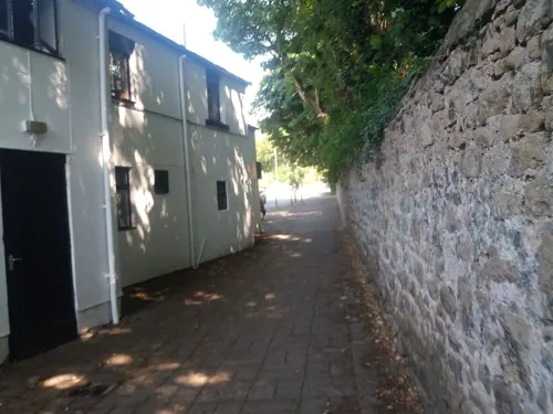
South Ribble Museum & Exhibition Centre
Museum · 0.7 mi
Church Road, Leyland
Tu 10:00-16:00;Th 13:00-16:00;Fr 10:00-16:00;Sa 10:00-13:00

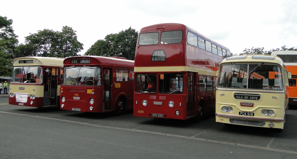
British Commercial Vehicle Museum
Museum · 0.4 mi
Automotive museum in Lancashire, England, United Kingdom
King Street, Leyland

Astley Hall
Museum · 3.2 mi
Grade I listed English country house in Chorley, United Kingdom


Parks, trails and playgrounds14


Cuerden Valley Park
Park · 1.5 mi
Park in Cuerden, Lancashire, England


2 more on the map.
Restaurants and cafes85
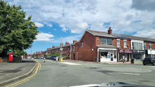
Fat Sam’s Bar &Grill
Restaurant · 0.4 mi
165-167 Towngate, Leyland
We-Th 11:30-23:00; Fr-Sa 11:30-00:00; Su 11:30-22:00
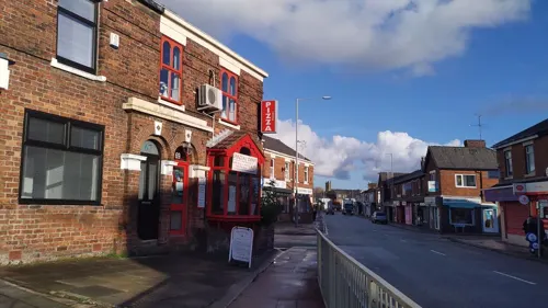
Antonellos
Restaurant · Italian
69 Hough Lane, Leyland
Tu-Th 16:00-21:00; Fr 16:00-22:00; Sa 14:00-22:00; Su 14:00-20:00


Wonderland
Restaurant · Chinese · 0.7 mi
Lancastergate, Leyland

Old Original Seven Stars
Bar and pub · 1.3 mi
2 Slater Lane, Leyland
73 more on the map.
History
The name Leyland derives from the Old English lǣgeland meaning 'unploughed land'.
Leyland was an area of fields, with Roman roads passing through, from ancient Wigan to Walton-le-Dale. It is mentioned in the Domesday Book (1085). In 1066, King Edward the Confessor presided over the whole of Leyland. The manor was divided into three large ploughlands, which were controlled by local noblemen. In the 12th century, it came under the barony of Penwortham.
The area of Worden, which is now Worden Park, was one of nine oxgangs of land granted to the Knights Hospitaller, by Roger de Lacy, in Lancashire, but the land was not assigned to any individual and a local man, who was a very close friend of de Lacy, Hugh Bussel, was assigned holder of the land in 1212.
Notable features that remain include the St Andrew's Parish Church, built around 1200 AD, and the large stone Leyland Cross, thought to date back to Saxon times.
From the History section of Leyland, Lancashire on Wikipedia, under CC BY-SA 4.0.
More about Leyland
Geography
Leyland is made up of six different areas. The town centre itself counts as the main retail area, with the railway station, library and shops nearby. The other areas include Broadfield, Moss Side, Worden Park, Turpin Green and the Wade Hall estate.
Having been joined by Clayton Brook, draining the village of the same name to the east, after skirting Lostock Hall, the River Lostock flows south west, past Farington and through the western suburbs of Leyland, collecting Mill Brook (from Worden Park) and Hollin's Brook (draining Runshaw Moor), before moving west towards Croston.
Education
High schools in Leyland include Balshaw's CE High School near Leyland Cross, St Mary's Catholic High School, Worden Academy, a smaller high school situated to the west of the town and Wellfield Academy near the town centre.
From the Wikipedia article Leyland, Lancashire, under CC BY-SA 4.0.
Notable people from Leyland
 Ashley DaltonBritish politician, from 2024, Member of Parliament for West LancashirePhoto: ©House of Commons, CC BY 3.0
 Josh JonesBritish rugby league playerPhoto: Fleets, CC BY-SA 4.0
 Patrick DeverBritish long-distance runnerPhoto: Ian Robertson from East Lothian, Scotland, CC BY 2.0
- Jimmy BannisterEnglish footballer (1880-1953)
- Mark Couliermake-up artist
- Frank MossEnglish footballer and manager (1909-1970)
- Brian PilkingtonEnglish footballer (1933-2020)
- Kay PurcellEnglish actress (1963–2020)
- Michael BinghamEnglish football player (born 1981)
- John GrahamEnglish footballer, born 1926
- James CrossEnglish cricketer (1862-1927)
- Fred BeardsworthEnglish footballer (1889-1964)
Born in Leyland, according to Wikidata (CC0). Each name links to its Wikipedia article.
Where to stay4
Churches and places of worship19
Shopping18
Gas and EV charging4
Schools, colleges and libraries21
Leyland St Mary's Roman Catholic Primary School
School · Roman Catholic · 0.5 mi
Haig Avenue, Leyland
Healthcare12
Broadoaks Child Development Centre
Clinic and pharmacy · 0.4 mi
Balcarres Road, Leyland
Child and Adolescent Mental Health Service (CAMHS)
Clinic and pharmacy · 0.4 mi
Balcarres Road, Leyland
Map of Leyland
190 places. The map loads OpenStreetMap tiles when you open it.
Getting there and nearby towns
Warton Aerodrome (WRT) is the nearest airport with scheduled flights listed in OpenStreetMap, 9 miles away.
- Clayton-le-Woods 1 mi east, about 1 min by car
- Preston 5 mi north, about 7 min by car
- Blackburn 9 mi northeast, about 15 min by car
- Horwich 9 mi southeast, about 14 min by car
- Wigan 11 mi south, about 18 min by car
- Skelmersdale 11 mi south, about 17 min by car
- Ormskirk 12 mi southwest, about 19 min by car
- Hindley 12 mi south, about 20 min by car
- Westhoughton 12 mi southeast, about 20 min by car
- Bolton 13 mi southeast, about 21 min by car
Drive times are estimates from straight-line distance, not routes.
Towns near Leyland


Keep exploring
Local news
Headlines from INDB.
Reviews, tips and questions
Loading what members have shared...
Sources and licences
- GeoNames (CC BY 4.0): population, coordinates, regions and time zone
- Mapillary (see each image): photos
- OpenStreetMap contributors (ODbL 1.0): places, airports, map data
- Wikidata (CC0 1.0): elevation, founding date, time zone, website, landmarks and historic places
- Wikimedia Commons (see each image): photos
- Wikipedia (CC BY-SA 4.0): overview and history text
Photo credits
- Leyland 3 railway station 2093568 337956a7, Ben Brooksbank, CC BY-SA 2.0
- Leyland railway station 2058940 df372bb6, Ben Brooksbank, CC BY-SA 2.0
- Leyland 6 railway station 2063566 c685cadc, Ben Brooksbank, CC BY-SA 2.0
- Bus lineup, 2012 Leyland Transport Festival, Sherpa_536, CC BY 2.0
- Astley Hall after restoration, Kevin Waterhouse, CC BY-SA 2.0
- The Preston Temple by Munzerr, Andy Munzer from Bristol, UK, CC BY 2.0
- St James' Church, Brindle, Alexander P Kapp, CC BY-SA 2.0
- St Saviours, Church Road, BB, User:Charlie odd, Public domain
- St Andrew's Church, Leyland, Alexander P Kapp, CC BY-SA 2.0
- Leyland St Ambrose, Gammock, CC BY-SA 4.0
- Railway Worden Park, Ann Cook, CC BY-SA 2.0
- Street-level photo, tonys999, CC BY-SA 4.0
- Street-level photo, tonys999, CC BY-SA 4.0
- Street-level photo, mappo2, CC BY-SA 4.0
- Street-level photo, tonys999, CC BY-SA 4.0
- Street-level photo, tonys999, CC BY-SA 4.0
- Street-level photo, tonys999, CC BY-SA 4.0
- Street-level photo, tonys999, CC BY-SA 4.0
- Street-level photo, tonys999, CC BY-SA 4.0
- Street-level photo, tonys999, CC BY-SA 4.0
- Street-level photo, tonys999, CC BY-SA 4.0
- Street-level photo, tonys999, CC BY-SA 4.0
- Street-level photo, tonys999, CC BY-SA 4.0
- Street-level photo, tonys999, CC BY-SA 4.0
- Street-level photo, tonys999, CC BY-SA 4.0
- Street-level photo, tonys999, CC BY-SA 4.0
- Street-level photo, tonys999, CC BY-SA 4.0
- Street-level photo, tonys999, CC BY-SA 4.0
- Street-level photo, tonys999, CC BY-SA 4.0
- Street-level photo, tonys999, CC BY-SA 4.0
- Street-level photo, tonys999, CC BY-SA 4.0
- Street-level photo, tonys999, CC BY-SA 4.0
- Street-level photo, L33JKN, CC BY-SA 4.0
- Street-level photo, tonys999, CC BY-SA 4.0
- Street-level photo, tonys999, CC BY-SA 4.0
- Street-level photo, tonys999, CC BY-SA 4.0
- Street-level photo, tonys999, CC BY-SA 4.0
- Street-level photo, tonys999, CC BY-SA 4.0
- Street-level photo, tonys999, CC BY-SA 4.0


Page built November 10, 2026. Spotted a mistake? Tell us or suggest a place.