


Southport, United Kingdom
Southport is a town of 91,703 people in England, United Kingdom.
Why visit Southport
Townapedia lists 8 museums and landmarks, 15 parks and trails, 218 places to eat, 26 places to stay and 11 attractions in and around town.
Highlights include Vue, Garrick Theatre, Southport, British Lawnmower Museum and The Atkinson.
Weather in Southport
Forecast from MET Norway (CC BY 4.0). Full forecast
About Southport
Southport is a seaside town in the Metropolitan Borough of Sefton in Merseyside, England. It lies on the West Lancashire coastal plain and the east coast of the Irish Sea, approximately 17 miles (27 km) north of Liverpool and 15 miles (24 km) southwest of Preston. At the 2021 census, Southport had a population of 94,421, making it the eleventh most populous settlement in North West England and the third most populous settlement in the Liverpool City Region.
From the Wikipedia article Southport (this version), under CC BY-SA 4.0.
Travel tips from other travellers: Southport on Wikivoyage (CC BY-SA 4.0).
Photos of Southport


Things to do11
Garrick Theatre, Southport
Cinema and theater
Former theatre, cinema and bingo hall in Southport, Merseyside, England


Pleasureland Southport
Monument and historic site · 0.4 mi
Amusement park in Southport, England
Southport Arts Centre
Cinema and theater
Arts centre with theatre, library and art gallery in Southport, Merseyside, England, UK

Southport Model Railway Village
Monument and historic site
UK amusement park

Southport Theatre
Cinema and theater · 0.5 mi
Theatre in Southport, England
The Southport Theatre & Convention Centre
Cinema and theater · 0.5 mi
The Promenade, Southport

Southport Winter Gardens
Cinema and theater
Former entertainment complex in Southport, Merseyside, England
Museums and landmarks8

British Lawnmower Museum
Museum · 0.5 mi
Museum in Southport, England
106-114 Shakespeare Street, Southport
Mo-Fr 09:00-17:00; Sa 09:00-13:00


Lifeboat Memorial, Southport
Monument and historic site · 0.9 mi
Memorial to lifeboat crews in Southport Cemetery, Southport, Merseyside, England, UK
Monumental Obelisk, Southport
Monument and historic site
Monument to lifeboat crews in Southport, Merseyside, England, UK


Parks, trails and playgrounds15
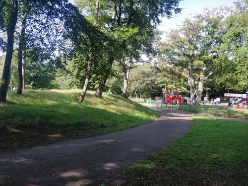
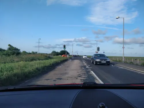
Marshside RSPB reserve
Park · 2.5 mi
Nature reserve in Southport, Merseyside, England
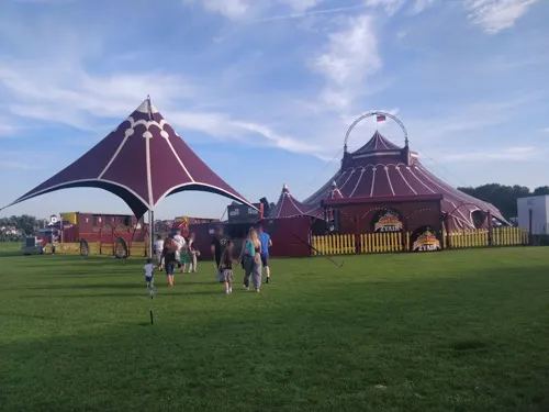

Victoria Park, Southport
Park · 0.4 mi
Park in Southport, United Kingdom



3 more on the map.
Restaurants and cafes218
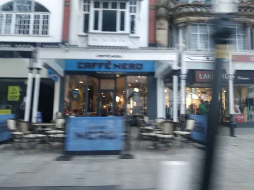
Portovino
Restaurant · Pizza, Coffee Shop, Juice · 1.4 mi
187 Sussex Road, Southport
We-Fr 15:00-22:00, Sa-Su 12:00-22:00


206 more on the map.
History
There have been settlements in the area now comprising Southport since the Domesday Book, and some parts of the town have names of Viking origin.
The earliest recorded human activity in the region was during the Middle Stone Age when mesolithic hunter-gatherers were attracted by the abundant red deer and elk populations, as well as the availability of fish, shellfish, and woodland.
Roman coins have been found at Halsall Moss and Crossens, although the Romans never settled southwest Lancashire.
The first objective evidence of an early settlement in the region is in the Domesday Book, in which the area is called Otergimele. The Domesday Book states that there were 50 huts in Otergimele, housing a population 200. The population was scattered thinly across the region, and it was at the northeast end of Otergimele (present-day Crossens), where blown sand gave way to alluvial deposits from the River Ribble estuary, that a small concentration of people occurred.
It was here that a primitive church might have been built, which gave the emerging village its name of Churchtown, the parish being North Meols (pronounced "meals"). A church called St Cuthbert's is still at the centre of Churchtown.
Read more of the history
With a booming fishing industry, the area grew and hamlets became part of the parish of North Meols. From south to north, these villages were South Hawes, Haweside, Little London, Higher Blowick, Lower Blowick, Rowe-Lane, Churchtown, Marshside, Crossens, and Banks. As well as Churchtown, there were vicarages in Crossens and Banks.
Parts of the parish were almost completely surrounded by water until 1692 when Thomas Fleetwood of Bank Hall cut a channel to drain Martin Mere to the sea. From this point on, attempts at large-scale drainage of Martin Mere and other marshland continued until the 19th century, since when the water has been pumped away. This left behind a legacy of fine agricultural soil and created a booming farming industry.
In the late 18th century, it was becoming fashionable for the well-to-do to desert inland spa towns and visit the seaside to bathe in the salt sea waters. At that time, doctors recommended bathing in the sea to help cure aches and pains. In 1792, William Sutton, the landlord of the Black Bull Inn in Churchtown (now the Hesketh Arms) and known to locals as "The Old Duke", realised the importance of the newly created canal systems across the UK and set up a bathing house in the virtually uninhabited dunes at South Hawes by the seaside just four miles (6 km) away from the newly constructed Leeds and Liverpool Canal and two miles southwest of Churchtown.
When a widow from Wigan built a cottage nearby in 1797 for seasonal lodgers, Sutton quickly built a new inn on the site of the bathing house which he called the South Port Hotel, moving to live there the following season. There was no port, but "Southport" soon became the name of the town. The locals thought him mad and referred to the building as the Duke's Folly, but Sutton arranged transport links from the canal that ran through Scarisbrick, four miles from the hotel, and trade was remarkably good. The hotel survived until 1854, when it was demolished to make way for traffic at the end of Lord Street, but its presence and the impact of its founder are marked by a plaque in the vicinity, by the name of one street at the intersection, namely Duke Street, and by a hotel on Duke Street which bears the legacy name of Dukes Folly Hotel.
Southport grew quickly in the 19th century as it gained a reputation for being a more refined seaside resort than its neighbour Blackpool. Southport had a head start compared to all the other places on the Lancashire coast because it had easy access to the canal system. Other seaside bathing areas could not really get going until the railways were built some years later. The Leeds and Liverpool canal brought people from Liverpool, Manchester, Bolton and Wigan amongst others. By 1820 Southport had over 20,000 visitors per year.
Southport Pier is referred to as the first true "pleasure pier", being one of the earliest pier structures to be erected using iron. A design from James Brunlees was approved at a cost of £8,700 and on 4 August 1859 a large crowd witnessed the driving home of the first support pile. The opening of the pier was celebrated on 2 August 1860.
On the night of 9 December 1886, the worst lifeboat disaster in the history of the UK occurred off the shores of Southport. A cargo ship called the Mexico was on its way to South America when it found itself in difficulty. Lifeboats from Lytham, St. Annes, and Southport set off to try to rescue those aboard the vessel. The crews battled against storm-force winds as they rowed towards the casualty. The entire crew from the St. Anne's boat was lost and all but two of the Southport crew were too. In all, 28 lifeboatmen were lost.
A memorial was erected in Duke Street Cemetery and there is a permanent display in the museum at The Atkinson on Lord Street. There is also a memorial inside the Lifeboat house, now operated by the Southport Offshore Rescue Trust. Mexico was just one of many shipwrecks in the Southport area.
From 1894 to 1912 Birkdale and the adjoining village of Ainsdale were separate from Southport and administered by Birkdale Urban District Council before becoming part of the county borough of Southport in 1912. This was a huge expansion of the town.
In 1914, a very short romance story between a "2 park road Southport" private soldier and French lady took place in Valenciennes in north France during early First World War as described by Andrée Ducatez's Journal.
From the History section of Southport on Wikipedia, under CC BY-SA 4.0.
More about Southport
Geography
The closest cities are Preston 20 km (12 miles) to the north east and Liverpool 27 km (17 miles) to the south.
Existing on the West Lancashire Coastal Plain, most of the town is only slightly above sea level and thus parts of Southport used to be susceptible to flooding. Marine Drive was regularly closed due to flooding from high tides, but in February 1997, new sea defences started being constructed and in 2002 the whole project was completed.
Southport has a maritime climate like most of the UK. Due to its position by the coast, Southport rarely sees substantial snowfall and temperatures rarely fall below −5 °C (23 °F) so it does not have frequent frosts. Southport generally has moderate precipitation, unlike the rest of western UK.
The coast-to-coast Trans Pennine Trail (TPT) stretches the breadth of northern England – 215 miles (346 km) from Southport in the west to Hornsea in the east. The TPT is a route for walkers, cyclists and horse riders linking the North and Irish seas and passing through the Pennines. It runs alongside rivers and canals and through some of the most historic towns and cities in the North of England.
Economy
As a seaside town Southport has a history of leisure and recreation and is still dependent on tourism. The town went into decline when cheap air travel arrived in the 1960s and people chose to holiday abroad due to competitive prices and more reliable weather. However, the town kept afloat with people coming to spend the day by the seaside on bank holidays and weekends. The town has diversified with annual events, shopping and conferences. In 2011, Southport was named the fourteenth-most popular coastal resort in the country, benefiting from a 23% rise in money spent in the resort in that year. Part of the resort's progress is a result of the money invested in Southport over recent years.
Southport Airshow, the north west's biggest airshow, held in the summer
Southport 24 Hour Race, A sailing race that sees boats racing continuously for 24 hours even in extreme weather conditions. Entries have included Olympic gold medallists and teams from the Republic of Ireland and France, and even the US and Australia. It is regarded as one of the hardest endurance races in the world.
Arts and culture
One of Southport's main attractions for many years was Pleasureland, a fairground established in 1912. It was owned by the Thompson Family, and was closed in September 2006. A replacement fairground on the same site, provisionally named New Pleasureland, opened in July 2007. An earlier permanent funfair, Peter Pan's Playground, closed in the 1980s and is now the site of part of the Ocean Plaza shopping development.
A former landmark of Pleasureland was the Looping Star roller coaster, which was on site from 1985 to 1987. It featured in the video for the pop single Wonderful Life, by Liverpool band Black, which was also shot at other parts of the Sefton and North West coastline. On 24 April 2009 a serious fire occurred at the oldest attraction within New Pleasureland. Called The River Caves, it was completely destroyed in this arson attack, and a 16-year-old boy was arrested in connection with the fire.
Education
There are several schools in the town. The all-girls Greenbank High School is situated next to the Royal Birkdale Golf Club, and is a certified Specialist Language school. Actress Miranda Richardson was educated at the school. Its brother school is the all-boys Birkdale High School, which specialises in mathematics.
There are several other high schools in the town, including Meols Cop High School, Stanley High School, which is a specialist sports school (whose former students include comedian Lee Mack and chef Marcus Wareing), and Christ the King High School.
The town's last remaining independent preparatory school, Sunnymede School, which was in Westcliffe Road, Birkdale closed in 2010 due to a lack of pupils. In the past the town had more independent schools which included Tower Dene, Brighthelmston School (girls) and University School (boys). Kingswood College (originally St Wyburn's) is now housed outside Southport at Scarisbrick Hall.
The town has two further education colleges: Southport College, situated near to the town centre, and King George V College (KGV), located on Scarisbrick New Road in the Blowick area of the town.
From the Wikipedia article Southport, under CC BY-SA 4.0.
Notable people from Southport
 Miranda RichardsonBritish actressPhoto: JaceMerlyn, CC BY-SA 4.0
 Jack RodwellEnglish association football player (born 1991)Photo: Leon Queeley derivative work: Dudek1337, CC BY 2.0
 David JonesEnglish association football playerPhoto: Devon78, CC BY-SA 4.0
 Tony WaitersEnglish footballer and manager (1937-2020)Photo: Joop van Bilsen for Anefo, CC0
 James H. Johnsonfigure skater (1874–1921)Photo: Unknown author Unknown author, Public domain
 Sally WaltonBritish field hockey player (born 1981)Photo: West Midlands Police from West..., CC BY-SA 2.0
 Nigel DaviesBritish chess playerPhoto: Stefan64, CC BY-SA 3.0
 Lee MackEnglish comedian and actor (born 1968)Photo: Amy Martin Photography, CC BY-SA 4.0
- Marc AlmondBritish singer
- Dora BryanBritish actress of stage, film and television (1923-2014)
- E. T. WhittakerBritish mathematician (1873-1956)
- Fran HalsallBritish swimmer, Olympic athlete, world champion
Born in Southport, according to Wikidata (CC0). Each name links to its Wikipedia article.
Where to stay26
Churches and places of worship33
Shopping53
Gas and EV charging4
Schools, colleges and libraries13
Christ The King Catholic High School and Sixth Form Centre
School · Roman Catholic · 1.3 mi
Stamford Road, Southport
St Teresa's Catholic Infant and Nursery School
School · Roman Catholic · 0.8 mi
Everton Road, Southport
King George V Sixth Form College
School · 1.4 mi
Scarisbrick New Road, Southport
Healthcare10
Map of Southport
250 places. The map loads OpenStreetMap tiles when you open it.
Getting there and nearby towns
Warton Aerodrome (WRT) is the nearest airport with scheduled flights listed in OpenStreetMap, 9 miles away.
- Formby 7 mi south, about 10 min by car
- Ormskirk 8 mi southeast, about 12 min by car
- Maghull 9 mi south, about 15 min by car
- Blackpool 12 mi north, about 19 min by car
- Litherland 12 mi south, about 20 min by car
- Poulton-le-Fylde 13 mi north, about 21 min by car
- Fazakerley 13 mi south, about 21 min by car
- Preston 15 mi northeast, about 24 min by car
- Liverpool 16 mi south, about 26 min by car
- Wallasey 16 mi south, about 25 min by car
Drive times are estimates from straight-line distance, not routes.
Towns near Southport


Keep exploring
Local news
Headlines from INDB.
Reviews, tips and questions
Loading what members have shared...
Sources and licences
- GeoNames (CC BY 4.0): population, coordinates, regions and time zone
- Mapillary (see each image): photos
- OpenStreetMap contributors (ODbL 1.0): places, airports, map data
- Wikidata (CC0 1.0): elevation, founding date, time zone, website, landmarks and historic places
- Wikimedia Commons (see each image): photos
- Wikipedia (CC BY-SA 4.0): overview and history text
Photo credits
- Lord Street, Southport, Small-town hero, Public domain
- Entrance, Prince of Wales Hotel, Southport, Gerald England, CC BY-SA 2.0
- Prince of Wales Hotel, Southport, Gerald England, CC BY-SA 2.0
- Street Scene in Southport, England, Fatih Renkligil, CC BY-SA 4.0
- Royal Clifton Hotel, Southport, Naxxfish, CC BY-SA 4.0
- Marine Way Bridge, Small-town hero, Public domain
- British Lawnmower Museum, Southport, Rept0n1x, CC BY-SA 2.0
- Southport lifeboat disaster memorial 1, Small-town hero, Public domain
- St Teresa's Church, Birkdale, David Dixon, CC BY-SA 2.0
- Holy Trinity Church, Southport, David Dixon, CC BY-SA 2.0
- St John's Church, Birkdale, David Dixon, CC BY-SA 2.0
- St Joseph's Church, Birkdale, Mike Pennington, CC BY-SA 2.0
- Southport Pleasureland, Merseyside (370364) (9455638740), Robert Linsdell from St. Andrews, Canada, CC BY 2.0
- Southport Model Railway Village, Frombowen, CC BY-SA 4.0
- Bandstand at Victoria Park, Southport (3), Rept0n1x, CC BY-SA 3.0
- St James' Church, Birkdale, David Dixon, CC BY-SA 2.0
- Haig Avenue, Small-town hero, Public domain
- Bold Hotel, Southport, John S Turner, CC BY-SA 2.0
- St Luke's Church, St Luke's Road, Southport (NHLE Code 1379772) (September 2021) (4), Hassocks5489, CC0
- St Philip and St Paul with Wesley, Southport (1), Rept0n1x, CC BY-SA 3.0
- Haig Avenue Main Stand, Cls14, CC BY-SA 4.0
- Radiant yellow and red flower (Unsplash), paul morris oldskool2016, CC0
- LE149 Velocette, kitmasterbloke, CC BY 2.0
- Southport Theatre and Convention Centre during the 2020 Players Championship, Pete from Liverpool, UK, CC BY 2.0
- Atkinson Art Gallery, Southport, Jeff Buck, CC BY-SA 2.0
- Street-level photo, davidsong, CC BY-SA 4.0
- Street-level photo, davidsong, CC BY-SA 4.0
- Street-level photo, davidsong, CC BY-SA 4.0
- Street-level photo, davidsong, CC BY-SA 4.0
- Street-level photo, davidsong, CC BY-SA 4.0
- Street-level photo, davidsong, CC BY-SA 4.0
- Street-level photo, davidsong, CC BY-SA 4.0
- Street-level photo, davidsong, CC BY-SA 4.0
- Street-level photo, davidsong, CC BY-SA 4.0
- Street-level photo, davidsong, CC BY-SA 4.0
- Street-level photo, davidsong, CC BY-SA 4.0
- Street-level photo, davidsong, CC BY-SA 4.0
- Street-level photo, davidsong, CC BY-SA 4.0
- Street-level photo, davidsong, CC BY-SA 4.0
- Street-level photo, davidsong, CC BY-SA 4.0
- Street-level photo, davidsong, CC BY-SA 4.0
- Street-level photo, davidsong, CC BY-SA 4.0
- Street-level photo, davidsong, CC BY-SA 4.0
- Street-level photo, davidsong, CC BY-SA 4.0
- Street-level photo, davidsong, CC BY-SA 4.0
- Street-level photo, davidsong, CC BY-SA 4.0
- Street-level photo, davidsong, CC BY-SA 4.0
- Street-level photo, davidsong, CC BY-SA 4.0
- Street-level photo, davidsong, CC BY-SA 4.0
- Street-level photo, davidsong, CC BY-SA 4.0
- Street-level photo, davidsong, CC BY-SA 4.0
- Street-level photo, davidsong, CC BY-SA 4.0
- Street-level photo, davidsong, CC BY-SA 4.0
- Street-level photo, davidsong, CC BY-SA 4.0
- Street-level photo, davidsong, CC BY-SA 4.0
- Street-level photo, davidsong, CC BY-SA 4.0


Page built November 10, 2026. Spotted a mistake? Tell us or suggest a place.