


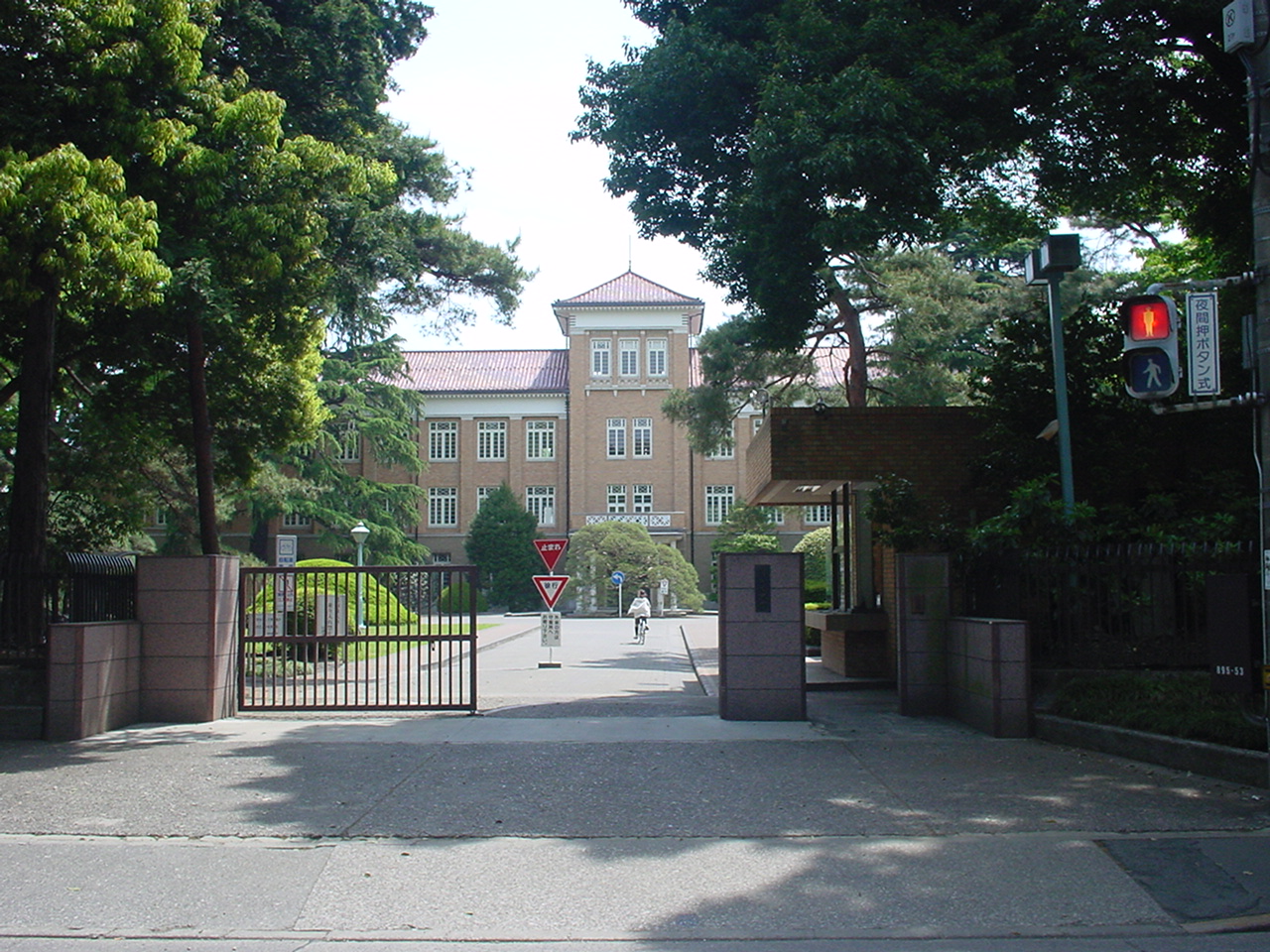

Higashiyamato, Japan
東大和市
Higashiyamato is a town of 83,901 people in Tokyo, Japan, founded in October 1, 1970.
Why visit Higashiyamato
Townapedia lists 45 museums and landmarks, 112 parks and trails, 178 places to eat, 3 places to stay and 11 attractions in and around town.
Highlights include Japan College of Social Work, Kunitachi College of Music, Kodaira Hirakushi Denchu Art Museum and National Institute of Polar Research.
Weather in Higashiyamato
Forecast from MET Norway (CC BY 4.0). Full forecast
About Higashiyamato
Higashiyamato (東大和市, Higashi-yamato-shi) is a city located in the western portion of the Tokyo Metropolis, Japan. As of 1 April 2021, the city had an estimated population of 85,294, and a population density of 6400 persons per km2. The total area of the city was 13.42 square kilometres (5.18 sq mi).
From the Wikipedia article Higashiyamato, Tokyo (this version), under CC BY-SA 4.0.
Things to do11

Japan College of Social Work
School · 5.6 km
Private university in Tokyo, Japan

Kunitachi College of Music
School · 4.6 km
Private University in Tokyo

Meiji Pharmaceutical University
School · 5.8 km
Private university in Kiyose, Tokyo, Japan

Musashino Art University
School · 4.1 km
University in Kodaira, western Tokyo

Seibu-en
Monument and historic site · 0.7 km
Amusement park in Tokorozawa, Japan




Museums and landmarks45

Kodaira Hirakushi Denchu Art Museum
Museum · 5.7 km
Art museum in Tokyo, Japan

National Institute of Polar Research
Museum · 6.5 km
Japanese research institute for Antarctica


Bell Tower from Kofuku-ji Temple
Monument and historic site · 2.8 km
Originally located at Kofuku-ji Temple in Nara Prefecture
Benten-do Hall (Former Sutra Repository of Seiryo-ji Temple, Hikone)
Monument and historic site · 2.8 km
Originally, this hexagonal hall was built for the memorial of Ii Naotaka at Seiryoji Temple in Shiga Prefecture, but was moved here in...

Chokugakumon (Imperial Tablet Gate)
Monument and historic site · 2.7 km
Originally located in the Taitoku-in Mausoleum (southern mausoleum of Zojo-ji Temple) of the second Shogun Hidetada, was erected in 1632...
First Pagoda (Former Takatsuki Hatakeyama Shrine Pagoda)
Monument and historic site · 2.8 km
Originally located at Hatayama Shrine in Takatsuki City, Osaka Prefecture, and was moved to what was then the UNESCO Village in 1960. It...
Former Main Gate of Keisho-in Temple
Monument and historic site · 2.6 km
Belonged to Keisho-in (慶性院), a temple that was located in the Yamaguchi Village. When the Murayama Reservoir (Tama Lake) was built in...
Main gate of Fudoji Temple (Gate to the residence of Duke Mori, former lord of the Choshu domain)
Monument and historic site · 2.8 km
The main gate in front of the main hall was relocated from the Edo residence of the Mori clan of the Choshu domain
Monument in honor of Professor Nakajima
Monument and historic site · 2.6 km
Designer of the Komazawa Water Tower (Setagaya). During the Taisho era, as an engineer for Tokyo Prefecture, he was involved in the...
Onarimon Gate (Tenninmon Gate)
Monument and historic site · 2.8 km
This gate was located in the Taitokuin Mausoleum of Zojoji Temple, and was erected by Tokugawa Iemitsu in 1632 (the 9th year of the...
33 more on the map.
Parks, trails and playgrounds112


Tokorozawa Aviation Memorial Park
Park · 4.7 km
Park in Tokorozawa, Saitama Prefecture, Japan




100 more on the map.
Restaurants and cafes178


みんなの酒場 らんらん
Restaurant · Oriental · 3.1 km
栄町1-11-60
We-Su 17:00-22:00

高岡珈琲店
Cafe · Coffee Shop, Sandwich · 2.2 km
65, 東大和市
Th-Tu 08:00-17:00
すてーき亭
Restaurant · Steak · 3.1 km
Mo-Su 11:30-15:00; Mo-Fr 17:30-00:00; Sa, Su 15:00-00:00
166 more on the map.
History
The area of present-day Higashiyamato was part of ancient Musashi Province. In the post-Meiji Restoration cadastral reform of April 1, 1889, Takagi Village was established within Kitatama District of Kanagawa Prefecture. The entire district was transferred to the control of Tokyo Prefecture on April 1, 1893. Takagi Village merged with five neighboring villages to form Yamato Village on November 1, 1919. It was elevated to town status on May 3, 1954, and renamed as Higashiyamato on its promotion to a city, on October 1, 1970.
There was a Hitachi Aircraft Company factory located in Higashiyamato during World War II. It was destroyed by US bombing raids. The Former Hitachi Aircraft Tachikawa Factory Transformer Substation was damaged during air attacks but remains as a war memorial.
From the History section of Higashiyamato, Tokyo on Wikipedia, under CC BY-SA 4.0.
Where to stay3
Churches and places of worship65
Shopping48
Gas and EV charging8
Schools, colleges and libraries56
Healthcare59
Map of Higashiyamato
250 places. The map loads OpenStreetMap tiles when you open it.
Getting there and nearby towns
Yokota Air Base (OKO) is the nearest airport with scheduled flights listed in OpenStreetMap, 9 km away.
- Higashimurayama 2 km southeast, about 2 min by car
- Musashimurayama 3 km southwest, about 3 min by car
- Tokorozawa 5 km northeast, about 5 min by car
- Kodaira 5 km southeast, about 5 min by car
- Higashikurume 6 km east, about 6 min by car
- Tachikawa 6 km south, about 6 min by car
- Kokubunji 7 km south, about 7 min by car
- Akishima 8 km southwest, about 8 min by car
- Nishi-Tokyo-shi 9 km southeast, about 9 min by car
- Koganei 9 km southeast, about 9 min by car
Drive times are estimates from straight-line distance, not routes.
Local news
Headlines from INDB.
Reviews, tips and questions
Loading what members have shared...
Sources and licences
- GeoNames (CC BY 4.0): population, coordinates, regions and time zone
- OpenStreetMap contributors (ODbL 1.0): places, airports, map data
- Wikidata (CC0 1.0): elevation, founding date, time zone, website, landmarks and historic places
- Wikimedia Commons (see each image): photos
- Wikipedia (CC BY-SA 4.0): overview and history text
Photo credits
- Higashiyamatocityoffice2, The original uploader was Hykw-a4 at Japanese Wikipedia ., CC BY-SA 3.0
- Kunitachiondai2, The original uploader was Hykw-a4 at Japanese Wikipedia ., CC BY-SA 3.0
- Meiji Pharmaceutical University, Nyao148, CC BY-SA 3.0
- Musashino Art University, The original uploader was Hykw-a4 at Japanese Wikipedia ., CC BY-SA 3.0
- Tsudajukuuniv, The original uploader was Hykw-a4 at Japanese Wikipedia ., CC BY-SA 3.0
- Kodaira Hirakushi Denchu Art Museum front, Calton, CC BY-SA 4.0
- National Institute of Japanese Literature, Tamago915 ( talk ), CC BY-SA 3.0
- Satoyamaminkah, four horsemen, CC BY-SA 3.0
- Tokorozawa Aviation Commemorative Park, Abasaa, Public domain
- Seibuen Amusement Park (11152952796), Tomohiro Ohtake from Kawasaki, Japan, CC BY 2.0
- Seibu Dome feb 23 2021 various 16 59 23 418000, Nesnad, CC BY 4.0
- Shofukuji Jizo Hall Left Front, Bryanmackinnon, Public domain
- Kitayama Park Iris Garden, Yasu, CC BY-SA 3.0
- Seibuenvelodrome, DS80s at Japanese Wikipedia, CC BY-SA 3.0
- Tokorozawa High School, Abasaa, Public domain
- Nanryô-chû-seimon, eien20, CC BY-SA 4.0
- Tokorozawa Yamaguchi JuniorHighschool, Asasa198, CC BY-SA 4.0
- Higashiyamato Hospital, Waka77, CC0
- Sayama Fudoson Bentendo, Suikotei, CC BY-SA 4.0
- Tokorozawa Konjoin Hondo 1, 京浜にけ, CC BY-SA 3.0
- Sayama Park, Higashiyamato, Tokyo, Japan, User: (WT-shared) Shoestring at wts wikivoyage, CC BY-SA 4.0
- Yasaka shrine Higashimurayama Tokyo, Mizushimasea, CC BY-SA 4.0
- Tokuzo-ji main gate 2023-09-10, Asanagi, CC0
- Baigan-ji main gate (1) 2023-09-10, Asanagi, CC0
- Siraumegakuen, The original uploader was Hykw-a4 at Japanese Wikipedia ., CC BY-SA 3.0
- Zojo-ji sanmon, KENPEI, CC BY-SA 3.0
- 西武園競輪場 No3, DS80s at Japanese Wikipedia, CC BY-SA 3.0
- Seibuen Yuenchi Entrance 2021, Kaze315, CC BY-SA 4.0
- Tokorozawa Sayamafudoson Hondo 1, 京浜にけ, CC BY-SA 3.0
- マルフク右 - panoramio, heriheri, CC BY 3.0
- マルフク左 - panoramio, heriheri, CC BY 3.0
- マルフク正面 - panoramio, heriheri, CC BY 3.0
- Wheel - Flickr - OiMax, OiMax, CC BY 2.0
- Seibu-yuenchi Sta.-platform-1 20160322, 掬茶, CC BY-SA 4.0
- Seibu-yuenchi Sta.-waiting room 20160322, 掬茶, CC BY-SA 4.0
- Seibu-yuenchi Sta.-ticket gate-2 20160322, 掬茶, CC BY-SA 4.0
- Seibu-yuenchi Sta.-platform-2 20160322, 掬茶, CC BY-SA 4.0
- 東村山市多摩湖町 多摩湖駅 20250525, Mikagekawase, CC BY 4.0
- Yuenchi-Nishi Station oct 3 2020 various 20 25 34 656000, Nesnad, CC BY 4.0
- Yuenchi-Nishi Station oct 3 2020 various 20 24 59 020000, Nesnad, CC BY 4.0
- Hachikokuyama Taiken no Sato 2023-09-10, Asanagi, CC0


Page built November 5, 2026. Spotted a mistake? Tell us or suggest a place.