


Ban Sang, Thailand
อำเภอบ้านสร้าง
Ban Sang is a town of 38,245 people in Prachin Buri, Thailand.
Why visit Ban Sang
Townapedia lists 1 museum or landmark in and around town.
Weather in Ban Sang
Forecast from MET Norway (CC BY 4.0). Full forecast
About Ban Sang
Ban Sang (Thai: บ้านสร้าง, pronounced [bâːn sâːŋ]) is the westernmost district (amphoe) of Prachinburi province, central Thailand.
From the Wikipedia article Ban Sang district (this version), under CC BY-SA 4.0.
Museums and landmarks1

วาสนา เงิน ทอง มั่งมีศรีสุข โชคลาภ เจริญรุ่งเรือง ไพศาล
Monument and historic site · 6.2 km
Churches and places of worship6

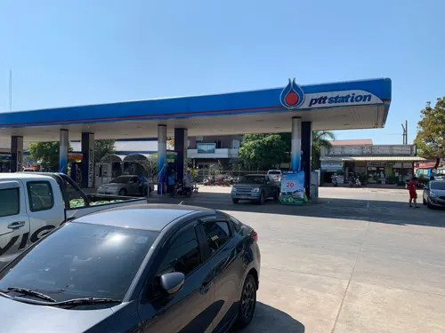
Gas and EV charging1
Schools, colleges and libraries1

History
In the past, the area of the district was dense forest with many wild elephants. Laotians from Vientiane moved to settle their village in the area, which they named Ban Chang (lit., 'elephant village'). Later the name changed to Ban Sang. Ban Sang district was established in 1905.
From the History section of Ban Sang district on Wikipedia, under CC BY-SA 4.0.
More about Ban Sang
Geography
Neighboring districts are (from the northwest clockwise): Ongkharak, Mueang Nakhon Nayok, and Pak Phli of Nakhon Nayok province; Mueang Prachinburi and Si Mahosot of Prachinburi Province; Ratchasan, Bang Khla, Khlong Khuean and Bang Nam Priao of Chachoengsao province.
From the Wikipedia article Ban Sang district, under CC BY-SA 4.0.
Healthcare1
Map of Ban Sang
10 places. The map loads OpenStreetMap tiles when you open it.
Getting there and nearby towns
Suvarnabhumi Airport (BKK) is the nearest airport with scheduled flights listed in OpenStreetMap, 61 km away.
- Chachoengsao 38 km southwest, about 38 min by car
- Nong Chok 42 km west, about 42 min by car
- Khlong Sam Wa 54 km west, about 54 min by car
- Lat Krabang 56 km southwest, about 56 min by car
- Khan Na Yao 62 km west, about 1 h by car
- Sai Mai 63 km west, about 1 h by car
- Saphan Sung 63 km southwest, about 1 h by car
- Bueng Kum 64 km west, about 1 h by car
- Bang Kapi 67 km west, about 1 h by car
- Suan Luang 68 km southwest, about 1 h 15 min by car
Drive times are estimates from straight-line distance, not routes.
Towns near Ban Sang


Keep exploring
Local news
Headlines from INDB.
Reviews, tips and questions
Loading what members have shared...
Sources and licences
- GeoNames (CC BY 4.0): population, coordinates, regions and time zone
- Mapillary (see each image): photos
- OpenStreetMap contributors (ODbL 1.0): places, airports, map data
- Wikidata (CC0 1.0): elevation, founding date, time zone, website
- Wikimedia Commons (see each image): photos
- Wikipedia (CC BY-SA 4.0): overview and history text
Photo credits
- Aranyaprathet to Bangkok (15038022844), Clay Gilliland, CC BY-SA 2.0
- Aranyaprathet to Bangkok (15472128339), Clay Gilliland, CC BY-SA 2.0
- Aranyaprathet to Bangkok (15472126889), Clay Gilliland, CC BY-SA 2.0
- Aranyaprathet to Bangkok (15658768675), Clay Gilliland, CC BY-SA 2.0
- Aranyaprathet to Bangkok (15473200110), Clay Gilliland, CC BY-SA 2.0
- Aranyaprathet to Bangkok (15659587972), Clay Gilliland, CC BY-SA 2.0
- Street-level photo, balthus_mc, CC BY-SA 4.0
Page built November 10, 2026. Spotted a mistake? Tell us or suggest a place.