


Why visit Alfeld
Townapedia lists 30 museums and landmarks, 25 parks and trails, 65 places to eat, 12 places to stay and 32 attractions in and around town.
Highlights include Stadtkino Alfeld, Himmelbergturm, Fagus-Gropius-Ausstellung and Schloss Brüggen.
Weather in Alfeld
Forecast from MET Norway (CC BY 4.0). Full forecast
About Alfeld
Alfeld (Leine) (German pronunciation: [ˈalfɛlt]) is a town in the state of Lower Saxony, Germany. Located on the Leine river and situated approximately 20 km southwest of Hildesheim, it is the second biggest city in the district of Hildesheim in southern Lower Saxony and part of the Metropolitan region Hannover-Braunschweig-Göttingen-Wolfsburg. Alfeld is a member of the Leinebergland region and on the German Timber-Frame Road. With the Fagus Factory, Alfeld became a UNESCO World Heritage Site in 2011.
From the Wikipedia article Alfeld (this version), under CC BY-SA 4.0.
Travel tips from other travellers: Alfeld on Wikivoyage (CC BY-SA 4.0).
Things to do32
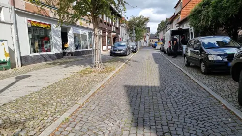
Stadtkino Alfeld
Cinema and theater · 0.6 km
28-29 Holzer Straße, Alfeld (Leine)
"Mo-Fr ab 14.30 So 30min vor Filmbeginn, Bitte Spielplan beachten"




20 more on the map.
Museums and landmarks30

Fagus-Gropius-Ausstellung
Museum · 0.6 km
Apr-Oct: Mo-Su, PH 10:00-17:00; Nov-Mar Mo-Su, PH 10:00-16:00; Dec...

Schloss Brüggen
Monument and historic site · 7.2 km
Betreten und Befahren verboten! Bitte keine Fotos!
Schloßstraße, Gronau (Leine)

Fagus Factory
Monument and historic site
58 Hannoversche Straße, Alfeld (Leine)






18 more on the map.
Parks, trails and playgrounds25





Freibad Delligsen
Sports field and stadium · 4.1 km
1A Am Freibad, Delligsen
May-Sep Mo-Fr 15:00-20:00, May-Sep PH,Sa,Su 10:00-20:00, May-Sep...


13 more on the map.
Restaurants and cafes65

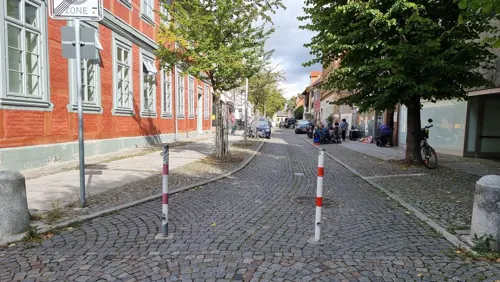
Glücksgans
Restaurant · German · 2.6 km
1 Am Sportplatz, Alfeld (Leine)
Tu, Th 16:00-22:00; Fr, Sa 12:00-22:00; Su 10:00-15:00
Landgasthof Zum braunen Hirsch
Restaurant · German · 2.0 km
14 Am Thie, Alfeld (Leine)
Mo off; Tu-Su 16:30-22:00
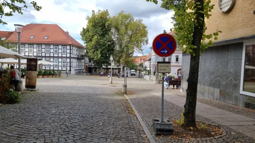
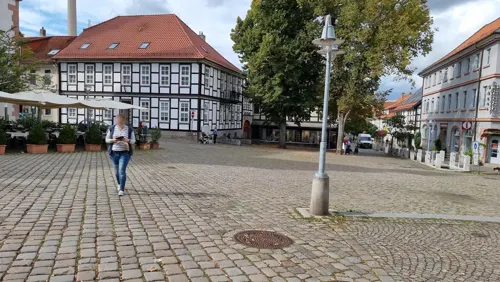
Piccolo Mondo
Restaurant · Italian
1 Marktplatz, Alfeld (Leine)
We-Mo 11:30-14:30, 17:30-23:00, Tu off
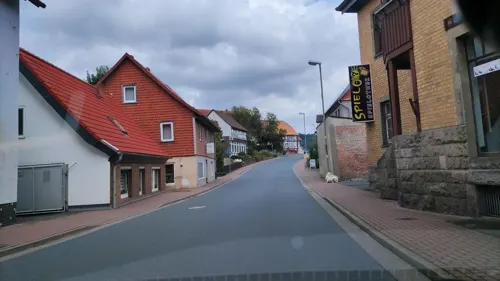
Restaurant im Hils
Restaurant · German · 6.4 km
11 Obere Hilsstraße, Delligsen
Mo 17:00-21:30; Th-Sa 17:00-21:30; Su 11:30-14:00, 17:00-21:30
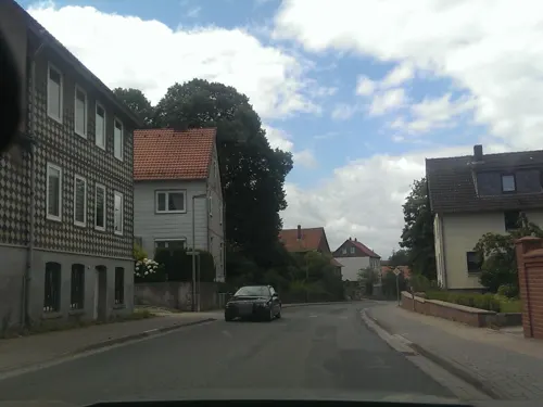
Sokratis Alfeld
Restaurant · Greek · 2.4 km
2 Warnetalstraße, Alfeld (Leine)
Mo-Su 11:30-14:30, 17:00-23:00
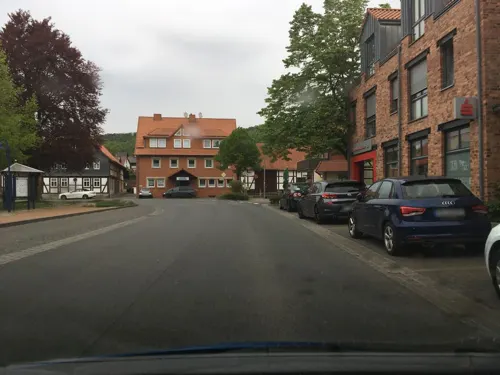
Zucchero
Restaurant · Italian · 4.8 km
56 Dr.-Jasper-Straße, Delligsen
Tu-Th 17:00-24:00; Fr-Su 17:00-02:00; Mo off
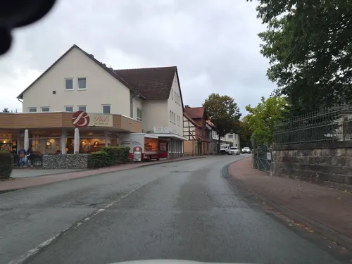
Biel's Café
Bakery · 4.8 km
17 Hilsstraße, Delligsen
Mo-Fr 06:00-18:00; Sa 06:00-17:00; Su 07:30-10:30; 14:00-17:00
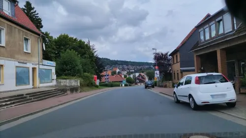
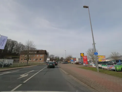


Landbäckerei Grube
Bakery · 0.9 km
46a Hannoversche Straße, Alfeld (Leine)
Mo-Fr 06:30-19:00; Sa 06:30-18:00
53 more on the map.
History
The town was founded before 1214, with the name Alvelde recorded in 1214, 1221, and 1233. The toponymic element "-feld" means "open area", "an undeveloped, open field", or "an untilled field". "Al-" likely derives from the Indoeuropean root "el-/ol-" meaning "water", "damp", or "flowing".
In 1426, Alfeld joined the Saxon League of Towns, thus becoming an indirect member of the Hanseatic League. The town was one of the smallest cities in the Hanseatic League, but had become prosperous in the fourteenth and fifteenth centuries through its trade in beer, hops, linen, and yarn.
Alfeld originally belonged to the Diocese of Hildesheim, but was transferred to the Principality of Brunswick-Wolfenbüttel after the Hildesheim Diocesan Feud (1519-1523). In retrospect, this Brunswick period constituted Alfeld's Golden Age, its economy and culture flourishing before the Thirty Years' War.
From the History section of Alfeld on Wikipedia, under CC BY-SA 4.0.
Where to stay12
Churches and places of worship26
Sankt Marien
Church · Roman Catholic · 0.8 km
5 Bismarckstraße, Alfeld (Leine)
Shopping22
Gas and EV charging7
Schools, colleges and libraries17
Healthcare10
Map of Alfeld
246 places. The map loads OpenStreetMap tiles when you open it.
Getting there and nearby towns
Hannover Airport (HAJ) is the nearest airport with scheduled flights listed in OpenStreetMap, 54 km away.
- Bad Salzdetfurth 15 km northeast, about 15 min by car
- Salzhemmendorf 18 km northwest, about 18 min by car
- Einbeck 19 km south, about 19 min by car
- Bad Gandersheim 19 km southeast, about 19 min by car
- Nordstemmen 20 km north, about 20 min by car
- Hildesheim 21 km northeast, about 21 min by car
- Bockenem 22 km east, about 22 min by car
- Dassel 22 km southwest, about 22 min by car
- Seesen 27 km southeast, about 27 min by car
- Harsum 27 km north, about 27 min by car
Drive times are estimates from straight-line distance, not routes.
Local news
Headlines from INDB.
Reviews, tips and questions
Loading what members have shared...
Sources and licences
- GeoNames (CC BY 4.0): population, coordinates, regions and time zone
- Mapillary (see each image): photos
- OpenStreetMap contributors (ODbL 1.0): places, airports, map data
- Wikidata (CC0 1.0): elevation, founding date, time zone, website
- Wikimedia Commons (see each image): photos
- Wikipedia (CC BY-SA 4.0): overview and history text
Photo credits
- Alfeld Rathaus 1 2005, Unknown author, CC BY-SA 3.0
- Alfeld Leine Hochwasser - panoramio, dysy31039, CC BY-SA 3.0
- Auf der Hackelmasch 1, 1, Alfeld, Landkreis Hildesheim, GeorgDerReisende, CC BY-SA 4.0
- Am Bahnhof 8, 2, Alfeld, Landkreis Hildesheim, GeorgDerReisende, CC BY-SA 4.0
- Auf der Hackelmasch 1, 2, Alfeld, Landkreis Hildesheim, GeorgDerReisende, CC BY-SA 4.0
- Kriegerdenkmal, 1, Auf der Hackelmasch, Alfeld, Landkreis Hildesheim, GeorgDerReisende, CC BY-SA 4.0
- Kriegerdenkmal, 2, Auf der Hackelmasch, Alfeld, Landkreis Hildesheim, GeorgDerReisende, CC BY-SA 4.0
- Alfeld Leine - panoramio (1), dysy31039, CC BY-SA 3.0
- Alfeld Leine - panoramio, dysy31039, CC BY-SA 3.0
- Sappi Alfeld am Fluss, Gerd Fahrenhorst, CC BY 3.0
- Bahnhofstraße 9, 1, Alfeld, Landkreis Hildesheim, GeorgDerReisende, CC BY-SA 4.0
- Leine, 2, Alfeld, Landkreis Hildesheim, GeorgDerReisende, CC BY-SA 4.0
- Mühlengraben, 2, Alfeld, Landkreis Hildesheim, GeorgDerReisende, CC BY-SA 4.0
- Sappi Alfeld Südseite an der Leine, Gerd Fahrenhorst, CC BY 4.0
- Mühlengraben, 1, Alfeld, Landkreis Hildesheim, GeorgDerReisende, CC BY-SA 4.0
- Ziegelmasch 2 - 5, 2, Alfeld, Landkreis Hildesheim, GeorgDerReisende, CC BY-SA 4.0
- Ziegelmasch 2 + 3, 1, Alfeld, Landkreis Hildesheim, GeorgDerReisende, CC BY-SA 4.0
- Leine, 1, Alfeld, Landkreis Hildesheim, GeorgDerReisende, CC BY-SA 4.0
- Dohnser Bach, 1, Alfeld, Landkreis Hildesheim, GeorgDerReisende, CC BY-SA 4.0
- Am Bahnhof 8, 1, Alfeld, Landkreis Hildesheim, GeorgDerReisende, CC BY-SA 4.0
- Bismarckdenkmal, 3, Alfeld, Landkreis Hildesheim, GeorgDerReisende, CC BY-SA 4.0
- Ziegelmasch 1, 15, Alfeld, Landkreis Hildesheim, GeorgDerReisende, CC BY-SA 4.0
- Bismarckdenkmal, 2, Alfeld, Landkreis Hildesheim, GeorgDerReisende, CC BY-SA 4.0
- Bismarckdenkmal, 1, Alfeld, Landkreis Hildesheim, GeorgDerReisende, CC BY-SA 4.0
- Bahnhof, 4, Alfeld, Landkreis Hildesheim, GeorgDerReisende, CC BY-SA 4.0
- Mühlengrabenbrücke, 2, Alfeld, Landkreis Hildesheim, GeorgDerReisende, CC BY-SA 4.0
- Ziegelmasch 1, 11, Alfeld, Landkreis Hildesheim, GeorgDerReisende, CC BY-SA 4.0
- Bahnhofstraße, 1, Alfeld, Landkreis Hildesheim, GeorgDerReisende, CC BY-SA 4.0
- Mühlengrabenbrücke, 3, Alfeld, Landkreis Hildesheim, GeorgDerReisende, CC BY-SA 4.0
- Mühlengrabenbrücke, 1, Alfeld, Landkreis Hildesheim, GeorgDerReisende, CC BY-SA 4.0
- Sappi Alfeld, alte Brücke, Gerd Fahrenhorst, CC BY 4.0
- 2006-06-02 Alfeld (Leine) von der Alfelder Papierfabrik gestiftete Brunnen-Skulptur Kollergang nach der Idee von Monika Jain (16746), Bernd Schwabe, CC BY-SA 4.0
- 2006-06-02 Alfeld (Leine) von der Alfelder Papierfabrik gestiftete Brunnen-Skulptur Kollergang nach der Idee von Monika Jain (51903), Bernd Schwabe, CC BY-SA 4.0
- 2006-06-02 Alfeld (Leine) von der Alfelder Papierfabrik gestiftete Brunnen-Skulptur Kollergang nach der Idee von Monika Jain (25125), Bernd Schwabe, CC BY-SA 4.0
- 2006-06-02 Alfeld (Leine) von der Alfelder Papierfabrik gestiftete Brunnen-Skulptur Kollergang nach der Idee von Monika Jain (82092), Bernd Schwabe, CC BY-SA 4.0
- Bahnhof, 1, Alfeld, Landkreis Hildesheim, GeorgDerReisende, CC BY-SA 4.0
- Busbahnhof, 1, Alfeld, Landkreis Hildesheim, GeorgDerReisende, CC BY-SA 4.0
- 2006-06-02 Alfeld (Leine) von der Alfelder Papierfabrik gestiftete Brunnen-Skulptur Kollergang nach der Idee von Monika Jain, Bernd Schwabe, CC BY-SA 4.0
- Bushaltestelle Bahnhof-ZOB, 2, Alfeld, Landkreis Hildesheim, GeorgDerReisende, CC BY-SA 4.0
- Ziegelmasch 2 - 5, 3, Alfeld, Landkreis Hildesheim, GeorgDerReisende, CC BY-SA 4.0
- Fagus Gropius Hauptgebaeude 200705 wiki front, Carsten Janssen, CC BY-SA 2.0 de
- Steinbruch bei Delligsen - panoramio, wusel007, CC BY-SA 3.0
- Naturschutzgebiet Unterer Lauensberg (NSG HA 096), Puusterke, CC BY-SA 3.0
- Nicolai-Kirche Alfeld 02, Clemensfranz, CC BY-SA 4.0
- Delligsen Düsterntal Schule a, Lulumara, CC0
- Himmelbergturm Himmelberg, Axel Hindemith, Public domain
- Lieth NSG 0001, Wogbruqu, CC BY-SA 4.0
- ND Lippoldshöhle - Tunnel (3), Ragnar1904, CC BY-SA 4.0
- Schiefer Holzer Berg 02, Puusterke, CC BY-SA 4.0
- Alfeld Marienkirche, Kirchenfan, CC0
- NSG HA 168 Wernershöhe (45), Lotte76, CC BY-SA 4.0
- Erich-Mäder-Glasmuseum in Delligsen-Grünenplan 02, Derbrauni, CC BY-SA 3.0
- NSG Amphibienbiotope an der Hohen Warte - Gewässer (13), Ragnar1904, CC BY-SA 4.0
- Fagus Gropius Exhibition interior Alfeld, SchlurcherBot, CC BY-SA 4.0
- Schloss Brüggen, user:Party2hearty, CC BY 4.0
- Brunkensen Kirche 1, Walter Wriste, CC0
- St. Georgs-Kirche in Delligsen IMG 3342, losch, CC BY-SA 3.0
- Limmer A Church, Jeffmyzel, CC BY-SA 4.0
- Kaierde Kirche, Bliggiqu, CC BY-SA 4.0
- Sieben Berge, Schutzhütte auf dem Himmelberg - panoramio, dysy31039, CC BY-SA 3.0
- Hohe Tafel - panoramio, dysy31039, CC BY-SA 3.0
- Tiermuseum Alfeld an der Leine (26898), Bernd Schwabe / Bernd Schwabe, CC BY-SA 4.0
- Street-level photo, hotteliene, CC BY-SA 4.0
- Street-level photo, inextremo96, CC BY-SA 4.0
- Street-level photo, inextremo96, CC BY-SA 4.0
- Street-level photo, inextremo96, CC BY-SA 4.0
- Street-level photo, inextremo96, CC BY-SA 4.0
- Street-level photo, Langfahrer, CC BY-SA 4.0
- Street-level photo, live, CC BY-SA 4.0
- Street-level photo, hotteliene, CC BY-SA 4.0
- Street-level photo, hotteliene, CC BY-SA 4.0
- Street-level photo, inextremo96, CC BY-SA 4.0
- Street-level photo, inextremo96, CC BY-SA 4.0
- Street-level photo, inextremo96, CC BY-SA 4.0
- Street-level photo, atze777, CC BY-SA 4.0
- Street-level photo, hotteliene, CC BY-SA 4.0
- Street-level photo, Langfahrer, CC BY-SA 4.0
- Street-level photo, Langfahrer, CC BY-SA 4.0
- Street-level photo, hotteliene, CC BY-SA 4.0
- Street-level photo, hotteliene, CC BY-SA 4.0
- Street-level photo, hotteliene, CC BY-SA 4.0
- Street-level photo, hotteliene, CC BY-SA 4.0
- Street-level photo, hotteliene, CC BY-SA 4.0
- Street-level photo, hotteliene, CC BY-SA 4.0
- Street-level photo, Langfahrer, CC BY-SA 4.0
- Street-level photo, Langfahrer, CC BY-SA 4.0
- Street-level photo, Langfahrer, CC BY-SA 4.0
- Street-level photo, Hightower-, CC BY-SA 4.0
- Street-level photo, Langfahrer, CC BY-SA 4.0
- Street-level photo, hotteliene, CC BY-SA 4.0


Page built November 8, 2026. Spotted a mistake? Tell us or suggest a place.