


Why visit Altenkunstadt
Townapedia lists 18 museums and landmarks, 11 parks and trails, 48 places to eat, 1 place to stay and 20 attractions in and around town.
Highlights include Kreibitzenberg, Külmitz, Bildstock and Cobbler Museum.
Weather in Altenkunstadt
Forecast from MET Norway (CC BY 4.0). Full forecast
About Altenkunstadt
Altenkunstadt (German pronunciation: [altn̩ˈkʊnʃtat]) is a municipality in the district of Lichtenfels in Bavaria, Germany. It lies on the left or south bank of the river Main across the valley from Burgkunstadt which sits on the hillside to the north.
From the Wikipedia article Altenkunstadt (this version), under CC BY-SA 4.0.
Things to do20




8 more on the map.
Museums and landmarks18



NordJURA-Museum
Museum · 4.5 km
7 Kirchplatz, Weismain
We,Fr 16:00-18:30; Sa 18:15-19:15

Schloss Ebneth
Monument and historic site · 4.1 km
18 Hauptstraße, Burgkunstadt

Schloss Giechkröttendorf
Monument and historic site · 4.2 km
25 Giechkröttendorf, Weismain

Schloss Maineck
Monument and historic site · 3.7 km
1 Schloßberg, Altenkunstadt


Schloss Strössendorf
Monument and historic site · 2.6 km
3 Am Schloß, Altenkunstadt

Alte Vogtei
Monument and historic site · 1.7 km
5 Regens-Wagner-Platz, Burgkunstadt

6 more on the map.
Parks, trails and playgrounds11


Park an der Seniorenresidenz Weismain
Park · 4.7 km
Hier entsteht ein Park mit Trimm-Dich-Pfad.


Restaurants and cafes48
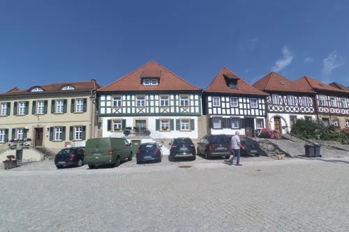
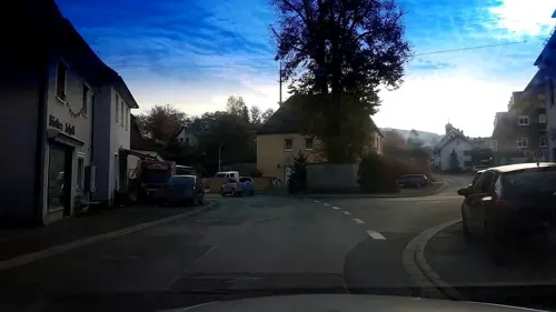
Wirtshaus Obendorfer
Restaurant · Regional · 4.4 km
2 Festungsweg, Weismain
We-Sa 17:00-22:30; Su,PH 10:00-14:00,17:00-22:00

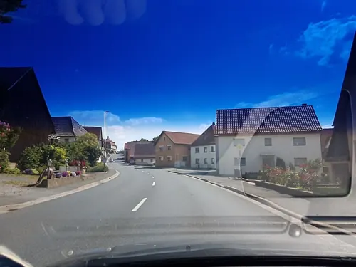
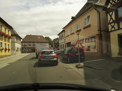
Nepomuk
Restaurant · 1.0 km
Pizza, Kuchen, Musik, Biergarten
Fr,Sa 16:00-01:00, PH,Su 10:00-24:00, We,Th 16:00-24:00
Café Lafleur
Cafe · Cake, Coffee Shop, Hotdog, Sandwich · 1.3 km
74 Kulmbacher Straße
We-Su 09:00-18:00
Gaststätte Gäbelein
Bar and pub · 4.6 km
1 Burgkunstadter Straße, Weismain
We-Fr 16:00-18:00+; Sa 17:00-18:00+; Su 09:30-12:00,17:00-18:00+; Mo,Tu off


36 more on the map.
Where to stay1
Churches and places of worship21
Kirche St. Martin
Church · Roman Catholic · 4.5 km
2 Kirchplatz, Weismain
St. Georg
Church · Roman Catholic · 2.1 km
25 Lichtenfelser Straße, Altenkunstadt
Shopping10
Gas and EV charging4
Schools, colleges and libraries6
Healthcare6
Map of Altenkunstadt
145 places. The map loads OpenStreetMap tiles when you open it.
Getting there and nearby towns
Verkehrslandeplatz Bayreuth (BYU) is the nearest airport with scheduled flights listed in OpenStreetMap, 32 km away.
- Sonnefeld 13 km northwest, about 13 min by car
- Lichtenfels 14 km west, about 14 min by car
- Kronach 14 km northeast, about 14 min by car
- Kulmbach 15 km east, about 15 min by car
- Stadelhofen 14 km south, about 14 min by car
- Bad Staffelstein 18 km west, about 18 min by car
- Stockheim 20 km north, about 20 min by car
- Hollfeld 21 km south, about 21 min by car
- Ebensfeld 22 km west, about 22 min by car
- Coburg 25 km northwest, about 25 min by car
Drive times are estimates from straight-line distance, not routes.
Local news
Headlines from INDB.
Reviews, tips and questions
Loading what members have shared...
Sources and licences
- GeoNames (CC BY 4.0): population, coordinates, regions and time zone
- Mapillary (see each image): photos
- OpenStreetMap contributors (ODbL 1.0): places, airports, map data
- Wikidata (CC0 1.0): elevation, founding date, time zone, website
- Wikimedia Commons (see each image): photos
- Wikipedia (CC BY-SA 4.0): overview and history text
Photo credits
- Altenkunstadt Pfarrhof Kirche, Benreis 16:38, 26. Jul. 2008 (CEST), CC BY-SA 3.0
- Altenkunstadt Marktplatz 2, ManniLo, CC BY-SA 4.0
- Altenkunstadt Marktplatz 3, ManniLo, CC BY-SA 4.0
- Altenkunstadt Marktplatz 5, ManniLo, CC BY-SA 4.0
- Altenkunstadt Osterbrunnen-20130407-RM-165359, Ermell, CC BY-SA 4.0
- Altenkunstadt Osterbrunnen-20130407-RM-165236, Ermell, CC BY-SA 4.0
- Altenkunstadt Klosterstraße 7, ManniLo, CC BY-SA 4.0
- Altenkunstadt Marktplatz 7, ManniLo, CC BY-SA 4.0
- Altenkunstadt Marktplatz 12, ManniLo, CC BY-SA 4.0
- Altenkunstadt Klosterstraße 14, ManniLo, CC BY-SA 4.0
- Altenkunstadt Mariä Geburt 252026, Ermell, CC BY-SA 4.0
- Altenkunstadt Mariä Geburt 252031, Ermell, CC BY-SA 4.0
- Altenkunstadt Mariä Geburt 252030, Ermell, CC BY-SA 4.0
- Altenkunstadt Mariä Geburt Kanzel 252027, Ermell, CC BY-SA 4.0
- Altenkunstadt Mariä Geburt 252034, Ermell, CC BY-SA 4.0
- Altenkunstadt Mariä Geburt 252016-HDR, Ermell, CC BY-SA 4.0
- Altenkunstadt Mariä Geburt 252021-HDR, Ermell, CC BY-SA 4.0
- Altenkunstadt Ra Krauß Straße 7, ManniLo, CC BY-SA 4.0
- Altenkunstadt Langheimer Straße 10, ManniLo, CC BY-SA 4.0
- Altenkunstadt Synagoge, ManniLo, CC BY-SA 4.0
- Altenkunstadt - Neumühle IV, Trollhead, CC BY-SA 4.0
- Altenkunstadt - Neumühle III, Trollhead, CC BY-SA 4.0
- Altenkunstadt - Neumühle II, Trollhead, CC BY-SA 4.0
- Altenkunstadt Neumühle, ManniLo, CC BY-SA 4.0
- Stolperstein Margot Wolf - Altenkunstadt, ManniLo, CC BY-SA 4.0
- Stolperstein Leo Wolf - Altenkunstadt, ManniLo, CC BY-SA 4.0
- Stolperstein Helene Wolf - Altenkunstadt, ManniLo, CC BY-SA 4.0
- Altenkunstadt Kienmühle, ManniLo, CC BY-SA 4.0
- Schloss Ebneth Nordwestansicht, Trollhead, CC BY-SA 3.0
- Schloss Strössendorf Südostansicht, Trollhead, CC BY-SA 3.0
- Külmitz Südansicht, Trollhead, CC BY 3.0
- Treppenstein Ebnether Keller, Trollhead, CC BY-SA 3.0
- Weismain, Kirchplatz, 7, 9, 11-001, Tilman2007, CC BY-SA 3.0
- Redwitz an der Rodach, Obristfeld, Kirche, 001, Tilman2007, CC BY-SA 3.0
- Altenkunstadt kath Kirche, Benreis 18:12, 26. Jul. 2008 (CEST), CC BY-SA 3.0
- Burgkunstadter Martern, Trollhead, CC BY 3.0
- Katholische Kirche Burgkunstadt, Trollhead, CC BY-SA 3.0
- Mainroth Kirche, Benreis, CC BY-SA 3.0
- Die Weismainer Stadtpfarrkirche, Gerdt at German Wikipedia, Public domain
- Weismain-Kreuzkapelle-02, Störfix, CC BY-SA 3.0 de
- Evangelisch-Lutherische Kirche Weismain 05, Immanuel Giel, CC BY-SA 4.0
- Burgkunstadt Evangelische Kirche Luftbild-20240815-RM-154638, Reinhold Möller, CC BY-SA 4.0
- Pfersag Wasserfall Februar 2011, Trollhead, CC BY 3.0
- Schloß und Gutshof Ebneth 2021 (1), Benreis, CC BY-SA 4.0
- Giechkröttendorf-Schloß, Störfix, CC BY-SA 3.0 de
- Schloss Maineck, Benreis, CC BY-SA 3.0
- Burgkunstadt, Regens-Wager-Platz 5-002, Tilman2007, CC BY-SA 3.0
- Geistl.-Rat-Quinger-Straße, Kath. Pfarrkirche Mariä Geburt Altenkunstadt 20180426 001, Tilman2007, CC BY-SA 4.0
- Kirchplatz 2 Weismain 20180426 001, Tilman2007, CC BY-SA 4.0
- Woffendorf-Kapelle, Störfix, CC BY-SA 3.0 de
- Kirchturm St. Katharina Strössendorf, Trollhead, CC BY-SA 3.0
- St.Georg Pfaffendorf Südwestansicht, Trollhead, CC BY-SA 3.0
- Geutenreuth-St-Erhard-01, Störfix, CC BY-SA 3.0 de
- Burgkunstadt, Kath. Stadtpfarrkirche St. Heinrich und Kunigunde-006, Tilman2007, CC BY-SA 3.0
- Street-level photo, wegavision, CC BY-SA 4.0
- Street-level photo, r66, CC BY-SA 4.0
- Street-level photo, raspberry, CC BY-SA 4.0
- Street-level photo, raspberry, CC BY-SA 4.0
- Street-level photo, r66, CC BY-SA 4.0
- Street-level photo, raspberry, CC BY-SA 4.0
- Street-level photo, raspberry, CC BY-SA 4.0
- Street-level photo, changchun1, CC BY-SA 4.0
- Street-level photo, wegavision, CC BY-SA 4.0
- Street-level photo, msdess, CC BY-SA 4.0
- Street-level photo, msdess, CC BY-SA 4.0
- Street-level photo, wegavision, CC BY-SA 4.0
- Street-level photo, qso4you_com, CC BY-SA 4.0
- Street-level photo, r66, CC BY-SA 4.0
- Street-level photo, r66, CC BY-SA 4.0
- Street-level photo, msdess, CC BY-SA 4.0
- Street-level photo, raspberry, CC BY-SA 4.0
- Street-level photo, raspberry, CC BY-SA 4.0
- Street-level photo, raspberry, CC BY-SA 4.0
- Street-level photo, qso4you_com, CC BY-SA 4.0
- Street-level photo, raspberry, CC BY-SA 4.0
- Street-level photo, r66, CC BY-SA 4.0
- Street-level photo, r66, CC BY-SA 4.0
- Street-level photo, raspberry, CC BY-SA 4.0
- Street-level photo, qso4you_com, CC BY-SA 4.0
- Street-level photo, changchun1, CC BY-SA 4.0
- Street-level photo, r66, CC BY-SA 4.0
- Street-level photo, r66, CC BY-SA 4.0


Page built November 9, 2026. Spotted a mistake? Tell us or suggest a place.