


Attendorn, Germany
Attendorn is a town of 24,773 people in North Rhine-Westphalia, Germany.
Why visit Attendorn
Townapedia lists 50 museums and landmarks, 63 parks and trails, 114 places to eat, 33 places to stay and 123 attractions in and around town.
Highlights include Atta Cave, Elspe Festival, Atta-Höhle and Haus Bamenohl.
Weather in Attendorn
Forecast from MET Norway (CC BY 4.0). Full forecast
About Attendorn
The Hanseatic town of Attendorn (German pronunciation: [ˈatn̩dɔʁn] ) is a medium-sized district town in North Rhine-Westphalia in the Olpe district in the southern Sauerland region with 25,089 inhabitants. It is known nationwide for the Atta Cave and Lake Bigge. Since March 19, 2012, Attendorn has been officially allowed to use the title “Hanseatic town.”
From the Wikipedia article Attendorn (this version), under CC BY-SA 4.0.
Things to do123

Atta Cave
Monument and historic site · 0.9 km
Dripstone cave in Germany

Elspe Festival
Cinema and theater · 10.0 km
Theatre festival in Germany


111 more on the map.
Museums and landmarks50


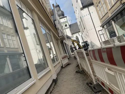




Schloss Ahausen
Monument and historic site · 3.9 km
1 Ahausen, Finnentrop




38 more on the map.
Parks, trails and playgrounds63





51 more on the map.
Restaurants and cafes114

China Restaurant "Nan King"
Restaurant · Asian
25 Kölner Straße, Attendorn
Mo-Su 12:00-14:30,18:00-21:30
Hof Roscheid
Restaurant · Regional · 4.9 km
Mo 17:00-21:00; Tu-We 11:30-21:00; Fr-Su 11:30-21:00; PH 11:30-21:00
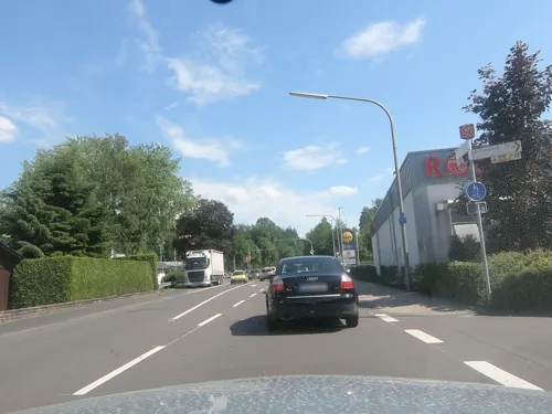
In Vino Veritas
Restaurant · Italian · 7.1 km
33 Bamenohler Straße, Finnentrop
Mo-Sa 12:00-14:30,18:00-24:00; Su 12:00-14:30,17:00-23:00; PH...
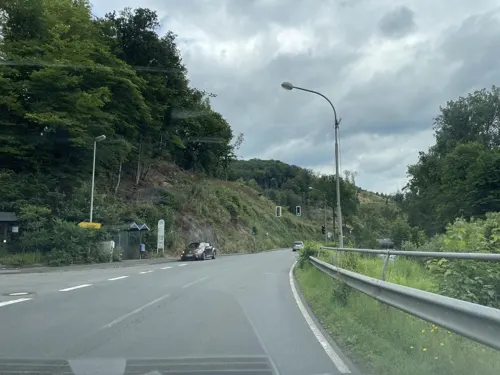


Zur Oestertalsperre
Restaurant · 7.4 km
1 An der Oestertalsperre, Plettenberg
Tu-Fr 11:30-17:30; Sa 11:00-17:30
102 more on the map.
History
The town's location was favoured by the good climate in the Attendorn-Elsper Limestone Double Basin (Attendorn-Elsper-Kalkdoppelmulde), the fruitful soil and favourable transport potential, and was already attracting people in prehistoric times. Heavier settlement, however, can be traced only as far back as the Middle Ages.
The town lies at the crossroads of two former long-distance roads, the Heidenstraße (“Heath Road”) and the so-called Königsstraße (“King’s Road”). Here, in Charlemagne’s time, arose a parish. Under the St.-Johannes-Kirche (church) are found the foundations of an old missionary church. In 1072, Archbishop Anno of Cologne endowed the Grafschaft Abbey and granted it, among other things, rights to an estate in Attendorn. Indeed, the monastery's endowment document stands as the town's earliest documentary mention.
In 1222, town rights, on the Soest model, were granted the town under Engelbert II of Berg. Schnellenberg Castle, built about 1200, and the acquisition of the Waldenburg (another castle) in 1248 served to safeguard Cologne's interests in the region.
From the History section of Attendorn on Wikipedia, under CC BY-SA 4.0.
Where to stay33
Churches and places of worship44
Buddhistisches Retreatzentrum Sellenrade der Karma Kagyü Linie
Place of worship · Tibetan · 5.9 km
5 Sellenrade, Meinerzhagen
Pfarrkirche St. Servatius
Church · Roman Catholic · 7.8 km
4 Zum Kellenberg, Lennestadt
Shopping33
Gas and EV charging12
Raiffeisen Tankstelle Helden
Gas station · 3.8 km
3 Mecklinghauser Straße, Attendorn
Schools, colleges and libraries28
Gemeinschaftsgrundschule Attandarra, Standort Am Stürzenberg
School · 0.7 km
2 Am Stürzenberg, Attendorn
Healthcare11
Apotheke am Schützenplatz
Clinic and pharmacy · 7.8 km
62 Kölner Straße, Lennestadt
Map of Attendorn
250 places. The map loads OpenStreetMap tiles when you open it.
Getting there and nearby towns
Dortmund Airport (DTM) is the nearest airport with scheduled flights listed in OpenStreetMap, 48 km away.
- Plettenberg 9 km north, about 9 min by car
- Lennestadt 11 km east, about 11 min by car
- Olpe 11 km south, about 11 min by car
- Kirchhundem 14 km east, about 14 min by car
- Drolshagen 15 km southwest, about 15 min by car
- Werdohl 18 km northwest, about 18 min by car
- Meinerzhagen 18 km west, about 18 min by car
- Kreuztal 19 km south, about 19 min by car
- Neuenrade 19 km northwest, about 19 min by car
- Lüdenscheid 22 km northwest, about 22 min by car
Drive times are estimates from straight-line distance, not routes.
Local news
Headlines from INDB.
Reviews, tips and questions
Loading what members have shared...
Sources and licences
- GeoNames (CC BY 4.0): population, coordinates, regions and time zone
- Mapillary (see each image): photos
- OpenStreetMap contributors (ODbL 1.0): places, airports, map data
- Wikidata (CC0 1.0): elevation, founding date, time zone, website, landmarks and historic places
- Wikimedia Commons (see each image): photos
- Wikipedia (CC BY-SA 4.0): overview and history text
Photo credits
- Attendorn2006, Toni1983 (Toni Müller) at de.wikipedia, Public domain
- Attendorn St. Johannes Baptist pulpit, Arnoldius, CC BY-SA 4.0
- Attendorn St. Johannes Baptist central nave, Arnoldius, CC BY-SA 4.0
- Attendorn, Germany (Film scan) 1973 (11380862635), Thomas Depenbusch, CC BY 2.0
- Attendorn, Germany 1977 (5588948711), Thomas Depenbusch, CC BY 2.0
- Attendorn 1975 (8392087351), Thomas Depenbusch, CC BY 2.0
- Sauerlandstammtisch-Attendornerkundung-1-Asio, Asio otus, CC BY-SA 3.0
- Attendorn, Germany (7266802184), Thomas Depenbusch, CC BY 2.0
- Attendorn, Germany (7266797424), Thomas Depenbusch, CC BY 2.0
- Attendorn, Germany (7266798354), Thomas Depenbusch, CC BY 2.0
- Attendorn, Germany (7266800288), Thomas Depenbusch, CC BY 2.0
- Attendorn, Germany (7266799394), Thomas Depenbusch, CC BY 2.0
- Attendorn, Germany (7266801206), Thomas Depenbusch, CC BY 2.0
- Attendorn, Germany (7266945494), Thomas Depenbusch, CC BY 2.0
- Attendorn exhibition trizonesia, Arnoldius, CC BY-SA 4.0
- St. Johann Baptist Kirche, Sauerländer Dom in Attendorn - panoramio, qwesy qwesy, CC BY 3.0
- Attendorn 1979 (2234692217), Thomas Depenbusch, CC BY 2.0
- Attendorn 1979 (2235479730), Thomas Depenbusch, CC BY 2.0
- Attendorn 1979 (2235480264), Thomas Depenbusch, CC BY 2.0
- Attendorn, Germany (6167099061), Thomas Depenbusch, CC BY 2.0
- Attendorn 1978 (5897175902), Thomas Depenbusch, CC BY 2.0
- Attendorn, Germany (Film scan) 1976 (11380901904), Thomas Depenbusch, CC BY 2.0
- Attendorn St. Johannes Baptist 1951, Manfred Niermann, CC BY-SA 4.0
- Burg Schnellenberg, Attendorn (8099820179), Heribert Pohl --- Thanks for half a million clicks! from Germering bei München, Bayern, CC BY-SA 2.0
- Attendorner Bürgerwehr stürmt die Burg Bilstein (8564246167), Heribert Pohl --- Thanks for half a million clicks! from Germering bei München, Bayern, CC BY-SA 2.0
- Attendorn, Sauerland. Im Hintergrund die Burg Schnellenberg (8564302605), Heribert Pohl --- Thanks for half a million clicks! from Germering bei München, Bayern, CC BY-SA 2.0
- Attendorn, Burg Schnellenberg (8842051982), Heribert Pohl --- Thanks for half a million clicks! from Germering bei München, Bayern, CC BY-SA 2.0
- Attendorn --- Vergessene Straße (7649741026), Heribert Pohl --- Thanks for half a million clicks! from Germering bei München, Bayern, CC BY-SA 2.0
- Attendorn-StJohannesBaptist-1-Asio, Asio otus, CC BY-SA 3.0
- Attendorn-GerichtPotthucke-1-Asio, Asio otus, CC BY-SA 3.0
- Attendorner Bürgerwehr stürmt die Burg Bilstein (8564247409), Heribert Pohl --- Thanks for half a million clicks! from Germering bei München, Bayern, CC BY-SA 2.0
- Attendorn, Germany (Film scan) 1979 (11380852016), Thomas Depenbusch, CC BY 2.0
- Luftaufnahme Elspe Festival Gelände, Cassidy71, CC BY-SA 3.0
- Atta-Höhle, Rainer Lippert, Public domain
- Bieketurm in Attendorn, Morty at German Wikipedia, CC BY-SA 3.0 de
- Ruine Burg Borghausen, -- Wolfgang Poguntke 18:54, 8. Jul. 2007 (CEST), CC BY-SA 2.0 de
- Aerial image of Burg Schnellenberg (view from the southeast), Carsten Steger, CC BY-SA 4.0
- Attendorn, Am Wassertor 11, Bärwinkel,Klaus, CC BY 3.0
- Kirche Kirchveischede-2, -- Wolfgang Poguntke--, CC BY-SA 2.0 de
- Ev-Kirche Attendorn, Wolfgang Poguntke, CC BY 3.0
- Haus Bamenohl-front, Plettman, CC BY-SA 4.0
- Bamenohl Laufwasserkraftwerk bei Nacht, Christian Drüeke, CC BY-SA 3.0
- Motte Attendorn-Berlinghausen, -- Wolfgang Poguntke 20:03, 25. Feb. 2008 (CET), CC BY-SA 2.0 de
- Neu-Listernohl, St. Augustinus, Bärwinkel,Klaus, CC BY 3.0
- Schloss Ahausen-4, -- Wolfgang Poguntke 18:15, 29. Feb. 2008 (CET), CC BY-SA 2.0 de
- Attendorn 2909, Mbdortmund, GFDL 1.2
- Kapelle Waldenburg, Wolfgang Poguntke, CC BY 3.0
- Burg Waldenburg-3, Wolfgang Poguntke, CC BY-SA 3.0
- Naturschutzgebiet Hohe Lei, Martin Lindner, CC BY 3.0
- Attendorn, Westwall 48, Bärwinkel,Klaus, CC BY 3.0
- Kirche St. Jakobus d. Ä. Lichtringhausen, Bärwinkel,Klaus, CC BY-SA 4.0
- Plettenberg-LettmeckeErloeserkirche1-Bubo, Bubo, CC BY-SA 3.0
- Friedenskirche Petersburg, Bärwinkel,Klaus, CC BY-SA 4.0
- Attendorn, Neuapostolische Kirche, Bärwinkel,Klaus, CC BY-SA 4.0
- Rieflinghausen, St. Servatius, Bärwinkel,Klaus, CC BY-SA 4.0
- Naturschutzgebiet Atta-Höhle, Martin Lindner, CC BY-SA 3.0
- Breiter Hagen, Stefan Flöper, CC BY-SA 4.0
- Wunderwäldchen 9, Stefan Flöper, CC BY-SA 4.0
- Ahauser Klippen, Martin Lindner, CC BY 3.0
- Naturschutzgebiet Auf dem Hahne, Janine Klute, CC BY 4.0
- Naturschutzgebiet Auwald Biggen, Martin Lindner, CC BY-SA 3.0
- Naturschutzgebiet Bamenohl, Martin Lindner, CC BY-SA 4.0
- Street-level photo, chuck, CC BY-SA 4.0
- Street-level photo, madonna100, CC BY-SA 4.0
- Street-level photo, baldur80, CC BY-SA 4.0
- Street-level photo, troher15, CC BY-SA 4.0
- Street-level photo, uwekoch, CC BY-SA 4.0
- Street-level photo, uwekoch, CC BY-SA 4.0
- Street-level photo, uwekoch, CC BY-SA 4.0
- Street-level photo, uwekoch, CC BY-SA 4.0
- Street-level photo, troher15, CC BY-SA 4.0
- Street-level photo, uwekoch, CC BY-SA 4.0
- Street-level photo, uwekoch, CC BY-SA 4.0
- Street-level photo, live, CC BY-SA 4.0
- Street-level photo, uwekoch, CC BY-SA 4.0


Page built November 8, 2026. Spotted a mistake? Tell us or suggest a place.