


Bad Fredeburg, Germany
Bad Fredeburg is a town of 3,995 people in North Rhine-Westphalia, Germany.
Why visit Bad Fredeburg
Townapedia lists 26 museums and landmarks, 12 parks and trails, 22 places to eat, 8 places to stay and 16 attractions in and around town.
Highlights include Dillenberg, Hömberg, Burg Fredeburg and Gerichtsmuseum Bad Fredeburg.
Weather in Bad Fredeburg
Forecast from MET Norway (CC BY 4.0). Full forecast
About Bad Fredeburg
Bad Fredeburg (German pronunciation: [baːt ˈfʁeːdəbʊʁk]) is a locality in the municipality Schmallenberg in the High Sauerland District in North Rhine-Westphalia, Germany.
From the Wikipedia article Bad Fredeburg (this version), under CC BY-SA 4.0.
Things to do16

4 more on the map.
Museums and landmarks26

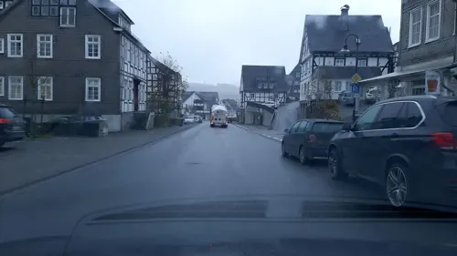
Burg Fredeburg
Monument and historic site
Burgrest (Mauerrest)
4 Auf der Burg, Schmallenberg
24/7

14 more on the map.
Parks, trails and playgrounds12






Restaurants and cafes22

Landcafé Birkenhof
Cafe · Regional · 2.2 km
19 Heustraße, Schmallenberg
Fr 14:00-17:00; Sa 14:30-18:30
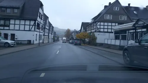
Pizza Treff Burger Haus 3
Restaurant · Pizza
23 Im Ohle, Schmallenberg
Mo 11:00-21:00; Tu off; We-Fr 11:00-21:00; Sa-Su 12:00-21:00

Guntermanns Stuben
Restaurant
Öffnungszeiten täglich ab 11 Uhr geöffnet Mittwoch Ruhetag
2 Im Ohle, Schmallenberg

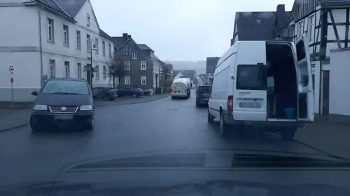
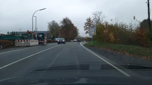


Pizzeria Colosseum
Restaurant · Pizza · 0.9 km
Nebenraum nicht zugänglich.
25 Wehrscheid, Schmallenberg
Keglerklause
Restaurant · German
1a In der Schmiedinghausen, Schmallenberg
10 more on the map.
History
In the first decades of the 14th century, the Dietrich III. of Bilstein built the "Vredeburg", which was to preserve peace in the country according to the name. The construction of the castle also meant the foundation of the town in front of the castle gates. In a devastating town fire in 1810, the entire old town was destroyed and a new building was built in the upper town.
In the 1975 communal area reforms in the Sauerland and Paderborn the already existing Town of Schmallenberg was merged with the Town of Fredeburg. Bad Fredeburg has been Kneippheilbad since 1995.
From the History section of Bad Fredeburg on Wikipedia, under CC BY-SA 4.0.
Where to stay8
vdk-Hotel Zum Hallenberg
Motel and hotel · 1.0 km
60 Zum Hallenberg, Schmallenberg
Churches and places of worship11
Herz-Jesu-Kirche
Church · Catholic · 2.6 km
4 Zur Dorfmitte, Schmallenberg
Hl.-Geist-Kapelle
Church · Catholic · 0.6 km
4 An der Stadtkapelle, Schmallenberg
Shopping7
Gas and EV charging4
Schools, colleges and libraries5
Healthcare2
Map of Bad Fredeburg
113 places. The map loads OpenStreetMap tiles when you open it.
Getting there and nearby towns
Airport Paderborn/Lippstadt (PAD) is the nearest airport with scheduled flights listed in OpenStreetMap, 52 km away.
- Schmallenberg 4 km southwest, about 4 min by car
- Winterberg 16 km east, about 16 min by car
- Bad Berleburg 16 km south, about 16 min by car
- Meschede 18 km north, about 18 min by car
- Lennestadt 19 km southwest, about 19 min by car
- Kirchhundem 19 km southwest, about 19 min by car
- Bestwig 20 km north, about 20 min by car
- Olsberg 22 km northeast, about 22 min by car
- Hilchenbach 26 km southwest, about 26 min by car
- Arnsberg 27 km northwest, about 27 min by car
Drive times are estimates from straight-line distance, not routes.
Local news
Headlines from INDB.
Reviews, tips and questions
Loading what members have shared...
Sources and licences
- GeoNames (CC BY 4.0): population, coordinates, regions and time zone
- Mapillary (see each image): photos
- OpenStreetMap contributors (ODbL 1.0): places, airports, map data
- Wikidata (CC0 1.0): elevation, founding date, time zone, website
- Wikimedia Commons (see each image): photos
- Wikipedia (CC BY-SA 4.0): overview and history text
Photo credits
- Bad Fredeburg (Schmallenberg), Stefan Didam - Schmallenberg, CC BY-SA 3.0
- Quelle der Schmiedinghausen bei Bad Fredeburg.jpg 01, BeaNatur, CC BY 4.0
- Quelle der Schmiedinghausen bei Bad Fredeburg.jpg 02, BeaNatur, CC BY 4.0
- Herz Jesu Schmallenberg, Teta; cropped & recoloured by Rabanus Flavus, CC BY-SA 3.0
- Naturschutzgebiet Quellgebiet der Henne, Stefan Didam - Schmallenberg, CC BY-SA 3.0
- Gleidorf, kapel 2010-08-12 11.14, Michielverbeek, CC BY-SA 3.0
- Henne Quellgebiet fd (2), Friedhelm Dröge, CC BY-SA 3.0
- Fredeb.fd, Friedhelm Dröge, CC BY-SA 4.0
- Fre.Oh.fd (2), Friedhelm Dröge, CC BY-SA 4.0
- Fre Al.fd, Friedhelm Dröge, CC BY-SA 4.0
- St.Wendelin fd, Friedhelm Dröge, CC BY-SA 4.0
- Schmallenberg-Altenhof Kapelle St. Marien, El Grafo, CC BY-SA 4.0
- Altenhof 2015, El Grafo, CC BY-SA 4.0
- ISS040-E-20287 - View of Earth, Earth Science and Remote Sensing Unit , Lyndon B. Johnson Space Center, Public domain
- ISS031-E-87294 - View of Earth, Earth Science and Remote Sensing Unit , Lyndon B. Johnson Space Center, Public domain
- ISS040-E-20286 - View of Earth, Earth Science and Remote Sensing Unit , Lyndon B. Johnson Space Center, Public domain
- ISS030-E-206148 - View of Earth, Earth Science and Remote Sensing Unit , Lyndon B. Johnson Space Center, Public domain
- ISS031-E-91232 - View of Earth, Earth Science and Remote Sensing Unit , Lyndon B. Johnson Space Center, Public domain
- ISS031-E-90719 - View of Earth, Earth Science and Remote Sensing Unit , Lyndon B. Johnson Space Center, Public domain
- ISS030-E-166180 - View of Earth, Earth Science and Remote Sensing Unit , Lyndon B. Johnson Space Center, Public domain
- ISS030-E-208240 - View of Earth, Earth Science and Remote Sensing Unit , Lyndon B. Johnson Space Center, Public domain
- ISS023-E-46163 - View of Earth, Earth Science and Remote Sensing Unit , Lyndon B. Johnson Space Center, Public domain
- ISS023-E-22024 - View of Earth, Earth Science and Remote Sensing Unit , Lyndon B. Johnson Space Center, Public domain
- ISS027-E-19893 - View of Earth, Earth Science and Remote Sensing Unit , Lyndon B. Johnson Space Center, Public domain
- ISS026-E-15174 - View of Earth, Earth Science and Remote Sensing Unit , Lyndon B. Johnson Space Center, Public domain
- Holthausen Innenraum der Ölbergkapelle fd, Friedhelm Dröge, CC BY-SA 4.0
- Holthausen Ölbergkapelle fd, Friedhelm Dröge, CC BY-SA 4.0
- Saalhauser Berge NE, Jörg Braukmann Milseburg, CC BY-SA 3.0
- Holthausen Sauerländer Speicher fd, Friedhelm Dröge, CC BY-SA 4.0
- Street-level photo, Lowiekse, CC BY-SA 4.0
- Street-level photo, Lowiekse, CC BY-SA 4.0
- Street-level photo, Lowiekse, CC BY-SA 4.0
- Street-level photo, Lowiekse, CC BY-SA 4.0
- Street-level photo, Lowiekse, CC BY-SA 4.0
- Street-level photo, Lowiekse, CC BY-SA 4.0
- Street-level photo, Lowiekse, CC BY-SA 4.0
- Street-level photo, Lowiekse, CC BY-SA 4.0


Page built November 9, 2026. Spotted a mistake? Tell us or suggest a place.