


Arnsberg, Germany
Arnsberg is a town of 74,879 people in North Rhine-Westphalia, Germany.
Why visit Arnsberg
Townapedia lists 122 museums and landmarks, 76 parks and trails, 123 places to eat, 22 places to stay and 71 attractions in and around town.
Highlights include KulturSchmiede, Bommerskopf, Altes Rathaus and Sauerland-Museum.
Weather in Arnsberg
Forecast from MET Norway (CC BY 4.0). Full forecast
About Arnsberg
Arnsberg (German pronunciation: [ˈaʁnsbɛʁk] ; Westphalian: Arensperg) is a town in the Hochsauerland county, in the German state of North Rhine-Westphalia. It is the location of the Regierungsbezirk Arnsberg administration and one of the three local administration offices of the Hochsauerlandkreis district.
From the Wikipedia article Arnsberg (this version), under CC BY-SA 4.0.
Photos of Arnsberg


Things to do71


59 more on the map.
Museums and landmarks122


Haus Niederberge
Monument and historic site · 7.6 km
67 Olper Straße, Meschede

Trafohaus Jägerbrücke
Monument and historic site · 2.4 km
16 Mühlenstraße, Arnsberg

Weichs’scher Hof
Monument and historic site · 2.1 km
1 Schloßstraße, Arnsberg


Glockenturm
Monument and historic site · 2.1 km
Glockenturm in Arnsberg
1a Schloßstraße, Arnsberg

Kloster Rumbeck
Monument and historic site · 1.8 km
77 Mescheder Straße, Arnsberg

Oberfreistuhl, Femegerichtsbarkeit
Monument and historic site · 2.4 km


Brennpunkt - Feuerwehrmuseum der Generationen
Museum · 2.7 km
1 Branddirektor-Kraemer-Straße, Arnsberg
"Geöffnet Sa. u. So. 14:00-17:00 in UNGERADEN Kalenderwochen"

110 more on the map.
Parks, trails and playgrounds76




NASS - Neues Freizeitbad Arnsberg GmbH
Sports field and stadium · 7.7 km
30 Vogelbruch, Arnsberg
Mo-Su 09:00-22:00 "Erlebnisbad" || Mo-Su 10:00-22:00 "Sauna" ||...
Buchenalthölzer nördlich des oberen Flamecketales
Hiking and trails · 5.5 km
64 more on the map.
Restaurants and cafes123
Altes Backhaus
Restaurant · German · 2.1 km
27 Alter Markt, Arnsberg
Mo-Fr 17:00-22:00; Sa 12:00-22:00; Su 12:00-20:00
Braubrüder - Bierkulinarik
Restaurant · Regional · 1.8 km
6 Neumarkt, Arnsberg
Mo-Th 11:30-22:00; Fr 11:30-23:00; Sa 09:00-23:00; Su,PH 09:00-22:00
Bäckerei Cafe Franzes
Cafe · 7.7 km
18 Olper Straße, Meschede
Mo 06:00-13:00; Tu-Fr 06:00-18:00; Sa 06:00-12:30; Su 08:00-17:00
Bäckerei Franzes
Bakery · 6.2 km
70 Rönkhauser Straße, Arnsberg-Müschede
Mo-Fr 05:30-18:00, Sa 06:00-14:00, Su 07:30-14:00
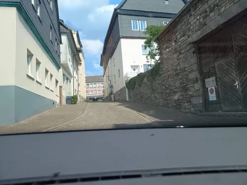
Bäckerei Hahne
Bakery · 2.0 km
2 Apostelstraße, Arnsberg
Mo-Fr 06:30-18:00; Sa 06:30-12:30; Su,PH 08:00-11:00
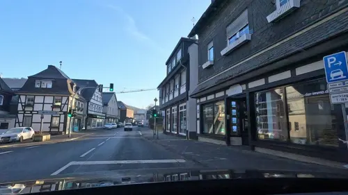
Franzes
Bakery · 6.1 km
25 Hauptstraße, Freienohl
Mo,Tu,Th,Fr 06:30-13:00,14:30-18:00, We 06:30-13:00; Sa 06:30-12:30

'La Baguette'
Restaurant · Bistro, Baguette, Soup, Kaffee, Bowls, Salad · 1.9 km
Ihr Baguette-Stübchen im Herzen von Alt-Arnsberg. Täglich wechselnde Angebote, leckere Hausgemachte Suppen 🍲, Baguette 🥖 , Croques 🥖...
6 Steinweg, Arnsberg
Mo-Fr 08:00-15:00; Sa 09:00-13:00
Waldgasthaus Schürmann
Restaurant · Regional · 7.8 km
7 Lattenberg, Arnsberg
We-Th 11:00-18:00;Fr-Sa 11:00+;Su 11:00-18:00

Backerei Hahne
Bakery · 4.4 km
26 Glösinger Straße, Arnsberg
Mo-Fr 05:30-18:00; Sa 05:30-12:30; Su,PH 08:00-11:00,14:00-17:00
Bäckerei Hahne
Bakery · 1.7 km
56 Gutenbergplatz, Arnsberg
Mo-Fr 06:30-18:00; Sa 06:30-12:30; Su,PH 08:00-11:00

111 more on the map.
History
Arnsberg was first mentioned in 789 in the Carolingian records (Urbar) as belonging to the abbey of Werden.
Arnsberg was the seat of the Counts of Arnsberg from around 1070 and received city rights in 1238. In 1368 Gottfried IV, the last Count of Arnsberg, handed over the city and county to the Electorate of Cologne as he had no heir, whereafter it was incorporated into the Duchy of Westphalia (a possession of Cologne).
They built Arnsberg Castle there, whose remains can still be visited and are occasionally used for public celebrations.
In the 12th century, old Arnsberg became the seat of Westphalian jurisdiction (whose coat of arms is still used today by the Hochsauerlandkreis). Later, the city lost its independence and was subject to the Electors (Archbishops) of Cologne.
Arnsberg Castle was reconstructed by Johann Conrad Schlaun as a residential palace and hunting lodge for Elector Clemens August of Bavaria. It was destroyed in the Seven Years' War in 1769.
In 1794 the French attacked Cologne, so parts of the treasure of the Cologne Cathedral were brought to safety in Arnsberg, along with the relics of the Biblical Magi. In 1804, the treasure was returned to Cologne, as commemorated by a plaque in the Propsteikirche.
In 1816, Arnsberg came under Prussian rule and was made a local administrative centre.
Read more of the history
During the Second World War, Arnsberg first suffered widespread destruction and catastrophic loss of lives when RAF Lancasters breached the dam of the Möhne Reservoir on the night of 16 to 17 May 1943 (Operation Chastise). The nearby Abbey Himmelpforten was completely washed away.
Later, dozens of Arnsberg's citizens were killed in several British air raids aimed at destroying the railway viaduct. The targets were finally destroyed on 19 March 1945 using a 'Grand Slam' bomb.
The current city of Arnsberg was created in 1975 by merging 12 surrounding municipalities (Bachum, Breitenbruch, Herdringen, Holzen, Müschede, Niedereimer, Oeventrop, Rumbeck, Uentrop, Voßwinkel and Wennigloh) into one city.
Old Arnsberg itself and Neheim-Hüsten are the two main urban areas, while the other parts are mainly rural areas.
From the History section of Arnsberg on Wikipedia, under CC BY-SA 4.0.
More about Arnsberg
Geography
Arnsberg is located in the north-east of the Sauerland in the Ruhr river valley. The river Ruhr meanders around the south of the old town of Arnsberg. The town is nearly completely encircled by forest, and the nature park Arnsberger Wald lies to the north. Its neighbouring municipalities are: Ense, Möhnesee,Warstein, Meschede, Sundern, Balve, and Menden.
Arnsberg is connected by Federal Motorway 46 (Autobahn 46) Brilon in the east and (using the Federal Motorway 445) to Werl in the west. It is also connected by several railroad stations, which provide a connection to the major city Dortmund and the Ruhrgebiet. There is also a regional airport, located in the city district of Vosswinkel, which is exclusively used for small private aircraft.
The municipal territory spans a distance of up to 13 kilometres (8.1 mi) from the southern to the northern limits.
Since the local government reforms of 1975, Arnsberg has consisted of 15 boroughs (Ortsteile):
Arts and culture
The Kunstverein Arnsberg operates in Arnsberg. Founded in 1987 and devoted to contemporary art, Kunstverein Arnsberg has presented solo exhibitions by artists including Georg Baselitz, Thomas Ruff, Karin Sander, Dan Perjovschi, Boris Mikhailov, Gregor Schneider, Erwin Wurm, the Turner Prize winner Susan Philipsz and the Marcel Duchamp Prize winner Laurent Grasso.
From the Wikipedia article Arnsberg, under CC BY-SA 4.0.
Notable people from Arnsberg
 Helena FrommGerman taekwondo practitionerPhoto: Heiner Köpke, CC BY-SA 3.0
 Hannah NeiseGerman skeleton racerPhoto: Steffen Prößdorf, CC BY-SA 4.0
 Andrea FischerGerman politician (Bündnis 90/Greens) (1960-)Photo: Martin Lindner, CC BY 3.0
 Philipp HofmannGerman footballerPhoto: Silesia711, CC BY-SA 4.0
 Franz Anton MengeGerman entomologist (1808-1880)Photo: Anton Menge, Johann Heinrich Robert Göppert, Public domain
 Fritz CremerGerman sculptor (1906–1993)Photo: Johannes Riemann, CC BY-SA 4.0
 Olaf RoseGerman historian and politicianPhoto: Sven Teschke, CC BY-SA 3.0 de
 Ludwig Arndts von ArnesbergGerman politician (1803–1878)Photo: Josef Kriehuber, Public domain
- Lothar CollatzGerman mathematician (1910–1990)
- Wilhelm HasencleverGerman politician (1837–1889)
- Betsy von FurstenbergGerman-American actress; baroness (1931-2015)
- Max SchedeGerman surgeon (1844-1902)
Born in Arnsberg, according to Wikidata (CC0). Each name links to its Wikipedia article.
Where to stay22
Churches and places of worship50
Mariä Opferung
Church · Roman Catholic · 7.0 km
38 Hachener Straße, Sundern (Sauerland)
St. Antonius Abbas
Church · Roman Catholic · 7.5 km
2 Lange Straße, Sundern (Sauerland)
Stadtkapelle St. Georg
Church · Catholic · 2.1 km
2 Hanstein, Arnsberg
St.-Franziskus-Xaverius-Kapelle
Church · Catholic · 4.5 km
65 Müssenbergstraße, Arnsberg
Shopping35
Gas and EV charging26
T-Grüne Mineralöl GmbH & Co. KG
Gas station · 5.2 km
19a Niedereimerfeld, Arnsberg
Schools, colleges and libraries28
St. Nikolaus Schule Freienohl Grundschule
School · 6.3 km
3 Pestalozzistraße, Meschede
Healthcare15
Rochus-Apotheke
Clinic and pharmacy · 8.0 km
154 Hauptstraße, Sundern (Sauerland)
Map of Arnsberg
250 places. The map loads OpenStreetMap tiles when you open it.
Getting there and nearby towns
Dortmund Airport (DTM) is the nearest airport with scheduled flights listed in OpenStreetMap, 36 km away.
- Möhnesee 13 km north, about 13 min by car
- Meschede 14 km east, about 14 min by car
- Balve 16 km west, about 16 min by car
- Warstein 20 km east, about 20 min by car
- Wickede 20 km northwest, about 20 min by car
- Soest 21 km north, about 21 min by car
- Belecke 20 km northeast, about 20 min by car
- Hemer 22 km west, about 22 min by car
- Werl 22 km northwest, about 22 min by car
- Bestwig 22 km east, about 22 min by car
Drive times are estimates from straight-line distance, not routes.
Towns near Arnsberg


Keep exploring
Local news
Headlines from INDB.
Reviews, tips and questions
Loading what members have shared...
Sources and licences
- GeoNames (CC BY 4.0): population, coordinates, regions and time zone
- Mapillary (see each image): photos
- OpenStreetMap contributors (ODbL 1.0): places, airports, map data
- Wikidata (CC0 1.0): elevation, founding date, time zone, website
- Wikimedia Commons (see each image): photos
- Wikipedia (CC BY-SA 4.0): overview and history text
Photo credits
- Arnsberg-Altstadt, Jörg Braukmann, CC BY-SA 4.0
- Arnsberg Ruhr im Alten Feld FFSN-2774, Michael Kramer, CC BY-SA 3.0
- Arnsberg Neustadt FFSN-4220, Petra Klawikowski, CC BY-SA 3.0
- Arnsberg Ruhrtalbrücke Rumbeck FFSN-4217, Petra Klawikowski, CC BY-SA 3.0
- Arnsberg Hellefelderstraße FFSN-4069, Petra Klawikowski, CC BY-SA 3.0
- Arnsberg Ruhr b Schuetzenbruecke talauf 20190413 1007, Karlunun, CC BY-SA 4.0
- Arnsberg Sportanlagen Eichholz FFSN-4223, Petra Klawikowski, CC BY-SA 3.0
- Arnsberg Autobahnbrücke Hünenburg FFSN-4213, Petra Klawikowski, CC BY-SA 3.0
- Arnsberg Neustadt FFSN-4061, Petra Klawikowski, CC BY-SA 3.0
- Arnsberg Autobahnbrücken Mühlbachtal und Hünenburg FFSN-4211, Petra Klawikowski, CC BY-SA 3.0
- Hexentanzplatz Eichholz Arnsberg, Machahn, CC BY-SA 4.0
- 030 Mühlengraben bei Arnsberg, Kersti, CC BY-SA 4.0
- NSG Eichholz, 5, Arnsberg, Hochsauerlandkreis, GeorgDerReisende, CC BY-SA 4.0
- 031 Mühlengraben bei Arnsberg, Kersti, CC BY-SA 4.0
- 033 Mühlengraben bei Arnsberg, Kersti, CC BY-SA 4.0
- 032 Brücke über den Mühlengraben bei Arnsberg, Kersti, CC BY-SA 4.0
- 035 Mühlengraben bei Arnsberg, Kersti, CC BY-SA 4.0
- Kinderteich, NSG Eichholz, 4, Arnsberg, Hochsauerlandkreis, GeorgDerReisende, CC BY-SA 4.0
- Wedinghauser Straße 23, 1, Arnsberg, Hochsauerlandkreis, GeorgDerReisende, CC BY-SA 4.0
- 037 Die Ruhr unterhalb der Staustufe für den Mühlengraben bei Arnsberg, Kersti, CC BY-SA 4.0
- 039 Blick von der Kamelbrücke bei Arnsberg auf den Weg "Auf den Kämpen" der unterhalb der Staustufe, Kersti, CC BY-SA 4.0
- Arnsberg Talbrücke Deitmecke FFSN-2760, Michael Kramer, CC BY-SA 3.0
- 038 Blick zur Staustufe der Ruhr für den Mühlengraben bei Arnsberg, Kersti, CC BY-SA 4.0
- 040 Blick von der Kamelbrücke bei Arnsberg auf die RLG-Strecke Neheim–Hüsten Ost–Arnsberg Jägerbrücke, Kersti, CC BY-SA 4.0
- 036 Blick zur Staustufe der Ruhr für den Mühlengraben bei Arnsberg, Kersti, CC BY-SA 4.0
- NSG Eichholz, 3, Arnsberg, Hochsauerlandkreis, GeorgDerReisende, CC BY-SA 4.0
- Kinderteich, NSG Eichholz, 1, Arnsberg, Hochsauerlandkreis, GeorgDerReisende, CC BY-SA 4.0
- Kinderteich, NSG Eichholz, 2, Arnsberg, Hochsauerlandkreis, GeorgDerReisende, CC BY-SA 4.0
- Wedinghauser Straße 19, 1, Arnsberg, Hochsauerlandkreis, GeorgDerReisende, CC BY-SA 4.0
- Wedinghauser Straße 22, 1, Arnsberg, Hochsauerlandkreis, GeorgDerReisende, CC BY-SA 4.0
- Wedinghauser Straße 22, 2, Arnsberg, Hochsauerlandkreis, GeorgDerReisende, CC BY-SA 4.0
- Wedinghauser Straße 17, 1, Arnsberg, Hochsauerlandkreis, GeorgDerReisende, CC BY-SA 4.0
- Arnsberg Lüsenberg FFSN-4058, Petra Klawikowski, CC BY-SA 3.0
- Alter Markt in Arnsberg II, Jörg Braukmann, CC BY-SA 4.0
- Laurentianum A-Bau Eingangsbereich, ABF, CC BY-SA 3.0
- Auferstehungskirche (Arnsberg), Jörg Braukmann, CC BY-SA 4.0
- Haus Niederberge Meschede-Berge, Stefan Didam - Schmallenberg, CC BY-SA 3.0
- Sundern-Hellefeld Kirche, Stefan Didam - Schmallenberg, CC BY-SA 3.0
- Forsthaus Obereimer, Machahn 21:34, 27 March 2008 (UTC), CC BY 3.0
- Arnsbergschloss3, Machahn 11:56, 27 July 2006 (UTC), CC BY-SA 3.0
- Mariengymnasium Arnsberg2, Machahn 21:37, 27 March 2008 (UTC), CC BY 3.0
- Bruchhausenklein, Machahn 09:57, 9 October 2007 (UTC), CC BY 3.0
- Sauerland-Museum Arnsberg, Sauerland-Museum, CC BY-SA 4.0
- Arnsberg Kloster Rumbeck FFSN-2930, Michael Kramer, CC BY-SA 3.0
- Wedinghausen1, Machahn 12:04, 27 July 2006 (UTC), CC BY-SA 3.0
- Oberfreistuhl-abf-, ABF, CC BY-SA 3.0
- St. Petri Hüsten, Jörg Braukmann, CC BY-SA 4.0
- Stadtkapelle St. Georg, Machahn 11:16, 28 January 2007 (UTC), CC BY-SA 3.0
- Marienhospital-arnsberg, A.Savin, CC BY-SA 3.0
- Kulturschmiede 1, Benutzer:Machahn, CC BY-SA 3.0
- Arnsberg Weichsscher Hof Vorderseite, Machahn, CC BY-SA 3.0
- Umspannstation, SchuhE, CC BY-SA 3.0
- Hachen Maria Opferung fd., Friedhelm Dröge, CC BY-SA 4.0
- Sundern-Altenhellefeld-StAntoniusAbbas1-Bubo, Bubo, CC BY-SA 3.0
- NSG HSK-043 Breitenbruch-Neuhaus-13.10.10, Ökologix, CC BY-SA 3.0
- Burg Hachen, Stefan Didam - Schmallenberg, CC BY-SA 3.0
- Ruhr unterhalb Ehmsendenkmal in Arnsberg 2016 b, Guda Oly, CC BY 2.0
- Gymnasium Laurentianum Arnsberg (2), ABF, CC BY-SA 3.0
- Arnsberg 2011 03, Helmlechner, CC BY-SA 3.0
- Street-level photo, sunufatarungo, CC BY-SA 4.0
- Street-level photo, zuse, CC BY-SA 4.0
- Street-level photo, uwekoch, CC BY-SA 4.0
- Street-level photo, herrtichy, CC BY-SA 4.0
- Street-level photo, sunufatarungo, CC BY-SA 4.0
- Street-level photo, algirdasc, CC BY-SA 4.0
- Street-level photo, algirdasc, CC BY-SA 4.0
- Street-level photo, algirdasc, CC BY-SA 4.0
- Street-level photo, algirdasc, CC BY-SA 4.0
- Street-level photo, zuse, CC BY-SA 4.0
- Street-level photo, zuse, CC BY-SA 4.0
- Street-level photo, uwekoch, CC BY-SA 4.0
- Street-level photo, uwekoch, CC BY-SA 4.0
- Street-level photo, sunufatarungo, CC BY-SA 4.0
- Street-level photo, uwekoch, CC BY-SA 4.0
- Street-level photo, live, CC BY-SA 4.0
- Street-level photo, uwekoch, CC BY-SA 4.0
- Street-level photo, mtadsls42, CC BY-SA 4.0
- Street-level photo, chuck, CC BY-SA 4.0
- Street-level photo, uwekoch, CC BY-SA 4.0
- Street-level photo, live, CC BY-SA 4.0
- Street-level photo, uwekoch, CC BY-SA 4.0


Page built November 9, 2026. Spotted a mistake? Tell us or suggest a place.