


Why visit Bad Nauheim
Townapedia lists 143 museums and landmarks, 53 parks and trails, 213 places to eat, 20 places to stay and 19 attractions in and around town.
Highlights include Adolfsturm, Johannisberg, Wetterau-Museum and Dicker Turm.
Weather in Bad Nauheim
Forecast from MET Norway (CC BY 4.0). Full forecast
About Bad Nauheim
Bad Nauheim (German pronunciation: [baːt ˈnaʊhaɪm] ) is a spa town in Wetteraukreis, Hesse, Germany.
From the Wikipedia article Bad Nauheim (this version), under CC BY-SA 4.0.
Travel tips from other travellers: Bad Nauheim on Wikivoyage (CC BY-SA 4.0).
Photos of Bad Nauheim


Things to do19




Hartmann Hofladen
Farm and orchard · 1.8 km
103 Friedberger Straße, Bad Nauheim
Mo-Sa 08:30-12:00, 16:00 - 18:30


Hofladen Schwabe
Farm and orchard · 2.2 km
Tu, Th, Sa 16:00-20:00, Sa 10:30-12:00
7 more on the map.
Museums and landmarks143

Wetterau-Museum
Museum · 3.4 km
16 Haagstraße, Friedberg (Hessen)
Tu-Fr 09:00-12:00, 14:00-17:00, Sa 10:00-12:00, 14:00-17:00, Su 10:00-17:00

Dicker Turm
Monument and historic site · 2.9 km
1 Vorstadt zum Garten, Friedberg (Hessen)

Historische Mikwe / Judenbad
Museum · 3.0 km
Tu-Fr 09:00-12:00,14:00-17:00;Sa,Su 10:00-12:00,14:00-17:00




Maschinenzentrale
Monument and historic site · 0.9 km
5 Am Goldstein, Bad Nauheim
131 more on the map.
Parks, trails and playgrounds53



Gesundheitsgarten
Park
Mar-Apr: 10:00-18:00; May-Aug: 09:00-21:00; Sep: 09:00-19:00; Oct...

Spielplatz Kettelerstraße
Playground · 1.7 km
May-Sep 08:00-21:00, Oct-Apr 08:00-19:00

41 more on the map.
Restaurants and cafes213
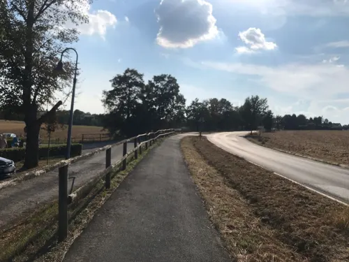
Brunnenwärterhaus
Restaurant · German · 3.0 km
Biergarten neben dem Restaurant
5 Am Sauerbrunnen, Bad Nauheim
Mo-Tu off; We-Sa 17:30-23:00; Su 11:30-22:00
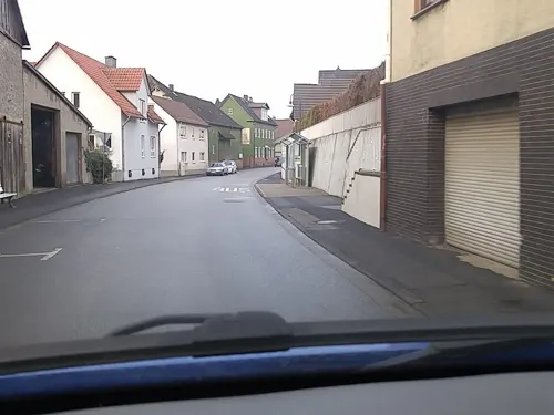
Hof Steinmühle
Restaurant · Buschenschank · 2.2 km
Im Sommer Straußwirtschaft. Ansonsten nur für Events.
2 Schwalheimer Hauptstraße, Bad Nauheim
May 31 - Sep 30: Th,Fr,Su 17:00-22:00
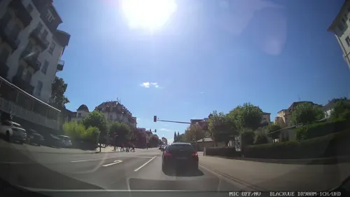
China-Restaurant Jade
Restaurant · Chinese · 0.7 km
6 Bahnhofsallee, Bad Nauheim
Tu-Fr 11:30-15:00,17:30-22:00; Sa,Su,PH 11:30-22:00; Mo off
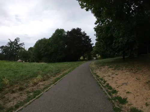
Kaktus
Cafe · Sandwich · 3.3 km
16 Hospitalgasse, Friedberg (Hessen)
Mo-Th 18:00-01:00; Fr-Sa 18:00-02:00
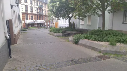
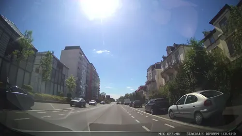
Miso
Restaurant · Sushi · 0.7 km
18 Frankfurter Straße, Bad Nauheim
Mo-Sa 11:30-22:30; PH,Su 15:00-22:30
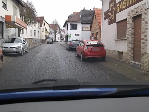
Rote Pumpe Straußwirtschaft
Bar and pub · Regional · 2.2 km
6 Nieder-Mörler-Straße, Bad Nauheim
Tu-Sa 16:00-22:00; Su,PH 13:00-22:00
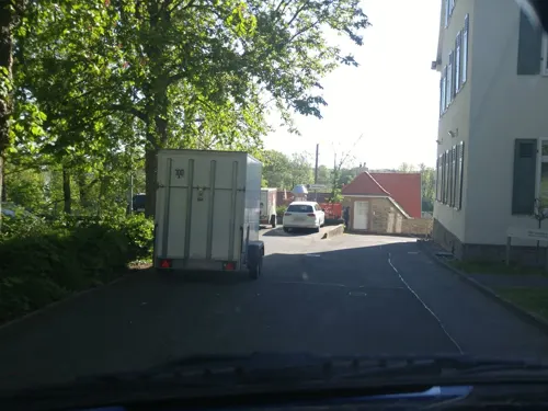
Zeitgeist
Restaurant · Regional · 0.8 km
16 Nördlicher Park, Bad Nauheim
We-Sa 12:00-14:30, 17:30-22:00, Su 11:00-15:00, 17:00-20:00

Da Davide
Restaurant · Pizza, Italian
17 In den Kolonnaden, Bad Nauheim
Tu-Su 11:30-14:30, 17:30-23:00; Mo off

El Sol
Restaurant · Spanish, Italian · 1.0 km
71 Schwalheimer Straße, Bad Nauheim
We-Mo,PH 11:30-14:30,17:30-23:00
201 more on the map.
History
Before the Holocaust, there had been an on-and-off Jewish presence in Bad Nauheim since around 1303. At that time, nearly 400 Jews lived in the town, making up nearly 3% of the population. On Kristallnacht, the schoolhouse, Jewish stores, businesses and the synagogue were desecrated and ransacked. Many Jews were taken to concentration camps that night. Some were released. Of those set free, many were rearrested. By the end of the Holocaust, there were just three Jews remaining in Bad Nauheim. For the most part, those who were not murdered had left the country.
The Grand Hotel in Bad Nauheim was also the location of the Gestapo-led internment of around 115 Americans who were working in the U.S. Embassy as well as American journalists in Berlin in December 1941. During their five-month internment at the Grand Hotel, they published the Bad Nauheim Pudding, a locally created newspaper, until it was censored by the Germans. They also formed what they called Badheim University, which allowed the internees education in areas such as languages, phonetics, bible study, and travelogs. The group would leave Bad Nauheim on 12 May 1942 after their five-month internment in Jeschke's Grand Hotel.
Read more of the history
During World War II, Adolf Hitler had a command complex in nearby Langenhain-Ziegenberg called Adlerhorst, "the Eagle's Nest" (not to be confused with Kehlsteinhaus of Obersalzberg, which was never referred to as "the Eagle's Nest" by the Nazis).
On 29 March 1945 Bad Nauheim was occupied by troops from the US Third Army. It was occupied by troops of the Fifteenth United States Army, which was a small group tasked with gathering historical information of Allied operations and documenting tactical methods of war from the Allied troops. It was used as a residential area for American occupation forces after World War II. Despite its proximity to Frankfurt am Main and Hitler's command complex, Bad Nauheim was totally spared from Allied bombing. American occupants from that time were told that President Roosevelt had loved the town so much from his days there that he ordered it spared.
Elvis Presley lived in Bad Nauheim from 1958 to 1960 while serving in the U.S. Army. At the time, he was assigned to the 1st Medium Tank Battalion, 32d Armor, 3d Armored Division, at Ray Barracks near Friedberg. Since 2002, Bad Nauheim has hosted an annual Elvis festival.
Other famous people who have stayed in the town include Jamsetji Tata, founder of the Tata Group conglomerate company (he died in Bad Nauheim on 19 May 1904 at the age of 82), Irish novelist and Catholic priest Patrick Sheehan (who holidayed at the Hotel Augusta Victoria in Bad Nauheim from 6–23 September 1904), Franklin D. Roosevelt (as a boy, FDR had been taken for several extended visits to Bad Nauheim where his father underwent a water cure for his heart condition), the Saudi Arabian football team during the 2006 FIFA World Cup, George S. Patton (who celebrated his sixtieth birthday in the grand ballroom of the Grand Hotel), and Albert Kesselring, a Nazi general who died there in 1960.
From the History section of Bad Nauheim on Wikipedia, under CC BY-SA 4.0.
Notable people from Bad Nauheim
 Jasmin MoghbeliUS astronautPhoto: Bill Stafford, Public domain
 Caroline LinkGerman film director and screenwriterPhoto: Kaethe17, CC BY-SA 4.0
 Jürgen PontoGerman banker and chairman of the Dresdner Bank board of directors (1923-1977)Photo: Lutz Kleinhans, CC BY-SA 4.0
 Karl Christian von LangsdorfGerman scientistPhoto: zeitgenössischer Stecher, Public domain
 Dirk SchlächterGerman musicianPhoto: Dario De Marco, Public domain
 Julian DuddaGerman footballerPhoto: Steffen Ewald, CC BY-SA 3.0
 Heinrich StröbelGerman journalist and politician (1869-1944)Photo: Deutsches Reich. Reichstag., Public domain
 Knut FleckensteinGerman politicianPhoto: Diliff, CC BY-SA 3.0
 Charles LahrGerman anarchist, bookseller and publisher (1885–1971)Photo: Unknown author Unknown author, Public domain
- Rainer PhilippOlympic ice hockey player
- Holger GeschwindnerGerman basketball player
- Tufan TosunoğluTurkish association football player (born 1988)
Born in Bad Nauheim, according to Wikidata (CC0). Each name links to its Wikipedia article.
Where to stay20
Churches and places of worship22
Reinhardskirche
Church · Russian Orthodox
14 Reinhardstraße, Bad Nauheim
Stadtkirche 'Unserer Lieben Frau'
Church · Protestant · 3.3 km
44 Engelsgasse, Friedberg (Hessen)
Bonifatiuskirche
Church · Roman Catholic
13 Zanderstraße, Bad Nauheim
Gustav-Adolf-Kapelle
Church · Protestant · 3.0 km
18 Nauheimer Straße, Ober-Mörlen
Shopping33
Gas and EV charging12
Ladestation im City-Parkhaus
EV charging · 3.3 km
Alte Bahnhofstraße, Friedberg (Hessen)
Tankcenter Nieder-Mörlen
Gas station · 2.0 km
245 Frankfurter Straße, Bad Nauheim
Schools, colleges and libraries35
Bibliothekszentrum Klosterbau
Library · 3.2 km
8 Augustinergasse, Friedberg (Hessen)
Johann-Peter-Schäfer-Schule für Blinde und Sehbehinderte
School · 3.1 km
1 Johann-Peter-Schäfer-Straße, Friedberg (Hessen)
Bibliothekszentrum Klostebau
Library · 3.1 km
8 Augustinergasse, Friedberg (Hessen)
Healthcare26
Klinik für Psychiatrie & Psychotherapie
Hospital · 3.4 km
3 Johann-Peter-Schäfer-Straße, Friedberg (Hessen)
Map of Bad Nauheim
250 places. The map loads OpenStreetMap tiles when you open it.
Getting there and nearby towns
Frankfurt Airport (FRA) is the nearest airport with scheduled flights listed in OpenStreetMap, 40 km away.
- Friedberg 3 km south, about 3 min by car
- Ober-Mörlen 4 km west, about 4 min by car
- Wölfersheim 7 km northeast, about 7 min by car
- Rosbach vor der Höhe 8 km southwest, about 8 min by car
- Butzbach 9 km northwest, about 9 min by car
- Reichelsheim 10 km east, about 10 min by car
- Münzenberg 10 km north, about 10 min by car
- Florstadt 11 km southeast, about 11 min by car
- Echzell 11 km east, about 11 min by car
- Friedrichsdorf 14 km southwest, about 14 min by car
Drive times are estimates from straight-line distance, not routes.
Towns near Bad Nauheim


Keep exploring
Local news
Headlines from INDB.
Reviews, tips and questions
Loading what members have shared...
Sources and licences
- GeoNames (CC BY 4.0): population, coordinates, regions and time zone
- Mapillary (see each image): photos
- OpenStreetMap contributors (ODbL 1.0): places, airports, map data
- Wikidata (CC0 1.0): elevation, founding date, time zone, website
- Wikimedia Commons (see each image): photos
- Wikipedia (CC BY-SA 4.0): overview and history text
Photo credits
- Bad Nauheim Aerial fg017, Fritz Geller-Grimm, CC BY-SA 3.0
- Bad Nauheim-Dankeskirche von Suedwesten-20140319, Mylius, GFDL 1.2
- Bad Nauheim-Reinhardskirche von Suedwesten-20140319, Mylius, GFDL 1.2
- Bad Nauheim-Dankeskirche von Nordwesten-20140319, Mylius, GFDL 1.2
- Bad Nauheim-Alicenstrasse 13 15 von Nordwesten-20140308, Mylius, GFDL 1.2
- Bad Nauheim-Alicenstrasse 19 von Nordwesten-20140308, Mylius, GFDL 1.2
- Bad Nauheim, Aliceplatz - geo.hlipp.de - 19682, Helmut Zozmann on geo.hlipp.de, CC BY-SA 2.0
- Bad Nauheim, Schulstraße 10 (1), Karsten11, CC0
- Bad Nauheim, Schulstraße 10, Karsten11, CC0
- Bad Nauheim, Aliceplatz - geo.hlipp.de - 19674, Helmut Zozmann on geo.hlipp.de, CC BY-SA 2.0
- Bad Nauheim-Reinhardskirche von Nordosten-20140319, Mylius, GFDL 1.2
- Bad Nauheim-Hauptstrasse 29 31 von Suedwesten-20140311, Mylius, GFDL 1.2
- Bad Nauheim-Parkstrasse 4 von Nordwesten-20140306, Mylius, GFDL 1.2
- Bad Nauheim-Parkstrasse 8 von Nordosten-20140306, Mylius, GFDL 1.2
- Tablet bei Oldtimerparade in Bad Nauheim, Hydro, CC BY-SA 4.0
- Oldtimerparade Bad Nauheim (05), Hydro, CC BY-SA 4.0
- Oldtimerparade Bad Nauheim (03) Cadillac, Hydro, CC BY-SA 4.0
- Oldtimerparade Bad Nauheim (02), Hydro, CC BY-SA 4.0
- Oldtimerparade Bad Nauheim (04), Hydro, CC BY-SA 4.0
- Oldtimerparade Bad Nauheim (07) Opel, Hydro, CC BY-SA 4.0
- Oldtimerparade Bad Nauheim (08), Hydro, CC BY-SA 4.0
- Oldtimerparade Bad Nauheim (06) Opel, Hydro, CC BY-SA 4.0
- Bad Nauheim-Hauptstrasse 24 von Suedosten-20140308, Mylius, GFDL 1.2
- Kurpark Bad Nauheim (1), Hydro, CC BY-SA 4.0
- Bad Nauheim-Terrassenstrasse 2 von Suedosten-20140307, Mylius, GFDL 1.2
- Kurstraße 9 (Bad Nauheim) 03, Cherubino, CC BY-SA 4.0
- Bad Nauheim-Friedrichstrasse 3 von Suedosten-20140311, Mylius, GFDL 1.2
- Bad Nauheim-Friedrichstrasse 1 von Suedosten-20140311, Mylius, GFDL 1.2
- Bad Nauheim Dankeskirche Altarraum, TeKaBe, CC BY-SA 4.0
- Bad Nauheim Dankeskirche Mittelschiff, TeKaBe, CC BY-SA 4.0
- Bad Nauheim-Friedrichstrasse 11 von Nordosten-20140311, Mylius, GFDL 1.2
- Bad Nauheim-Parkstrasse 32 von Nordwesten-20140306, Mylius, GFDL 1.2
- Bad Nauheim Karlbrunnen, Indiana68, CC BY-SA 4.0
- Bad Nauheim Karlbrunnen Info, Indiana68, CC BY-SA 4.0
- Bad Nauheim-Terrassenstrasse 4 von Nordosten-20140307, Mylius, GFDL 1.2
- Bad Nauheim-Burgscheune von Suedosten-20140311, Mylius, GFDL 1.2
- Kurbrunnen3 Bad Nauheim, Indiana68, CC BY-SA 4.0
- Bad Nauheim, Heilwasser-Analyse Kurbrunnen, DocWoKav, CC BY-SA 4.0
- Bad Nauheim, Heilwasser-Analyse Karlsbrunnen, DocWoKav, CC BY-SA 4.0
- Bad Nauheim, Heilwasser-Analyse Ludwigsbrunnen, DocWoKav, CC BY-SA 4.0
- Schanze Bad Nauheim, Frank Winkelmann, CC BY 3.0
- Friedberg Hessen - Burg Friedberg Haupttor Suedseite, Harald Gärtner, CC BY-SA 3.0
- Friedberg (Hessen) Eingang Burg, Sven Teschke, CC BY-SA 3.0
- ECN Choreo of fan section behind the goal, Chivista, CC BY-SA 3.0
- Judenbad Friedberg Innenansicht f. Wikipedia Foto K.Augustin, Stadtarchiv Friedberg, CC BY-SA 3.0
- Bad Nauheim Aussichtsturm auf dem Johannisberg von N, Heinrich Stürzl, CC BY-SA 4.0
- Sankt Lioba Schule - 3, James Steakley, CC BY-SA 4.0
- Bad Nauheim Johannisberg 1900, Unknown author Unknown author, Public domain
- Friedberg Hessen -Stadtpfarrkirche Unserer Lieben Frau von Suedwesten-20140319, Mylius, GFDL 1.2
- Bad Nauheim Sprudelhof, Eve Zedd, CC BY-SA 3.0
- Friedberg - Stadtmuseum, Oliver Abels ( SBT ), CC BY-SA 3.0
- Wilhelmskirche, Tadam, CC BY-SA 4.0
- NSG Salzwiesen von Wisselsheim DJI 0596, Michael Wolf ( Webseite ), CC BY-SA 3.0
- Bad Nauheim-St Bonifatius von Suedwesten-20140314, Mylius, GFDL 1.2
- St. Georgskapelle (Friedberg) Außen 01, Cherubino, CC BY-SA 4.0
- NSG Kiesgrube Laukertsberg bei Nieder-Mörlen DJI 0579, Michael Wolf ( Webseite ), CC BY-SA 3.0
- Friedberg (Hessen) Adolfsturm 4735, Sven Teschke , Büdingen, CC BY-SA 3.0 de
- Der dicke Turm (Friedberg) 03, Cherubino, CC BY-SA 4.0
- Steinern Kreuz (Friedberg) 18, Cherubino, CC BY-SA 4.0
- Christuskirche Nieder Moerlen Sommer, Rockhunt2000, CC BY-SA 4.0
- Bad Nauheim Römischer Signalturm auf dem Johannisberg von O, Heinrich Stürzl, CC BY-SA 4.0
- Bad Nauheim-Stadtschule von Nordwesten-20140306, Mylius, GFDL 1.2
- Usa-Kapellchen, 1, Nieder-Mörlen, Bad Nauheim, Wetteraukreis, GeorgDerReisende, CC BY-SA 4.0
- LGS Bad Nauheim Kristallturm 3151, Sven Teschke , Büdingen, CC BY-SA 3.0 de
- Bad Nauheim-Burgscheune von Westen-20140308, Mylius, GFDL 1.2
- Street-level photo, scg1176, CC BY-SA 4.0
- Street-level photo, troher15, CC BY-SA 4.0
- Street-level photo, scg1176, CC BY-SA 4.0
- Street-level photo, chuck, CC BY-SA 4.0
- Street-level photo, chuck, CC BY-SA 4.0
- Street-level photo, scg1176, CC BY-SA 4.0
- Street-level photo, scg1176, CC BY-SA 4.0
- Street-level photo, scg1176, CC BY-SA 4.0
- Street-level photo, lllooommm, CC BY-SA 4.0
- Street-level photo, tmka, CC BY-SA 4.0
- Street-level photo, kreuzschnabel, CC BY-SA 4.0
- Street-level photo, scg1176, CC BY-SA 4.0
- Street-level photo, mfa, CC BY-SA 4.0
- Street-level photo, troher15, CC BY-SA 4.0
- Street-level photo, dominik354, CC BY-SA 4.0
- Street-level photo, scg1176, CC BY-SA 4.0
- Street-level photo, scg1176, CC BY-SA 4.0
- Street-level photo, scg1176, CC BY-SA 4.0
- Street-level photo, chuck, CC BY-SA 4.0
- Street-level photo, lllooommm, CC BY-SA 4.0
- Street-level photo, scg1176, CC BY-SA 4.0
- Street-level photo, scg1176, CC BY-SA 4.0
- Street-level photo, troher15, CC BY-SA 4.0
- Street-level photo, tmka, CC BY-SA 4.0
- Street-level photo, scg1176, CC BY-SA 4.0
- Street-level photo, miguel_andrade, CC BY-SA 4.0
- Street-level photo, kreuzschnabel, CC BY-SA 4.0
- Street-level photo, scg1176, CC BY-SA 4.0
- Street-level photo, kreuzschnabel, CC BY-SA 4.0


Page built November 9, 2026. Spotted a mistake? Tell us or suggest a place.