


Bergheim, Germany
Bergheim is a town of 63,558 people in North Rhine-Westphalia, Germany.
Why visit Bergheim
Townapedia lists 118 museums and landmarks, 41 parks and trails, 203 places to eat, 13 places to stay and 16 attractions in and around town.
Highlights include Medio.Rhein.Erft, Glessener Höhe, Pianomuseum Haus Eller and Burg Grouven.
Weather in Bergheim
Forecast from MET Norway (CC BY 4.0). Full forecast
About Bergheim
Bergheim (German pronunciation: [ˈbɛʁkhaɪm] ; Ripuarian: Berchem) is a German town, 22 km west of Cologne and the capital of the Rhein-Erft-Kreis (district). The town's Niederaußem district is one of the most important suppliers for energy from lignites in Europe.
From the Wikipedia article Bergheim, North Rhine-Westphalia (this version), under CC BY-SA 4.0.
Photos of Bergheim


Things to do16




Hofladen Fam. Rüttgers
Farm and orchard · 2.6 km
Hähnsaler Hof, Bergheim
Tu 09:00-12:00; Fr 15:00-18:00; Sa 09:00-12:00; PH off

4 more on the map.
Museums and landmarks118


Burg Grouven
Monument and historic site · 3.3 km
48 Römerstraße, Elsdorf

Schloss Bedburg
Monument and historic site · 6.3 km
34 Graf-Salm-Straße, Bedburg




Dresens Fahrradhaus
Monument and historic site
39 Hauptstraße, Bergheim
Energieausstellung
Museum · 2.4 km
Schließzeiten Weihnachten/Neujahr 19/20 und Karneval 2020 sind ergänzt
Sa,Su,PH 10:00-17:00
106 more on the map.
Parks, trails and playgrounds41


Wald und Wiesenflächen zwischen Schloss Frens und Pliesmühle
Hiking and trails · 4.8 km

Schlosspark Paffendorf
Park · 2.5 km
Apr-Sep: Mo-Su,PH 10:00-19:00; Oct: Mo-Su,PH 10:00-17:00; Nov-Mar:...




Jakob-Bühr-Platz
Park · 3.2 km
Benannt nach einem ehemaligen Ortsvorsteher von Quadrath-Ichendorf
29 more on the map.
Restaurants and cafes203

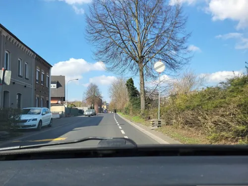
ICI
Restaurant · Steak House · 6.1 km
Argentinisches Steakhaus
7-9 Adolf-Silverberg-Straße, Bedburg
Tu-Th 19:00-24:00; Fr 18:00-24:00; Sa 00:00-01:00, 18:00-24:00; Su...
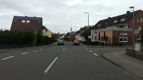
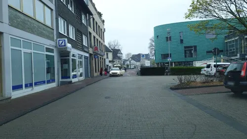
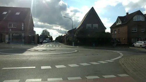
Da Pizza Boys
Restaurant · Pizza · 3.6 km
10 Wiedenaustraße, Bergheim
Mo-Sa 11:30-22:30; Th 12:00-22:30; Su 15:00-22:30
Eiscafe Cucco's
Ice cream · Ice Cream, Cake, Coffee · 5.6 km
106 Köln-Aachener Straße, Elsdorf
Feb-Sep Mo-Sa 12:30-20:00; Feb-Sep Su 12:00-20:00; Feb-Sep Th off;...

Alexander
Restaurant · Greek · 5.8 km
126 Erftstraße, Kerpen
Mo,We-Sa 17:00-23:00; Su 11:30-14:30,17:00-22:00
Alt Giesendorf
Restaurant · Regional · 5.7 km
91 Etzweilerstraße, Elsdorf
We-Sa 17:00-23:00; Su 11:30-14:30, 17:00-22:00; Mo off
Brauhaus zur Krone
Restaurant · Regional
78 Hauptstraße, Bergheim
Tu-Sa 11:30-14:30,17:00-24:00; Su, PH 12:00-21:00

Del Sole - Restaurant & Pizzeria
Restaurant · Italian · 5.9 km
25 Astrid-Lindgren-Straße, Kerpen
Tu-Sa 17:00-23:00, Su 12:00-22:00

191 more on the map.
History
There is a burial hill in Niederaußem, dating from about 4000 BC. Romans settled in Bergheim around 50 BC. They constructed the major Roman road, the Via Belgica, that crossed the area where Bergheim is today. Later the Franks took control over the region. In the Middle Ages, Bergheim was granted city rights and later became part of the County of Jülich. In the 19th and 20th centuries Bergheim grew rapidly through the settlement of industry based on the local lignite coal. In World War II, the Wesseling synthetic oil plant was bombed during the Oil Campaign of World War II. Then in April 1944, a large underground plant for synthetic oil manufactured from lignite was set up outside Bergheim.
From the History section of Bergheim, North Rhine-Westphalia on Wikipedia, under CC BY-SA 4.0.
More about Bergheim
Geography
Bergheim is about 22 km west of Cologne, approximately 72 metres above sea level. Its highest point is the Glessener Höhe (Glessen Height) at 204 metres. The Erft River flows through Bergheim. The town lies in the Zülpicher Börde, which belongs to the Kölner Bucht. Economically and geographically Bergheim is in the Rhenish lignite coalfield.
From the Wikipedia article Bergheim, North Rhine-Westphalia, under CC BY-SA 4.0.
Notable people from Bergheim
 Wolfgang SeifenGerman organistPhoto: Double Croche, CC0
- Christian MüllerGerman footballer, born 1938
- Sarah KreuzGerman singer
Born in Bergheim, according to Wikidata (CC0). Each name links to its Wikipedia article.
Where to stay13
Churches and places of worship43
St. Luzia
Church · Roman Catholic · 6.2 km
2 Wilhelm-Sommer-Straße, Elsdorf
Alte St. Willibrord Kirche
Church · Catholic · 5.2 km
46 Theodor-Heuss-Straße, Bedburg
St. Cosmas und Damianus
Church · Catholic · 3.6 km
1 Pfarrer-Piel-Straße, Bergheim
Shopping58
Gas and EV charging21
Schools, colleges and libraries41
Healthcare25
Praxis für Mund-, Kiefer- und Gesichtschirurgie
Clinic and pharmacy · 0.6 km
15 Blumenstraße, Bergheim
Map of Bergheim
250 places. The map loads OpenStreetMap tiles when you open it.
Getting there and nearby towns
Düsseldorf-Mönchengladbach Airport (MGL) is the nearest airport with scheduled flights listed in OpenStreetMap, 32 km away.
- Elsdorf 5 km west, about 5 min by car
- Bedburg 6 km northwest, about 6 min by car
- Kerpen 10 km southeast, about 10 min by car
- Rommerskirchen 9 km north, about 9 min by car
- Pulheim 13 km northeast, about 13 min by car
- Frechen 13 km east, about 13 min by car
- Türnich 13 km southeast, about 13 min by car
- Niederzier 15 km southwest, about 15 min by car
- Grevenbroich 16 km north, about 16 min by car
- Titz 16 km west, about 16 min by car
Drive times are estimates from straight-line distance, not routes.
Towns near Bergheim


Keep exploring
Local news
Headlines from INDB.
Reviews, tips and questions
Loading what members have shared...
Sources and licences
- GeoNames (CC BY 4.0): population, coordinates, regions and time zone
- Mapillary (see each image): photos
- OpenStreetMap contributors (ODbL 1.0): places, airports, map data
- Wikidata (CC0 1.0): elevation, founding date, time zone, website
- Wikimedia Commons (see each image): photos
- Wikipedia (CC BY-SA 4.0): overview and history text
Photo credits
- Bürgermeistersäule in Bergheim NRW, Bob Goedert, CC BY-SA 4.0
- Kriegerdenkmal, Bergheim, Rhein-Erft-Kreis-1638, Raimond Spekking, CC BY-SA 4.0
- Kriegerdenkmal, Bergheim, Rhein-Erft-Kreis-1637, Raimond Spekking, CC BY-SA 4.0
- Kriegerdenkmal, Bergheim, Rhein-Erft-Kreis-1639, Raimond Spekking, CC BY-SA 4.0
- Kriegerdenkmal, Bergheim, Rhein-Erft-Kreis-1636, Raimond Spekking, CC BY-SA 4.0
- Medio.Rhein.Erft, Bergheim-1631, Raimond Spekking, CC BY-SA 4.0
- Medio.Rhein.Erft, Bergheim-1632, Raimond Spekking, CC BY-SA 4.0
- Medio.Rhein.Erft, Bergheim-1629, Raimond Spekking, CC BY-SA 4.0
- Bierbrunnen beim Rathaus Bergheim Erft (a), Bob Goedert, CC0
- Bierbrunnen beim Rathaus Bergheim Erft (d), Bob Goedert, CC0
- Bierbrunnen beim Rathaus Bergheim Erft (c), Bob Goedert, CC0
- Bierbrunnen beim Rathaus Bergheim Erft (b), Bob Goedert, CC0
- Rathaus Bergheim-1646, Raimond Spekking, CC BY-SA 4.0
- Rathaus Bergheim-1642, Raimond Spekking, CC BY-SA 4.0
- Rathaus Bergheim-1625, Raimond Spekking, CC BY-SA 4.0
- Rathaus Bergheim-1647, Raimond Spekking, CC BY-SA 4.0
- Rathaus Bergheim-1643, Raimond Spekking, CC BY-SA 4.0
- Rathaus Bergheim-1624, Raimond Spekking, CC BY-SA 4.0
- Gletscherfindlinge beim Rathaus Bergheim, Bob Goedert, CC0
- Bethlehemer Straße, Bergheim, Blick Richtung Nordosten-1630, Raimond Spekking, CC BY-SA 4.0
- Kalvarienberg, Bergheim, Rhein-Erft-Kreis-1627, Raimond Spekking, CC BY-SA 4.0
- Hubert-Rheinfeld-Platz, Bergheim, Blick Richtung Osten-1628, Raimond Spekking, CC BY-SA 4.0
- Historisches Rathaus Bergheim-1641, Raimond Spekking, CC BY-SA 4.0
- Historisches Rathaus Bergheim-1645, Raimond Spekking, CC BY-SA 4.0
- Historisches Rathaus Bergheim-1644, Raimond Spekking, CC BY-SA 4.0
- Cäcilienweg, Bergheim, Blick Richtung Nordosten-1675, Raimond Spekking, CC BY-SA 4.0
- Bergheim Klosterstraße Stolperstein Hilde Falk, Bob Goedert, CC BY-SA 4.0
- Bergheim Klosterstraße Stolperstein Isidor Falk, Bob Goedert, CC BY-SA 4.0
- Synagoge Bergheim (NRW) Gedenkplatte, Bobophon, CC BY-SA 4.0
- Bergheim, Kunstinstallation Kölner Tor, Stadtplan als Bodenrelief, Bob Goedert, CC0
- Baudenkmal Bergheim-Erft Hauptstr 98 Knabenpensionat (Plaque), Bob Goedert, CC0
- Baudenkmal Bergheim-Erft Hauptstr 87 Die Arche (Plaque), Bob Goedert, CC0
- Baudenkmal Bergheim-Erft Hauptstr 87 Die Arche, Bob Goedert, CC0
- Baudenkmal Bergheim-Erft Hauptstr 89 Bartholomäus-Ehlen-Haus (Plaque), Bob Goedert, CC0
- Baudenkmal Bergheim-Erft Hauptstr 89 Bartholomäus-Ehlen-Haus, Bob Goedert, CC0
- Baudenkmal Bergheim-Erft Hauptstr 91 Over-Haus, Bob Goedert, CC0
- Glessener Höhe, Alexander Orth, Public domain
- Burg-hemmersbach, A.Savin, CC BY-SA 3.0
- Burg stammeln elsdorf, Klaus Graf, CC BY-SA 3.0
- Erftgymnasium, A.Savin, CC BY-SA 3.0
- Niederaußem Erlöserkirche 01, Achim Raschka ( talk ), CC BY-SA 4.0
- Para-cycling German championships and Europe Cup 2016 08, Nicola, CC BY-SA 4.0
- Ahe Sindorfer Straße 19 02, Achim Raschka ( talk ), CC BY-SA 4.0
- Denkmal 018 - Haus Laach, DaRealFox, CC BY-SA 3.0
- Medio.Rhein.Erft, Tohma, CC BY-SA 4.0
- St. Kosmas und Damian (Glesch) (1), Chris06, CC BY-SA 4.0
- Petrikirche, Quadrath-Ichendorf-9461, Raimond Spekking, CC BY-SA 3.0
- Quadrath-Ichendorf Heilig Kreuz 01, Achim Raschka ( talk ), CC BY-SA 4.0
- Heppendorf Katholische Kirche 01, Achim Raschka ( talk ), CC BY-SA 4.0
- Kerpen-Sindorf Church StUlrich, A.Savin, CC BY-SA 3.0
- Evkirche-sindorf, A.Savin, CC BY-SA 3.0
- Kirdorf - Theodor-Heuss-Straße 46 Kirche, Alt-Sankt-Willibrordus III, NoRud, CC BY-SA 4.0
- Aachener Tor, Tohma ( talk ), CC BY-SA 4.0
- Burg-grouven, A.Savin, CC BY-SA 3.0
- Schloss Bedburg 3, Tohma ( talk ), CC BY-SA 4.0
- Burg Thorr; (4) Gesamtansicht, Denkmal-Nr. 5, Bergheim, Horst Schmitz, CC BY-SA 3.0
- Rath - Rather Mühle 3, NoRud, CC BY-SA 4.0
- Bedburg-Werwolfweg-Kasterer See 01, Dat doris, CC BY-SA 4.0
- Rurmäander, Moramaso, CC BY-SA 4.0
- Kirche Angelsdorf, Wickie37, CC BY-SA 3.0
- Ahe Kirche 01, Achim Raschka ( talk ), CC BY-SA 4.0
- SchlossPaffendorf, Bert, CC BY 2.0
- Rheinisches Braunkohlerevier DE, Thoroe, CC BY-SA 2.0
- Street-level photo, noel, CC BY-SA 4.0
- Street-level photo, walldi222, CC BY-SA 4.0
- Street-level photo, hirschkauz, CC BY-SA 4.0
- Street-level photo, hirschkauz, CC BY-SA 4.0
- Street-level photo, etlam, CC BY-SA 4.0
- Street-level photo, etlam, CC BY-SA 4.0
- Street-level photo, hirschkauz, CC BY-SA 4.0
- Street-level photo, Joshingalu, CC BY-SA 4.0
- Street-level photo, walldi222, CC BY-SA 4.0
- Street-level photo, noel, CC BY-SA 4.0
- Street-level photo, etlam, CC BY-SA 4.0
- Street-level photo, etlam, CC BY-SA 4.0
- Street-level photo, noel, CC BY-SA 4.0
- Street-level photo, etlam, CC BY-SA 4.0
- Street-level photo, mfa, CC BY-SA 4.0
- Street-level photo, noel, CC BY-SA 4.0
- Street-level photo, mfa, CC BY-SA 4.0
- Street-level photo, etlam, CC BY-SA 4.0
- Street-level photo, hektor1989, CC BY-SA 4.0
- Street-level photo, bigpapa2908, CC BY-SA 4.0
- Street-level photo, noel, CC BY-SA 4.0
- Street-level photo, walldi222, CC BY-SA 4.0
- Street-level photo, bigpapa2908, CC BY-SA 4.0
- Street-level photo, walldi222, CC BY-SA 4.0


Page built November 9, 2026. Spotted a mistake? Tell us or suggest a place.