


Why visit Diekholzen
Townapedia lists 44 museums and landmarks, 19 parks and trails, 32 places to eat, 4 places to stay and 26 attractions in and around town.
Highlights include Bosenberg, Griesberg, Roemer- und Pelizaeus-Museum and Marienburg.
Weather in Diekholzen
Forecast from MET Norway (CC BY 4.0). Full forecast
About Diekholzen
Diekholzen is a village and a municipality in the district of Hildesheim, in Lower Saxony, Germany. It is situated approximately 6 km southwest of Hildesheim on the Beuster, a tributary of the Innerste.
From the Wikipedia article Diekholzen (this version), under CC BY-SA 4.0.
Things to do26





14 more on the map.
Museums and landmarks44

Roemer- und Pelizaeus-Museum
Museum · 6.1 km
Museum in Hildesheim, Germany, among others with collection of ancient Egypt



32 more on the map.
Parks, trails and playgrounds19


Friedrich-Ebert-Stadion
Sports field and stadium · 4.9 km
1 An der Pottkuhle, Hildesheim




7 more on the map.
Restaurants and cafes32

Söhrer Forsthaus
Restaurant · German · 2.8 km
13 Forststraße, Diekholzen
Mo-Tu off; We-Fr 15:00-22:00; Sa 12:00-22:00; Su 11:30-17:00
Kupferschmiede
Restaurant · 3.5 km
6 Steinberg, Hildesheim
Th,Fr 17:00-21:00; Sa,Su 11:00-21:00; Mo-We off
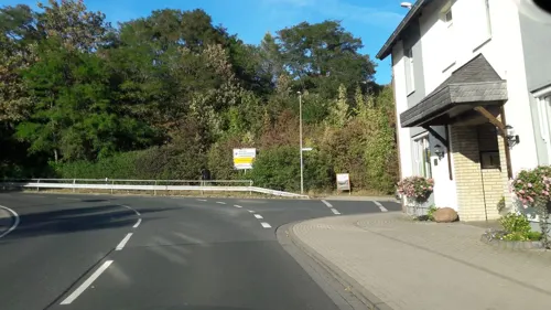
Zur Scharfen Ecke
Restaurant · German · 4.9 km
1 Itzumer Hauptstraße, Hildesheim
Mo-Fr 17:30+; Tu off; We off; Sa,Su 11:30+
7Berge
Restaurant · Pizza, Burger, Indian, Greek, Pakistani, Noodle, Salad · 4.8 km
13 Kurze Halbe, Sibbesse
Tu-Su 12:00-22:00

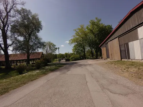
Hofcafé
Cafe · 4.8 km
14 Domänenstraße, Hildesheim
Tu-Su 09:00-18:00


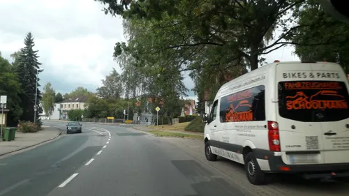


Cafe und Begegnungsstätte K16
Cafe · 2.8 km
16 Klagesberg, Diekholzen
20 more on the map.
History
In 1974, the former villages of Diekholzen, Söhre, Barienrode and Egenstedt were united to form the municipality of Diekholzen. Each village has its own history and various sights. Most of the inhabitants are Roman Catholics. The largest village of the municipality is Diekholzen with an administration building, a school, a hospital, several shops, a supermarket, some restaurants and a hotel. Several times a day, each village of the municipality is accessible from Hildesheim and from Alfeld by bus.
From the History section of Diekholzen on Wikipedia, under CC BY-SA 4.0.
Where to stay4
Churches and places of worship30
Klosterkirche St. Michael Marienrode
Church · Roman Catholic · 2.0 km
Egloffsteinstraße, Hildesheim
Shopping10
Gas and EV charging4
Schools, colleges and libraries9
Healthcare4
Luisen Apotheke
Clinic and pharmacy · 3.6 km
57a Kurt-Schumacher-Straße, Hildesheim
Map of Diekholzen
182 places. The map loads OpenStreetMap tiles when you open it.
Getting there and nearby towns
Hannover Airport (HAJ) is the nearest airport with scheduled flights listed in OpenStreetMap, 44 km away.
- Hildesheim 6 km north, about 6 min by car
- Bad Salzdetfurth 7 km southeast, about 7 min by car
- Gronau 10 km west, about 10 min by car
- Heyersum 10 km northwest, about 10 min by car
- Nordstemmen 12 km northwest, about 12 min by car
- Elze 13 km west, about 13 min by car
- Harsum 13 km north, about 13 min by car
- Alfeld 14 km southwest, about 14 min by car
- Sarstedt 16 km north, about 16 min by car
- Schellerten 16 km northeast, about 16 min by car
Drive times are estimates from straight-line distance, not routes.
Local news
Headlines from INDB.
Reviews, tips and questions
Loading what members have shared...
Sources and licences
- GeoNames (CC BY 4.0): population, coordinates, regions and time zone
- Mapillary (see each image): photos
- OpenStreetMap contributors (ODbL 1.0): places, airports, map data
- Wikidata (CC0 1.0): elevation, founding date, time zone, website, landmarks and historic places
- Wikimedia Commons (see each image): photos
- Wikipedia (CC BY-SA 4.0): overview and history text
Photo credits
- Diekholzen 012, Torbenbrinker, CC BY-SA 3.0
- Bushaltestelle Schule, 2, Diekholzen, Landkreis Hildesheim, GeorgDerReisende, CC BY-SA 4.0
- Bushaltestelle Schule, 1, Diekholzen, Landkreis Hildesheim, GeorgDerReisende, CC BY-SA 4.0
- 2019-12-15 112436 Diekholzen St. Jakobus der Ältere, Tim Rademacher, CC BY-SA 4.0
- Kalte Beuster, 1, Diekholzen, Landkreis Hildesheim, GeorgDerReisende, CC BY-SA 4.0
- Hildesheim Roemer.Pelizaeus.Museum, Longbow4u, Public domain
- Hildesheimer Dom 2015, Roland Struwe, CC BY-SA 4.0
- Hildesheim Himmelthür Orthodox church-2, Hildesheim_Himmelthür_Orthodox_church.JPG : Qasinka derivative work: Rabanus Flavus, Public domain
- HildesheimMagdalenenkirche, Ramessos, Public domain
- Hildesheim St. Bernward, torbenbrinker (turned and cropped by Rabanus Flavus ), Attribution
- Hildesheim St Godehard Fruehling, bph, Attribution
- Hildesheim-St- Lamberti-Neue Turmhaube-001-Hildesia, photography by Hildesia, Public domain
- Kirchturm der St.-Mauritius-Kirche (Hildesheim), Abu-Dun, CC BY-SA 3.0
- St Michaels Church Hildesheim, Heinz-Josef Lücking, CC BY-SA 3.0 de
- Lappenberg 002, Torbenbrinker, CC BY-SA 3.0
- 1000 Kulturwissenschaftler aus der gesamten Bundesrepublik studieren auf dem Kulturcampus Domaene Marienburg der Stiftung Universität Hildesheim. Foto Isa Lange, Universität Hildesheim, Isa Lange, CC BY-SA 3.0
- Am roten Steine - Innerste 22, Ragnar1904, CC BY-SA 3.0
- Finkenberg (1), Ragnar1904, CC BY-SA 3.0
- Panorama - Steinberg (Hildesheim), Abu-Dun, CC BY-SA 3.0
- Hildesheim-Marienburg hell, Longbow4u (brightened + cropped by Rabanus Flavus, CC BY-SA 3.0
- Schwarze Heide - Heidelandschaft 4, Ragnar1904, CC BY-SA 3.0
- Hildesheim-Marienrode StMichael Innen-2, Hildesheim-Marienrode_StMichael_Innen.jpg : Rabanus Flavus derivative work: Rabanus Flavus, Public domain
- TosmarbergGipfel, EkkehardDomning, CC BY-SA 4.0
- Blick über Petze auf FMT Sibbesse (2009), Jochen Teufel, CC BY-SA 3.0
- Friedrich-Ebert-Stadion, 1, Hildesheim, GeorgDerReisende, CC BY-SA 4.0
- Röderhof Kirche, Kirchenfan, CC0
- Steinberg (Tosmar), EkkehardDomning, CC BY-SA 4.0
- Marienburg Hildesheim Eingang 2016, Axel Hindemith, CC BY-SA 3.0
- Schwarze Heide - Nebenweg 5, Ragnar1904, CC BY-SA 3.0
- Hildesheim-Marienrode StMichael Suedwest-2, Hildesheim-Marienrode_StMichael_Suedwest.jpg : Rabanus Flavus derivative work: Rabanus Flavus, Public domain
- Marienrode - panoramio (28), V-Toll, CC BY-SA 3.0
- Marienrode - panoramio (30), V-Toll, CC BY-SA 3.0
- Marienrode - panoramio (33), V-Toll, CC BY-SA 3.0
- Marienrode Hildesheim 04, Clemensfranz, CC BY-SA 4.0
- Marienrode - 19. Mai 2013 - panoramio (25), V-Toll, CC BY-SA 3.0
- Marienrode - panoramio (32), V-Toll, CC BY-SA 3.0
- Marienrode - panoramio (34), V-Toll, CC BY-SA 3.0
- Marienrode Hildesheim 03, Clemensfranz, CC BY-SA 4.0
- Antenne auf dem Escherberg - panoramio, Ocean Star, CC BY 3.0
- Marienrode - panoramio (18), V-Toll, CC BY-SA 3.0
- Street-level photo, Langfahrer, CC BY-SA 4.0
- Street-level photo, agranizo, CC BY-SA 4.0
- Street-level photo, Schmarvis, CC BY-SA 4.0
- Street-level photo, ankeric, CC BY-SA 4.0
- Street-level photo, Langfahrer, CC BY-SA 4.0
- Street-level photo, ankeric, CC BY-SA 4.0
- Street-level photo, Langfahrer, CC BY-SA 4.0
- Street-level photo, ankeric, CC BY-SA 4.0
- Street-level photo, raspberry, CC BY-SA 4.0
- Street-level photo, Langfahrer, CC BY-SA 4.0
- Street-level photo, ankeric, CC BY-SA 4.0
- Street-level photo, Langfahrer, CC BY-SA 4.0
- Street-level photo, agranizo, CC BY-SA 4.0
- Street-level photo, Langfahrer, CC BY-SA 4.0


Page built November 9, 2026. Spotted a mistake? Tell us or suggest a place.