


Why visit Edenkoben
Townapedia lists 92 museums and landmarks, 17 parks and trails, 250 places to eat, 89 places to stay and 15 attractions in and around town.
Highlights include Breitenberg, Heidelberg, Friedensdenkmal and Schloss Villa Ludwigshöhe.
Weather in Edenkoben
Forecast from MET Norway (CC BY 4.0). Full forecast
About Edenkoben
Edenkoben (German pronunciation: [ˈeːdn̩ˌkoːbn̩] ; Palatine German: Edekowe) is a municipality in the Südliche Weinstraße district, in Rhineland-Palatinate, Germany. It lies approximately halfway between Landau and Neustadt an der Weinstraße. Edenkoben is one of the towns situated along the German Wine Route. Edenkoben is the seat of the Verbandsgemeinde ("collective municipality") Edenkoben.
From the Wikipedia article Edenkoben (this version), under CC BY-SA 4.0.
Photos of Edenkoben


Things to do15




Freilichttheater
Cinema and theater · 3.3 km
Spielort des Edelhoftheaters seit 2019. Spielzeit: Sommer (Juni / Juli) Anzahl Besucher je Vorstellung 140 - 168


3 more on the map.
Museums and landmarks92

Friedensdenkmal
Monument and historic site · 2.4 km
Zur Erinnerung an den Sieg im Krieg von 1870/71
24/7


Kloster Heilsbruck
Monument and historic site · 0.8 km
170 Klosterstraße, Edenkoben

Ritterstein 236 "Haingeraide-Loogfelsen"
Monument and historic site · 2.8 km
Westlich von Edenkoben an der Straße zur Kropsburg. Grenzstein, auch Loogfelsen genannt, mit gut erhaltenen Grenzzeichen.

Museum für Weinbau und Stadtgeschichte Edenkoben
Museum
Apr-Dec We 10:00-12:00; Fr 15:00-18:00; Sa-Su 14:00-17:00

80 more on the map.
Parks, trails and playgrounds17




Freibad Kalmitbad
Sports field and stadium · 2.0 km
Mo,We,Fr 10:00-20:00; Tu,Th 06:30-20:00; Sa,Su,PH 08:00-19:00


5 more on the map.
Restaurants and cafes250
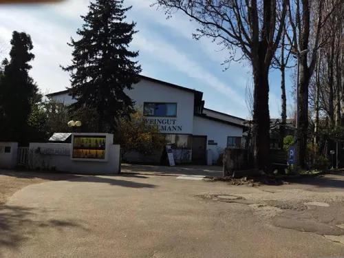
Weingut Anselmann
Restaurant · German · 1.9 km
58-60 Staatsstraße, Edesheim
Mo-Sa 08:00-20:30; Su 09:00-20:30
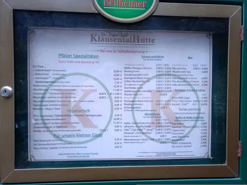
Klausentalhütte
Restaurant · Regional · 3.9 km
1 Weißkreuzstraße, Neustadt an der Weinstraße
Nov-Mar We, Sa, Su 10:30+; Apr-Aug Tu-Th, Sa, Su 10:30+; Sep-Oct...
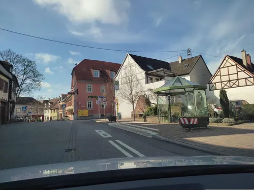

Altes Schlößchen
Restaurant · 2.3 km
27 Maikammerer Straße, Sankt Martin
Mo-Fr 08:00-18:00; Sa 09:00-17:00; Su,PH 09:30-12:00
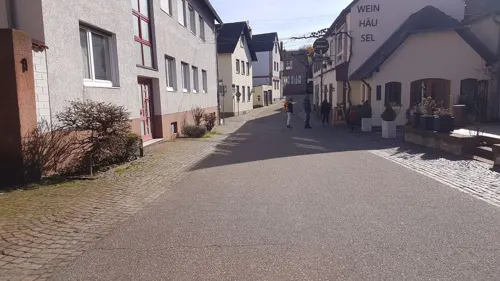
Bächeleck
Restaurant · Regional · 2.3 km
20 Maikammerer Straße, Sankt Martin
Tu-Su 12:00-22:00, PH 12:00-22:00
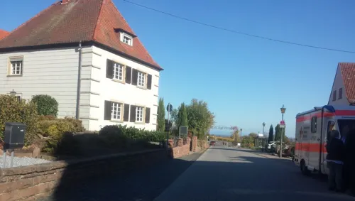
Consulat des Weines
Restaurant · 2.2 km
42 Maikammerer Straße, Sankt Martin
Tu-Sa 11:30-14:00,18:00-21:00; Su 11:30-14:00; Mo off
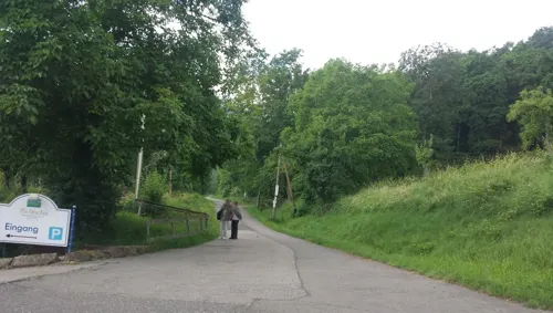
Gasthaus Sesel
Restaurant · German · 3.2 km
200 Theresienstraße
Mo,Tu,Th, Fr 12:00-14:00,17:30-22:00; We12:00-14:00; Sa,Su 12:00-22:00
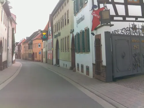
Gasthaus zum Winzer
Restaurant · Regional · 2.3 km
8 Weinstraße Süd, Maikammer
We-Su 11:30-14:30,17:30-23:00
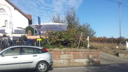
Il Gusto
Restaurant · Italian · 2.2 km
34 Maikammerer Straße, Sankt Martin
We-Th 17:00-22:00; Fr-Su 12:00-22:00

Gutshof Bauer's Stuben
Restaurant · German · 3.5 km
3 Altdorfer Straße, Venningen
Jan,Feb Sa[-2] -1 day,Sa[-2],Sa[-2] +1 day,Sa[-1] -1...
Hotel Restaurant La Corona
Restaurant · Italian · 2.4 km
21 Weinstraße Nord, Maikammer
Mo,We-Sa 11:30-14:30,17:30-23:00; Su 11:30-14:30,17:00-22:30
Kirchstübel
Restaurant · Regional · 2.6 km
9 Kirchstraße, Sankt Martin
We,Th,Fr 18:00-22:00; Sa,Su 12:00-22:00
238 more on the map.
History
This part of the Rhineland passed to Bavaria at 1815 following the Congress of Vienna, which reallocated many of the territories that had comprised Napoleon's empire. Like several towns in the area, Edenkoben has both a Roman Catholic and a Protestant church (recalling King Maximillian's marriage to a Protestant princess).
Edenkoben's status as an administrative and cultural centre for the surrounding villages is reflected in the presence of several high-grade schools. The little town also has a considerable cultivation and trade in wine. Outside the primary (agricultural) sector, industries include the manufacture of automotive exhaust systems and of doors. In former times there was a sulphur-spring here called Kurbrunnen.
Read more of the history
Edenkoben is overlooked, on its west side, by the imposing Friedensdenkmal, from the top of which visitors can enjoy a fine view across to the Rhine. Originally constructed to celebrate German unity in the aftermath of the Franco-Prussian War, the memorial was renamed Friedensdenkmal (Peace Memorial) after 1945, when celebration of German military victories fell out of fashion in Europe: at the time of writing the Friedensdenkmal contains a small restaurant. The inscription on the Unification / Peace memorial reflects the determination of the German government in 1871 to downplay the extent to which the Treaty of Frankfurt resulted from military victory by Prussia. Given the frequency with which the German-speaking Rhenish provinces had been devastated by French armies in the seventeenth and eighteenth centuries, it was in this region easy to emphasize the defensive nature of German unification.
From the History section of Edenkoben on Wikipedia, under CC BY-SA 4.0.
Notable people from Edenkoben
 Eugen von LommelGerman physicist (1837-1899)Photo: Anonymous Unknown author, Public domain
 Friedrich ArnoldGerman anatomist and physiologist (1803–1890)Photo: Unknown author Unknown author, Public domain
 Ralf FücksGerman politicianPhoto: Heinrich-Böll-Stiftung from Berlin,..., CC BY-SA 2.0
- Franz WeidenreichGerman anatomist (1873–1948)
- James BlenkAmerican Roman Catholic archbishop (1856–1917)
- Richard Schneider-EdenkobenGerman screenwriter and film director (1899-1986)
- Johann Adam HartmannAmerican trapper (1748-1836)
- Q5366399American soccer coach
Born in Edenkoben, according to Wikidata (CC0). Each name links to its Wikipedia article.
Where to stay89
Gästehaus an der Weinstraßenmitte
Motel and hotel · 3.7 km
612 Weinstraße, Neustadt an der Weinstraße
Churches and places of worship26
Alsterweiler Kapelle
Church · Catholic · 2.8 km
5 Alsterweiler Hauptstraße, Maikammer
Evangelische Stadtkirche
Church · Protestant
21 Ludwigsplatz, Edenkoben
Dreifaltigkeitskapelle
Church · Roman Catholic · 3.2 km
68 Hauptstraße, Kirrweiler
Shopping18
Gas and EV charging10
Schools, colleges and libraries10
Hochschule für Finanzen - Landesfinanzschule Rheinland-Pfalz
School
33 Luitpoldstraße, Edenkoben
Berufsbildende Schule SÜW Standort Edenkoben
School · 0.7 km
1 Schillerstraße, Edenkoben
Healthcare7
Map of Edenkoben
250 places. The map loads OpenStreetMap tiles when you open it.
Getting there and nearby towns
City-Airport Mannheim (MHG) is the nearest airport with scheduled flights listed in OpenStreetMap, 35 km away.
- Neustadt an der Weinstraße 7 km north, about 7 min by car
- Landau in der Pfalz 10 km south, about 10 min by car
- Offenbach an der Queich 11 km southeast, about 11 min by car
- Lustadt 12 km east, about 12 min by car
- Haßloch 13 km northeast, about 13 min by car
- Lingenfeld 16 km east, about 16 min by car
- Böhl-Iggelheim 17 km northeast, about 17 min by car
- Germersheim 19 km southeast, about 19 min by car
- Rülzheim 19 km southeast, about 19 min by car
- Bad Dürkheim 20 km north, about 20 min by car
Drive times are estimates from straight-line distance, not routes.
Towns near Edenkoben


Keep exploring
Local news
Headlines from INDB.
Reviews, tips and questions
Loading what members have shared...
Sources and licences
- GeoNames (CC BY 4.0): population, coordinates, regions and time zone
- Mapillary (see each image): photos
- OpenStreetMap contributors (ODbL 1.0): places, airports, map data
- Wikidata (CC0 1.0): elevation, founding date, time zone, website
- Wikimedia Commons (see each image): photos
- Wikipedia (CC BY-SA 4.0): overview and history text
Photo credits
- Edenkobenc, Wisohr, CC BY-SA 3.0
- Edenkoben, Luitpoldstraße 20260501, P170, CC BY-SA 4.0
- Edenkoben Chorraum St. Ludwig, Cosmo3null, CC BY-SA 4.0
- Edenkoben, Weinstraße 20260501, P170, CC BY-SA 4.0
- Kreuzweg St. Ludwig Edenkoben, Cosmo3null, CC BY-SA 4.0
- Wohnhaus Metzgergasse 11 Edenkoben, Malagus1, CC0
- Tinyplanet Of Edenkoben, Thomas K, CC BY 3.0
- Edenkoben Weinstraße 059 003 2017 02 15, Friedrich Haag, CC BY-SA 4.0
- Edenkoben Weinstraße 059 002 2017 02 15, Friedrich Haag, CC BY-SA 4.0
- Edenkoben Weinstraße / Tanzstraße 002 2017 02 15, Friedrich Haag, CC BY-SA 4.0
- Edenkoben Weinstraße / Tanzstraße 001 2017 02 15, Friedrich Haag, CC BY-SA 4.0
- Edenkoben Weinstraße 060 001 2017 02 15, Friedrich Haag, CC BY-SA 4.0
- Edenkoben Weinstraße 060 002 2017 02 15, Friedrich Haag, CC BY-SA 4.0
- Decke des Friedensdenkmals in Edenkoben, Sonihero, CC BY-SA 4.0
- Edenkoben Tanzstraße 27 001 2017 02 15, Friedrich Haag, CC BY-SA 4.0
- Edenkoben Weinstraße 059 004 2017 02 15, Friedrich Haag, CC BY-SA 4.0
- Edenkoben Weinstraße 059 001 2017 02 15, Friedrich Haag, CC BY-SA 4.0
- Edenkoben Tanzstraße 27 003 2017 02 15, Friedrich Haag, CC BY-SA 4.0
- Edenkoben Weinstraße 057 001 2017 02 15, Friedrich Haag, CC BY-SA 4.0
- Edenkoben Tanzstraße 27 002 2017 02 15, Friedrich Haag, CC BY-SA 4.0
- Edenkoben Weinstraße 056/058 002 2017 02 15, Friedrich Haag, CC BY-SA 4.0
- Edenkoben Weinstraße 056/058 001 2017 02 15, Friedrich Haag, CC BY-SA 4.0
- Edenkoben Weinstraße 056/058 003 2017 02 15, Friedrich Haag, CC BY-SA 4.0
- Edenkoben Weinstraße 056/058 005 2017 02 15, Friedrich Haag, CC BY-SA 4.0
- Edenkobener Gebäude Luitpoldstraße 26, Hans Waizenegger, CC BY-SA 3.0
- Edenkoben Tanzstraße 13 002 2017 02 15, Friedrich Haag, CC BY-SA 4.0
- Edenkoben Weinstraße 056/058 006 2017 02 15, Friedrich Haag, CC BY-SA 4.0
- Edenkoben Weinstraße 060 003 2017 02 15, Friedrich Haag, CC BY-SA 4.0
- Edenkoben Tanzstraße 13 001 2017 02 15, Friedrich Haag, CC BY-SA 4.0
- Edenkoben Weinstraße 056/058 004 2017 02 15, Friedrich Haag, CC BY-SA 4.0
- Edenkoben Weinstraße 049, 051, 053 (Denkmalzone) 004 2017 02 15, Friedrich Haag, CC BY-SA 4.0
- Edenkoben Weinstraße 049, 051, 053 (Denkmalzone) 003 2017 02 15, Friedrich Haag, CC BY-SA 4.0
- Edenkoben Weinstraße 049, 051, 053 (Denkmalzone) 005 2017 02 15, Friedrich Haag, CC BY-SA 4.0
- Edenkoben Weinstraße 049, 051, 053 (Denkmalzone) 002 2017 02 15, Friedrich Haag, CC BY-SA 4.0
- Edenkoben Weinstraße 049, 051, 053 (Denkmalzone) 001 2017 02 15, Friedrich Haag, CC BY-SA 4.0
- Edenkoben Tanzstraße 04 002 2017 02 15, Friedrich Haag, CC BY-SA 4.0
- 2025-09-06 Schloss Villa Ludwigshoehe 001, Ahmet Düz, Dreiländer- & Oberrheinfotograf, CC BY-SA 4.0
- 180829-Blaettersberg-01, BlueBreezeWiki, CC BY-SA 3.0
- Alsterweiler Kapelle 02, Immanuel Giel, Public domain
- 180812-Friedensdenkmal-06, BlueBreezeWiki, CC BY-SA 3.0
- 2012 Pfälzerwald 527 Wetterkreuzberg, Steffen 962, CC0
- 2012 Pfälzerwald 520 Breitenberg, Steffen 962, CC0
- Kloster Heilsbruck von Süden, Altera levatur, CC BY-SA 4.0
- AS-Innenhof mit Fachwerkgiebel, Hofnarr-AS, CC BY-SA 4.0
- Venningen Judenkirchhof, Rudolf Wild, CC BY-SA 4.0
- St-Martin 2022 52, Kmtextor, CC BY 4.0
- Hainfeld katholische Pfarrkirche 20140711, Rudolf Stricker, CC BY-SA 2.0 de
- Rhodt Kirchturm 1, RuWild, CC BY-SA 4.0
- 2013 Pfälzerwald 094 Wetterkreuzberg Kapelle, Steffen 962, CC0
- Edenkoben St Ludwig, Rudolf Wild, CC BY-SA 4.0
- 2025-09-12 D500-0625 Achim-Lammerts Maikammer-Johanniskirche, Achim Lammerts (Syntaxys), CC BY-SA 4.0
- Ritterstein 236 Haingeraide-Loogfelsen, pfalz39, CC BY-SA 3.0
- Edenkoben Prot Kirche 5, Rudolf Wild, CC BY-SA 4.0
- 2025 Pfälzerwald 089 Sankt Martin Wingertsberg, Steffen 962, CC BY-SA 4.0
- 2025 Pfälzerwald 067 Sankt Martin Heidelberg Gipfel mit Ringwall lmnr2, Steffen 962, CC BY-SA 4.0
- Street-level photo, changchun1, CC BY-SA 4.0
- Street-level photo, wegavision, CC BY-SA 4.0
- Street-level photo, NorMan61, CC BY-SA 4.0
- Street-level photo, wegavision, CC BY-SA 4.0
- Street-level photo, wegavision, CC BY-SA 4.0
- Street-level photo, changchun1, CC BY-SA 4.0
- Street-level photo, wegavision, CC BY-SA 4.0
- Street-level photo, ramap, CC BY-SA 4.0
- Street-level photo, VIA_TZ, CC BY-SA 4.0
- Street-level photo, VIA_TZ, CC BY-SA 4.0
- Street-level photo, changchun1, CC BY-SA 4.0
- Street-level photo, atze02, CC BY-SA 4.0
- Street-level photo, rausk, CC BY-SA 4.0
- Street-level photo, atze02, CC BY-SA 4.0
- Street-level photo, wegavision, CC BY-SA 4.0
- Street-level photo, wegavision, CC BY-SA 4.0
- Street-level photo, wegavision, CC BY-SA 4.0
- Street-level photo, wegavision, CC BY-SA 4.0
- Street-level photo, ramap, CC BY-SA 4.0
- Street-level photo, changchun1, CC BY-SA 4.0
- Street-level photo, changchun1, CC BY-SA 4.0
- Street-level photo, wegavision, CC BY-SA 4.0
- Street-level photo, wegavision, CC BY-SA 4.0
- Street-level photo, changchun1, CC BY-SA 4.0
- Street-level photo, ramap, CC BY-SA 4.0
- Street-level photo, changchun1, CC BY-SA 4.0


Page built November 9, 2026. Spotted a mistake? Tell us or suggest a place.