


Gummersbach, Germany
Gummersbach is a town of 53,131 people in North Rhine-Westphalia, Germany.
Why visit Gummersbach
Townapedia lists 46 museums and landmarks, 44 parks and trails, 175 places to eat, 22 places to stay and 93 attractions in and around town.
Highlights include Wiehltal bridge, Schauspielhaus, Heimatmuseum Bergneustadt and Eisenbahnmuseum Dieringhausen.
Weather in Gummersbach
Forecast from MET Norway (CC BY 4.0). Full forecast
About Gummersbach
Gummersbach (German pronunciation: [ˈɡʊmɐsbax] ) is a town in the state of North Rhine-Westphalia, Germany, being the district seat of the Oberbergischer Kreis. It is located 50 kilometres (31 mi) east of Cologne.
From the Wikipedia article Gummersbach (this version), under CC BY-SA 4.0.
Travel tips from other travellers: Gummersbach on Wikivoyage (CC BY-SA 4.0).
Photos of Gummersbach


Things to do93


Seven - Kinocenter Gummersbach
Cinema and theater
16 - 18 Steinmüllerallee, Gummersbach
Mo-Th 16:45-20:30; Fr,Sa 14:00-23:00; Su 14:00-20:30


Burgtheater
Cinema and theater
16 Kaiserstraße, Gummersbach
"generell geschlossen"
81 more on the map.
Museums and landmarks46

Heimatmuseum Bergneustadt
Museum · 5.9 km
1 Wallstraße, Bergneustadt
Tu-Su 11:00-17:00; Mo off; PH unknown


Haus Lützinghausen
Monument and historic site · 4.6 km
24 Vogteistraße, Gummersbach


Meerhardtturm
Monument and historic site · 5.4 km
Konstruktion als Ruine


Haus Dahl
Museum · 4.3 km
Historisches Bauernhaus, ältestes in Oberberg
3 Dahl, Marienheide
Su 14:00-18:00; Nov-Mar off

34 more on the map.
Parks, trails and playgrounds44

Nass- und Feuchtgrünlandkomplex östlich Holzwipper
Hiking and trails · 7.2 km


Quellbach- und Laubwaldbereich im Gervershagener Forst
Hiking and trails · 6.5 km
32 more on the map.
Restaurants and cafes175
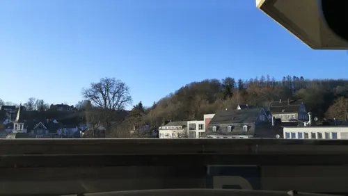
Brauhaus Gummersbach
Restaurant · German
15 Hindenburgstraße, Gummersbach
Mo-Th 10:00-23:30, Fr,Sa 10:00-00:30, Su 12:00-20:00
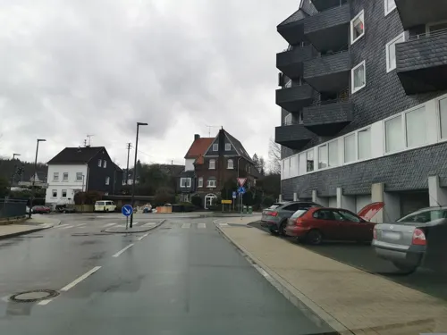
Heier Stuben
Restaurant · German · 6.8 km
7 Leppestraße, Marienheide
Mo-Sa 17:00-22:00; We off; Su 11:00-14:00,17:00-22:00
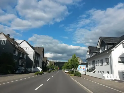
Pizza 49 Daro
Restaurant · Pizza · 7.0 km
334 Kölner Straße
Tu-Th 11:00-22:00; Fr,Sa 11:00-23:00; Su 11:00-22:00; Mo off
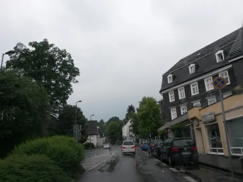
Pizza King Gummersbach Pizza & Burger Lieferdienst
Restaurant · Pizza, Salad, Burger, Turkish, Brunch
44 Kaiserstraße, Gummersbach
Mo-Su 11:00-22:00


Die Mühlenhelle
Restaurant · International · 5.3 km
1 Hohler Straße, Gummersbach
We-Su 18:00-24:00; Su 12:00-14:30
Mensa der TH Köln Campus Gummersbach
Restaurant · International
1 Steinmüllerallee, Gummersbach
Mo-Fr 11:15-14:30

Café - Konditorei Hecker (Die Chocolatiers)
Bakery
18 Kaiserstraße, Gummersbach
Mo-Sa 09:00-18:00; Su 10:00-18:00

163 more on the map.
History
In 1109 Gummersbach was mentioned in official documents for the first time. The document in question concerned the lowering of the episcopal tax for the church in Gummersbach by Archbishop Frederick I. At that time the name of the town was spelled as Gumeresbracht. In 1855 Gummersbach's industrial history began with the foundation of the company Steinmüller. With the company's success the little village began to grow to a town. Gummersbach received town privileges in 1857. For decades to come many inhabitants found work at Steinmüller. In 2002 the new parent company Babcock Borsig AG went out of business and so Steinmüller was shut down, too. After most of the premises were no longer in use, the town bought the property in order to develop it. The premises played a key role for the municipality, as it made up half of the downtown area by then. In the following years, among other things, an arena, a shopping mall and a new university campus were built.
From the History section of Gummersbach on Wikipedia, under CC BY-SA 4.0.
More about Gummersbach
Education
Communal elementary schools in the towncentre and the districts Becke, Bernberg, Derschlag, Dieringhausen, Hülsenbusch, Niederseßmar, Steinenbrück and Windhagen
Town secondary school Gummersbach-Hepel, http://www.rs-hepel.de/
Town high school – Lindengymnasium, http://www.lindengymnasium.de/
Cologne University of Applied Sciences, Faculty of Computer Science and Engineering Science, https://www.th-koeln.de/informatik-und-ingenieurwissenschaften/
From the Wikipedia article Gummersbach, under CC BY-SA 4.0.
Notable people from Gummersbach
 Heiner BrandGerman handball player and coachPhoto: Michael Schilling, CC BY-SA 3.0
 Paul DruxGerman handball playerPhoto: Frau N. Zimmer = Walter Mier, CC BY-SA 4.0
 Dan van HusenGerman actor (1945–2020)Photo: Angela George at..., CC BY-SA 3.0
 Jan SosniokGerman actorPhoto: Maximilian Bühn, CC BY-SA 4.0
 Florian AltGerman motorcycle racerPhoto: Steffen Prößdorf, CC BY-SA 4.0
 Werner HeuserGerman painter (1880-1964)Photo: Werner Heuser (1880-1964), CC BY-SA 3.0 de
 Benedikt DudaGerman table tennis playerPhoto: Granada, CC BY-SA 4.0
 Hella von SinnenGerman comedian and television presenterPhoto: Elke Wetzig ( Elya ), CC BY-SA 3.0
- Ilona GusenbauerAustrian high jumper
- Francis OnyekaGerman association football player
- Adele Bloesch-StöckerSwiss composer (1875-1978)
- Hartmut StegemannGerman academic (1933–2005)
Born in Gummersbach, according to Wikidata (CC0). Each name links to its Wikipedia article.
Where to stay22
Churches and places of worship60
Sankt Johann Baptist
Church · Roman Catholic · 7.4 km
Pastoratsstraße, Marienheide
Sankt Mariä Heimsuchung
Church · Roman Catholic · 6.8 km
6 Klosterstraße, Marienheide
Sankt Matthias
Church · Roman Catholic · 5.5 km
1 Löhstraße, Bergneustadt
Evangeliums-Christen Gemeinde Gummersbach-Berstig e.V.
Church · Baptist · 1.4 km
3 Am Hüttenberg, Gummersbach
Shopping58
Gas and EV charging16
Schools, colleges and libraries36
Technische Hochschule Köln (Campus Gummersbach)
School
1 Steinmüllerallee, Gummersbach
Healthcare23
Map of Gummersbach
250 places. The map loads OpenStreetMap tiles when you open it.
Getting there and nearby towns
Cologne Bonn Airport (CGN) is the nearest airport with scheduled flights listed in OpenStreetMap, 34 km away.
- Bergneustadt 6 km east, about 6 min by car
- Marienheide 7 km north, about 7 min by car
- Meinerzhagen 11 km northeast, about 11 min by car
- Engelskirchen 11 km west, about 11 min by car
- Kierspe 12 km north, about 12 min by car
- Lindlar 13 km west, about 13 min by car
- Nümbrecht 14 km south, about 14 min by car
- Drolshagen 15 km east, about 15 min by car
- Wipperfürth 15 km northwest, about 15 min by car
- Waldbröl 17 km south, about 17 min by car
Drive times are estimates from straight-line distance, not routes.
Towns near Gummersbach


Keep exploring
Local news
Headlines from INDB.
Reviews, tips and questions
Loading what members have shared...
Sources and licences
- GeoNames (CC BY 4.0): population, coordinates, regions and time zone
- Mapillary (see each image): photos
- OpenStreetMap contributors (ODbL 1.0): places, airports, map data
- Wikidata (CC0 1.0): elevation, founding date, time zone, website, landmarks and historic places
- Wikimedia Commons (see each image): photos
- Wikipedia (CC BY-SA 4.0): overview and history text
Photo credits
- Sparkasse GM, Salva88, CC BY-SA 3.0
- Gummersbach, St. Franziskus (12), Subbass1, CC BY-SA 4.0
- Gummersbach, St. Franziskus (04), Subbass1, CC BY 3.0
- Gummersbach, St. Franziskus (08), Subbass1, CC BY-SA 4.0
- Gummersbach, St. Franziskus (02), Subbass1, CC BY 3.0
- Gummersbach, St. Franziskus (21), Subbass1, CC BY-SA 4.0
- Gummersbach, St. Franziskus (12) (cropped), Subbass1, CC BY-SA 4.0
- Gummersbach, St. Franziskus (06), Subbass1, CC BY-SA 4.0
- Gummersbach, St. Franziskus (09), Subbass1, CC BY-SA 4.0
- Gummersbach, St. Franziskus (10), Subbass1, CC BY-SA 4.0
- Gummersbach, St. Franziskus (13), Subbass1, CC BY-SA 4.0
- Gummersbach, St. Franziskus (15), Subbass1, CC BY-SA 4.0
- Gummersbach, St. Franziskus (11), Subbass1, CC BY-SA 4.0
- Gummersbach, St. Franziskus (07), Subbass1, CC BY-SA 4.0
- Gummersbach, St. Franziskus (03), Subbass1, CC BY 3.0
- Gummersbach, St. Franziskus (05), Subbass1, CC BY-SA 4.0
- Gummersbach, St. Franziskus (14), Subbass1, CC BY-SA 4.0
- Gummersbach, St. Franziskus (16), Subbass1, CC BY-SA 4.0
- Gummersbach, St. Franziskus (19), Subbass1, CC BY-SA 4.0
- Gummersbach, St. Franziskus (20), Subbass1, CC BY-SA 4.0
- Gummersbach, St. Franziskus (01), Subbass1, CC BY 3.0
- Gummersbach, St. Franziskus (18), Subbass1, CC BY-SA 4.0
- Gummersbach, St. Franziskus (17), Subbass1, CC BY-SA 4.0
- Gummersbach, Einheitsbäume, Buche 2024, Winter, 02, Stadt Gummersbach; cropped by Wilhelm Zimmerling PAR, CC BY-SA 4.0
- Gummersbach, Einheitsbäume, Eiche 2024, Winter, 02, Stadt Gummersbach; cropped by Wilhelm Zimmerling PAR, CC BY-SA 4.0
- Gummersbach, Einheitsbäume, Eiche 2024, Winter, 01, Stadt Gummersbach, CC BY-SA 4.0
- Gummersbach, Einheitsbäume 2024, Winter, 02, Stadt Gummersbach, CC BY-SA 4.0
- Gummersbach, Einheitsbäume 2024, Winter, 04, Stadt Gummersbach; cropped by Wilhelm Zimmerling PAR, CC BY-SA 4.0
- Gummersbach, Einheitsbäume, Kiefer 2024, Winter, 01, Holger Wirtz, CC BY-SA 4.0
- Gummersbach, Einheitsbäume 2024, Winter, 03, Stadt Gummersbach, CC BY-SA 4.0
- Gummersbach, Einheitsbäume, Kiefer 2024, Winter, 02, Stadt Gummersbach; cropped by Wilhelm Zimmerling PAR, CC BY-SA 4.0
- Gummersbach, Einheitsbäume, Buche 2024, Winter, 01, Stadt Gummersbach, CC BY-SA 4.0
- Gummersbach, Einheitsbäume 2024, Winter, 01, Stadt Gummersbach, CC BY-SA 4.0
- Weihershagen, Jörg Kopp at de.wikipedia, CC BY-SA 3.0
- Gummersbach - Brückenstraße - Bruno-Goller-Haus 02 ies, Frank Vincentz, CC BY-SA 3.0
- Lützinghausen Burg Winter 2, Unknown author, CC BY-SA 3.0
- Schloss Gimborn 09, Dickelbers, CC BY-SA 4.0
- Preußische T 14, Eisenbahnmuseum Dieringhausen, Busbahnhof, CC BY-SA 3.0
- Marienheide Gimborn - Sankt Johann Baptist 02 ies, Frank Vincentz, CC BY-SA 3.0
- Kirche Hülsenbusch 2, me, Public domain
- Kirche Marienhagen, Sebastian Hirsch ( Diskussion ), CC BY-SA 3.0
- Wehrkirche Marienheide-Müllenbach Vogelperspektive, Muellenbach79, CC BY-SA 3.0
- Bergneustadt - Kirchstraße - Kirche ex 01 ies, Frank Vincentz, CC BY-SA 3.0
- Gummersbach - Evangelische Kirche 01 ies, Frank Vincentz, CC BY-SA 3.0
- Kirche hackenberg-1, The original uploader was Mrfinch at German Wikipedia ., CC BY-SA 3.0
- Halty turm 1, Guido Schmickler, CC BY-SA 2.5
- Meerhardtturp, Travus, CC BY-SA 3.0
- Gummersbach - Steinmüllerallee - Halle 32 01 ies, Frank Vincentz, CC BY-SA 3.0
- Bergneustadt-Heimatmuseum1-Bubo, Bubo, CC BY-SA 3.0
- NSG GM-014 Rengsebecken, DiAuras, CC BY-SA 4.0
- Evangelische Kirche Dieringhausen, Tohma, CC BY-SA 4.0
- GM-051 Nass- und Feuchtgrünlandkomplex östl. Holzwipper (10), DiAuras, CC BY-SA 4.0
- Haus der Geschichten, Okoenigs at German Wikipedia, Public domain
- HAKaWallfahrtskirche Marienheide, Unknown author, CC BY-SA 3.0
- Street-level photo, uwekoch, CC BY-SA 4.0
- Street-level photo, uwekoch, CC BY-SA 4.0
- Street-level photo, uwekoch, CC BY-SA 4.0
- Street-level photo, ASRvw, CC BY-SA 4.0
- Street-level photo, uwekoch, CC BY-SA 4.0
- Street-level photo, fuffel, CC BY-SA 4.0
- Street-level photo, tobiasreg, CC BY-SA 4.0
- Street-level photo, joergpauly, CC BY-SA 4.0
- Street-level photo, joergpauly, CC BY-SA 4.0
- Street-level photo, uwekoch, CC BY-SA 4.0
- Street-level photo, joergpauly, CC BY-SA 4.0
- Street-level photo, uwekoch, CC BY-SA 4.0
- Street-level photo, fuffel, CC BY-SA 4.0
- Street-level photo, uwekoch, CC BY-SA 4.0
- Street-level photo, uwekoch, CC BY-SA 4.0
- Street-level photo, uwekoch, CC BY-SA 4.0
- Street-level photo, uwekoch, CC BY-SA 4.0


Page built November 9, 2026. Spotted a mistake? Tell us or suggest a place.