


Why visit Helmbrechts
Townapedia lists 16 museums and landmarks, 17 parks and trails, 52 places to eat, 8 places to stay and 16 attractions in and around town.
Highlights include Hofliebe Eismanufaktur, Aussichtsturm Kirchberg, Oberfränkisches Textilmuseum Helmbrechts and Feuerwehrmuseum.
Weather in Helmbrechts
Forecast from MET Norway (CC BY 4.0). Full forecast
About Helmbrechts
Helmbrechts (German pronunciation: [ˈhɛlmbʁɛçts] ) is a town in the district of Hof, in Bavaria, Germany. It is situated on the southern edge of the Franconian Forest, 20 km southwest of Hof.
From the Wikipedia article Helmbrechts (this version), under CC BY-SA 4.0.
Things to do16





4 more on the map.
Museums and landmarks16
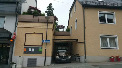
Oberfränkisches Textilmuseum Helmbrechts
Museum
17 Münchberger Straße, Helmbrechts
Tu-Fr 10:00-12:00,14:00-16:00; Sa,Su 10:00-16:00; Mo off


Schloß Schauenstein
Monument and historic site · 5.2 km
1 Schloßplatz, Schauenstein

St. Maria
Monument and historic site · 6.3 km
9 Hauptstraße, Marktleugast
Heimatmuseum Schauenstein
Museum · 5.2 km
1 Schloßplatz, Schauenstein

4 more on the map.
Parks, trails and playgrounds17

Aquawell
Sports field and stadium
7 Adolf-Haack-Straße
Mo-Tu, Th-Fr 08:00-21:00; We 08:00-18:00; Sa 13:00-20:00; Su 09:00-18:00
Naturfreibad Helmbrechts
Sports field and stadium · 1.6 km
80 Hofer Straße, Helmbrechts
Mo-Su 08:00-20:30



5 more on the map.
Restaurants and cafes52

Bauernhof-Café zur Geigersmühle
Cafe · Regional, Cake · 2.8 km
2 Geigersmühle, Helmbrechts
Sa-Su 14:00+; PH off
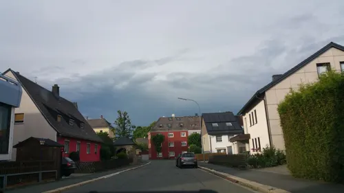
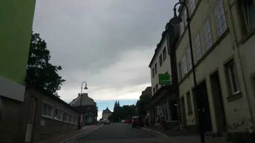
Voilà Cafébar Patisserie
Cafe
1 Kulmbacher Straße, Helmbrechts
Fr, Sa 09:00-21:00; We,Th,Su 09:00-18:00; Mo,Tu off
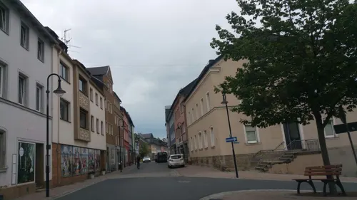
Bella Sizilia
Restaurant · Italian, Pizza
14 Kulmbacher Straße, Helmbrechts
We-Mo 17:00-22:00
Buecherhof Café
Cafe
Tägliches_Mittagstisch_(2*/Woche_vegan/vegetarisch)
Mo-Fr 09:00-21:00; Sa "nach Vereinbarung"; Su off

Goldener Adler Hellas
Restaurant · Greek
58 Kulmbacher Straße, Helmbrechts
Mo 17:00 - 22:00; Tu-Su 11:30 - 14:00; 17:00 - 22:00
Orient Pizza Express
Restaurant · Kebab, Pizza
14 Luitpoldstraße, Helmbrechts
Tu-Sa 11:00-14:00,16:00-22:00; PH,Su 14:00-22:00; Mo off
Purucker Bäckerei Konditorei und Café
Bakery
8 Münchberger Straße, Helmbrechts
Mo-Fr 04:30-18:00; Sa 04:30-13:00; Su 07:00-11:00


Cafe Herpich
Restaurant · 4.0 km
27, Schauenstein
Sa off; Mo-Fr 16:30-21:00; Su 14:00-22:00; May-Oct Mo off; May-Oct...
40 more on the map.
History
The first documented mention of Helmbrechts dates back to 1232. Township was granted to Helmbrechts by Count Friedrich V. of Nürnberg in the year 1422. Helmbrechts has been in Bavarian rule since 1810, and eventually became part of the German Empire in 1871, and then the German republic after World War I. During World War II, Helmbrechts was the location of the Helmbrechts concentration camp, a women's subcamp of the Flossenbürg concentration camp, which was founded near Helmbrechts in the summer of 1944. Over 1,200 women, mostly from German-occupied Poland, Soviet Union, Czechoslovakia and Hungary, were imprisoned in the subcamp and used as forced labour. Dozens of prisoners died, including some being beaten to death or hanged after escape attempts. Around 200 women died in a death march, when the Germans evacuated the subcamp in April 1945. Following World War II, the town formed part of West Germany until 1990.
From the History section of Helmbrechts on Wikipedia, under CC BY-SA 4.0.
Where to stay8
Churches and places of worship13
St.-Joseph-Kirche
Church · Catholic · 5.9 km
8 Kirchallee, Marktleugast
Shopping14
Gas and EV charging6
Schools, colleges and libraries10
Healthcare2
Map of Helmbrechts
154 places. The map loads OpenStreetMap tiles when you open it.
Getting there and nearby towns
Verkehrslandeplatz Hof-Plauen (HOQ) is the nearest airport with scheduled flights listed in OpenStreetMap, 11 km away.
- Münchberg 7 km southeast, about 7 min by car
- Naila 11 km north, about 11 min by car
- Hof 16 km northeast, about 16 min by car
- Schwarzenbach an der Saale 16 km east, about 16 min by car
- Oberkotzau 16 km east, about 16 min by car
- Rehau 23 km east, about 23 min by car
- Kulmbach 24 km southwest, about 24 min by car
- Kronach 27 km west, about 27 min by car
- Mainleus 28 km southwest, about 28 min by car
- Selb 30 km east, about 30 min by car
Drive times are estimates from straight-line distance, not routes.
Local news
Headlines from INDB.
Reviews, tips and questions
Loading what members have shared...
Sources and licences
- GeoNames (CC BY 4.0): population, coordinates, regions and time zone
- Mapillary (see each image): photos
- OpenStreetMap contributors (ODbL 1.0): places, airports, map data
- Wikidata (CC0 1.0): elevation, founding date, time zone, website
- Wikimedia Commons (see each image): photos
- Wikipedia (CC BY-SA 4.0): overview and history text
Photo credits
- Helmbrechts Rathaus Kirche, Benreis, CC BY-SA 3.0
- Helmbrechts, der Hans-Seiffert-Brunnen, Dguendel, CC BY 3.0
- Helmbrechts, Kulmbacher Straße und Luitpoldstraße, Dguendel, CC BY 3.0
- Helmbrechts, die Torgasse, Dguendel, CC BY 3.0
- Helmbrechts, Christkönig (05), Subbass1, CC BY-SA 4.0
- Helmbrechts, Christkönig (01), Subbass1, CC BY-SA 4.0
- Helmbrechts, Christkönig (04), Subbass1, CC BY-SA 4.0
- Helmbrechts, Christkönig (06), Subbass1, CC BY-SA 4.0
- Helmbrechts, Christkönig (09), Subbass1, CC BY-SA 4.0
- Helmbrechts, Christkönig (08), Subbass1, CC BY-SA 4.0
- Helmbrechts, Christkönig (03), Subbass1, CC BY-SA 4.0
- Helmbrechts, Christkönig (07), Subbass1, CC BY-SA 4.0
- Helmbrechts, Christkönig (10), Subbass1, CC BY-SA 4.0
- Helmbrechts, Christkönig (11), Subbass1, CC BY-SA 4.0
- Helmbrechts, die Münchberger Straße, Dguendel, CC BY 3.0
- Helmbrechts, Rathaus und Kriegsgefallenen-Gedächtnisstätte, Dguendel, CC BY 3.0
- Helmbrechts, Christkönig (15), Subbass1, CC BY-SA 4.0
- Helmbrechts, Christkönig (25), Subbass1, CC BY-SA 4.0
- Helmbrechts, Christkönig (20), Subbass1, CC BY-SA 4.0
- Helmbrechts, Christkönig (19), Subbass1, CC BY-SA 4.0
- Helmbrechts, Christkönig (24), Subbass1, CC BY-SA 4.0
- Helmbrechts, Christkönig (18), Subbass1, CC BY-SA 4.0
- Helmbrechts, Christkönig (26), Subbass1, CC BY-SA 4.0
- Helmbrechts, Christkönig (17), Subbass1, CC BY-SA 4.0
- Helmbrechts, Christkönig (21), Subbass1, CC BY-SA 4.0
- Helmbrechts, Christkönig (22), Subbass1, CC BY-SA 4.0
- Helmbrechts, Christkönig (23), Subbass1, CC BY-SA 4.0
- Helmbrechts, Christkönig (16), Subbass1, CC BY-SA 4.0
- Helmbrechts, Christkönig (02), Subbass1, CC BY-SA 4.0
- Helmbrechts, Christkönig (12), Subbass1, CC BY-SA 4.0
- Helmbrechts, Christkönig (13), Subbass1, CC BY-SA 4.0
- Helmbrechts, Christkönig (14), Subbass1, CC BY-SA 4.0
- Helmbrechts, Christkönig (28), Subbass1, CC BY-SA 4.0
- Helmbrechts, Christkönig (33), Subbass1, CC BY-SA 4.0
- Helmbrechts, Christkönig (32), Subbass1, CC BY-SA 4.0
- Schauenstein x003, PeterBraun74, CC BY-SA 3.0
- Helmbrechts, Johanniskirche (56), Subbass1, CC BY-SA 4.0
- Wüstenselbitz Kirche, Benreis, CC BY-SA 4.0
- Wachende Jungfrau Dez 2013, Benreis, CC0
- NSG-00114.01 Thronbachtal (Landkreis Hof), Gliwi, CC BY-SA 4.0
- Schauenstein Schloss 2015 (7), Benreis, CC BY-SA 4.0
- St.Maria Hohenberg, lutzto, CC BY-SA 3.0
- Döbra, Bartholomäuskirche (46), Subbass1, CC BY-SA 4.0
- Gustav-Adolf-Kirche Ahornis 2, Mamello, CC BY 3.0
- Konradsreuth 2014 xy 10, PeterBraun74, CC BY-SA 4.0
- Helmbrechts, Christkönig (35), Subbass1, CC BY-SA 4.0
- Marktleugast Hohenberg St. Josef (1), Benreis, CC BY-SA 4.0
- Aussichtsturm Kirchberg xy 2, PeterBraun74, CC BY-SA 3.0
- Street-level photo, b4sti4n, CC BY-SA 4.0
- Street-level photo, b4sti4n, CC BY-SA 4.0
- Street-level photo, tqm, CC BY-SA 4.0
- Street-level photo, b4sti4n, CC BY-SA 4.0
- Street-level photo, b4sti4n, CC BY-SA 4.0
- Street-level photo, wegavision, CC BY-SA 4.0
- Street-level photo, b4sti4n, CC BY-SA 4.0
- Street-level photo, b4sti4n, CC BY-SA 4.0
- Street-level photo, b4sti4n, CC BY-SA 4.0
- Street-level photo, b4sti4n, CC BY-SA 4.0
- Street-level photo, b4sti4n, CC BY-SA 4.0
- Street-level photo, b4sti4n, CC BY-SA 4.0
- Street-level photo, b4sti4n, CC BY-SA 4.0
- Street-level photo, b4sti4n, CC BY-SA 4.0
- Street-level photo, b4sti4n, CC BY-SA 4.0
- Street-level photo, b4sti4n, CC BY-SA 4.0
- Street-level photo, b4sti4n, CC BY-SA 4.0
- Street-level photo, b4sti4n, CC BY-SA 4.0
- Street-level photo, b4sti4n, CC BY-SA 4.0
- Street-level photo, wegavision, CC BY-SA 4.0
- Street-level photo, hdmn, CC BY-SA 4.0
- Street-level photo, b4sti4n, CC BY-SA 4.0
- Street-level photo, b4sti4n, CC BY-SA 4.0


Page built November 9, 2026. Spotted a mistake? Tell us or suggest a place.