


Why visit Lingen
Townapedia lists 89 museums and landmarks, 62 parks and trails, 161 places to eat, 22 places to stay and 20 attractions in and around town.
Highlights include Filmpalast CineWorld, Hofladen Krone-Raue, Kunsthalle Lingen and Historisches Rathaus.
Weather in Lingen
Forecast from MET Norway (CC BY 4.0). Full forecast
About Lingen
Lingen (German pronunciation: [ˈlɪŋən] ), officially Lingen (Ems), is a town in Lower Saxony, Germany. In 2024, its population was 59,896 with 2,262 people who had registered the city as their secondary residence. Lingen, specifically "Lingen (Ems)" is located on the river Ems in the southern part of the Emsland District, which borders North Rhine-Westphalia in the south and the Netherlands in the west.
From the Wikipedia article Lingen, Germany (this version), under CC BY-SA 4.0.
Travel tips from other travellers: Lingen on Wikivoyage (CC BY-SA 4.0).
Photos of Lingen


Things to do20

Filmpalast CineWorld
Cinema and theater · 0.8 km
40 Willy-Brandt-Ring, Lingen (Ems)
Mo-We 16:30+; Th-Su 14:00+

Hofladen Bioland Gemüsegärtnerei Krüßel
Farm and orchard · 6.8 km
23 Estringer Straße, Lingen (Ems)
Tu 15:00-18:30; Fr 15:00-18:30
Diekamps Fietzenstop
Farm and orchard · 4.4 km
Diekamps Fietzenstop bietet: ● einen Kaffeeautomaten ● Bratwurstautomat ● zwei Verkaufsautomaten mit regionalen Produkten ●...
21 Brögberner Str., 49811 Lingen (Ems)
Hof Pleus _ Pigstop
Farm and orchard · 7.8 km
Hofladen, Kaffeeautomaten und mehr
16a Mosslinger Weg
24/7

Theater an der Wilhelmshöhe
Cinema and theater · 0.9 km
44 Willy-Brandt-Ring, Lingen (Ems)
Vogellehrstand
Scenic view · 4.4 km
Ausguck zur Beobachtung der umgebenden Flora und Fauna mit interaktiver Installation zum Studium von Vogelstimmen
8 more on the map.
Museums and landmarks89


Historisches Rathaus
Monument and historic site · 0.6 km
15 Am Markt, Lingen (Ems)



TPZ Lingen
Museum
Theaterpädagogisches Zentrum der Emsländischen Landschaft e.V.
5-6 Universitätsplatz, Lingen (Ems)
Emslandmuseum Lingen
Museum
An Feiertagen geschlossen (außer Tag der Deutschen Einheit und Reformationstag)
Tu-Su 14:30-17:30

77 more on the map.
Parks, trails and playgrounds62



Linus Lingen
Sports field and stadium · 1.4 km
31 Waldstraße, Lingen
Mo-Sa 09:00-21:00; Su,PH 09:00-19:00


Marina Segelvereins Speichersee Emsland
Marina and boat launch · 7.8 km

50 more on the map.
Restaurants and cafes161

Alte Posthalterei
Restaurant · German · 0.6 km
1 Große Straße, Lingen (Ems)
Su-Tu 11:00-22:00, We 10:00-22:00, Th-Fr 11:00-22:00, Sa 09:00-22:00
Hotel und Restaurant "Zur Krone"
Restaurant · German · 8.8 km
106 Osterbrocker Straße, Geeste
Sa-Th 08:00-14:00,17:00+
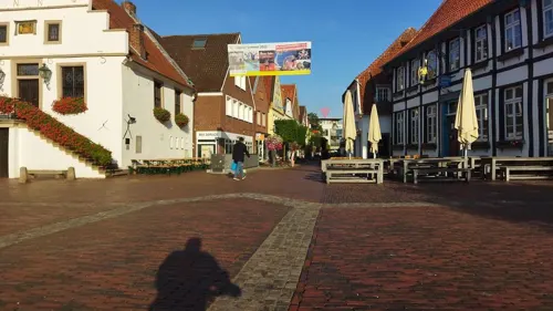
Cafe Extrablatt
Cafe · Coffee Shop · 0.6 km
12 Am Markt, Lingen (Ems)
Mo-Sa 09:00-24:00; Su,PH 09:30-24:00
Fährrestaurant Hotel am Wasserfall
Restaurant · International · 6.0 km
2 Am Wasserfall, Lingen (Ems)
We-Mo 12:00-14:00, 18:00-22:00

AIVILO Café & Weinbar
Cafe · Coffee Shop
8 Burgstraße, Lingen (Ems)
We,Sa 10:00-18:00; Th,Fr,Su 11:00-18:00

Gasthof Niemann - Sportlereck
Restaurant · German · 7.5 km
3 Bramharstraße, Lingen (Ems)
Mo-Fr 14:00+, Sa-Su 09:30+
149 more on the map.
History
Lingen was first mentioned in the Middle Ages (975 AD). From 804 to 1180 the region was part of the Duchy of Saxony inside the Carolingian Empire, and then remained part of the German-speaking Holy Roman Empire until 1806. A initially independent county of Lingen (Grafschaft Lingen) was erected in 1388 and remained until 1713, when Prussia took over. In detail though, the county and city in the 17th and 18th were repeatedly conquered by Dutch and Spanish troops: initially Catholic, from 1541 to 1547 the citizens were forced to become Lutheran, then the troops of Catholic Charles V conquered the county and city and in 1550 gave it to his sister Mary, Governor of the Habsburg Netherlands. From 1555 to 1597 Lingen was the easternmost point of the Spanish Empire of Philip II and became part of the Eighty Years' War.
Read more of the history
From 1597 to 1605 Lingen was conquered by the Calvinist and Dutch Union of Utrecht, then retaken by the Catholic Spanish troops and from 1632 to 1672 again was part of the Calvinist Union of Utrecht. For two years the Prince-Bishopric of Münster had the city, which then from 1674 to 1713 was part of the Calvinist Union of Utrecht again, when Frederick I of Prussia inherited the county. From 1807 to 1813 the troops of Napoleon Bonaparte occupied the region, and from 1810 to 1813 Lingen was part of France. In 1814 it again was part of Prussia, and in 1815 became part of the newly founded kingdom of Hanover. As result of the Austro-Prussian War in 1866 the kingdom of Hanover and also Lingen were annexed by the kingdom of Prussia, and in 1871 became part of the German Empire.
From the History section of Lingen, Germany on Wikipedia, under CC BY-SA 4.0.
More about Lingen
Economy
Lingen is known for its offshore- and nuclear industry (Emsland Nuclear Power Plant). The University of Applied Sciences Osnabrueck has set up a branch campus, located in the centre of Lingen, with the three Institutes for Management and Engineering, Communications Management and Teaching of Theatre. In 2000 the institutes in Lingen merged into the Faculty of Society and Technology.
From the Wikipedia article Lingen, Germany, under CC BY-SA 4.0.
Notable people from Lingen
 Michael RensingGerman footballerPhoto: Fuguito, CC BY-SA 3.0
 Bernd RosemeyerGerman racecar driver and icon of national-socialismPhoto: Unknown Unknown, CC BY-SA 3.0 de
 Ingo SchultzGerman sprinterPhoto: André Zehetbauer from Schwerin, Deutschland, CC BY-SA 2.0
 Thilo LeugersGerman football playerPhoto: Fakwes, CC BY-SA 3.0
 Conny WessmannGerman activist (1965–1989)Photo: Stefan Bellini, CC0
 Theodorus Jacobus FrelinghuysenGerman-American theologian (1691-1747)Photo: Zeete, CC BY-SA 4.0
 Wilfried TelkämperGerman politicianPhoto: Rosa Luxemburg-Stiftung, CC BY 2.0
- Christian DrostenGerman virologist and university teacher
- Joseph RosemeyerGerman racing cyclist (1872-1919)
- Peter van RoyeWest German rower
- Jens GiesekeGerman politician
- Eberhard von DanckelmannPrussian politician (1643-1722)
Born in Lingen, according to Wikidata (CC0). Each name links to its Wikipedia article.
Where to stay22
Churches and places of worship30
Reformierte Kirche
Church · Reformed · 0.7 km
Kirchstraße, Lingen (Ems)
Evangelisch-reformierte Kirche
Church · Protestant · 5.3 km
12 Kösterhook, Lingen (Ems)
Shopping53
Gas and EV charging30
Schools, colleges and libraries33
Berufsbildende Schulen Lingen -Gewerbliche Fachrichtungen-
School · 1.9 km
23 Beckstraße, Lingen (Ems)
Healthcare17
Map of Lingen
250 places. The map loads OpenStreetMap tiles when you open it.
Getting there and nearby towns
Münster Osnabrück Airport (FMO) is the nearest airport with scheduled flights listed in OpenStreetMap, 50 km away.
- Geeste 9 km northwest, about 9 min by car
- Wietmarschen 13 km west, about 13 min by car
- Emsbüren 14 km south, about 14 min by car
- Freren 15 km east, about 15 min by car
- Meppen 19 km north, about 19 min by car
- Haselünne 20 km northeast, about 20 min by car
- Nordhorn 20 km southwest, about 20 min by car
- Spelle 20 km southeast, about 20 min by car
- Twist 22 km northwest, about 22 min by car
- Salzbergen 22 km south, about 22 min by car
Drive times are estimates from straight-line distance, not routes.
Towns near Lingen


Keep exploring
Local news
Headlines from INDB.
Reviews, tips and questions
Loading what members have shared...
Sources and licences
- GeoNames (CC BY 4.0): population, coordinates, regions and time zone
- Mapillary (see each image): photos
- OpenStreetMap contributors (ODbL 1.0): places, airports, map data
- Wikidata (CC0 1.0): elevation, founding date, time zone, website
- Wikimedia Commons (see each image): photos
- Wikipedia (CC BY-SA 4.0): overview and history text
Photo credits
- Urbodomo de Lingen 1, Thomas Pusch, CC BY-SA 3.0
- Georgstraße 14, Lingen (01), K.ristof, CC BY-SA 3.0
- Stolpersteinlage Lingen Georgstraße 12, Gmbo 2013, CC0
- Stolperstein Lingen Georgstraße 12 Marianne Grünberg, Gmbo 2013, CC0
- Stolperstein Lingen Georgstraße 12 Bendix Grünberg, Gmbo 2013, CC0
- Stolpersteinlage Lingen Kaiserstraße 1, Gmbo 2013, CC0
- Stolperstein Lingen Georgstraße 12 Gerda Grünberg, Gmbo 2013, CC0
- Stolpersteine Lingen Georgstraße 12, Gmbo 2013, CC0
- Stolpersteine Lingen Kaiserstraße 1, Gmbo 2013, CC0
- Stolperstein Lingen Kaiserstraße 1 Caroline Heilbronn, Gmbo 2013, CC0
- Stolperstein Lingen Georgstraße 12 Herman Nico de Jong, Gmbo 2013, CC0
- Stolperstein Lingen Georgstraße 12 Elise de Jong, Gmbo 2013, CC0
- Stolperstein Lingen Georgstraße 12 Rosette Groenberg, Gmbo 2013, CC0
- Stolperstein Lingen Georgstraße 12 Bob de Jong, Gmbo 2013, CC0
- Stolperstein Lingen Kaiserstraße 1 Wilhelm Heilbronn, Gmbo 2013, CC0
- Wohnhaus Georgstraße 9 Lingen P4060713, Worldfootage, CC BY-SA 4.0
- Wohnhaus Georgstraße 11 Lingen P4060714, Worldfootage, CC BY-SA 4.0
- Wohnhaus Georgstraße 13 Lingen P4060716, Worldfootage, CC BY-SA 4.0
- Landratsamt (heute Polizei) Georgstraße 16 Lingen P4060717, Worldfootage, CC BY-SA 4.0
- Wohnhaus Kaiserstraße 2 Lingen P4060766, Worldfootage, CC BY-SA 4.0
- Wohnhaus Georgstraße 15 Lingen P4060718, Worldfootage, CC BY-SA 4.0
- Justizvollzugsanstalt (Pförtnerhaus) Lingen P4060711, Worldfootage, CC BY-SA 4.0
- Wohnhaus Georgstraße 9 Lingen P4060719, Worldfootage, CC BY-SA 4.0
- Wohnhaus Nordstraße 3 - 5 Lingen P4060712, Worldfootage, CC BY-SA 4.0
- Stolpersteinlage Lingen Georgstraße 6, Gmbo 2013, CC0
- Stolperstein Lingen Georgstraße 6 Hermann Silbermann, Gmbo 2013, CC0
- Wohnhaus Kaiserstraße 3 Lingen P4060765, Worldfootage, CC BY-SA 4.0
- Stolpersteine Lingen Georgstraße 6, Gmbo 2013, CC0
- Justizvollzugsanstalt (Nebengebäude) Kaiserstraße 5 Lingen P4060764, Worldfootage, CC BY-SA 4.0
- Wohnhaus Georgstraße 23 Lingen P4060723, Worldfootage, CC BY-SA 4.0
- Justizvollzugsanstalt (Direktorenwohnhaus) Lingen P4060763, Worldfootage, CC BY-SA 4.0
- Wohnhaus Georgstraße 21 Lingen P4060722, Worldfootage, CC BY-SA 4.0
- Wohnhaus Georgstraße 19 Lingen P4060721, Worldfootage, CC BY-SA 4.0
- Wohnhaus Georgstraße 17 Lingen P4060720, Worldfootage, CC BY-SA 4.0
- Villa Alte Haselünner Straße 4 Lingen P4060708, Worldfootage, CC BY-SA 4.0
- Wohnhaus Alte Haselünner Straße 9 Lingen P4060709, Worldfootage, CC BY-SA 4.0
- Alte Posthalterei in Lingen (1), Krzysztof Golik, CC BY-SA 4.0
- Geeste - Osterbroker Straße - Biotop 08 ies, Frank Vincentz, CC BY-SA 3.0
- St Josef Lingen 2008, Michael B. BeVor 19:43, 23. Dez. 2008 (CET), CC BY-SA 3.0 de
- Naturschutzgebiet Wacholderheide (Lingen) (Kennzeichen NSG WE 163), ant.scha, CC BY-SA 3.0
- Großsteingrab auf dem Radberg, Megalithicguy, CC BY-SA 3.0
- Historisches Rathaus Lingen (Ems), Stadt Lingen (Ems), CC0
- Preĝejo St. Bonifatius en Lingen 2, Thomas Pusch, CC BY-SA 3.0
- Lohne, Kirche St. Antonius, Rauenstein, CC BY-SA 3.0
- Schepsdorf - Kirche -01, Heribert Duling (Famduling), CC BY-SA 3.0 de
- Bonifatius-Hospital, Lexipedia1995, CC BY-SA 4.0
- Geeste St. Antonius church, Hinnek.Higgens, CC BY-SA 4.0
- Geeste Dalum Christus König church, Hinnek.Higgens, CC BY-SA 4.0
- Kreuzkirche Universitätsplatz en Lingen, Thomas Pusch, CC BY-SA 3.0
- Reformierte Kirche en Lingen, Thomas Pusch, CC BY-SA 3.0
- Baccum Evangelisch reformierte Kirche 01, J.-H. Janßen, CC BY-SA 3.0
- Baccum St Antonius 01, J.-H. Janßen, CC BY-SA 3.0
- Grosssteingrab-Mundersumer-Sand-2020-10-22, User:Stefan_Kunzmann, CC BY-SA 4.0
- Kunsthalle Lingen, Eingang, Gerd Fahrenhorst, CC BY 4.0
- Street-level photo, Langfahrer, CC BY-SA 4.0
- Street-level photo, brunsben, CC BY-SA 4.0
- Street-level photo, brunsben, CC BY-SA 4.0
- Street-level photo, changchun1, CC BY-SA 4.0
- Street-level photo, deleted_user, CC BY-SA 4.0
- Street-level photo, brunsben, CC BY-SA 4.0
- Street-level photo, deleted_user, CC BY-SA 4.0
- Street-level photo, deleted_user, CC BY-SA 4.0
- Street-level photo, littlefool, CC BY-SA 4.0
- Street-level photo, b166er, CC BY-SA 4.0
- Street-level photo, changchun1, CC BY-SA 4.0
- Street-level photo, avent, CC BY-SA 4.0
- Street-level photo, brunsben, CC BY-SA 4.0
- Street-level photo, brunsben, CC BY-SA 4.0
- Street-level photo, brunsben, CC BY-SA 4.0
- Street-level photo, brunsben, CC BY-SA 4.0
- Street-level photo, marczoutendijk, CC BY-SA 4.0
- Street-level photo, littlefool, CC BY-SA 4.0


Page built November 9, 2026. Spotted a mistake? Tell us or suggest a place.