


Why visit Oberndorf
Townapedia lists 10 museums and landmarks, 6 parks and trails, 36 places to eat, 7 places to stay and 6 attractions in and around town.
Highlights include Kino Paradies, Heimat und Waffenmuseum and Burg Waseneck.
Weather in Oberndorf
Forecast from MET Norway (CC BY 4.0). Full forecast
Things to do6



Museums and landmarks10
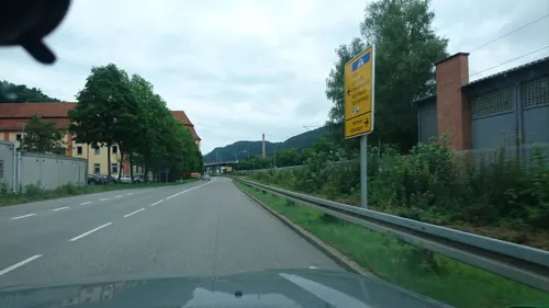
Heimat und Waffenmuseum
Museum
14 Klosterstraße, Oberndorf am Neckar
Tu-Fr 14:00-17:00; Sa,Su 11:00-17:00


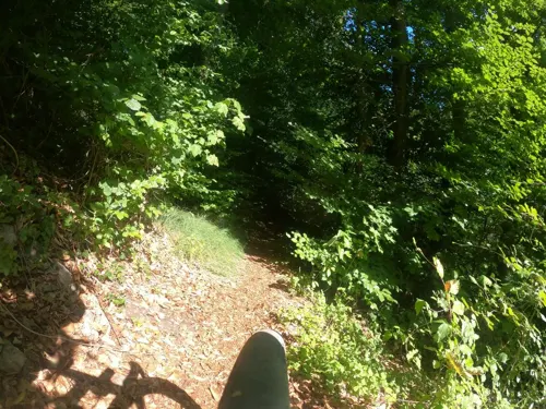
Parks, trails and playgrounds6

Freibad Oberndorf
Sports field and stadium · 1.1 km
11 Austraße, Oberndorf am Neckar



Restaurants and cafes36

Al Capriccio
Restaurant · Italian
2 Tuchbergstraße, Oberndorf am Neckar
Tu-Su 11:30-14:00,17:00-22:30; Sa 17:00-22:30
Tres
Restaurant · Spanish
16 Hauptstraße, Oberndorf am Neckar
Tu 17:30-24:00; We-Sa 00:00-01:00,17:30-24:00; Su...
Gaststätte-Restaurant Turnerheim
Restaurant · German, Greek · 1.2 km
15 Austraße, Oberndorf am Neckar
Mo,Tu,Th-Sa 17:00-22:00; Su 11:00-14:00,17:00-21:00; PH 11:00-14:00; We off

Eiscafe Venezia
Cafe · Ice Cream
1 Obertorplatz, Oberndorf am Neckar
Mo-Sa 10:00-19:00, Sa 11:00-19:00
A modo mio
Restaurant · 2.5 km
1 Untere Straße, Oberndorf am Neckar
We-Su,PH 12:00-21:00



24 more on the map.
Where to stay7
Gasthof-Hotel zum Wasserfall
Motel and hotel · German, Regional · 0.9 km
60 Lindenstraße, Oberndorf am Neckar
Gästehaus Dependance Zum Wasserfall
Motel and hotel · 0.8 km
46 Wasserfallstraße, Oberndorf am Neckar
Churches and places of worship12
Dreifaltigkeitskirche
Church · Catholic · 1.3 km
7 Ringstraße, Oberndorf am Neckar
Evangelische Stadtkirche
Church · Protestant
33 Brandeckerstraße, Oberndorf am Neckar
Katholische Kirche St. Michael
Church · Roman Catholic
2 Hafenmarkt, Oberndorf am Neckar
Neuapostolische Kirche
Church · New Apostolic · 0.7 km
6 Rosenfelder Straße, Oberndorf am Neckar
Neuapostolische Kirche
Church · New Apostolic · 1.2 km
2 Ringstraße, Oberndorf am Neckar
Freie evangelische Gemeinde Oberndorf
Church · 1.1 km
25 Neckarstraße, Oberndorf am Neckar
Shopping7
Gas and EV charging6
TurboTankstelle
Gas station · 1.6 km
12 Friedrich-List-Straße, Oberndorf am Neckar
Schools, colleges and libraries9
Healthcare5
SRH Krankenhaus Oberndorf a.N.
Hospital · 0.8 km
14 Hölderlinstraße, Oberndorf am Neckar
Map of Oberndorf
104 places. The map loads OpenStreetMap tiles when you open it.
Getting there and nearby towns
Lahr Airport (LHA) is the nearest airport with scheduled flights listed in OpenStreetMap, 56 km away.
- Sulz am Neckar 9 km northeast, about 9 min by car
- Rottweil 14 km south, about 14 min by car
- Schramberg 16 km southwest, about 16 min by car
- Trossingen 24 km south, about 24 min by car
- Villingen-Schwenningen 26 km south, about 26 min by car
- St. Georgen im Schwarzwald 25 km southwest, about 25 min by car
- Spaichingen 27 km southeast, about 27 min by car
- Tuttlingen 39 km southeast, about 39 min by car
- Wildberg 39 km north, about 39 min by car
- Tübingen 44 km northeast, about 44 min by car
Drive times are estimates from straight-line distance, not routes.
Local news
Headlines from INDB.
Reviews, tips and questions
Loading what members have shared...
Sources and licences
- GeoNames (CC BY 4.0): population, coordinates, regions and time zone
- Mapillary (see each image): photos
- OpenStreetMap contributors (ODbL 1.0): places, airports, map data
- Wikidata (CC0 1.0): elevation, founding date, time zone, website
- Wikimedia Commons (see each image): photos
Photo credits
- Narrentag-Oberndorf 2024-Nachtumzug-, Rainer Halama, CC BY-SA 4.0
- Narrentag-Oberndorf 2024-Nachtumzug-08026, Rainer Halama, CC BY-SA 4.0
- Narrentag-Oberndorf 2024-Nachtumzug-08009, Rainer Halama, CC BY-SA 4.0
- Narrentag-Oberndorf 2024-Nachtumzug-08010, Rainer Halama, CC BY-SA 4.0
- Narrentag-Oberndorf 2024-Nachtumzug-08011, Rainer Halama, CC BY-SA 4.0
- Narrentag-Oberndorf 2024-Nachtumzug-08006, Rainer Halama, CC BY-SA 4.0
- Narrentag-Oberndorf 2024-Nachtumzug-08007, Rainer Halama, CC BY-SA 4.0
- Narrentag-Oberndorf 2024-Nachtumzug-08012, Rainer Halama, CC BY-SA 4.0
- Narrentag-Oberndorf 2024-Nachtumzug-08016, Rainer Halama, CC BY-SA 4.0
- Narrentag-Oberndorf 2024-Nachtumzug-08017, Rainer Halama, CC BY-SA 4.0
- Narrentag-Oberndorf 2024-Nachtumzug-08013, Rainer Halama, CC BY-SA 4.0
- Narrentag-Oberndorf 2024-Nachtumzug-08015, Rainer Halama, CC BY-SA 4.0
- Narrentag-Oberndorf 2024-Nachtumzug-08022, Rainer Halama, CC BY-SA 4.0
- Narrentag-Oberndorf 2024-Nachtumzug-08020, Rainer Halama, CC BY-SA 4.0
- 20260918 Pfarrhaus Oberndorf am Neckar-A6407408, Zinnmann, CC BY-SA 4.0
- Narrentag-Oberndorf 2024-Nachtumzug-2901, Rainer Halama, CC BY-SA 4.0
- Narrentag-Oberndorf 2024-Nachtumzug-07594, Rainer Halama, CC BY-SA 4.0
- Narrentag-Oberndorf 2024-Nachtumzug-07685, Rainer Halama, CC BY-SA 4.0
- Narrentag-Oberndorf 2024-Nachtumzug-07993, Rainer Halama, CC BY-SA 4.0
- Narrentag-Oberndorf 2024-Nachtumzug-07996, Rainer Halama, CC BY-SA 4.0
- Narrentag-Oberndorf 2024-Nachtumzug-07853, Rainer Halama, CC BY-SA 4.0
- Narrentag-Oberndorf 2024-Nachtumzug-07644, Rainer Halama, CC BY-SA 4.0
- Narrentag-Oberndorf 2024-Nachtumzug-07943, Rainer Halama, CC BY-SA 4.0
- Narrentag-Oberndorf 2024-Nachtumzug-07682, Rainer Halama, CC BY-SA 4.0
- Narrentag-Oberndorf 2024-Nachtumzug-07904, Rainer Halama, CC BY-SA 4.0
- Narrentag-Oberndorf 2024-Nachtumzug-07632, Rainer Halama, CC BY-SA 4.0
- Narrentag-Oberndorf 2024-Nachtumzug-07586, Rainer Halama, CC BY-SA 4.0
- Narrentag-Oberndorf 2024-Nachtumzug-07988, Rainer Halama, CC BY-SA 4.0
- Narrentag-Oberndorf 2024-Nachtumzug-07585, Rainer Halama, CC BY-SA 4.0
- Narrentag-Oberndorf 2024-Nachtumzug-07823, Rainer Halama, CC BY-SA 4.0
- Narrentag-Oberndorf 2024-Nachtumzug-07981, Rainer Halama, CC BY-SA 4.0
- Narrentag-Oberndorf 2024-Nachtumzug-07866, Rainer Halama, CC BY-SA 4.0
- Narrentag-Oberndorf 2024-Nachtumzug-07656, Rainer Halama, CC BY-SA 4.0
- Narrentag-Oberndorf 2024-Nachtumzug-2904, Rainer Halama, CC BY-SA 4.0
- Narrentag-Oberndorf 2024-Nachtumzug-07663, Rainer Halama, CC BY-SA 4.0
- Narrentag-Oberndorf 2024-Nachtumzug-07975, Rainer Halama, CC BY-SA 4.0
- Narrentag-Oberndorf 2024-Nachtumzug-07977, Rainer Halama, CC BY-SA 4.0
- Narrentag-Oberndorf 2024-Nachtumzug-07925, Rainer Halama, CC BY-SA 4.0
- Narrentag-Oberndorf 2024-Nachtumzug-07753, Rainer Halama, CC BY-SA 4.0
- Narrentag-Oberndorf 2024-Nachtumzug-07997, Rainer Halama, CC BY-SA 4.0
- Burg Waseneck 1, James Steakley, CC BY-SA 3.0
- SRH Krankenhaus Oberndorf a.N., Martin Rust, CC BY-SA 3.0
- Oberndorf Kino KKK, Photo: Andreas Praefcke, CC BY 3.0
- Oberndorf Klosterkirche 01, Photo: Andreas Praefcke, CC BY 3.0
- Blick von der Schillerhöhe auf Rheinmetall Waffe Defence Munition Niederlassung Mauser Oberndorf - panoramio, qwesy qwesy, CC BY 3.0
- Street-level photo, tasmaniadevil, CC BY-SA 4.0
- Street-level photo, tasmaniadevil, CC BY-SA 4.0
- Street-level photo, voschix, CC BY-SA 4.0
- Street-level photo, mfa, CC BY-SA 4.0
- Street-level photo, pablopita, CC BY-SA 4.0
- Street-level photo, tasmaniadevil, CC BY-SA 4.0
- Street-level photo, tasmaniadevil, CC BY-SA 4.0
- Street-level photo, plexi32, CC BY-SA 4.0
- Street-level photo, nvbwseifert, CC BY-SA 4.0
- Street-level photo, plexi32, CC BY-SA 4.0
- Street-level photo, plexi32, CC BY-SA 4.0
- Street-level photo, plexi32, CC BY-SA 4.0
- Street-level photo, tasmaniadevil, CC BY-SA 4.0
- Street-level photo, tasmaniadevil, CC BY-SA 4.0
- Street-level photo, nvbwseifert, CC BY-SA 4.0


Page built November 8, 2026. Spotted a mistake? Tell us or suggest a place.