


Schieder-Schwalenberg, Germany
Schieder-Schwalenberg is a town of 9,443 people in North Rhine-Westphalia, Germany.
Why visit Schieder-Schwalenberg
Townapedia lists 39 museums and landmarks, 13 parks and trails, 39 places to eat, 15 places to stay and 43 attractions in and around town.
Highlights include Kahlenbergturm, Aussichtsturm Hungerberg, Kreuzweg and Papiermühle Plöger.
Weather in Schieder-Schwalenberg
Forecast from MET Norway (CC BY 4.0). Full forecast
About Schieder-Schwalenberg
Schieder-Schwalenberg (German pronunciation: [ˈʃiːdɐ ˈʃvaːlənˌbɛʁk] ; Low German: Schüer-Schwalenberg) is a town in the Lippe district, in North Rhine-Westphalia, Germany. It is situated approximately 20 km (12 mi) east of Detmold.
From the Wikipedia article Schieder-Schwalenberg (this version), under CC BY-SA 4.0.
Things to do43





Wellings Hofladen mit Bauernhofeis
Farm and orchard · 3.0 km
11 Born, Marienmünster
24/7
31 more on the map.
Museums and landmarks39


Papiermühle Plöger
Museum · 5.1 km
11 Im Niesetal, Schieder-Schwalenberg
May-Oct: Sa 10:00-17:00; Su 10:00-12:00,15:00-17:00

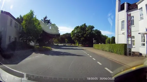
Möbelmuseum
Museum · 6.5 km
1 Rolfzener Straße, Steinheim
We,Su 14:00-17:00; PH off


Schloss Schieder
Monument and historic site · 5.2 km
1 Im Kurpark, Schieder-Schwalenberg

Schloss Thienhausen
Monument and historic site · 5.6 km
Dreizehnlindenweg, Steinheim
GR047-3a
Monument and historic site · 5.8 km
Ehemalige Grenze zwischen dem Fürstentum Lippe und Fürstentum Paderborn


Stoppelberg
Monument and historic site · 4.5 km
Reste der Wehranlage der Stadt Stoppelberg, die im 13. Jahrhundert vom Grafen von Schwalenberg auf dem gleichnamigen Berg gegründet...
27 more on the map.
Parks, trails and playgrounds13





1 more on the map.
Restaurants and cafes39

Zur Burg Schwalenberg
Restaurant
Am WE mit Frühstück. Gut bürgerliche Küche. Ausflugslokal für Jung und Alt
2 Burg, Schieder-Schwalenberg
Fr 14:30-22:00; Sa 12:00-22:00; Su 12:00-21:00
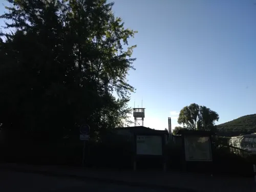
Café Restaurant Breitengrad
Restaurant · Pizza, Burger, Coffee Shop, Regional · 5.4 km
3 Kronenbruch, Schieder-Schwalenberg
Mo-Su 11:00-20:00
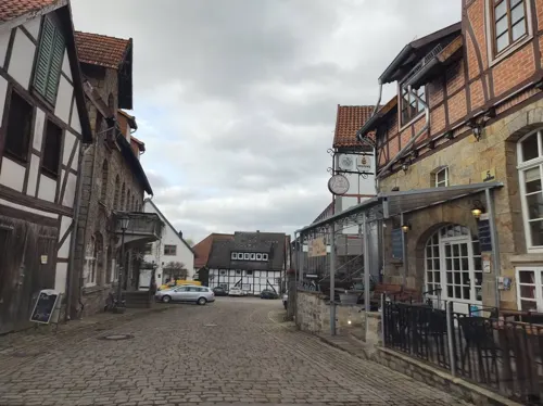
Mal Anders
Restaurant · German
50er Jahre Kneipe mit Rock'n'Roll ab Mittags und Rock/Metal ab Abneds. Kleine Speisekarte: versch. Kuchen, auch versch. Schnitzel etc.
5 In der Tränke, Schieder-Schwalenberg
Fr 19:00-02:00; Sa 13:30-02:00; Su 11:00-20:00
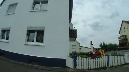
Pizzeria Piccolo
Restaurant · Pizza · 5.9 km
28 Hauptstraße, Lügde
Tu-Fr 16:00-22:00, Sa,Su 12:00-22:00
Restaurante la Piazzetta
Restaurant · Italian, Pasta, Pizza
18 Marktstraße, Schieder-Schwalenberg
Tu-Sa 12:00-14:30, 17:30-22:30; Su 12:00-14:30, 17:00-22:00
Bäckerei Engel
Bakery · 4.9 km
1 Schwalenberger Straße, Schieder-Schwalenberg
Mo-Sa 06:00-18:00, Su 07:30-17:00

Gaststätte "Zum Fuhrmann"
Bar and pub · 3.9 km
11 Hauptstraße, Marienmünster
Tu-Fr 17:00+; Sa-Su 10:00+; Mo off



27 more on the map.
History
The County of Schwalenberg was first mentioned with count Widekind I in 1127. The original seat of the counts had been Oldenburg Castle at Marienmünster. The monastery of Marienmünster was founded by the counts in 1128. Schwalenberg Castle was built between 1228 and 1231 by count Volkwin III. During the 13th century the territory of the counts was split between several branches, creating the county of Schwalenberg itself (then mainly restricted to a small territory around Schwalenberg Castle), the county of Pyrmont (existing from 1194 until 1495), the county of Waldeck (existing as a principality until 1918) and the county of Sternberg (existing from 1243 until 1377, later disputed between the counts of Schaumburg and the counts of Lippe). When the Schwalenberg branch extinguished in 1365, its territory was divided between the House of Lippe (which used Schwalenberg Castle as a seat of junior branches and later distributed parts of the county to its branches Lippe-Biesterfeld and Lippe-Weissenfeld), and the Prince-Bishopric of Paderborn.
From the History section of Schieder-Schwalenberg on Wikipedia, under CC BY-SA 4.0.
Where to stay15
Waldblick
Motel and hotel · 5.0 km
13 Auf der Mühlenbreite, Schieder-Schwalenberg
Churches and places of worship15
Kath. Kirche "St. Marien"
Church · Catholic · 4.7 km
6 Stoppelbergstraße, Steinheim
St. Laurentius
Church · Roman Catholic · 4.4 km
68 Auf der Mühlenbreite, Schieder-Schwalenberg
Shopping6
Der Fliegende Hollander
Shop · 4.8 km
19 Schwalenberger Straße, Schieder-Schwalenberg
Gas and EV charging4
E-Bike Ladestation Dorfgemeinschaftshaus Sommersell;Dorfgemeinschaftshaus Sommersell
EV charging · 4.3 km
Schools, colleges and libraries7
Healthcare1
Map of Schieder-Schwalenberg
182 places. The map loads OpenStreetMap tiles when you open it.
Getting there and nearby towns
Flugplatz Bielefeld (BFE) is the nearest airport with scheduled flights listed in OpenStreetMap, 46 km away.
- Steinheim 7 km west, about 7 min by car
- Lügde 10 km north, about 10 min by car
- Blomberg 10 km northwest, about 10 min by car
- Nieheim 10 km southwest, about 10 min by car
- Bad Pyrmont 13 km north, about 13 min by car
- Barntrup 14 km northwest, about 14 min by car
- Höxter 17 km southeast, about 17 min by car
- Brakel 18 km south, about 18 min by car
- Holzminden 18 km east, about 18 min by car
- Bad Driburg 20 km southwest, about 20 min by car
Drive times are estimates from straight-line distance, not routes.
Local news
Headlines from INDB.
Reviews, tips and questions
Loading what members have shared...
Sources and licences
- GeoNames (CC BY 4.0): population, coordinates, regions and time zone
- Mapillary (see each image): photos
- OpenStreetMap contributors (ODbL 1.0): places, airports, map data
- Wikidata (CC0 1.0): elevation, founding date, time zone, website
- Wikimedia Commons (see each image): photos
- Wikipedia (CC BY-SA 4.0): overview and history text
Photo credits
- Glashutte am SchiederSee, Franz Paus (contact: Frank Benner ), CC BY-SA 3.0
- Schieder-Schwalenberg - 016 - Papenwinkel 12 (8), Tsungam, CC BY-SA 3.0
- Schieder-Schwalenberg - 100 - Unterm Fleck (3), Tsungam, CC BY-SA 3.0
- Schieder-Schwalenberg - 11 - Brauergildestraße 9, Tsungam, CC BY-SA 3.0
- Schieder-Schwalenberg - 62 - Brauergildestraße 1, Tsungam, CC BY-SA 3.0
- Schieder-Schwalenberg - 38 - Brauergildestraße 5, Tsungam, CC BY-SA 3.0
- Schieder-Schwalenberg - 12 - Brauergildestraße 21 (2), Tsungam, CC BY-SA 3.0
- Schieder-Schwalenberg - 12 - Brauergildestraße 21 (3), Tsungam, CC BY-SA 3.0
- Schieder-Schwalenberg - 25 - Brauergildestraße 3, Tsungam, CC BY-SA 3.0
- Schieder-Schwalenberg - 26 - Brauergildestraße 4, Tsungam, CC BY-SA 3.0
- Schieder-Schwalenberg - 69 - Marktstraße 9 (2), Tsungam, CC BY-SA 3.0
- Schieder-Schwalenberg - 69 - Marktstraße 9 (1), Tsungam, CC BY-SA 3.0
- Schieder-Schwalenberg - 08 - Marktstraße 5 (2), Tsungam, CC BY-SA 3.0
- Schieder-Schwalenberg - 63 - Klingenberg 2, Tsungam, CC BY-SA 3.0
- Schieder-Schwalenberg - 43 - Marktstraße 10 (2), Tsungam, CC BY-SA 3.0
- Schieder-Schwalenberg - 16 - Papenwinkel 12 (1), Tsungam, CC BY-SA 3.0
- Schieder-Schwalenberg - 12 - Brauergildestraße 21 (1), Tsungam, CC BY-SA 3.0
- Schieder-Schwalenberg - 07 - Marktstraße 11, Tsungam, CC BY-SA 3.0
- Schieder-Schwalenberg - 08 - Marktstraße 5 (1), Tsungam, CC BY-SA 3.0
- Schieder-Schwalenberg - 2017-04-24 - Rathaus, Tsungam, CC BY-SA 4.0
- Schieder-Schwalenberg - 36 - Brauergildestraße 25, Tsungam, CC BY-SA 3.0
- Schieder-Schwalenberg - 68 - Marktstraße 2, Tsungam, CC BY-SA 3.0
- Schieder-Schwalenberg - 66 - Klingenberg 8, Tsungam, CC BY-SA 3.0
- Schieder-Schwalenberg - 85 - Brauergildestraße 23, Tsungam, CC BY-SA 3.0
- Schieder-Schwalenberg - 16 - Papenwinkel 12 (2), Tsungam, CC BY-SA 3.0
- Schieder-Schwalenberg - 57 - Alte Torstraße 6, Tsungam, CC BY-SA 3.0
- Schieder-Schwalenberg - 24 - Marktstraße 16, Tsungam, CC BY-SA 3.0
- Schieder-Schwalenberg - 51 - Marktstraße 6, Tsungam, CC BY-SA 3.0
- Schieder-Schwalenberg - 43 - Marktstraße 10 (1), Tsungam, CC BY-SA 3.0
- Schieder-Schwalenberg - 59 - Alte Torstraße 10, Tsungam, CC BY-SA 3.0
- Marienmünster - 2016-10-15 - Abtei (38), Tsungam, CC BY-SA 4.0
- Schieder-Schwalenberg - Befestigungsanlage Alt Schieder (3), Tsungam, CC0
- Schieder-Schwalenberg - 2014-09-08 - Burg Schwalenberg, Tsungam, CC BY-SA 4.0
- Lügde - 2014-09-08 - Evangelische Kirche Elbrinxen (6), Tsungam, CC BY-SA 4.0
- Schieder-Schwalenberg - 20 - Im Kurpark 1 (3), Tsungam, CC BY-SA 3.0
- Schieder-Schwalenberg - 2014-09-11 - SW - Rodenstatt (11), Tsungam, CC BY-SA 4.0
- Steinheim westfalen 2012 002, Klaus Graf, CC BY-SA 3.0
- Hungerberg, Stefan Jan Schmidt, CC BY-SA 3.0
- Lügde - 2015-05-24 - LIP-049 Ilsenbach (3), Tsungam, CC BY-SA 3.0
- Schieder-Schwalenberg - 107 - Kahlenbergturm (2), Tsungam, CC BY-SA 3.0
- Marienmünster - Oldenburg - 1, Ath, CC0
- Schieder-Schwalenberg - 48 - Im Niesetal 11 (11), Tsungam, CC BY-SA 3.0
- Lügde - 2014-09-08 - Schwalenberger Wald, Himmelsteich (3), Tsungam, CC BY-SA 4.0
- Sommersell - St. Peter und Paul - 1, Ath, CC0
- Schalenstein Bennerberg-Schieder-Schwalenberg, Grugerio, CC BY-SA 3.0
- Felix winkelnkemper - 50105873108, Felix Winkelnkemper, CC BY 2.0
- Schieder-Schwalenberg - 2025-08-09 - LSG Emmertal südwestlich Noltehof + NSG Emmeroberlauf und Beberbach (DSC 6546), Tsungam, CC BY-SA 4.0
- Schieder-Schwalenberg - 2015-05-12 - Emmertal (3), Tsungam, CC BY-SA 3.0
- Lügde - 2015-05-24 - LIP-049 Ilsenbach (11), Tsungam, CC BY-SA 3.0
- Schieder-Schwalenberg - 2015-06-04 - LIP-025 Nieseniederung (2), Tsungam, CC BY-SA 4.0
- Steinheim - 2016-04-24 - NSG HX-068 (005), Tsungam, CC BY-SA 4.0
- Marienmünster - 2016-10-15 - Hungerbergkapelle (2), Tsungam, CC BY-SA 4.0
- Street-level photo, thetornado76, CC BY-SA 4.0
- Street-level photo, drq23, CC BY-SA 4.0
- Street-level photo, thetornado76, CC BY-SA 4.0
- Street-level photo, ramap, CC BY-SA 4.0
- Street-level photo, thetornado76, CC BY-SA 4.0
- Street-level photo, derlipper, CC BY-SA 4.0
- Street-level photo, thetornado76, CC BY-SA 4.0
- Street-level photo, thetornado76, CC BY-SA 4.0
- Street-level photo, thetornado76, CC BY-SA 4.0
- Street-level photo, thetornado76, CC BY-SA 4.0
- Street-level photo, thetornado76, CC BY-SA 4.0
- Street-level photo, ImoEx, CC BY-SA 4.0
- Street-level photo, Schmarvis, CC BY-SA 4.0
- Street-level photo, Schmarvis, CC BY-SA 4.0
- Street-level photo, derlipper, CC BY-SA 4.0
- Street-level photo, thetornado76, CC BY-SA 4.0
- Street-level photo, thetornado76, CC BY-SA 4.0
- Street-level photo, thetornado76, CC BY-SA 4.0
- Street-level photo, thetornado76, CC BY-SA 4.0
- Street-level photo, klausx, CC BY-SA 4.0
- Street-level photo, ramap, CC BY-SA 4.0
- Street-level photo, ma1pp1er, CC BY-SA 4.0
- Street-level photo, thetornado76, CC BY-SA 4.0
- Street-level photo, hendel, CC BY-SA 4.0


Page built November 9, 2026. Spotted a mistake? Tell us or suggest a place.