


Why visit Sögel
Townapedia lists 44 museums and landmarks, 25 parks and trails, 23 places to eat, 4 places to stay and 8 attractions in and around town.
Highlights include Hamberg, Windberg, Jagdschloss Clemenswerth and Großsteingrab Püttkesberge.
Weather in Sögel
Forecast from MET Norway (CC BY 4.0). Full forecast
About Sögel
Sögel is a municipality in the Emsland district, in Lower Saxony, Germany. Sögel is most known for the Clemenswerth Palace, a hunting lodge built 1737–1749 by Johann Conrad Schlaun for Elector Clemens August.
From the Wikipedia article Sögel (this version), under CC BY-SA 4.0.
Things to do8

Museums and landmarks44


Großsteingrab auf der Buschhöhe 1
Monument and historic site · 3.5 km
Großsteingrab auf der Buschhöhe 2
Monument and historic site · 3.5 km

Großsteingrab bei den Düvelskuhlen 1
Monument and historic site · 3.8 km
Großsteingrab bei den Düvelskuhlen 2
Monument and historic site · 4.0 km


32 more on the map.
Parks, trails and playgrounds25


Hügelgräberheide bei Groß und Klein Berßen
Hiking and trails · 6.3 km


Kleingewässer im Nordender Feld östlich Groß Berßen
Hiking and trails · 5.9 km
§30-Biotop
Schaapmoor
Hiking and trails · 4.1 km
Das 210 ha große Schutzgebiet umfasst einen Ausschnitt aus dem Niederungsbereich der Nordradde. Das charakteristische Biotopmosaik aus...
Grünland im ehem. Hochmoor am Sögeler Grenzgraben westlich der Lahner Heide
Hiking and trails · 4.3 km
§30-Biotop
Kleingewässer im ehem. Hochmoor am Sögeler Grenzgraben westlich der Lahner Heide
Hiking and trails · 4.6 km
§30-Biotop

Birken-Bruchwald zw. Groß Berßen und Hüven im Bereich Wolfstangen
Hiking and trails · 6.0 km
§30-Biotop
13 more on the map.
Restaurants and cafes23
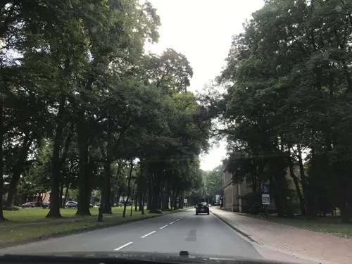
Bäckerei Anneken
Cafe
Bäckerei und Stehcafe
54 Clemens-August-Straße, Sögel
Mo-Th 06:00-14:00; Sa 06:00-12:00; Su 07:45-11:00

Lotus
Restaurant · Asian
2 Am Markt, Sögel
Mo off; Tu-Fr 17:30-22:00; Su 11:30-15:00, 17:00-22:00; Sa, PH...
Montenegro
Restaurant · German, Fish, Greek, Barbecue, International, Mediterranean, Seafood · 0.7 km
1 Rothenbacher Weg, Sögel
Mo,We-Sa 18:00-23:00; Su,PH 12:00-14:00, 18:00-23:00; Tu off
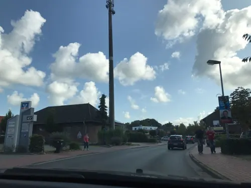


Wein & Genuss
Brewery and winery
25a Clemens-August-Straße, Sögel
Mo-We 15:00-18:00; Th,Fr 10:00-13:00, 15:00-18:00; Sa 10:00-13:00;...
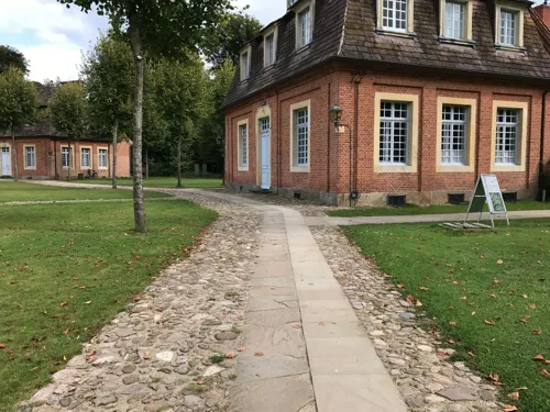


Schlosskeller
Restaurant · 1.3 km
2 Clemenswerth, Sögel
derzeit (September 2026) wegen Renovierung geschlossen. Curently...
Presto Pronto
Restaurant · Indian, Italian
4 Sigiltrastraße, Sögel
Tu-Th 12:00-14:00, 17:00-22:30; Fr,Sa 12:00-14:00, 17:00-23:00; Su...

Café Zum Amtsbrunnen
Cafe
2a Mühlenstraße, Sögel
Mo-Tu,Th,Sa 12:00-24:00; Su 11:00-21:00; Fr 11:00-24:00
11 more on the map.
Where to stay4
Churches and places of worship6
St. Johannes der Täufer
Church · Roman Catholic · 6.3 km
Hauptstraße, Spahnharrenstätte
Rumänisch-orthodoxe Kirchengemeinde Papenburg-Sögel
Church · Romanian Orthodox · 1.3 km
54 Sprakeler Straße, Sögel
St.-Franziskus-Kirche Werpeloh
Church · Catholic · 3.8 km
35 Hauptstraße, Werpeloh
Shopping10
Gas and EV charging6
Schools, colleges and libraries6
Healthcare4
Map of Sögel
136 places. The map loads OpenStreetMap tiles when you open it.
Getting there and nearby towns
Flugplatz Varrelbusch (VAC) is the nearest airport with scheduled flights listed in OpenStreetMap, 36 km away.
- Werlte 11 km east, about 11 min by car
- Haren 19 km west, about 19 min by car
- Haselünne 19 km south, about 19 min by car
- Löningen 20 km southeast, about 20 min by car
- Meppen 23 km southwest, about 23 min by car
- Papenburg 27 km north, about 27 min by car
- Friesoythe 30 km northeast, about 30 min by car
- Geeste 32 km southwest, about 32 min by car
- Ostrhauderfehn 34 km north, about 34 min by car
- Cloppenburg 35 km east, about 35 min by car
Drive times are estimates from straight-line distance, not routes.
Local news
Headlines from INDB.
Reviews, tips and questions
Loading what members have shared...
Sources and licences
- GeoNames (CC BY 4.0): population, coordinates, regions and time zone
- Mapillary (see each image): photos
- OpenStreetMap contributors (ODbL 1.0): places, airports, map data
- Wikidata (CC0 1.0): elevation, founding date, time zone, website
- Wikimedia Commons (see each image): photos
- Wikipedia (CC BY-SA 4.0): overview and history text
Photo credits
- Sögel - Clemenswerth - Zentralpavillon 18 ies, Frank Vincentz, CC BY-SA 3.0
- Rundblick Sögel - panoramio, Holger Düttmann, CC BY-SA 3.0
- Sögel, de toren van de Sankt Jakobus Kirche IMG 7270 2020-08-08 13.20, Michielverbeek, CC BY-SA 4.0
- Sögel, blauwe schapen op de rotonde IMG 7275 2020-08-08 13.33, Michielverbeek, CC BY-SA 4.0
- Sögel donkey statue, Bob0the0mighty, CC BY-SA 4.0
- Gloriette Clemenswerth Sögel 2023CF 02, Clemensfranz, CC BY-SA 4.0
- Gloriette Clemenswerth Sögel 2023CF 01, Clemensfranz, CC BY-SA 4.0
- Clemenswerth Palace in Sögel 05, Dickelbers, CC BY-SA 3.0
- Clemenswerth Palace in Sögel 11, Dickelbers, CC BY-SA 3.0
- Clemenswerth Palace in Sögel 04, Dickelbers, CC BY-SA 3.0
- Clemenswerth Palace in Sögel 03, Dickelbers, CC BY-SA 3.0
- Clemenswerth Palace in Sögel 16, Dickelbers, CC BY-SA 3.0
- SchlossClemenswerthPavillon, Allie_Caulfield, CC BY 2.0
- Ostenwalde Ganggrab, Corradox, CC BY-SA 3.0
- Großsteingrab Werpeloh II, Megalithicguy, CC BY-SA 3.0
- Stavern - Gut Sprakel - Großsteingrab 06 ies, Frank Vincentz, CC BY-SA 3.0
- Sögel - Nach Püttkesberge - Großsteingrab Püttkesberge 16 ies, Frank Vincentz, CC BY-SA 3.0
- Werpeloh - Zum Steingrab - Steingrab Werpeloh III 08 ies, Frank Vincentz, CC BY-SA 3.0
- Werpeloh-Steingrab-4-a, Holger rix, CC BY-SA 3.0
- Lahn Kölkesdose, Corradox, CC BY-SA 3.0
- Großsteingrab Düvelskuhlen I, Megalithicguy, CC BY-SA 4.0
- Groß Berßen Hügelgräberheide, Corradox, CC BY-SA 3.0
- Spahnharrenstätte - Alter Loruper Weg - Männige Berge 14 ies, Frank Vincentz, CC BY-SA 3.0
- Groß Berßen - Am Wiesengrund - Hügelgräberheide - Grabhügelfeld 14 ies, Frank Vincentz, CC BY-SA 3.0
- Sögel - Clemens-August-Straße + St. Jakobus 03 ies, Frank Vincentz, CC BY-SA 3.0
- Spahnharrenstätte - Hauptstraße - Friedhof + St. Johannes der Täufer 02 ies, Frank Vincentz, CC BY-SA 3.0
- Sögel - Clemenswerth - Zentralpavillon 05 ies, Frank Vincentz, CC BY-SA 3.0
- NLD Großsteingrab Werpeloh 5 01, Nadja Lüdemann, Niedersächsisches Landesamt für Denkmalpflege, CC BY-SA 4.0
- Sögel - Stavener Straße - Düvelskühlen I 09 ies, Frank Vincentz, CC BY-SA 3.0
- Sögel - Nach Püttkesberge - Großsteingrab Püttkesberge 07 ies, Frank Vincentz, CC BY-SA 3.0
- Klein Berßen - Hügelgräberheide-Manseberge 14 ies, Frank Vincentz, CC BY-SA 3.0
- Gedenktafel 1 - panoramio, Holger Düttmann, CC BY-SA 3.0
- Denkmal 5 Tage im April - panoramio, Holger Düttmann, CC BY-SA 3.0
- Gedenktafel 2 - panoramio, Holger Düttmann, CC BY-SA 3.0
- St Jakobus Kirche - panoramio, Holger Düttmann, CC BY-SA 3.0
- SchlossClemenswerthMarstall, Allie_Caulfield, CC BY 2.0
- 2006-04-18 Schloss Clemenswerth, Bad Zwischenahn, Cloppenburg 002 Clemenswerth (3331344946), Allie_Caulfield from Germany, CC BY 2.0
- Klostergarten Clemenswerth 2023CF 01, Clemensfranz, CC BY-SA 4.0
- SchlossClemenswerthKapellePavillons, Allie_Caulfield, CC BY 2.0
- Schloß Clemenswerth - panoramio (4), Holger Düttmann, CC BY-SA 3.0
- Klostergarten Clemenswerth 2023CF 02, Clemensfranz, CC BY-SA 4.0
- Street-level photo, svenruppert, CC BY-SA 4.0
- Street-level photo, svenruppert, CC BY-SA 4.0
- Street-level photo, svenruppert, CC BY-SA 4.0
- Street-level photo, svenruppert, CC BY-SA 4.0
- Street-level photo, mongognom, CC BY-SA 4.0
- Street-level photo, mongognom, CC BY-SA 4.0
- Street-level photo, svenruppert, CC BY-SA 4.0
- Street-level photo, svenruppert, CC BY-SA 4.0
- Street-level photo, svenruppert, CC BY-SA 4.0
- Street-level photo, svenruppert, CC BY-SA 4.0
- Street-level photo, tfoperator, CC BY-SA 4.0
- Street-level photo, mongognom, CC BY-SA 4.0


Page built November 9, 2026. Spotted a mistake? Tell us or suggest a place.