


Stadtoldendorf, Germany
Stadtoldendorf is a town of 6,082 people in Lower Saxony, Germany.
Why visit Stadtoldendorf
Townapedia lists 13 museums and landmarks, 9 parks and trails, 17 places to eat, 3 places to stay and 16 attractions in and around town.
Highlights include Kellbergturm, Bützeberg, Homburg and Station Nr. 27 des Preußischen optischen Telegrafen.
Weather in Stadtoldendorf
Forecast from MET Norway (CC BY 4.0). Full forecast
About Stadtoldendorf
Stadtoldendorf (German pronunciation: [ˌʃtatˈʔɔldn̩dɔʁf] ) is a town in the center of the Holzminden district, Lower Saxony, Germany. Stadtoldendorf is the seat of the Samtgemeinde ("collective municipality") Eschershausen-Stadtoldendorf.
From the Wikipedia article Stadtoldendorf (this version), under CC BY-SA 4.0.
Things to do16


4 more on the map.
Museums and landmarks13


Station Nr. 27 des Preußischen optischen Telegrafen
Monument and historic site · 3.0 km
Station Nr. 27 des preußischen optischen Telegrafen Berlin-Köln-Koblenz (1832 - 1849): „Holzberg“ Hainade
ehem. Gut Giesenberg
Monument and historic site · 1.8 km
Ehemaliges Gut Giesenberg (abgetragene Mauerreste am Eingang noch sichtbar)


1 more on the map.
Parks, trails and playgrounds9



Freibad Stadtoldendorf
Sports field and stadium · 0.6 km
1 Jahnsweg, Stadtoldendorf

Restaurants and cafes17

Zum Weißen Roß
Bar and pub · Sri Lankan, German · 4.6 km
Sri lankan (Ceylon food) only on special request several days in advance
1 Bruch, Wangelnstedt
Tu-Su 18:00+; Mo off
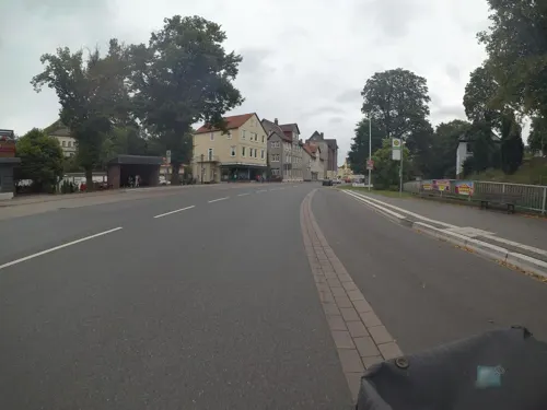
Café und Bäckerei Engel
Bakery
1 Neue Straße, Stadtoldendorf
Mo-Fr 05:30-18:00, Sa 06:00-14:00, Su 07:30-17:00


Strauch's
Restaurant
26 Linnenkämper Straße, Stadtoldendorf
Mo-Tu off; We-Sa 17:00-22:00; Su 12:00-16:00
Waldgaststätte Mittendorff's Park
Restaurant · 1.5 km
1 Schützenhaus, Stadtoldendorf
Tu-Fr 17:00-22:00; Sa-Su 11:00-22:00 || "Nach Vereinbarung"
Mammut Restaurant
Restaurant · German, Burger · 1.6 km
Mammut Camping & Restaurant
41 Linnenkämper Straße, Stadtoldendorf
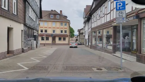
Bistro & Caféteria Forum
Restaurant
7 Markt, Stadtoldendorf
Mo-Sa 11:00-02:00; We 17:30-00:00; Fr off; Su 17:30-24:00
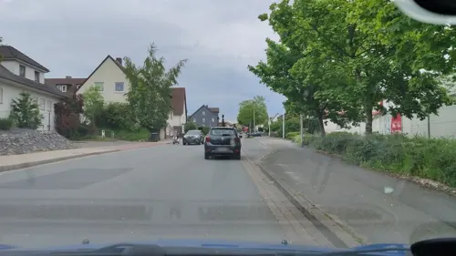
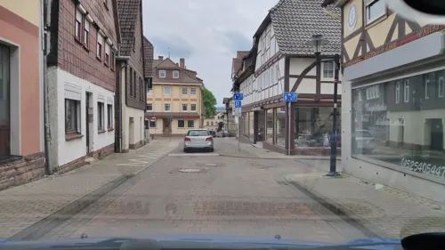


Restaurant GJUCI
Restaurant · Greek · 0.8 km
33 Linnenkämper Straße, Stadtoldendorf

5 more on the map.
Where to stay3
Churches and places of worship14
St. Nicolai Kirche
Church · Lutheran · 3.4 km
5 Am Alten Born, Deensen
Evangelisch-Freikirchliche Gemeinde Stadtoldendorf
Church · Baptist · 0.7 km
5 Holeburgweg, Stadtoldendorf
Shopping6
Gas and EV charging4
Schools, colleges and libraries4
Healthcare3
Sonnen-Apotheke im Charlottenstift
Clinic and pharmacy · 0.7 km
2 Krankenhausweg, Stadtoldendorf
Map of Stadtoldendorf
89 places. The map loads OpenStreetMap tiles when you open it.
Getting there and nearby towns
Kassel Airport (KSF) is the nearest airport with scheduled flights listed in OpenStreetMap, 54 km away.
- Dassel 10 km southeast, about 10 min by car
- Holzminden 14 km southwest, about 14 min by car
- Alfeld 17 km northeast, about 17 min by car
- Einbeck 18 km east, about 18 min by car
- Höxter 21 km southwest, about 21 min by car
- Salzhemmendorf 21 km north, about 21 min by car
- Uslar 25 km south, about 25 min by car
- Bad Pyrmont 28 km northwest, about 28 min by car
- Lügde 27 km west, about 27 min by car
- Bad Gandersheim 27 km east, about 27 min by car
Drive times are estimates from straight-line distance, not routes.
Local news
Headlines from INDB.
Reviews, tips and questions
Loading what members have shared...
Sources and licences
- GeoNames (CC BY 4.0): population, coordinates, regions and time zone
- Mapillary (see each image): photos
- OpenStreetMap contributors (ODbL 1.0): places, airports, map data
- Wikidata (CC0 1.0): elevation, founding date, time zone, website
- Wikimedia Commons (see each image): photos
- Wikipedia (CC BY-SA 4.0): overview and history text
Photo credits
- Rathaus Stadtoldendorf, Jan Stubenitzky ( Dehio ), CC BY-SA 3.0
- Stadtoldendorf Pfarrhaus StDionys, Dehio, CC BY-SA 4.0
- StDionys Stadtoldendorf 01, Dehio, CC BY-SA 4.0
- Stolperstein in Stadtoldendorf für Dr Richard Wolff Flaster, GNUs Freunde, CC BY-SA 4.0
- Stolperstein in Stadtoldendorf für Dr Richard Wolff, GNUs Freunde, CC BY-SA 4.0
- Stolperstein in Stadtoldendorf für Hermann Fröhlich, GNUs Freunde, CC BY-SA 4.0
- Stolperstein in Stadtoldendorf für LEO Fröhlich, GNUs Freunde, CC BY-SA 4.0
- Stolperstein in Stadtoldendorf für Arthur Braun, GNUs Freunde, CC BY-SA 4.0
- Stolperstein in Stadtoldendorf für Klara Braun, GNUs Freunde, CC BY-SA 4.0
- Stolperstein in Stadtoldendorf für Helene Braun, GNUs Freunde, CC BY-SA 4.0
- Stolperstein in Stadtoldendorf für Kurt Wallhausen, GNUs Freunde, CC BY-SA 4.0
- Stolpersteine in Stadtoldendorf für Familien Wallhausen und Braun, GNUs Freunde, CC BY-SA 4.0
- Stolperstein in Stadtoldendorf für Charlotte Wallhausen, GNUs Freunde, CC BY-SA 4.0
- StDionys Stadtoldendorf 02, Dehio, CC BY-SA 4.0
- Stadtoldendorf Rathaus, Dehio, CC BY-SA 4.0
- Bärenbrunnen (Stadtoldendorf) 3, Gerd Fahrenhorst, CC BY 4.0
- Bärenbrunnen (Stadtoldendorf) 2, Gerd Fahrenhorst, CC BY 4.0
- Bärenbrunnen (Stadtoldendorf) 1, Gerd Fahrenhorst, CC BY 4.0
- Bärenbrunnen (Stadtoldendorf) 4, Gerd Fahrenhorst, CC BY 4.0
- Stolperstein in Stadtoldendorf für Paul Heinberg, GNUs Freunde, CC BY-SA 4.0
- Stolperstein in Stadtoldendorf für Hugo Frank, GNUs Freunde, CC BY-SA 4.0
- Stolperstein in Stadtoldendorf für Clara Grünewald, GNUs Freunde, CC BY-SA 4.0
- Stolperstein in Stadtoldendorf für Herbert Frank, GNUs Freunde, CC BY-SA 4.0
- Stolperstein in Stadtoldendorf für Heinz Rosenhain, GNUs Freunde, CC BY-SA 4.0
- Stolperstein in Stadtoldendorf für Erna Rosenhain, GNUs Freunde, CC BY-SA 4.0
- Marktbrunnen (Stadtoldendorf) 2, Gerd Fahrenhorst, CC BY 4.0
- Marktbrunnen (Stadtoldendorf) 1, Gerd Fahrenhorst, CC BY 4.0
- Jule-Johler-Brunnen (Stadtoldendorf) 3, Gerd Fahrenhorst, CC BY 4.0
- Jule-Johler-Brunnen (Stadtoldendorf) 2, Gerd Fahrenhorst, CC BY 4.0
- Jule-Johler-Brunnen (Stadtoldendorf) 1, Gerd Fahrenhorst, CC BY 4.0
- Freundschaftsbrunnen (Stadtoldendorf) 2, Gerd Fahrenhorst, CC BY 4.0
- Freundschaftsbrunnen (Stadtoldendorf) 1, Gerd Fahrenhorst, CC BY 4.0
- Freundschaftsbrunnen (Stadtoldendorf) 3, Gerd Fahrenhorst, CC BY 4.0
- Freundschaftsbrunnen (Stadtoldendorf) 4, Gerd Fahrenhorst, CC BY 4.0
- Freundschaftsbrunnen (Stadtoldendorf) 5, Gerd Fahrenhorst, CC BY 4.0
- KellbergturmStadtoldendorf, Ankl, CC BY-SA 3.0
- Holzberg, Jan Stubenitzky ( Dehio ), CC BY-SA 3.0
- StNicolai Deensen, Jan Stubenitzky ( Dehio ), CC BY-SA 3.0
- HlHerzJesu Stadtoldendorf 02, Dehio, CC BY-SA 4.0
- Arholzen Kirche, Jan Stubenitzky ( Dehio ), CC BY-SA 3.0
- Lenne church, El novvov, CC BY-SA 3.0
- Gefallenendenkmal Einigungskriege (Stadtoldendorf), Gerd Fahrenhorst, CC BY 4.0
- Kloster Amelungsborn, Patrik Scholz, Public domain
- Burg Homburg Gesamtansicht Bauzaun, Axel Hindemith, CC BY-SA 3.0
- Street-level photo, cageythree, CC BY-SA 4.0
- Street-level photo, marczoutendijk, CC BY-SA 4.0
- Street-level photo, cageythree, CC BY-SA 4.0
- Street-level photo, bufonto, CC BY-SA 4.0
- Street-level photo, hotteliene, CC BY-SA 4.0
- Street-level photo, cageythree, CC BY-SA 4.0
- Street-level photo, cageythree, CC BY-SA 4.0
- Street-level photo, cageythree, CC BY-SA 4.0
- Street-level photo, cageythree, CC BY-SA 4.0
- Street-level photo, hotteliene, CC BY-SA 4.0
- Street-level photo, cageythree, CC BY-SA 4.0
- Street-level photo, hotteliene, CC BY-SA 4.0
- Street-level photo, hotteliene, CC BY-SA 4.0
- Street-level photo, cageythree, CC BY-SA 4.0
- Street-level photo, hotteliene, CC BY-SA 4.0


Page built November 9, 2026. Spotted a mistake? Tell us or suggest a place.